Mesoscale convective vortex

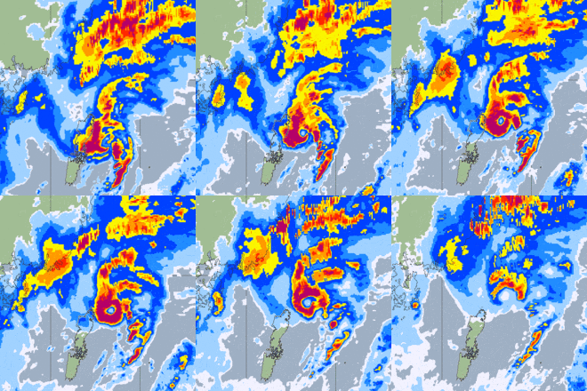
A mesoscale convective vortex (MCV) is a low-pressure center within an mesoscale convective system (MCS) that pulls winds into a circling pattern, or vortex. With a core only 30 to 60 miles (97 km) wide and 1 to 3 miles (4.8 km) deep, an MCV is often overlooked in standard weather analysis.[1] But an MCV can take on a life of its own, persisting for up to 12 hours after its parent MCS has dissipated. This orphaned MCV will sometimes then become the seed of the next thunderstorm outbreak. An MCV that moves into tropical waters, such as the Gulf of Mexico, can serve as the nucleus for a tropical storm or hurricane.[1]
May 2009 Mid-Mississippi Valley MCV
On Friday, May 8, 2009, a major MCV controversially dubbed an "inland hurricane" by local media moved through southern Missouri, southern Illinois, western Kentucky, and southwestern Indiana, killing at least 6 and injuring dozens more. Damage estimates were in the hundreds of millions. Top speeds of 106 mph (171 km/h) were reported in Carbondale, Illinois.[2][3][4][5]
See also
- Convective storm detection
- Derecho
- Line echo wave pattern
- Mesoscale convective system and mesoscale convective complex
- Mesovortex
- Supercell
References
- 1 2 WFO Paducah, KY. "Thunderstorm Types". Severe Weather 101. National Weather Service. Retrieved May 2, 2016.
- ↑ NSSL. "Updated: What was it that caused the May 8 windstorm?". National Weather Service. Retrieved May 2, 2016.
- ↑ CIMSS. "Radar loop". University of Wisconsin. Retrieved May 2, 2016.
- ↑ Eric Berger (May 10, 2009). "Midwest experiences an inland hurricane". Chron. Retrieved May 2, 2016.
- ↑ "Storms Cut Through Midwest, Killing 5". The New York Times. May 10, 2009.
External links
- NOAA Glossary
- Houze, R.A., Jr. (2004). "Mesoscale convective systems". Rev. Geophys. 42: RG4003. Bibcode:2004RvGeo..42.4003H. doi:10.1029/2004RG000150.