Mocanaqua, Pennsylvania
| Mocanaqua,
Luzerne County Pennsylvania | |
|---|---|
| Census-designated place | |
|
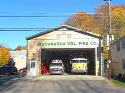
Volunteer Fire Department | |
|
Nickname(s): "Little Bear" Ma-con-na-quah, | |
 Mocanaqua,
Luzerne County PennsylvaniaLocation within the state of Pennsylvania | |
| Coordinates: 41°8′28″N 76°8′19″W / 41.14111°N 76.13861°WCoordinates: 41°8′28″N 76°8′19″W / 41.14111°N 76.13861°W | |
| Country | United States |
| State | Pennsylvania |
| County | Luzerne |
| Township | Conyngham Township |
| Government | |
| • Type | 2nd Class Township |
| Area | |
| • Total | 0.5 sq mi (1.4 km2) |
| • Land | 0.5 sq mi (1.3 km2) |
| • Water | 0.04 sq mi (0.1 km2) |
| Population (2010) | |
| • Total | 646 |
| • Density | 1,200/sq mi (460/km2) |
| Time zone | Eastern (EST) (UTC-5) |
| • Summer (DST) | EDT (UTC-4) |
| Area code(s) | 570 |
Mocanaqua is a census-designated place (CDP) in Conyngham Township, Luzerne County, Pennsylvania, United States. The population was 646 at the 2010 census.[1]
Geography
Mocanaqua is located at 41°8′28″N 76°8′19″W / 41.14111°N 76.13861°W.[2]
According to the United States Census Bureau, the CDP has a total area of 0.54 square miles (1.4 km2), of which 0.50 square miles (1.3 km2) is land and 0.04 square miles (0.1 km2), or 9.55%, is water.[3] It is located on the east bank of the Susquehanna River along Pennsylvania Route 239, which crosses the river at Mocanaqua to the borough of Shickshinny.
School District
Students attend the Greater Nanticoke Area School District.
.jpg) Polish Falcons Building
Polish Falcons Building
References
| Wikimedia Commons has media related to Mocanaqua, Pennsylvania. |
- ↑ "Profile of General Population and Housing Characteristics: 2010 Demographic Profile Data (DP-1): Mocanaqua CDP, Pennsylvania". U.S. Census Bureau, American Factfinder. Retrieved April 27, 2012.
- ↑ "US Gazetteer files: 2010, 2000, and 1990". United States Census Bureau. 2011-02-12. Retrieved 2011-04-23.
- ↑ "Geographic Identifiers: 2010 Demographic Profile Data (G001): Mocanaqua CDP, Pennsylvania". U.S. Census Bureau, American Factfinder. Retrieved April 27, 2012.

