Montana Highway 200
| ||||
|---|---|---|---|---|
 | ||||
| Route information | ||||
| Maintained by MDT | ||||
| Length: | 706.624 mi[1] (1,137.201 km) | |||
| Major junctions | ||||
| West end: |
| |||
|
| ||||
| East end: |
| |||
| Location | ||||
| Counties: | Richland, Dawson, McCone, Garfield, Petroleum, Fergus, Judith Basin, Cascade, Lewis and Clark, Powell, Missoula, Lake, Sanders | |||
| Highway system | ||||
| ||||

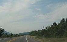
Highway 200 (MT 200) in the U.S. state of Montana is a route running east-west covering the entire state of Montana. From the starting point at ID 200, near Heron, Montana the highway runs east to ND 200 near Fairview, Montana. It is part of a chain of state highways numbered 200 which extend from Idaho across Montana, North Dakota and Minnesota. Montana Highway 200 is also the longest route signed as a state highway in the United States.
Highway 200 helps to connect many small towns located in central Montana and the vast plains area of eastern Montana, to larger western Montana cities such as Great Falls and Missoula.
The highway runs parallel to the Blackfoot River from McNamara to Milltown. The highway is subject to hazardous driving conditions in the winter, particularly due to black ice. The road crosses Rogers Pass on the continental divide on its way west to Missoula.
At its western end, west of Missoula, Highway 200 follows the Clark Fork River eastward at the feet of the Cabinet Mountains until it meets the Flathead River at MT 135. It then follows the Flathead River east to Dixon where the Flathead River turns north. Highway 200 continues east following the Jocko River until the intersection of Highway 200 and US 93 at Ravalli. The highway then bends south to join I-90 east into Missoula.
Major intersections
| County | Location | mi | km | Destinations | Notes |
|---|---|---|---|---|---|
| Sanders | | 0.000 | 0.000 | Continuation into Idaho | |
| | 10.418 | 16.766 | |||
| | |||||
| | |||||
| | 76.706 | 123.446 | |||
| | 85.030 | 136.843 | |||
| | |||||
| | |||||
| Lake | Ravalli | 115.803 | 186.367 | West end of US 93 overlap | |
| | |||||
| Missoula | | ||||
| Wye | 143.004 | 230.143 | West end of I-90 overlap; MT 200 west follows exit 96 | ||
| | 146.612 | 235.949 | Airway Boulevard | I-90 exit 99 | |
| Missoula | 148.388 | 238.807 | East end of US 93 overlap; I-90 exit 101 | ||
| 151.451 | 243.737 | Orange Street | I-90 exit 104 | ||
| 152.315 | 245.127 | West end of US 12 overlap; I-90 exit 105 | |||
| East Missoula | 153.940 | 247.742 | East Missoula | I-90 exit 107 | |
| West Riverside | 156.885 | 252.482 | East end of I-90 / US 12 overlap; MT 200 east follows exit 109 | ||
| Bonner | |||||
| Clearwater Junction | 189.465 | 304.914 | |||
| Powell | | 213.308 | 343.286 | ||
| Lewis and Clark | | ||||
| Rogers Pass | 248 | 399 | Continental Divide (elevation 5,610 feet (1,710 m)) | ||
| | |||||
| Bowman's Corner | 266.655 | 429.140 | |||
| Cascade | Simms | ||||
| | 297.069 | 478.086 | West end of US 89 overlap | ||
| | 305.044 | 490.921 | West end of I-15 overlap; MT 200 west follows exit 290 | ||
| | 309.142 | 497.516 | Manchester | I-15 exit 286 | |
| | 313.020 | 503.757 | Eastbound exit and westbound entrance; I-15 exit 282 | ||
| Great Falls | 314.999 | 506.942 | I-15 exit 280 | ||
| | 316.588 | 509.499 | East end of I-15 overlap; west end of I-315 / MT 3 overlap; MT 200 east follows exit 278 | ||
| Great Falls | 316.923 | 510.038 | 14th Street Southwest | I-315 exit 0 | |
| 317.416 | 510.832 | Fox Farm Road / 6th Street Southwest | East end of I-315 overlap | ||
| west end of I-15 Bus. overlap | |||||
| 319.582– 319.662 | 514.317– 514.446 | West end of US 87 overlap | |||
| | 322.762 | 519.435 | |||
| | |||||
| | |||||
| Armington Junction | 342.240 | 550.782 | East end of US 89 overlap | ||
| Judith Basin | | ||||
| Geyser | |||||
| | 378.939 | 609.843 | |||
| | |||||
| | |||||
| Moccasin | |||||
| | |||||
| Fergus | Eddies Corner | 406.937 | 654.902 | East end of MT 3 overlap; west end of US 191 overlap | |
| | 421.272 | 677.972 | |||
| Lewistown | |||||
| west end of US 191 Bus. overlap | |||||
| east end of US 191 Bus. overlap | |||||
| | 454.798 | 731.926 | East end of US 87 overlap | ||
| Petroleum | Winnett | ||||
| | |||||
| Garfield | | 552.525 | 889.203 | ||
| Jordan | |||||
| | |||||
| Garfield–McCone county line | Flowing Well | 588.970 | 947.855 | ||
| McCone | | ||||
| | |||||
| Circle | |||||
| 620.305 | 998.284 | ||||
| | 621.349 | 999.964 | |||
| Dawson | Richey | ||||
| Richland | | 692.396 | 1,114.303 | West end of MT 16 overlap | |
| Sidney | 694.964 | 1,118.436 | East end of MT 16 overlap | ||
| Fairview | |||||
| | 706.624 | 1,137.201 | North Dakota state line | ||
1.000 mi = 1.609 km; 1.000 km = 0.621 mi
| |||||
References
- ↑ "Montana Road Log" (PDF). Montana Department of Transportation. 2011. Retrieved January 20, 2012.