Mount Rowe
| Mt. Rowe | |
|---|---|
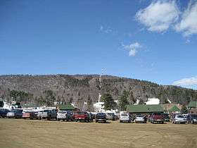
 Mount Rowe as seen from the Gunstock Mountain Resort parking lot | |
| Highest point | |
| Elevation | 1,680 ft (510 m) |
| Coordinates | 43°32′43″N 71°22′41″W / 43.54528°N 71.37806°WCoordinates: 43°32′43″N 71°22′41″W / 43.54528°N 71.37806°W |
| Geography | |
| Location |
Town of Gilford, Belknap County, New Hampshire |
| Parent range | Belknap Mountains |
| Topo map | USGS Laconia, NH |
Mount Rowe, elevation 1,680 feet (510 m), is a mountain located north of Gunstock Mountain in the Belknap Range, Belknap County, New Hampshire, United States. It has been home to multiple alpine ski operations, including the original Gunstock Mountain Resort single chairlift (now removed), the Belknap Ski Jumps, and the defunct Alpine Ridge/Mt. Rowe ski area.
External links
- Mt. Rowe - FranklinSites.com Hiking Guide
- Mount Rowe/Alpine Ridge, New England Lost Ski Areas Project
- "Mt. Rowe", Belknap Range Trails site
This article is issued from Wikipedia - version of the 12/18/2015. The text is available under the Creative Commons Attribution/Share Alike but additional terms may apply for the media files.