Trams in Munich
 | |
| Overview | |
|---|---|
| Locale | Munich, Germany |
| Transit type | Tram |
| Number of lines |
1952: 21 1964: 21 1972: 18 + 3 Olympic special routes 1996: 9 2010: 11 2011: 11 2012: 13 2013: 13[1] |
| Number of stations | 165[2] |
| Daily ridership | 284,900 (2012) |
| Annual ridership | 104 million (2012)[2] |
| Operation | |
| Began operation |
1876 (horsecar)[2] 1895 (electric trams)[2] |
| Operator(s) | Münchner Verkehrsgesellschaft |
| Number of vehicles | 106[2] |
| Technical | |
| System length |
1952: 120 km (75 mi) 1964: 135 km (84 mi) 1972: 120 km (75 mi) 1984: 83 km (52 mi) 1996: 68 km (42 mi) 2010: 75 km (47 mi) 2011:80 km (50 mi) 2012:80 km (50 mi) 2013: 80 km (50 mi)>[3] |
| Track gauge | 1,435 mm (4 ft 8 1⁄2 in) |
| Electrification | 750 Volts |
| Average speed | 19.3 mph (31.1 km/h)[2] |

The Munich tramway is the tramway network for the city of Munich in Germany. Today it is operated by the municipally owned Münchner Verkehrsgesellschaft (the Munich Transport Company, or MVG) and is known officially and colloquially as the Tram. Previous operators have included Société Anonyme des Tramways de Munich, the Münchner Trambahn-Aktiengesellschaft, the Städtische Straßenbahnen and the Straßenbahn München.
The tram network interconnects with the MVG's bus network, the Munich U-Bahn and the Munich S-Bahn, all of which use a common tariff as part of the Münchner Verkehrs- und Tarifverbund (Munich Transport and Tariff Association, or MVV) transit area.
As of 2012, the daytime tram network comprises 13 lines[2][4] and is 79 kilometres (49 mi) long with 165 stops.[2] There is also a night tram service with four routes.[2] The network is operated by 106 trams (as of 2012),[2] and transported 98 million people in 2010[5] and 104 million people in 2012.[2]
History


The tramway started in 1876, with a horsecar service.[2] The first tramways extended from Karlsplatz (Stachus), which remains one of central nodes of Munich's tram network. Two years later, the Société Anonyme des Tramways de Munich was founded. In 1882, the Münchner Trambahn-Aktiengesellschaft (MTAG) was founded.[2][6]
Electric trams were introduced in 1895,[2] and in 1900, the last horsecar was taken out of service.[2] In 1907, MTAG was taken over by the city, and changed its name to Städtische Straßenbahnen. In 1919, the municipal agency Münchner Straßenbahnen was established. After World War II ended in 1945, only twenty tram lines remained; of 444 trams, only 168 were in operational condition. In 1956, the first new tram line after the war was opened.[2]
The 1972 Munich Olympic Games presaged a major expansion of public transport in the city. In 1965, construction of the Munich U-Bahn, the city's rapid transit system, was started. It opened in 1971, the same year as the transit authority MVV was founded. In 1972 a new S-Bahn network opened that, like the U-Bahn, was carried in new tunnels under the city centre. As these networks grew, they seemed to threaten the tram network, with extensive line closures in favour of the new modes.[6]
Such closures continued into the 1990s, but in 1991 the city council passed a plan to upgrade and modernize the tramway, as the trams were seen to be a better fit to expected passenger flows on many routes. Three years later, Class R2 low-floor trams were introduced, along with a night network. These were followed, in 1999, by the larger class R3 trams. In 2001, the voltage on which the trams operate was increased from 600 to 750 V. The following year the MVG was formed.[2][6]
In 2009 the brand new route 23 was opened.[2] This route acts as a feeder route for U-Bahn lines U3 and U6, to which it connects in an elaborate terminus above Münchner Freiheit U-Bahn station. The line has no interchanges with other tram routes, but is linked to the rest of the tram network by a connecting track that carries no public service.[6] At the same time,February 2009, class S trams (Variotram) were introduced.
In December 2011 an extension was opened from the previous Effnerplatz terminus to St. Emmeram.[2] The extension was 4.3 kilometres (2.7 mi) long and added seven new tram stops to the network. Tram route 16 was extended to serve St. Emmeram, with knock-on effects on routes 17, 18 and 27.[6][7]
In December 2012 new routes 22 and 28 were opened.[8]
In December 2013, the extension of route 19 line, from its previous terminus at Pasing-Marienplatz to München-Pasing railway station, was opened in order to enable better interchange with S-Bahn and long-distance train services.[9]
Operation
Vehicles


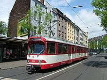
The tram system uses five classes of tram:
- The class P tram is a two-section high-floor articulated motor tram carried on two four-wheeled trucks, usually operating with a similar articulated trailer tram. The trams were built by Rathgeber between 1967 and 1969, and a two-car set carries 315 passengers, with 151 seated. As of 2011, there are only six sets remaining, of which two are reserved for special services. The Class P tram was withdrawn in November 2014 for a short time.[10]
- The class R2 tram is a three-section 100% low-floor articulated motor tram carried on six axles. The trams were built by Adtranz to their GT6N design between 1994 and 1997, and carry 157 passengers, of whom 58 are seated. As of 2011, 68 trams are in service, operating on all lines.[11]
- The class R3 tram is a four-section 100% low-floor articulated motor tram carried on eight axles. The trams were built by Adtranz to their GT8N2 design between 1999 and 2001, and carry 218 passengers, of whom 67 are seated. As of 2011, 20 trams are in service, operating on lines 17, 19, 20, 21, 27, and also 25 on school holidays and weekend.[12]
- The class S tram is a five-section 100% low-floor articulated motor tram carried on eight axles. The trams were built by Stadler to their Variotram design, and carry 221 passengers, of whom 75 are seated. Four trams of this design were delivered in 2009, and a further 10 are on order, with delivery expected in 2011, operating on lines 19, 20, 21 and 22.[13][14][15]
- The class T1 tram is a four-section 100% low-floor articulated motor tram carried on eight axles. The trams were built by Siemens to their Avenio design and carry 220 passengers. Eight trams are on order, and the first was delivered to Munich in November 2012.[16] The first car (or cars) entered service on 17 September 2014 on line 19.[17]
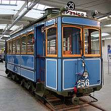
A number of older trams are still owned by the MVG. Some are displayed in the MVG Museum, and may occasionally be seen on special services. Other Munich trams are displayed in the 'Verkehrszentrum' (Transport Centre) of the Deutsches Museum in Munich.
Network


As of 2012, the Munich tram network comprises thirteen daytime routes and four night routes.[2] The tram network totals 79 kilometres (49 mi) of route length,[2] including 55 kilometres (34 mi) of segregated tram lane,[2] with 165 stops.[2][6]
The network is standard gauge track and configured to allow a maximum body width of 2.3 metres (7 ft 7 in). It is electrified using overhead lines at 750 VDC. As all Munich trams are single ended, facilities for turning trams, such as turning loops or wye tracks, are provided at all termini and strategic intermediate points.[2][6][13]
Daytime routes
The daytime route network operates between 04:45 and 01:30, and comprises the following routes:[4]
| Line | Route | Stops | Time |
|---|---|---|---|
| |
Scheidplatz |
17 | 21 min |
| |
Max-Weber-Platz |
16 | 24 min |
| |
Romanplatz – Donnersbergerstraße – Hackerbrücke |
36 | 49 min |
| |
Amalienburgstraße – Romanplatz – Donnersbergerstraße – Hackerbrücke |
29 | 35 min |
| |
Gondrellplatz – Westendstraße |
32 | 41 min |
| |
München-Pasing |
36 | 52 min |
| |
Moosach |
16 | 22 min |
| |
Westfriedhof |
13 | 17 min |
| |
Hochschule München – Hauptbahnhof |
8 | 9 min |
| |
Münchner Freiheit |
7 | 8 min |
| |
Max-Weber-Platz |
22 | 32 min |
| |
Petuelring |
15 | 19 min |
| |
Scheidplatz |
12 | 16 min |
Night routes
The night route network operates between 01:30 and 04:30, and comprises the following routes:[18]
| Line | Route |
|---|---|
| |
Amalienburgstraße – Romanplatz – Donnersbergerstraße – Hackerbrücke |
| |
München-Pasing |
| |
Moosach |
| |
Petuelring |
Future developments
The new 8.7-kilometre (5.4 mi) Tram Westtangente line is being constructed between Romanplatz and Aidenbachstraße U-Bahn station.[6][19][20] The line will stop at three U-Bahn and S-Bahn transfer points: Holzapfelkreuth U-Bahn station, Laimer Platz U-Bahn station, and München-Laim S-Bahn station. The line number for the new route has not yet been designated. It is expected to be completed in 2014.
Munich has expressed an interest in creating a northern tangential line, linking Elizabethplatz and Tivolistaße, thus relieving tramway congestion in the city centre, and reducing the noise caused by buses. As the route would pass through the environmentally-sensitive Englischer Garten, operating the 0.6-kilometre (0.37 mi) section without overhead wiring has been proposed. To this end, the MVG and Stadler equipped one S class tram with experimental lithium-ion batteries, and in May 2011 this tram set the world distance record for such operation by running 16 kilometres (9.9 mi) on a test track at Velten near Berlin. Remaining S class trams, both delivered and on order, are designed to be retro-fitted with similar equipment.[15][21]
References
- ↑ http://www.tundria.com/trams/DEU/Munich-1952.shtml
- 1 2 3 4 5 6 7 8 9 10 11 12 13 14 15 16 17 18 19 20 21 22 23 24 "MVG in figures" (PDF). mvg-mobil.de (via: http://www.mvg-mobil.de/en/about_us.html). Münchner Verkehrsgesellschaft mbH (MVG) Marketing. June 2013. Retrieved 2013-10-02. External link in
|website=(help) - ↑ http://www.tundria.com/trams/DEU/Munich-1952.shtml
- 1 2 "Tramnetz München" [Munich Tram Network] (PDF) (in German). MVV. December 9, 2012. Retrieved 2013-10-02.
- ↑ "MVG: wieder Fahrgastrekord bei U-Bahn, Bus und Tram; Zuwachs in allen Betriebszweigen" [MVG: Passenger record at U-Bahn, bus and tram; growth in all operating sectors] (PDF) (in German). MVG. 27 May 2011. Retrieved 2011-06-07.
- 1 2 3 4 5 6 7 8 Pulling, Neil (November 2010). "System Factfile 38: Munich, Germany". Tramways & Urban Transit. Ian Allan Ltd / Light Rail Transit Association. pp. 419–421.
- ↑ "Tram St. Emmeram" (in German). MVG. Retrieved 26 June 2012.
- ↑ "Fahrplanwechsel am 9. Dezember 2012 - MVG auf Wachstumskurs: Angebot wird 2013 um weitere 1,6% gesteigert" [Timetable change on 9 December 2012 - MVG on growth course: Supply is increased 2013 by further 1.6%] (in German). MVG. December 2012. Retrieved 2013-10-02.
- ↑ "Munich opens Pasing tram extension". http://www.railjournal.com/. Simmons-Boardman Publishing Inc. Retrieved 2014-04-10. External link in
|work=(help) - ↑ "Tram Typ P" [Tram Type P] (in German). MVG. Retrieved 9 June 2011.
- ↑ "Tram Typ R 2" [Tram Type R 2] (in German). MVG. Retrieved 9 June 2011.
- ↑ "Tram Typ R 3" [Tram Type R 3] (in German). MVG. Retrieved 9 June 2011.
- 1 2 Stadler Rail. "Niederflurstraßenbahn Typ Variobahn für die Stadtwerke München GmbH (SWM)" (PDF) (in German). Retrieved 3 April 2009.
- ↑ "Tram Typ S" [Tram Type S] (in German). MVG. Retrieved 9 June 2011.
- 1 2 "Stadler sets new catenary-free world record". Tramways & Urban Transit. Ian Allan Ltd / Light Rail Transit Association. July 2011. p. 251.
- ↑ "Siemens unveils first Avenio tram in München". Railway Gazette. Retrieved 2014-04-10.
- ↑ "New trams enter service [in München]". Today's Railways Europe (228). Platform 5 Publishing, Ltd. December 2014. p. 15. ISSN 1354-2753.
- ↑ "MVG Nachtlinien" (in German). MVG. Retrieved 2013-10-02.
- ↑ "Tram Pasing" (in German). MVG. Retrieved 17 June 2011.
- ↑ "Tram Westtangente" (in German). MVG. Retrieved 17 June 2011.
- ↑ "Straßenbahn oben ohne – Münchner Tram mit Batterieantrieb schafft Weltrekord" [Munich Tram with Battery drive creates world record] (PDF) (in German). MVG. Retrieved 30 June 2011.
External links
| Wikimedia Commons has media related to Tram transport in Munich. |
Coordinates: 48°08′54″N 11°27′42″E / 48.1484°N 11.4616°E

