Kola Bay
.jpeg)
1598 map of Kola Bay, from Gerrit de Veer's diary of Willem Barentsz' explorations.
Kola Bay (Russian: Кольский залив) or Murmansk Fjord is a 57-km-long fjord of the Barents Sea that cuts into the northern part of the Kola Peninsula. It is up to 7 km wide and has a depth of 200 to 300 metres. The Tuloma and Kola Rivers discharge into the bay.
The eastern shore is craggy and precipitous, the western one is comparatively level. The ports of Murmansk and Severomorsk sit on the east side. Polyarny, the main base of Russia's Northern Fleet, is on the west side of the bay.
Semidiurnal tides in the Murmansk Fjord are as high as 4 metres. In winter, the southern part of the bay may be covered in ice. The Kola Bay Bridge spans the Kola Bay near its southern end.
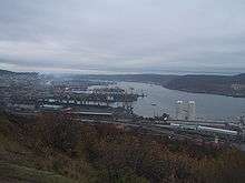
 View of Kola Bay in Murmansk
 Severomorsk Harbor
 A tugboat in Kola Bay on a winter day
Notes
| Wikimedia Commons has media related to Kola Bay. |
- This article is based on a translation of the equivalent article of the Russian Wikipedia on 13 July 2008.
Coordinates: 69°05′52″N 33°23′48″E / 69.09778°N 33.39667°E
This article is issued from Wikipedia - version of the 5/17/2015. The text is available under the Creative Commons Attribution/Share Alike but additional terms may apply for the media files.