| [3] |
Name on the Register |
Image |
Date listed[4] |
Location |
City or town |
Description |
|---|
| 1 |
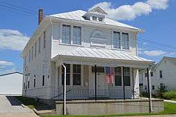
Coca-Cola Bottling Company Building |
|
000000001997-02-07-0000February 7, 1997
(#97000032) |
616 N. 24th St.
39°56′18″N 91°22′37″W / 39.938333°N 91.376944°W / 39.938333; -91.376944 (Coca-Cola Bottling Company Building) |
Quincy |
|
| 2 |
Downtown Quincy Historic District |
|
000000001983-04-07-0000April 7, 1983
(#83000298) |
Roughly bounded by Hampshire, Jersey, 4th and 8th Sts.
39°55′57″N 91°24′28″W / 39.9325°N 91.407778°W / 39.9325; -91.407778 (Downtown Quincy Historic District) |
Quincy |
|
| 3 |
Ebenezer Methodist Episcopal Chapel and Cemetery |
|
000000001984-06-04-0000June 4, 1984
(#84000921) |
Northwest of Golden
40°09′32″N 91°06′10″W / 40.158889°N 91.102778°W / 40.158889; -91.102778 (Ebenezer Methodist Episcopal Chapel and Cemetery) |
Golden |
|
| 4 |
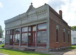
Exchange Bank |
|
000000001987-02-12-0000February 12, 1987
(#86003714) |
Quincy St.
40°06′26″N 91°04′15″W / 40.107222°N 91.070833°W / 40.107222; -91.070833 (Exchange Bank) |
Golden |
|
| 5 |
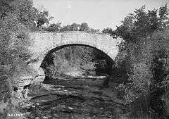
Fall Creek Stone Arch Bridge |
|
000000001996-11-07-0000November 7, 1996
(#96001282) |
1.2 miles northeast of Fall Creek-Payson Rd., across Fall Creek
39°47′28″N 91°17′30″W / 39.791111°N 91.291667°W / 39.791111; -91.291667 (Fall Creek Stone Arch Bridge) |
Payson |
|
| 6 |
Robert W. Gardner House |
|
000000001979-06-20-0000June 20, 1979
(#79000812) |
613 Broadway St.
39°56′09″N 91°24′21″W / 39.935833°N 91.405833°W / 39.935833; -91.405833 (Robert W. Gardner House) |
Quincy |
|
| 7 |
S.J. Lesem Building |
|
000000001999-11-22-0000November 22, 1999
(#99001377) |
135-137 N. 3rd St.
39°56′06″N 91°24′43″W / 39.935°N 91.411944°W / 39.935; -91.411944 (S.J. Lesem Building) |
Quincy |
|
| 8 |
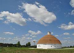
Lewis Round Barn |
|
000000002003-01-29-0000January 29, 2003
(#02001750) |
2007 E. 1250th St.
40°03′06″N 91°16′19″W / 40.051667°N 91.271944°W / 40.051667; -91.271944 (Lewis Round Barn) |
Mendon |
Originally listed in 1984 at its original site NW of Clayton, Iowa, reference #84000916. Was removed from the Register in March 2002 due to a pending relocation. The site was recertified with a new reference number in 2003 after successful relocation.
|
| 9 |
Lock and Dam No. 20 Historic District |
|
000000002004-03-10-0000March 10, 2004
(#04000180) |
Mississippi River southwest of Meyer
40°08′38″N 91°30′41″W / 40.143889°N 91.511389°W / 40.143889; -91.511389 (Lock and Dam No. 20 Historic District) |
Meyer |
Extends into Lewis County, Missouri
|
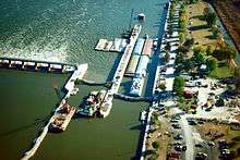
| 10 |
Lock and Dam No. 21 Historic District |
|
000000002004-03-10-0000March 10, 2004
(#04000181) |
0.5 miles west of Illinois Route 57
39°54′22″N 91°25′56″W / 39.906111°N 91.432194°W / 39.906111; -91.432194 (Lock and Dam No. 21 Historic District) |
Quincy |
Extends into Marion County, Missouri
|
| 11 |
Morgan-Wells House |
|
000000001977-11-16-0000November 16, 1977
(#77000471) |
421 Jersey St.
39°55′52″N 91°24′32″W / 39.931111°N 91.408889°W / 39.931111; -91.408889 (Morgan-Wells House) |
Quincy |
|
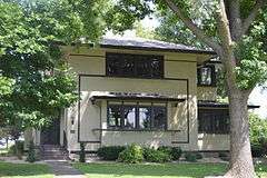
| 12 |
Richard F. Newcomb House |
|
000000001982-06-03-0000June 3, 1982
(#82002516) |
1601 Maine St.
39°55′56″N 91°23′24″W / 39.932222°N 91.39°W / 39.932222; -91.39 (Richard F. Newcomb House) |
Quincy |
|
| 13 |
One Thirty North Eighth Building |
|
000000001984-02-09-0000February 9, 1984
(#84000918) |
130 N. 8th St.
39°55′58″N 91°24′10″W / 39.932778°N 91.402778°W / 39.932778; -91.402778 (One Thirty North Eighth Building) |
Quincy |
|
| 14 |
Quincy East End Historic District |
|
000000001985-11-14-0000November 14, 1985
(#85002791) |
Roughly bounded by Hampshire, 24th, State, and 12th Sts.
39°55′51″N 91°23′11″W / 39.930833°N 91.386389°W / 39.930833; -91.386389 (Quincy East End Historic District) |
Quincy |
|
| 15 |
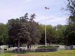
Quincy National Cemetery |
|
000000002011-05-06-0000May 6, 2011
(#11000242) |
36th and Maine Sts.
39°55′58″N 91°21′25″W / 39.932778°N 91.356944°W / 39.932778; -91.356944 (Quincy National Cemetery) |
Quincy |
Civil War Era National Cemeteries MPS
|
| 16 |
Quincy Northwest Historic District |
|
000000002000-05-11-0000May 11, 2000
(#00000414) |
Roughly bounded by Broadway, N. 2nd, Locust, and N. 12th Sts.
39°56′43″N 91°24′18″W / 39.945278°N 91.405°W / 39.945278; -91.405 (Quincy Northwest Historic District) |
Quincy |
|
| 17 |
John Roy Site |
|
000000001978-05-22-0000May 22, 1978
(#78001109) |
Southwest of the junction of 1700th Ave. and 2950th St.[5]
39°59′56″N 90°56′59″W / 39.99888°N 90.94972°W / 39.99888; -90.94972 (John Roy Site) |
Clayton |
|
| 18 |
South Side German Historic District |
|
000000001992-05-22-0000May 22, 1992
(#92000484) |
Roughly bounded by 6th, 12th, Washington, Jersey and York Sts.; also roughly bounded by Jefferson, S. 12th, Jackson and S. 5th Sts.
39°55′33″N 91°24′07″W / 39.925833°N 91.401944°W / 39.925833; -91.401944 (South Side German Historic District) |
Quincy |
Second set of boundaries represents a boundary increase of 000000001995-04-20-0000April 20, 1995
|
| 19 |
State Savings Loan and Trust |
|
000000001979-03-23-0000March 23, 1979
(#79000813) |
428 Maine St.
39°55′55″N 91°24′32″W / 39.931944°N 91.408889°W / 39.931944; -91.408889 (State Savings Loan and Trust) |
Quincy |
|
| 20 |
F. D. Thomas House |
|
000000001983-07-28-0000July 28, 1983
(#83000299) |
321 N. Ohio St.
40°02′50″N 91°03′51″W / 40.047361°N 91.064167°W / 40.047361; -91.064167 (F. D. Thomas House) |
Camp Point |
|
| 21 |
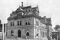
U.S. Post Office and Courthouse |
|
000000001977-12-02-0000December 2, 1977
(#77000472) |
200 N. 8th St.
39°56′01″N 91°24′10″W / 39.933611°N 91.402778°W / 39.933611; -91.402778 (U.S. Post Office and Courthouse) |
Quincy |
|
| 22 |
Ursa Town Hall |
|
000000002002-03-01-0000March 1, 2002
(#02000095) |
109 S. Warsaw St.
40°04′25″N 91°22′00″W / 40.073611°N 91.366667°W / 40.073611; -91.366667 (Ursa Town Hall) |
Ursa |
|
| 23 |
Villa Kathrine |
|
000000001978-12-08-0000December 8, 1978
(#78001110) |
532 S. 3rd
39°55′33″N 91°24′46″W / 39.925833°N 91.412778°W / 39.925833; -91.412778 (Villa Kathrine) |
Quincy |
|
| 24 |
William S. Warfield House |
|
000000001979-03-21-0000March 21, 1979
(#79000814) |
1624 Maine St.
39°55′53″N 91°23′23″W / 39.931389°N 91.389722°W / 39.931389; -91.389722 (William S. Warfield House) |
Quincy |
|
| 25 |
Ernest M. Wood Office and Studio |
|
000000001982-08-12-0000August 12, 1982
(#82002517) |
126 N. 8th St.
39°55′57″N 91°24′10″W / 39.9325°N 91.402778°W / 39.9325; -91.402778 (Ernest M. Wood Office and Studio) |
Quincy |
|
| 26 |
John Wood Mansion |
|
000000001970-04-17-0000April 17, 1970
(#70000228) |
425 S. 12th St.
39°55′39″N 91°23′45″W / 39.9275°N 91.395833°W / 39.9275; -91.395833 (John Wood Mansion) |
Quincy |
|
| 27 |
Woodland Cemetery |
|
000000002002-03-01-0000March 1, 2002
(#02000096) |
1020 S. 5th St.
39°55′01″N 91°12′55″W / 39.916944°N 91.215278°W / 39.916944; -91.215278 (Woodland Cemetery) |
Quincy |
|
