| [3] |
Name on the Register[4] |
Image |
Date listed[5] |
Location |
City or town |
Description |
|---|
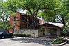
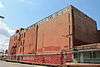
| 1 |
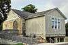
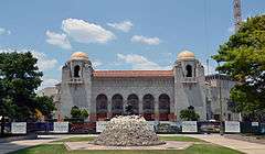
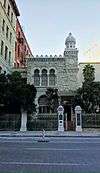
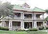
Alamo Methodist Church |
|
000000001979-06-11-0000June 11, 1979
(#79003446) |
1150 S. Alamo St.
29°24′41″N 98°29′35″W / 29.411417°N 98.492917°W / 29.411417; -98.492917 (Alamo Methodist Church) |
San Antonio |
A church built in 1912.
|
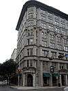
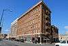
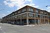
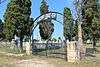
| 2 |
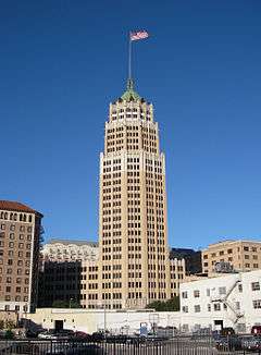
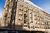
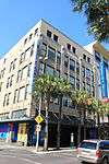
Alamo National Bank Building |
|
000000001984-01-05-0000January 5, 1984
(#84001574) |
316 E. Commerce St.
29°25′26″N 98°29′21″W / 29.423833°N 98.489167°W / 29.423833; -98.489167 (Alamo National Bank Building) |
San Antonio |
|
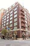
| 3 |
Alamo National Bank Building |
|
000000002006-05-10-0000May 10, 2006
(#06000364) |
105 S. St. Mary's St.
29°25′27″N 98°29′30″W / 29.424167°N 98.491667°W / 29.424167; -98.491667 (Alamo National Bank Building) |
San Antonio |
|
| 4 |
Alamo Plaza Historic District |
|
000000001977-07-13-0000July 13, 1977
(#77001425) |
Roughly bounded by S. Broadway, Commerce, Bonham and Travis Sts.
29°25′31″N 98°29′08″W / 29.425278°N 98.485556°W / 29.425278; -98.485556 (Alamo Plaza Historic District) |
San Antonio |
|
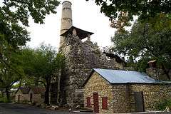
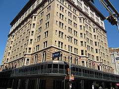
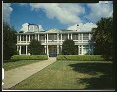
| 5 |
Alamo Portland and Roman Cement Works |
|
000000001976-12-12-0000December 12, 1976
(#76002005) |
Brackenridge Park
29°27′38″N 98°28′36″W / 29.460556°N 98.476667°W / 29.460556; -98.476667 (Alamo Portland and Roman Cement Works) |
San Antonio |
|
| 6 |
The Alamo |
|
000000001966-10-15-0000October 15, 1966
(#66000808) |
Alamo Plaza
29°25′32″N 98°29′10″W / 29.425556°N 98.486111°W / 29.425556; -98.486111 (The Alamo) |
San Antonio |
|
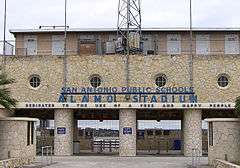
| 7 |
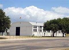
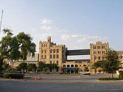
Alamo Stadium and Gymnasium |
|
000000002011-09-08-0000September 8, 2011
(#11000651) |
110 Tuleta Drive
29°27′46″N 98°28′42″W / 29.462847°N 98.478333°W / 29.462847; -98.478333 (Alamo Stadium and Gymnasium) |
San Antonio |
|
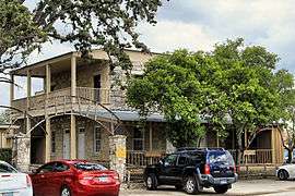
| 8 |
Aue Stagecoach Inn |
|
000000001979-08-01-0000August 1, 1979
(#79002912) |
Boerne Stage Rd. and I-10
29°39′55″N 98°37′43″W / 29.6652°N 98.62875°W / 29.6652; -98.62875 (Aue Stagecoach Inn) |
Leon Springs |
|
| 9 |
Aztec Theater |
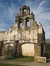
|
000000001992-10-22-0000October 22, 1992
(#92001403) |
104 N. St. Mary's St.
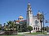
29°25′28″N 98°29′27″W / 29.424444°N 98.490833°W / 29.424444; -98.490833 (Aztec Theater) |
San Antonio |
|
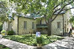
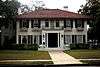
| 10 |
Barnes-Laird House |
|
000000001988-07-28-0000July 28, 1988
(#88001146) |
103 W. Ashby Pl.
29°26′58″N 98°29′40″W / 29.449444°N 98.494444°W / 29.449444; -98.494444 (Barnes-Laird House) |
San Antonio |
|
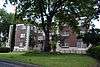
| 11 |
Barr Building |
|
000000001985-04-11-0000April 11, 1985
(#85000766) |
213-219 Broadway
29°25′41″N 98°29′15″W / 29.428056°N 98.4875°W / 29.428056; -98.4875 (Barr Building) |
San Antonio |
|
| 12 |
Base Administration Building |
|
000000001987-08-27-0000August 27, 1987
(#87001434) |
Randolph AFB
29°32′09″N 98°16′57″W / 29.535972°N 98.2825°W / 29.535972; -98.2825 (Base Administration Building) |
Randolph AFB |
|
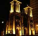
| 13 |
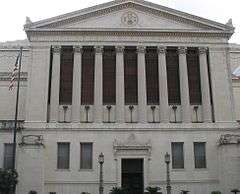
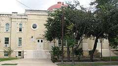
Bexar County Courthouse |
|
000000001977-08-29-0000August 29, 1977
(#77001426) |
Main Plaza
29°25′23″N 98°29′36″W / 29.423056°N 98.493333°W / 29.423056; -98.493333 (Bexar County Courthouse) |
San Antonio |
|
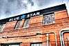
| 14 |
Blue Star Street Industrial Historic District |
|
000000001994-06-24-0000June 24, 1994
(#94000627) |
1432 S. Alamo St.
29°24′35″N 98°29′44″W / 29.409722°N 98.495556°W / 29.409722; -98.495556 (Blue Star Street Industrial Historic District) |
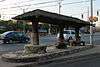
San Antonio |
|
| 15 |
James Butler Bonham Elementary School |
|
000000001978-11-17-0000November 17, 1978
(#78002890) |
925 S. St. Mary's St.
29°24′50″N 98°29′20″W / 29.413889°N 98.488889°W / 29.413889; -98.488889 (James Butler Bonham Elementary School) |
San Antonio |
|
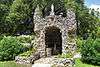
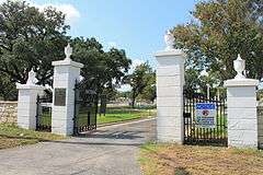
| 16 |
Brackenridge Park |
|
000000002011-08-04-0000August 4, 2011
(#11000513) |
Roughly bounded by Hildebrand Ave., Broadway & Ave. B, Josephine St., US 281, River Rd., Alpine Dr., N. St. Mary's St.
29°27′21″N 98°28′23″W / 29.455833°N 98.473056°W / 29.455833; -98.473056 (Brackenridge Park) |
San Antonio |
|
| 17 |
Brady Building-Empire Theater |
|
000000001999-03-17-0000March 17, 1999
(#99000283) |
204 E. Houston St.-226 N. St. Mary's St.
29°25′34″N 98°29′28″W / 29.42605°N 98.49114°W / 29.42605; -98.49114 (Brady Building-Empire Theater) |
San Antonio |
|
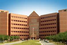
| 18 |
Brooke Army Medical Center |
|
000000002001-11-30-0000November 30, 2001
(#01001281) |
Building 1000, Stanley Rd., Fort Sam Houston
29°27′58″N 98°26′57″W / 29.466111°N 98.449167°W / 29.466111; -98.449167 (Brooke Army Medical Center) |
San Antonio |
|
| 19 |
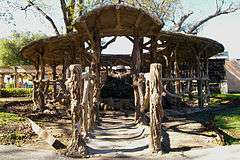
Buckeye Park Gate |
|
000000002004-10-22-0000October 22, 2004
(#04001169) |
1600 W. Wildwood
29°28′45″N 98°31′17″W / 29.479167°N 98.521389°W / 29.479167; -98.521389 (Buckeye Park Gate) |
San Antonio |
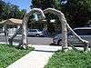
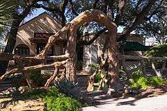
Sculpture by Dionicio Rodriguez
|
| 20 |
Builders Exchange Building |
|
000000001994-11-16-0000November 16, 1994
(#94001335) |
152 Pecan St.
29°25′42″N 98°29′30″W / 29.428472°N 98.491667°W / 29.428472; -98.491667 (Builders Exchange Building) |
San Antonio |
|
| 21 |
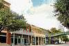
Bungalow Colony Historic District |
Upload image |
000000002003-07-08-0000July 8, 2003
(#03000627) |
Roughly bounded by Duncan Dr., Crockett Dr., Walker Rd. and Robins Dr.
29°22′48″N 98°33′39″W / 29.38°N 98.560833°W / 29.38; -98.560833 (Bungalow Colony Historic District) |
San Antonio |
|
| 22 |
Burns Building |
|
000000001999-03-18-0000March 18, 1999
(#99000284) |
401 E. Houston St.
29°25′35″N 98°29′18″W / 29.426389°N 98.488333°W / 29.426389; -98.488333 (Burns Building) |
San Antonio |
|
| 23 |
Bushnell |
|
000000001982-08-26-0000August 26, 1982
(#82004491) |
240 Bushnell
29°27′44″N 98°29′16″W / 29.462222°N 98.487778°W / 29.462222; -98.487778 (Bushnell) |
San Antonio |
|
| 24 |
Calcasieu Building |
|
000000001996-05-24-0000May 24, 1996
(#96000588) |
202-214 Broadway
29°25′40″N 98°29′14″W / 29.427639°N 98.487361°W / 29.427639; -98.487361 (Calcasieu Building) |
San Antonio |
|
| 25 |
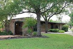
George Washington Carver Library and Auditorium |
|
000000002003-11-15-0000November 15, 2003
(#03001162) |
226 N. Hackberry St.
29°25′19″N 98°28′21″W / 29.421944°N 98.4725°W / 29.421944; -98.4725 (George Washington Carver Library and Auditorium) |
San Antonio |
|
| 26 |
Central Trust Company Building |
|
000000001982-08-11-0000August 11, 1982
(#82004492) |
603 Navarro St.
29°25′36″N 98°29′24″W / 29.426667°N 98.49°W / 29.426667; -98.49 (Central Trust Company Building) |
San Antonio |
|
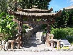
| 27 |
Chinese Sunken Garden Gate |
|
000000002004-10-22-0000October 22, 2004
(#04001167) |
Brackenridge Park, 4000 N. St. Mary's St.
29°27′45″N 98°28′38″W / 29.4625°N 98.477222°W / 29.4625; -98.477222 (Chinese Sunken Garden Gate) |
San Antonio |
Sculpture by Dionicio Rodriguez
|
| 28 |
Church of Nuestra Senora de la Candelaria y Guadalupe |
|
000000001975-02-25-0000February 25, 1975
(#75001949) |
115 Main Ave.
29°25′28″N 98°29′39″W / 29.424444°N 98.494167°W / 29.424444; -98.494167 (Church of Nuestra Senora de la Candelaria y Guadalupe) |
San Antonio |
|
| 29 |
City of San Antonio Municipal Auditorium |
|
000000001981-09-14-0000September 14, 1981
(#81000624) |
100 Auditorium Circle
29°25′50″N 98°29′20″W / 29.430556°N 98.48875°W / 29.430556; -98.48875 (City of San Antonio Municipal Auditorium) |
San Antonio |
|
| 30 |
City Public Service Company Building |
|
000000001995-12-07-0000December 7, 1995
(#95001422) |
201 N. St. Mary's St.
29°25′31″N 98°29′30″W / 29.425278°N 98.491667°W / 29.425278; -98.491667 (City Public Service Company Building) |
San Antonio |
|
| 31 |
L. B. Clegg House |
|
000000001979-12-07-0000December 7, 1979
(#79002913) |
123 W. Park Ave.
29°26′39″N 98°29′43″W / 29.44415°N 98.49533°W / 29.44415; -98.49533 (L. B. Clegg House) |
San Antonio |
|
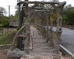
| 32 |
Dionicio Rodriguez Bridge in Brackenridge Park |
|
000000002004-10-22-0000October 22, 2004
(#04001166) |
4000 N. St. Mary's St.
29°27′53″N 98°28′06″W / 29.464722°N 98.468472°W / 29.464722; -98.468472 (Dionicio Rodriguez Bridge in Brackenridge Park) |
San Antonio |
Sculpture by Dionicio Rodriguez
|
| 33 |
Emil Elmendorf House |
|
000000001980-05-19-0000May 19, 1980
(#80004077) |
509 Burleson St.
29°25′58″N 98°28′22″W / 29.43282°N 98.47285°W / 29.43282; -98.47285 (Emil Elmendorf House) |
San Antonio |
|
| 34 |
Espada Aqueduct |
|
000000001966-10-15-0000October 15, 1966
(#66000809) |
Espada Rd., E of U.S. 281S
29°19′56″N 98°27′40″W / 29.332222°N 98.461111°W / 29.332222; -98.461111 (Espada Aqueduct) |
San Antonio |
|
| 35 |
The Fairmount Hotel |
|
000000001988-06-30-0000June 30, 1988
(#88000753) |
401 S. Alamo
29°25′14″N 98°29′18″W / 29.420556°N 98.488333°W / 29.420556; -98.488333 (The Fairmount Hotel) |
San Antonio |
|
| 36 |
Fence at Alamo Cement Company |
|
000000002005-08-09-0000August 9, 2005
(#05000861) |
7300 Jones Maltsberger Rd.
29°29′51″N 98°28′44″W / 29.4975°N 98.47875°W / 29.4975; -98.47875 (Fence at Alamo Cement Company) |
San Antonio |
Sculpture by Dionicio Rodriguez
|
| 37 |
First National Bank of San Antonio |
|
000000001972-03-16-0000March 16, 1972
(#72001348) |
239 E. Commerce St.
29°25′28″N 98°29′25″W / 29.4244°N 98.4902°W / 29.4244; -98.4902 (First National Bank of San Antonio) |
San Antonio |
|
| 38 |
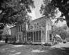
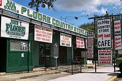
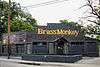
Floore Country Store |
|
000000002005-12-06-0000December 6, 2005
(#05001402) |
14492 Old Bandera Rd.
29°34′40″N 98°41′26″W / 29.577778°N 98.690556°W / 29.577778; -98.690556 (Floore Country Store) |
Helotes |
|
| 39 |
Fort Sam Houston |
|
000000001975-05-15-0000May 15, 1975
(#75001950) |
N edge of San Antonio
29°26′52″N 98°27′52″W / 29.447778°N 98.464444°W / 29.447778; -98.464444 (Fort Sam Houston) |
San Antonio |
|
| 40 |
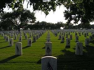
Fort Sam Houston National Cemetery |
|
000000002016-03-08-0000March 8, 2016
(#16000065) |
1520 Harry Wurzbach Road
29°28′36″N 98°25′58″W / 29.4768°N 98.4327°W / 29.4768; -98.4327 (Fort Sam Houston National Cemetery) |
San Antonio |
|
| 41 |
Fountain at Alamo Cement Company |
|
000000002005-08-09-0000August 9, 2005
(#05000862) |
7300 Jones Maltsberger Rd.
29°29′51″N 98°28′45″W / 29.4975°N 98.479167°W / 29.4975; -98.479167 (Fountain at Alamo Cement Company) |
San Antonio |
Sculpture by Dionicio Rodriguez
|
| 42 |
Fourth Ward School |
|
000000001978-11-17-0000November 17, 1978
(#78002891) |
141 Lavaca St.
29°25′02″N 98°29′12″W / 29.417222°N 98.486667°W / 29.417222; -98.486667 (Fourth Ward School) |
San Antonio |
|
| 43 |
Thomas H. Franklin House |
|
000000001986-05-22-0000May 22, 1986
(#86001135) |
105 E. French Pl.
29°27′02″N 98°29′37″W / 29.450556°N 98.493611°W / 29.450556; -98.493611 (Thomas H. Franklin House) |
San Antonio |
|
| 44 |
Friedrich Complex |
|
000000002002-09-26-0000September 26, 2002
(#02001059) |
1617 E. Commerce St.
29°25′14″N 98°28′14″W / 29.420556°N 98.470556°W / 29.420556; -98.470556 (Friedrich Complex) |
San Antonio |
|
| 45 |
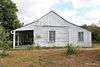
Garcia-Garza House |
|
000000001983-07-07-0000July 7, 1983
(#83003091) |
214 W. Salinas St.
29°25′41″N 98°29′42″W / 29.428056°N 98.495°W / 29.428056; -98.495 (Garcia-Garza House) |
San Antonio |
|
| 46 |
Goad Motor Company Building |
|
000000001997-12-08-0000December 8, 1997
(#97001530) |
317 Lexington Ave.
29°26′00″N 98°29′25″W / 29.433333°N 98.490278°W / 29.433333; -98.490278 (Goad Motor Company Building) |
San Antonio |
|
| 47 |
Carl Hilmar Guenther House |
|
000000001990-10-11-0000October 11, 1990
(#90001539) |
205 E. Guenther St.
29°24′41″N 98°29′45″W / 29.41145°N 98.49582°W / 29.41145; -98.49582 (Carl Hilmar Guenther House) |
San Antonio |
|
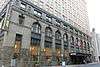
| 48 |
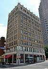
Gunter Hotel |
|
000000002007-01-09-0000January 9, 2007
(#06001233) |
205 E. Houston St.
29°25′36″N 98°29′28″W / 29.42669°N 98.491111°W / 29.42669; -98.491111 (Gunter Hotel) |
San Antonio |
|
| 49 |
A. H. Halff House |
|
000000001986-09-04-0000September 4, 1986
(#86002180) |
601 Howard St.
29°26′31″N 98°29′45″W / 29.441944°N 98.495833°W / 29.441944; -98.495833 (A. H. Halff House) |
San Antonio |
|
| 50 |
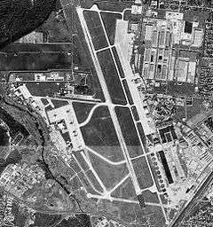
Hangar 9 |
|
000000001970-05-21-0000May 21, 1970
(#70000895) |
Brooks Air Force Base Inner Circle Rd.
29°20′38″N 98°26′39″W / 29.343889°N 98.444167°W / 29.343889; -98.444167 (Hangar 9) |
San Antonio |
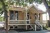
|
| 51 |
Ethel Wilson Harris House |
|
000000002001-04-03-0000April 3, 2001
(#01000325) |
6519 San Jose Dr.-San Antonio Missions NHP
29°21′48″N 98°28′50″W / 29.363333°N 98.480417°W / 29.363333; -98.480417 (Ethel Wilson Harris House) |
San Antonio |
Modern Movement house built in 1956, designed by Robert Harris, which happens to be included in the San Antonio Missions National Historical Park
|
| 52 |
John S. Harrison House |
|
000000002006-06-29-0000June 29, 2006
(#06000551) |
14997 Evans Rd.
29°34′32″N 98°18′19″W / 29.5755°N 98.305306°W / 29.5755; -98.305306 (John S. Harrison House) |
Selma |
|
| 53 |
The Havana |
|
000000001986-04-10-0000April 10, 1986
(#86000725) |
1015 Navarro St.
29°25′51″N 98°29′23″W / 29.430833°N 98.489722°W / 29.430833; -98.489722 (The Havana) |
San Antonio |
|
| 54 |
Hays Street Bridge |
|
000000002012-09-10-0000September 10, 2012
(#12000787) |
Hays St. over UPRR, N. Cherry, & Chestnut Sts.
29°25′49″N 98°28′40″W / 29.43034°N 98.47772°W / 29.43034; -98.47772 (Hays Street Bridge) |
San Antonio |
Historic Bridges of Texas MPS
|
| 55 |
Heidemann Ranch |
Upload image |
000000002011-07-06-0000July 6, 2011
(#11000423) |
26090 Toutant Beauregard Rd.
29°41′18″N 98°42′13″W / 29.688333°N 98.703611°W / 29.688333; -98.703611 (Heidemann Ranch) |
San Antonio |
Farms and Ranches of Bexar County, Texas MPS
|
| 56 |
Johann and Anna Heidgen House |
|
000000002004-06-09-0000June 9, 2004
(#04000591) |
121 Starr St.
29°25′34″N 98°28′56″W / 29.426111°N 98.482222°W / 29.426111; -98.482222 (Johann and Anna Heidgen House) |
San Antonio |
|
| 57 |
Heimann Building |
|
000000002005-01-27-0000January 27, 2005
(#04001396) |
118 N. Medina St.
29°25′37″N 98°30′17″W / 29.426806°N 98.504861°W / 29.426806; -98.504861 (Heimann Building) |
San Antonio |
|
| 58 |
Herrera Ranch |
Upload image |
000000002010-09-09-0000September 9, 2010
(#10000737) |
Old Somerset Rd. at Medina River
29°16′59″N 98°36′51″W / 29.283056°N 98.614028°W / 29.283056; -98.614028 (Herrera Ranch) |
Von Ormy |
|
| 59 |
Huebner-Onion Homestead and Stagecoach Stop |
|
000000002005-08-10-0000August 10, 2005
(#05000860) |
6613 Bandera Rd.
29°29′39″N 98°37′00″W / 29.494167°N 98.616667°W / 29.494167; -98.616667 (Huebner-Onion Homestead and Stagecoach Stop) |
Leon Valley |
|
| 60 |
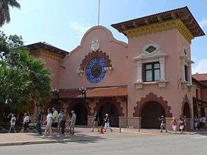
International & Great Northern Railroad Passenger Station |
|
000000001975-09-09-0000September 9, 1975
(#75001951) |
Medina and Houston Sts.
29°25′37″N 98°30′19″W / 29.426944°N 98.505278°W / 29.426944; -98.505278 (International & Great Northern Railroad Passenger Station) |
San Antonio |
|
| 61 |
Jacala Restaurant |
|
000000002004-10-22-0000October 22, 2004
(#04001168) |
2702 N. St. Mary's St.
29°27′01″N 98°29′13″W / 29.450278°N 98.486944°W / 29.450278; -98.486944 (Jacala Restaurant) |
San Antonio |
Facade is a sculpture by Dionicio Rodriguez
|
| 62 |
Kelly Field Historic District |
|
000000002003-07-10-0000July 10, 2003
(#03000626) |
Roughly encompassing the 1600 and 1700 Areas of Kelly AFB
29°22′57″N 98°34′15″W / 29.3825°N 98.570833°W / 29.3825; -98.570833 (Kelly Field Historic District) |
San Antonio |
|
| 63 |
King William Historic District |
|
000000001972-01-20-0000January 20, 1972
(#72001349) |
Roughly bounded by Durango, Alamo, Guenther Sts. and the San Antonio River
29°24′51″N 98°29′34″W / 29.414167°N 98.492778°W / 29.414167; -98.492778 (King William Historic District) |
San Antonio |
|
| 64 |
Krause House |
|
000000002010-07-19-0000July 19, 2010
(#10000469) |
8551 Old Pearsall Road
29°18′20″N 98°39′56″W / 29.305472°N 98.665444°W / 29.305472; -98.665444 (Krause House) |
San Antonio |
|
| 65 |
La Villita Historic District |
|
000000001972-01-20-0000January 20, 1972
(#72001350) |
Bounded by Durango, Navarro, Alamo Sts. and San Antonio River
29°25′17″N 98°29′20″W / 29.421389°N 98.488889°W / 29.421389; -98.488889 (La Villita Historic District) |
San Antonio |
|
| 66 |
Lavaca Historic District |
Upload image |
000000002000-07-05-0000July 5, 2000
(#00000773) |
Roughly bounded by S. Alamo St., S. Presa St., alley bet. Camargo St., Callahan Ave., Labor St., and Garfield Alley
29°24′47″N 98°29′14″W / 29.413056°N 98.487222°W / 29.413056; -98.487222 (Lavaca Historic District) |
San Antonio |
|
| 67 |
Robert E. Lee Hotel |
|
000000001996-02-16-0000February 16, 1996
(#96000063) |
111 Travis St.
29°25′39″N 98°29′39″W / 29.4275°N 98.494167°W / 29.4275; -98.494167 (Robert E. Lee Hotel) |
San Antonio |
|
| 68 |
Lerma's Nite Club |
|
000000002011-03-21-0000March 21, 2011
(#11000135) |
1602-1612 N Zarzamora
29°26′40″N 98°31′29″W / 29.444306°N 98.524792°W / 29.444306; -98.524792 (Lerma's Nite Club) |
San Antonio |
|
| 69 |
Light House |
|
000000002011-03-21-0000March 21, 2011
(#11000131) |
300 Argyle Ave
29°28′32″N 98°28′10″W / 29.475417°N 98.469514°W / 29.475417; -98.469514 (Light House) |
Alamo Heights |
|
| 70 |
Live Oak Park Site |
Upload image |
000000001978-12-15-0000December 15, 1978
(#78002889) |
Address Restricted
|
Live Oak |
41BX435
|
| 71 |
Livingston-Hess House |
|
000000001996-02-16-0000February 16, 1996
(#96000036) |
228 W. Huisache Ave.
29°27′21″N 98°29′46″W / 29.455833°N 98.496111°W / 29.455833; -98.496111 (Livingston-Hess House) |
San Antonio |
|
| 72 |
Main and Military Plazas Historic District |
|
000000001979-06-11-0000June 11, 1979
(#79002914) |
Roughly bounded by San Antonio River, E. Nueva, Laredo, and Houston Sts.
29°25′27″N 98°29′37″W / 29.424167°N 98.493611°W / 29.424167; -98.493611 (Main and Military Plazas Historic District) |
San Antonio |
|
| 73 |
Majestic Theatre |
|
000000001975-10-01-0000October 1, 1975
(#75001952) |
230 E. Houston St.
29°25′35″N 98°29′26″W / 29.42625°N 98.490556°W / 29.42625; -98.490556 (Majestic Theatre) |
San Antonio |
|
| 74 |
Maverick Building |
|
000000001995-01-24-0000January 24, 1995
(#94001593) |
606 N. Presa
29°25′35″N 98°29′18″W / 29.42625°N 98.488472°W / 29.42625; -98.488472 (Maverick Building) |
San Antonio |
|
| 75 |
Maverick-Altgelt Ranch and Fenstermaker-Fromme Farm |
Upload image |
000000001979-04-12-0000April 12, 1979
(#79002915) |
Address Restricted
|
San Antonio |
41BX493, 41BX494, 41BX495, 41BX496, 41BX497, 41BX498
|
| 76 |
Maverick-Carter House |
|
000000001998-07-21-0000July 21, 1998
(#98000844) |
119 Taylor St.
29°25′48″N 98°29′16″W / 29.42997°N 98.48779°W / 29.42997; -98.48779 (Maverick-Carter House) |
San Antonio |
|
| 77 |
Otto Meerscheidt House |
Upload image |
000000001980-07-04-0000July 4, 1980
(#80004488) |
332 Adams St.
29°24′30″N 98°29′25″W / 29.408333°N 98.490278°W / 29.408333; -98.490278 (Otto Meerscheidt House) |
San Antonio |
|
| 78 |
Menger Soap Works |
|
000000001973-12-12-0000December 12, 1973
(#73001958) |
400 block of N. Laredo St.
29°25′45″N 98°29′48″W / 29.429028°N 98.496667°W / 29.429028; -98.496667 (Menger Soap Works) |
San Antonio |
|
| 79 |
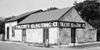
Merchants Ice and Cold Storage Company |
|
000000002002-09-26-0000September 26, 2002
(#02001060) |
1305 E. Houston St.
29°25′31″N 98°28′38″W / 29.425278°N 98.477222°W / 29.425278; -98.477222 (Merchants Ice and Cold Storage Company) |
San Antonio |
|
| 80 |
Meyer Pottery Archeological Complex |
Upload image |
000000001990-03-09-0000March 9, 1990
(#90000299) |
Address Restricted
|
Atascosa |
41BX128, aka Black Hill Pottery
|
| 81 |
Milam Building |
|
000000002014-05-18-0000May 18, 2014
(#15000246) |
115 East Travis Street
29°25′40″N 98°29′35″W / 29.427772°N 98.493019°W / 29.427772; -98.493019 (Milam Building) |
San Antonio |
|
| 82 |
Miraflores Park |
|
000000002006-06-14-0000June 14, 2006
(#04001176) |
800 Hildebrand
29°27′55″N 98°28′03″W / 29.46520°N 98.4675°W / 29.46520; -98.4675 (Miraflores Park) |
San Antonio |
|
| 83 |
Mission Concepcion |
|
000000001970-04-15-0000April 15, 1970
(#70000740) |
807 Mission Rd.
29°23′27″N 98°29′28″W / 29.390833°N 98.49125°W / 29.390833; -98.49125 (Mission Concepcion) |
San Antonio |
|
| 84 |
Mission Parkway |
Upload image |
000000001975-10-06-0000October 6, 1975
(#75001953) |
Along San Antonio River
29°21′06″N 98°28′11″W / 29.351667°N 98.469722°W / 29.351667; -98.469722 (Mission Parkway) |
San Antonio |
|
| 85 |
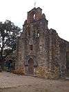
Mission San Francisco de la Espada |
|
000000001972-02-23-0000February 23, 1972
(#72001351) |
Espada Rd.
29°19′03″N 98°27′00″W / 29.3175°N 98.45°W / 29.3175; -98.45 (Mission San Francisco de la Espada) |
San Antonio |
Boundary increase January 28, 1974
|
| 86 |
Mission San Juan Capistrano |
|
000000001972-02-23-0000February 23, 1972
(#72001352) |
Mission Rd.
29°19′55″N 98°27′16″W / 29.331944°N 98.454444°W / 29.331944; -98.454444 (Mission San Juan Capistrano) |
San Antonio |
|
| 87 |
Monastery of Our Lady of Charity |
|
000000001999-06-25-0000June 25, 1999
(#99000719) |
1900 Montana
29°25′05″N 98°26′56″W / 29.418056°N 98.448889°W / 29.418056; -98.448889 (Monastery of Our Lady of Charity) |
San Antonio |
|
| 88 |
Monte Vista Residential Historic District |
Upload image |
000000001998-12-10-0000December 10, 1998
(#98001421) |
Roughly bounded by Hildebrand, Stadium, N. St. Mary's, Asby, and San Pedro Sts.
29°27′27″N 98°29′26″W / 29.4575°N 98.490556°W / 29.4575; -98.490556 (Monte Vista Residential Historic District) |
San Antonio |
|
| 89 |
William J. Morrison, Jr. House |
|
000000001990-07-12-0000July 12, 1990
(#90001078) |
710 N. Olive St.
29°25′41″N 98°28′16″W / 29.428056°N 98.471111°W / 29.428056; -98.471111 (William J. Morrison, Jr. House) |
San Antonio |
|
| 90 |
Jose Antonio Navarro Elementary School |
|
000000001978-11-29-0000November 29, 1978
(#78002892) |
623 S. Pecos St.
29°25′11″N 98°30′08″W / 29.419722°N 98.502222°W / 29.419722; -98.502222 (Jose Antonio Navarro Elementary School) |
San Antonio |
|
| 91 |
Jose Antonio Navarro House Complex |
|
000000001972-03-24-0000March 24, 1972
(#72001353) |
228-232 S. Laredo St.
29°25′23″N 98°29′50″W / 29.423056°N 98.497361°W / 29.423056; -98.497361 (Jose Antonio Navarro House Complex) |
San Antonio |
|
| 92 |
Old Lone Star Brewery |
|
000000001972-10-26-0000October 26, 1972
(#72001354) |
200 West Jones Ave.
29°26′13″N 98°28′53″W / 29.436944°N 98.481389°W / 29.436944; -98.481389 (Old Lone Star Brewery) |
San Antonio |
October 26, 1972 and September 25, 1979 (boundary increase)
|
| 93 |
Our Lady of Mount Carmel and St. Therese Church |
|
000000001998-07-09-0000July 9, 1998
(#98000843) |
906 Kentucky
29°26′45″N 98°31′30″W / 29.445833°N 98.525°W / 29.445833; -98.525 (Our Lady of Mount Carmel and St. Therese Church) |
San Antonio |
|
| 94 |
Hiram Partee House |
|
000000001984-09-20-0000September 20, 1984
(#84001576) |
605 Belknap Pl.
29°27′08″N 98°29′52″W / 29.452222°N 98.497778°W / 29.452222; -98.497778 (Hiram Partee House) |
San Antonio |
|
| 95 |
Perez Rancho Site and Delores Crossing |
Upload image |
000000002014-11-26-0000November 26, 2014
(#14000099) |
Address Restricted
|
San Antonio |
Lt. Col. Ygnacio Perez Stone Rancho Site, 41BX274
|
| 96 |
Pershing House |
|
000000001974-07-30-0000July 30, 1974
(#74002058) |
Staff Post Rd., Fort Sam Houston
29°26′42″N 98°28′10″W / 29.445°N 98.469306°W / 29.445; -98.469306 (Pershing House) |
San Antonio |
|
| 97 |
Plehwe Complex |
|
000000001983-12-15-0000December 15, 1983
(#83003755) |
W of Leon Springs on Boerne Stage Rd.
29°39′53″N 98°38′20″W / 29.6647°N 98.6388°W / 29.6647; -98.6388 (Plehwe Complex) |
Leon Springs |
|
| 98 |
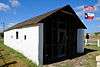
Post Chapel, Fort Sam Houston |
|
000000001974-05-17-0000May 17, 1974
(#74002057) |
Bldg. 2200, Wilson St.
29°26′54″N 98°27′31″W / 29.448333°N 98.458611°W / 29.448333; -98.458611 (Post Chapel, Fort Sam Houston) |
San Antonio |
|
| 99 |
Presnall-Watson Homestead |
Upload image |
000000002012-04-10-0000April 10, 2012
(#12000192) |
Address Restricted
|
San Antonio |
Farms and Ranches of Bexar County, Texas Multiple Property Submission
|
| 100 |
Prospect Hill Missionary Baptist Church |
|
000000001986-09-18-0000September 18, 1986
(#86002185) |
1601 Buena Vista
29°25′35″N 98°30′57″W / 29.42625°N 98.515972°W / 29.42625; -98.515972 (Prospect Hill Missionary Baptist Church) |
San Antonio |
|
| 101 |
The Quadrangle |
|
000000001974-07-30-0000July 30, 1974
(#74002059) |
Grayson St., Fort Sam Houston
29°26′40″N 98°27′44″W / 29.444444°N 98.462222°W / 29.444444; -98.462222 (The Quadrangle) |
San Antonio |
|
| 102 |
Randolph Field Historic District |
|
000000001996-07-08-0000July 8, 1996
(#96000753) |
Randolph Air Force Base, off Pat Booker Rd., 18 NE of San Antonio
29°31′56″N 98°16′48″W / 29.532222°N 98.28°W / 29.532222; -98.28 (Randolph Field Historic District) |
San Antonio |
|
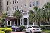
| 103 |
Saint Anthony Hotel |
|
000000001986-09-19-0000September 19, 1986
(#86002186) |
300 Travis St.
29°25′38″N 98°29′19″W / 29.427222°N 98.488611°W / 29.427222; -98.488611 (Saint Anthony Hotel) |
San Antonio |
|
| 104 |
St. Louis Hall at St. Mary's University |
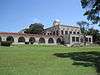
|
000000002008-03-24-0000March 24, 2008
(#08000239) |
1 Camino Santa Maria
29°27′10″N 98°33′40″W / 29.452778°N 98.561111°W / 29.452778; -98.561111 (St. Louis Hall at St. Mary's University) |
San Antonio |
|
| 105 |
St. Mark's Episcopal Church |
|
000000001998-02-12-0000February 12, 1998
(#98000103) |
315 E. Pecan St.
29°25′43″N 98°29′19″W / 29.428611°N 98.488611°W / 29.428611; -98.488611 (St. Mark's Episcopal Church) |
San Antonio |
|
| 106 |
Salado Battlefield and Archeological Site |
Upload image |
000000001978-11-21-0000November 21, 1978
(#78002893) |
Address Restricted
|
San Antonio |
|
| 107 |
San Antonio Casino Club Building |
|
000000001980-01-08-0000January 8, 1980
(#80004078) |
102 W. Crockett St.
29°25′30″N 98°29′19″W / 29.425°N 98.488611°W / 29.425; -98.488611 (San Antonio Casino Club Building) |
San Antonio |
|
| 108 |
Old San Antonio City Cemeteries Historic District |
|
000000002000-10-11-0000October 11, 2000
(#00000772) |
Roughly bounded by Nevada, New Braunfels, Paso Hondo, Palmetto, Potomac, St. James, Pine, E. Commerce, Dakota, Monumenta
29°25′08″N 98°27′52″W / 29.418889°N 98.464444°W / 29.418889; -98.464444 (Old San Antonio City Cemeteries Historic District) |
San Antonio |
|
| 109 |
San Antonio Drug Company |
|
000000001994-05-19-0000May 19, 1994
(#94000453) |
432 W. Market St.
29°25′25″N 98°29′29″W / 29.423611°N 98.491389°W / 29.423611; -98.491389 (San Antonio Drug Company) |
San Antonio |
|
| 110 |
San Antonio Loan and Trust Building |
Upload image |
000000001976-07-12-0000July 12, 1976
(#76002006) |
235 E. Commerce St.
29°25′25″N 98°29′26″W / 29.423611°N 98.490556°W / 29.423611; -98.490556 (San Antonio Loan and Trust Building) |
San Antonio |
|
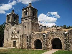
| 111 |
San Antonio Missions National Historical Park |
|
000000001978-11-10-0000November 10, 1978
(#78003147) |
Mission and Espada Rds. and San Jose Dr.
29°21′42″N 98°28′49″W / 29.361667°N 98.480278°W / 29.361667; -98.480278 (San Antonio Missions National Historical Park) |
San Antonio |
|
| 112 |
San Antonio National Cemetery |
|
000000001999-11-22-0000November 22, 1999
(#99001395) |
517 Paso Hondo St.
29°25′20″N 98°28′05″W / 29.422222°N 98.468056°W / 29.422222; -98.468056 (San Antonio National Cemetery) |
San Antonio |
|
| 113 |
San Antonio US Post Office and Courthouse |
|
000000002000-09-29-0000September 29, 2000
(#00001174) |
615 E. Houston St.
29°25′37″N 98°29′11″W / 29.426944°N 98.48625°W / 29.426944; -98.48625 (San Antonio US Post Office and Courthouse) |
San Antonio |
|
| 114 |
San Antonio Water Works Pump Station No. 2 |
|
000000001981-08-21-0000August 21, 1981
(#81000625) |
Brackenridge Park
29°26′55″N 98°28′37″W / 29.4487°N 98.4769°W / 29.4487; -98.4769 (San Antonio Water Works Pump Station No. 2) |
San Antonio |
|
| 115 |
San Jose Mission National Historic Site |
|
000000001966-10-15-0000October 15, 1966
(#66000810) |
6519 San Jose Dr.
29°21′44″N 98°28′47″W / 29.362222°N 98.479722°W / 29.362222; -98.479722 (San Jose Mission National Historic Site) |
San Antonio |
|
| 116 |
San Pedro Springs Park |
|
000000001979-11-01-0000November 1, 1979
(#79002916) |
San Pedro Ave.
29°26′48″N 98°30′05″W / 29.446667°N 98.501389°W / 29.446667; -98.501389 (San Pedro Springs Park) |
San Antonio |
|
| 117 |
Schroeder-Yturri House |
|
000000001975-04-14-0000April 14, 1975
(#75001954) |
1040 E. Commerce St.
29°25′20″N 98°28′54″W / 29.422153°N 98.481667°W / 29.422153; -98.481667 (Schroeder-Yturri House) |
San Antonio |
|
| 118 |
Scottish Rite Cathedral |
|
000000001996-02-16-0000February 16, 1996
(#96000068) |
308 Ave. E
29°25′39″N 98°29′03″W / 29.4275°N 98.484167°W / 29.4275; -98.484167 (Scottish Rite Cathedral) |
San Antonio |
|
| 119 |
Smith-Young Tower |
|
000000001991-11-13-0000November 13, 1991
(#91001682) |
310 S. St. Mary's St.
29°25′22″N 98°29′29″W / 29.422778°N 98.491319°W / 29.422778; -98.491319 (Smith-Young Tower) |
San Antonio |
|
| 120 |
Source of the River District |
Upload image |
000000001978-07-31-0000July 31, 1978
(#78002894) |
Address Restricted
|
San Antonio |
|
| 121 |
South Alamo Street-South Mary's Street Historic District |
Upload image |
000000001984-10-04-0000October 4, 1984
(#84000026) |
Bounded by the San Antonio River, S. Alamo, S. St. Mary's, and Temple Sts.
29°24′29″N 98°29′25″W / 29.408056°N 98.490278°W / 29.408056; -98.490278 (South Alamo Street-South Mary's Street Historic District) |
San Antonio |
|
| 122 |
Southern Pacific Depot Historic District |
|
000000001979-02-01-0000February 1, 1979
(#79002917) |
Roughly bounded by Crockett, Chestnut, Galveston, and Cherry Sts.
29°25′16″N 98°28′40″W / 29.421111°N 98.477778°W / 29.421111; -98.477778 (Southern Pacific Depot Historic District) |
San Antonio |
|
| 123 |
Southern Pacific Railroad Passenger Station |
|
000000001975-05-29-0000May 29, 1975
(#75001955) |
1174 E. Commerce St.
29°25′12″N 98°28′40″W / 29.42°N 98.477778°W / 29.42; -98.477778 (Southern Pacific Railroad Passenger Station) |
San Antonio |
|
| 124 |
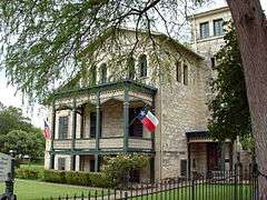
Spanish Governor's Palace |
|
000000001970-04-15-0000April 15, 1970
(#70000741) |
105 Military Plaza
29°25′30″N 98°29′45″W / 29.4249°N 98.4958°W / 29.4249; -98.4958 (Spanish Governor's Palace) |
San Antonio |
|
| 125 |
Staacke Brothers Building |
|
000000001980-09-02-0000September 2, 1980
(#80004079) |
309 E. Commerce St.
29°25′28″N 98°29′22″W / 29.424306°N 98.489444°W / 29.424306; -98.489444 (Staacke Brothers Building) |
San Antonio |
|
| 126 |
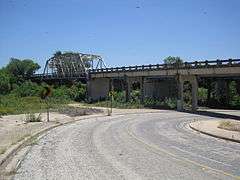
State Highway 3-A Bridge at Cibolo Creek |
|
000000001996-10-10-0000October 10, 1996
(#96001112) |
I-10 at the Bexar and Guadalupe Cnty. line
29°30′05″N 98°11′11″W / 29.501389°N 98.186389°W / 29.501389; -98.186389 (State Highway 3-A Bridge at Cibolo Creek) |
Schertz |
|
| 127 |
Stations of the Cross and Grotto at the Shrine of St. Anthony de Padua |
|
000000002004-12-23-0000December 23, 2004
(#04001170) |
100 Peter Baque Rd.
29°30′04″N 98°28′14″W / 29.501111°N 98.470556°W / 29.501111; -98.470556 (Stations of the Cross and Grotto at the Shrine of St. Anthony de Padua) |
San Antonio |
Sculpture by Dionicio Rodriguez
|
| 128 |
Stevens Building |
|
000000001984-05-10-0000May 10, 1984
(#84001614) |
315 E. Commerce St.
29°25′27″N 98°29′21″W / 29.424167°N 98.489167°W / 29.424167; -98.489167 (Stevens Building) |
San Antonio |
|
| 129 |
Thiele House and Thiele Cottage |
|
000000001983-03-03-0000March 3, 1983
(#83003092) |
411 and 415 Sixth St.
29°25′47″N 98°28′59″W / 29.429722°N 98.483056°W / 29.429722; -98.483056 (Thiele House and Thiele Cottage) |
San Antonio |
|
| 130 |
Thomas Jefferson High School |
|
000000001983-09-22-0000September 22, 1983
(#83003093) |
723 Donaldson Ave.
29°27′54″N 98°32′15″W / 29.465°N 98.5375°W / 29.465; -98.5375 (Thomas Jefferson High School) |
San Antonio |
|
| 131 |
The Toltec |
|
000000002010-07-26-0000July 26, 2010
(#10000498) |
131 Taylor Ave.
29°25′49″N 98°29′16″W / 29.430389°N 98.487694°W / 29.430389; -98.487694 (The Toltec) |
San Antonio |
Apartment Complex built between 1910 and 1920[6]
|
| 132 |
Travelers Hotel |
|
000000002015-09-18-0000September 18, 2015
(#15000617) |
220 Broadway
29°25′42″N 98°29′14″W / 29.428261°N 98.487099°W / 29.428261; -98.487099 (Travelers Hotel) |
San Antonio |
|
| 133 |
Trolley Stop in Alamo Heights |
|
000000002004-10-22-0000October 22, 2004
(#04001165) |
4900 blk of Broadway
29°28′17″N 98°27′48″W / 29.471389°N 98.463333°W / 29.471389; -98.463333 (Trolley Stop in Alamo Heights) |
Alamo Heights |
Sculpture by Dionicio Rodriguez
|
| 134 |
U.S. San Antonio Arsenal |
|
000000001969-12-30-0000December 30, 1969
(#69000200) |
Roughly bounded by S. Flores and E. Arsenal Sts., and the San Antonio River
29°24′28″N 98°29′44″W / 29.407778°N 98.495556°W / 29.407778; -98.495556 (U.S. San Antonio Arsenal) |
San Antonio |
|
| 135 |
Gustav Uhl House and Store |
|
000000002002-09-26-0000September 26, 2002
(#02001061) |
721 Avenue E
29°25′52″N 98°28′52″W / 29.431111°N 98.481111°W / 29.431111; -98.481111 (Gustav Uhl House and Store) |
San Antonio |
|
| 136 |
University of Incarnate Word Administration Building |
|
000000002010-05-17-0000May 17, 2010
(#10000267) |
4301 Broadway
29°28′01″N 98°27′54″W / 29.467083°N 98.465°W / 29.467083; -98.465 (University of Incarnate Word Administration Building) |
San Antonio |
|
| 137 |
Ursuline Academy |
|
000000001969-11-25-0000November 25, 1969
(#69000201) |
300 Augusta St.
29°25′52″N 98°29′32″W / 29.431111°N 98.492222°W / 29.431111; -98.492222 (Ursuline Academy) |
San Antonio |
|
| 138 |
Voelcker Farmstead Historic District |
Upload image |
000000002014-07-11-0000July 11, 2014
(#14000402) |
Address Restricted
|
San Antonio |
|
| 139 |
Vogel Belt Complex |
|
000000001975-04-10-0000April 10, 1975
(#75001956) |
111-121 Military Plaza
29°25′28″N 98°29′45″W / 29.424444°N 98.495833°W / 29.424444; -98.495833 (Vogel Belt Complex) |
San Antonio |
|
| 140 |
Walker Ranch |
Upload image |
000000001975-02-24-0000February 24, 1975
(#75001957) |
Address Restricted
|
San Antonio |
|
| 141 |
R.L. White Ranch |
Upload image |
000000001975-02-24-0000February 24, 1975
(#08000474) |
18744 Bandera Rd. E.
29°37′04″N 98°45′02″W / 29.617778°N 98.750556°W / 29.617778; -98.750556 (R.L. White Ranch) |
Helotes |
|
| 142 |
David J. and May Bock Woodward House |
|
000000001996-02-16-0000February 16, 1996
(#96000069) |
1717 San Pedro Ave.
29°27′01″N 98°29′59″W / 29.450278°N 98.499722°W / 29.450278; -98.499722 (David J. and May Bock Woodward House) |
San Antonio |
|
| 143 |
L. T. Wright House |
|
000000001983-04-01-0000April 1, 1983
(#83003094) |
342 Wilkens Ave.
29°23′42″N 98°29′08″W / 29.395°N 98.485694°W / 29.395; -98.485694 (L. T. Wright House) |
San Antonio |
|
| 144 |
Ximenes Chapel |
|
000000001980-09-08-0000September 8, 1980
(#80004080) |
113 Ruiz St.
29°26′03″N 98°30′13″W / 29.434167°N 98.503611°W / 29.434167; -98.503611 (Ximenes Chapel) |
San Antonio |
|
| 145 |
Yturri-Edmunds House |
|
000000001996-08-08-0000August 8, 1996
(#96000870) |
257 Yellowstone St.
29°23′53″N 98°29′15″W / 29.398194°N 98.4875°W / 29.398194; -98.4875 (Yturri-Edmunds House) |
San Antonio |
|
.jpg)
.jpg)

.jpg)

.jpg)
.jpg)
.jpg)
.jpg)
.jpg)

.JPG)

.jpg)