National Register of Historic Places listings in Downtown and Downtown West St. Louis
This is a list of properties and historic districts within the Downtown St. Louis and Downtown West, St. Louis areas of the city of St. Louis, Missouri that are listed on the National Register of Historic Places. The downtown area is defined by Cole Street to the north, the river front to the east, Chouteau Avenue to the south, and Jefferson Avenue to the west. Tucker Avenue divides Downtown to the east from Downtown West to the west.
For other listings in the city, see National Register of Historic Places listings in St. Louis north and west of downtown and National Register of Historic Places listings in St. Louis south and west of downtown. For listings in St. Louis County, outside the city limits of St. Louis, see National Register of Historic Places listings in St. Louis County, Missouri.
Current listings
| [1] | Name on the Register | Image | Date listed[2] | Location | Description |
|---|---|---|---|---|---|
| 1 | Advertising Building | 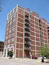 |
(#85000106) |
1627-1629 Locust St. 38°37′56″N 90°12′14″W / 38.632222°N 90.203889°W |
|
| 2 | Ambassador Theater Building | Upload image | (#83001039) |
411 N. 7th St. 38°37′46″N 90°11′28″W / 38.629444°N 90.191111°W |
Demolished in 1996.[3] |
| 3 | American Theater | 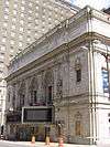 |
(#85000617) |
416 N. 9th St. 38°37′48″N 90°11′34″W / 38.630000°N 90.192778°W |
|
| 4 | American Zinc, Lead and Smelting Company Building | Upload image | (#98000363) |
20 S. 4th St. 38°37′28″N 90°11′10″W / 38.624444°N 90.186111°W |
|
| 5 | Arcade Building | 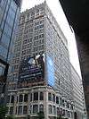 |
(#03000126) |
810 Olive St. 38°37′42″N 90°11′34″W / 38.628333°N 90.192778°W |
|
| 6 | Balmer & Weber Music House Co. Building | 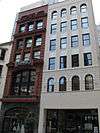 |
(#00001008) |
1004 Olive St. 38°37′44″N 90°11′42″W / 38.628889°N 90.195000°W |
|
| 7 | Beethoven Conservatory | 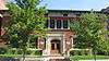 |
(#89000075) |
2301 Locust St. 38°38′03″N 90°12′44″W / 38.634167°N 90.212222°W |
|
| 8 | Bell Telephone Building | .jpg) |
(#99000936) |
920 Olive St. 38°37′44″N 90°11′40″W / 38.628889°N 90.194444°W |
|
| 9 | Berry Motor Car Service Building | 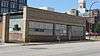 |
(#10000480) |
2220 Washington Ave. 38°38′04″N 90°12′41″W / 38.634444°N 90.211389°W |
|
| 10 | Blackwell-Wielandy Building | 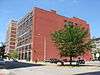 |
(#83001040) |
1601-1609 Locust St. 38°37′56″N 90°12′11″W / 38.632222°N 90.203056°W |
|
| 11 | Board of Education Building | 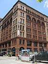 |
(#04001475) |
901-911 Locust St. and 401-409 N. Ninth St. 38°37′48″N 90°11′36″W / 38.630000°N 90.193333°W |
|
| 12 | Boatman's Bank Building |  |
(#98001265) |
300 North Broadway 38°37′40″N 90°11′19″W / 38.627778°N 90.188611°W |
|
| 13 | A. D. Brown Building |  |
(#80004502) |
1136 Washington Ave. 38°37′53″N 90°11′47″W / 38.631389°N 90.196389°W |
|
| 14 | Paul Brown Building |  |
(#02001496) |
818 Olive St. 38°37′42″N 90°11′36″W / 38.628333°N 90.193333°W |
|
| 15 | Building at 1009 Olive St. |  |
(#02000468) |
1009 Olive St. 38°37′46″N 90°11′42″W / 38.629444°N 90.195000°W |
|
| 16 | Building at 1121-23 Locust St. | 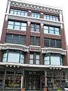 |
(#04000785) |
1121-23 Locust St. 38°37′50″N 90°11′46″W / 38.630556°N 90.196111°W |
|
| 17 | Building at 1300 Washington Avenue | 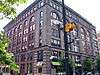 |
(#82004732) |
1300-1310 Washington Ave. 38°37′55″N 90°11′55″W / 38.631944°N 90.198611°W |
|
| 18 | Robert G. Campbell House | 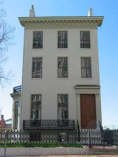 |
(#77001560) |
1508 Locust St. 38°37′53″N 90°12′06″W / 38.631389°N 90.201750°W |
|
| 19 | Centenary Methodist Episcopal Church, South | 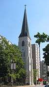 |
(#96001596) |
55 Plaza Sq. 38°37′50″N 90°12′13″W / 38.630556°N 90.203611°W |
|
| 20 | Centennial Malt House |  |
(#05001281) |
2017-19 Chouteau Ave. 38°37′17″N 90°12′47″W / 38.621389°N 90.213056°W |
|
| 21 | Century Building and Syndicate Trust Building |  |
(#02001054) |
Bounded by Locust, 9th, 10th, and Olive Sts. 38°37′46″N 90°11′39″W / 38.629444°N 90.194167°W |
The Century Building was demolished and replaced by a parking garage in February 2005.[4] |
| 22 | Chemical Building |  |
(#82004734) |
721 Olive St. 38°37′43″N 90°11′31″W / 38.628611°N 90.191944°W |
|
| 23 | Christ Church Cathedral | .jpg) |
(#90000345) |
1210 Locust St. 38°37′50″N 90°11′54″W / 38.630556°N 90.198333°W |
|
| 24 | City Club Building |  |
(#02000610) |
1012-1024 Locust St. 38°37′48″N 90°11′43″W / 38.630000°N 90.195278°W |
|
| 25 | Crunden-Martin Manufacturing Company | Upload image | (#05000013) |
104 Cedar, 760 S. 2nd St., and 757 S. 2nd St. 38°37′04″N 90°11′21″W / 38.617778°N 90.189167°W |
|
| 26 | Cupples Warehouse District | Upload image | (#85003615) |
Roughly Spruce and Clark Sts. between 7th and 11th Sts. 38°37′26″N 90°11′51″W / 38.623889°N 90.197500°W |
|
| 27 | Delany Building | 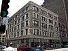 |
(#02000102) |
1000-06 Locust St. 38°37′47″N 90°11′41″W / 38.629722°N 90.194722°W |
|
| 28 | Downtown YMCA Building | Upload image | (#14000379) |
1528 Locust St. 38°37′54″N 90°12′10″W / 38.6317°N 90.2027°W |
|
| 29 | Eads Bridge | |
(#66000946) |
Spanning the Mississippi River at Washington St. 38°37′45″N 90°10′52″W / 38.629167°N 90.181111°W |
|
| 30 | Emerson Electric Company Building |  |
(#86003138) |
2012-2018 Washington Ave. 38°38′02″N 90°12′31″W / 38.633889°N 90.208611°W |
|
| 31 | Endicott-Johnson Shoe Distribution Plant | 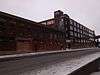 |
(#07001074) |
1132 Spruce St. 38°37′26″N 90°11′58″W / 38.623889°N 90.199444°W |
|
| 32 | Engine House No. 32 | Upload image | (#15000816) |
2000 Washington Ave. & 503 N. 20th St. 38°38′03″N 90°12′28″W / 38.63406°N 90.2079°W |
|
| 33 | Executive Office Building |  |
(#12000926) |
515-517 Olive St. 38°37′41″N 90°11′23″W / 38.628056°N 90.189722°W |
|
| 34 | Farm and Home Savings and Loan Association | 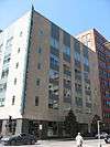 |
(#08001025) |
1001 Locust St. 38°37′48″N 90°11′40″W / 38.630000°N 90.194444°W |
|
| 35 | Fashion Square Building |  |
(#85003105) |
1307 Washington Ave. 38°37′57″N 90°11′55″W / 38.632500°N 90.198611°W |
|
| 36 | Eugene Field House | .jpg) |
(#75002137) |
634 S. Broadway 38°37′12″N 90°11′31″W / 38.620000°N 90.191944°W |
Home of civil rights lawyer Eugene Field |
| 37 | Ford Apartments | 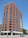 |
(#04001562) |
1405 Pine St. 38°37′47″N 90°12′03″W / 38.629722°N 90.200833°W |
|
| 38 | Franklin School | 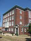 |
(#05000121) |
814 N. 19th St. 38°38′08″N 90°12′19″W / 38.635556°N 90.205278°W |
|
| 39 | Frisco Building | 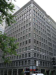 |
(#83001046) |
906 Olive St. 38°37′44″N 90°11′38″W / 38.628889°N 90.193889°W |
|
| 40 | Fulton Bag Company Building |  |
(#91001372) |
612-618 S. 7th St. 38°37′16″N 90°11′38″W / 38.621111°N 90.193889°W |
|
| 41 | Gateway Arch | 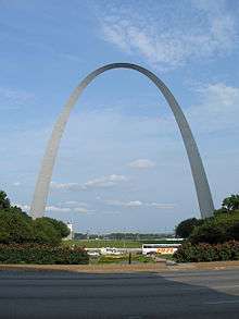 |
(#87001423) |
Memorial Dr. between the Poplar St. and Eads bridges 38°37′28″N 90°11′06″W / 38.624444°N 90.185000°W |
|
| 42 | General American Life Insurance Co. Buildings | 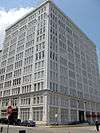 |
(#02001206) |
1501-1511 Locust St. 38°37′55″N 90°12′06″W / 38.631944°N 90.201667°W |
|
| 43 | General American Life Insurance Company National Headquarters |  |
(#07000461) |
706 Market St. 38°37′32″N 90°11′35″W / 38.625556°N 90.193056°W |
|
| 44 | William A. Gill Building | 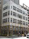 |
(#09000282) |
622 Olive St. 38°37′41″N 90°11′28″W / 38.628056°N 90.191250°W |
|
| 45 | Grand-Leader (Stix, Baer & Fuller Dry Goods Co.) Building |  |
(#03000650) |
601 Washington Ave. 38°37′50″N 90°11′22″W / 38.630556°N 90.189444°W |
|
| 46 | Haas Building |  |
(#04000747) |
410 N. Jefferson Ave. and 2327 Locust St. 38°38′03″N 90°12′48″W / 38.634167°N 90.213333°W |
|
| 47 | Elias Haas Building |  |
(#06000248) |
2223 Locust St. 38°38′02″N 90°12′43″W / 38.633889°N 90.211944°W |
|
| 48 | Hadley-Dean Glass Company |  |
(#79003634) |
701-705 N. 11th St. 38°37′56″N 90°11′42″W / 38.632222°N 90.195000°W |
|
| 49 | Halsey-Packard Building |  |
(#05001036) |
2201-2211 Locust St. 38°38′02″N 90°12′40″W / 38.633889°N 90.211111°W |
|
| 50 | Hamilton-Brown Shoe Factory |  |
(#00000437) |
2031 Olive St. 38°37′57″N 90°12′34″W / 38.632500°N 90.209444°W |
|
| 51 | Hargadine-McKittrick Dry Goods Building |  |
(#82004728) |
911 Washington Ave. 38°37′53″N 90°11′36″W / 38.631389°N 90.193333°W |
|
| 52 | Hotel Jefferson |  |
(#03001066) |
415 N. Tucker Boulevard 38°37′51″N 90°11′51″W / 38.630833°N 90.197500°W |
|
| 53 | Hotel Statler |  |
(#82004729) |
822 Washington Ave. 38°37′50″N 90°11′33″W / 38.630556°N 90.192500°W |
|
| 54 | International Fur Exchange Building |  |
(#98000313) |
2-14 S. 4th St. 38°37′30″N 90°11′19″W / 38.625000°N 90.188611°W |
|
| 55 | J.C. Penney Co. Warehouse Building | .jpg) |
(#98001563) |
400 S. 14th St. 38°37′28″N 90°12′07″W / 38.624444°N 90.201944°W |
|
| 56 | Jefferson National Expansion Memorial National Historic Site | 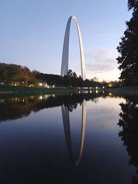 |
(#66000941) |
Mississippi River between Washington and Poplar Sts. 38°37′30″N 90°11′12″W / 38.625000°N 90.186667°W |
|
| 57 | J. Kennard and Sons Carpet Company Building |  |
(#00000438) |
400 Washington Ave. 38°37′46″N 90°11′14″W / 38.629444°N 90.187222°W |
|
| 58 | Kiel Opera House | 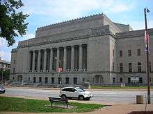 |
(#00000016) |
1400 Market St. 38°37′40″N 90°12′07″W / 38.627778°N 90.201944°W |
|
| 59 | Kieselhorst Piano Company Building |  |
(#08000268) |
1007 Olive St. 38°37′46″N 90°11′41″W / 38.629444°N 90.194861°W |
|
| 60 | Laclede Building |  |
(#98000994) |
408 Olive St. 38°37′38″N 90°11′18″W / 38.627222°N 90.188333°W |
|
| 61 | Laclede's Landing |  |
(#76002262) |
Roughly bounded by Washington, N. 3rd, Dr. Martin Luther King Dr., and the Mississippi River 38°37′48″N 90°11′02″W / 38.630000°N 90.183889°W |
|
| 62 | Lambert Building |  |
(#83001047) |
2101-2107 Locust St. 38°38′01″N 90°12′34″W / 38.633611°N 90.209444°W |
|
| 63 | Lambert-Deacon-Hull Printing Company Building |  |
(#80004508) |
2100 Locust St. 38°37′59″N 90°12′35″W / 38.633056°N 90.209722°W |
|
| 64 | LaSalle Building |  |
(#05001282) |
501 Olive St. 38°37′41″N 90°11′21″W / 38.628056°N 90.189167°W |
|
| 65 | Robert E. Lee Hotel | .jpg) |
(#07000021) |
205 N. 18th St. 38°37′51″N 90°12′22″W / 38.630833°N 90.206111°W |
|
| 66 | Lennox Hotel |  |
(#84002647) |
823-827 Washington Ave. 38°37′52″N 90°11′33″W / 38.631111°N 90.192500°W |
|
| 67 | Lesan-Gould Building | 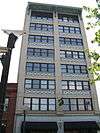 |
(#86003137) |
1320-1324 Washington Ave. 38°37′55″N 90°11′58″W / 38.631944°N 90.199306°W |
|
| 68 | Liggett & Myers Tobacco Co. Building | 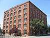 |
(#83001049) |
1900-1912 Pine St. 38°37′51″N 90°12′28″W / 38.630833°N 90.207778°W |
|
| 69 | Liggett and Myers (Rice-Stix) Building | 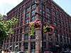 |
(#84002648) |
1000 Washington Ave. 38°37′51″N 90°11′40″W / 38.630833°N 90.194444°W |
|
| 70 | Lindell Real Estate Company Building | 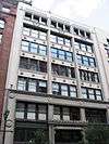 |
(#82004737) |
1015 Washington Ave. 38°37′54″N 90°11′40″W / 38.631528°N 90.194444°W |
|
| 71 | Louderman Building |  |
(#00001399) |
317 N. 11th St. 38°37′48″N 90°11′44″W / 38.630000°N 90.195556°W |
|
| 72 | Lucas Avenue Industrial Historic District |  |
(#00001009) |
Bounded by Washington, Delmar, 20th, and 21st Sts.; also roughly bounded by Locust St., Delmar, and 19th and 20th Sts. 38°38′06″N 90°12′29″W / 38.635000°N 90.208056°W |
Second set of boundaries represents a boundary increase of April 24, 2007 |
| 73 | Majestic Hotel |  |
(#84002653) |
1017-23 Pine St. and 200-10 N. 11th St. 38°37′44″N 90°11′44″W / 38.628889°N 90.195556°W |
|
| 74 | Majestic Manufacturing Company Buildings |  |
(#98001562) |
2014 Delmar Boulevard and 2011-2017 Lucas Ave. 38°38′08″N 90°12′29″W / 38.635556°N 90.208056°W |
|
| 75 | Mansion House Center Historic District | Upload image | (#16000547) |
200-444 N. 4th St. 38°37′41″N 90°11′15″W / 38.628092°N 90.187552°W |
|
| 76 | Marquette Hotel |  |
(#85002557) |
1734 Washington Ave. 38°38′00″N 90°12′17″W / 38.633333°N 90.204722°W |
Demolished in 1988.[5] |
| 77 | Maryland Hotel | 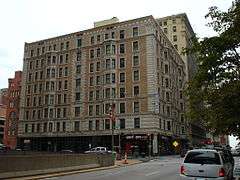 |
(#96000044) |
205 N. 9th St. 38°37′42″N 90°11′38″W / 38.628333°N 90.193889°W |
|
| 78 | May Company Department Store Building | 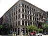 |
(#83001050) |
509-23 Washington Ave. 38°37′50″N 90°11′20″W / 38.630556°N 90.188889°W |
|
| 79 | Mayfair Hotel | 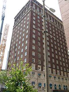 |
(#79003638) |
806 St. Charles Ave. 38°37′48″N 90°11′32″W / 38.630000°N 90.192222°W |
|
| 80 | Mississippi Valley Trust Company Building |  |
(#01000544) |
401 Pine St. 38°37′37″N 90°11′18″W / 38.626944°N 90.188333°W |
|
| 81 | Missouri Athletic Club Building |  |
(#07000325) |
405-409 Washington Ave. 38°37′48″N 90°11′14″W / 38.630000°N 90.187222°W |
13-story Renaissance Revival design by William B. Ittner; adjacent to an entrance to the Eads Bridge |
| 82 | Missouri Electric Light and Power Co. |  |
(#05000996) |
1906-1032 Locust St. 38°37′58″N 90°12′28″W / 38.632778°N 90.207778°W |
|
| 83 | Missouri Pacific Building |  |
(#02001441) |
210 N. 13th St. 38°37′46″N 90°11′56″W / 38.629444°N 90.198889°W |
Office building for the Missouri Pacific Railroad, designed by Mauran. Russell & Crowell and railroad Chief Engineer E. M. Tucker, built in 1928.[6] |
| 84 | Moon Brothers Carriage Company Building |  |
(#05001094) |
1706 Delmar Boulevard 38°38′04″N 90°12′11″W / 38.634444°N 90.203056°W |
|
| 85 | Municipal Courts Building |  |
(#12000927) |
1320 Market St. 38°37′38″N 90°12′03″W / 38.627222°N 90.200833°W |
|
| 86 | Municipal Service Building |  |
(#04001474) |
Bounded by Clark, Spruce, 11th, and Tucker 38°37′28″N 90°11′56″W / 38.624444°N 90.198889°W |
|
| 87 | National Cash Register Company Sales and Repair Building | Upload image | (#13000840) |
1011 Olive St. 38°37′46″N 90°11′42″W / 38.629477°N 90.195093°W |
|
| 88 | Old Laclede Gas and Light Company Building |  |
(#80004392) |
1017 Olive St. 38°37′46″N 90°11′43″W / 38.629444°N 90.195278°W |
|
| 89 | Old Weber Implement and Automobile Company | 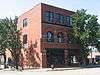 |
(#08000093) |
1900 Locust St. 38°37′57″N 90°12′25″W / 38.632500°N 90.206944°W |
|
| 90 | Olive and Locust Historic Business District | 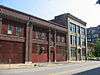 |
(#07001158) |
Roughly bounded by N. Jefferson, Olive, 21st, and St. Charles Sts. 38°38′01″N 90°12′44″W / 38.633611°N 90.212222°W |
|
| 91 | Peabody Coal Company National Headquarters | 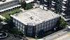 |
(#08001131) |
301 N. Memorial Dr. 38°37′39″N 90°11′12″W / 38.627500°N 90.186667°W |
|
| 92 | Pet Plaza | 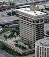 |
(#04000749) |
400 S. 4th St. 38°37′17″N 90°11′24″W / 38.621389°N 90.190000°W |
|
| 93 | Peters Shoe Company Building | 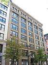 |
(#84002663) |
1232-36 Washington Ave. 38°37′54″N 90°11′53″W / 38.631667°N 90.198056°W |
|
| 94 | Phipps-Wallace Store Building | 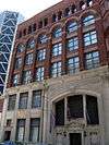 |
(#00001398) |
312-316 N. 8th St. 38°37′45″N 90°11′31″W / 38.629028°N 90.191944°W |
|
| 95 | Plaza Square Apartments Historic District | 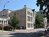 |
(#07000705) |
Bounded by 15th, Olive, 17th, and Chestnut Sts. 38°37′49″N 90°12′16″W / 38.630278°N 90.204444°W |
|
| 96 | Polar Wave Ice and Fuel Company, Plant No. 6 | Upload image | (#06000629) |
502 LaSalle St. 38°36′59″N 90°11′39″W / 38.616389°N 90.194167°W |
|
| 97 | Railway Exchange Building | 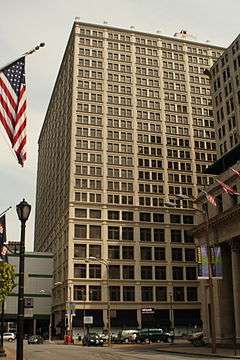 |
(#09000411) |
600 Locust St. 38°37′43″N 90°11′26″W / 38.628611°N 90.190556°W |
|
| 98 | St. Louis Mart and Terminal Warehouse | Upload image | (#16000477) |
1222 Spruce St. 38°37′28″N 90°12′01″W / 38.624494°N 90.200385°W |
|
| 99 | St. Louis News Company |  |
(#10000755) |
1008-1010 Locust St. 38°37′47″N 90°11′41″W / 38.629722°N 90.194861°W |
|
| 100 | St. Louis Post-Dispatch Building |  |
(#00000015) |
1139 Olive St. 38°37′48″N 90°11′49″W / 38.630000°N 90.196944°W |
|
| 101 | St. Louis Post-Dispatch Printing Building |  |
(#84002672) |
1111 Olive St. 38°37′47″N 90°11′47″W / 38.629722°N 90.196389°W |
|
| 102 | Saint Louis Provident Association Building |  |
(#01000652) |
2221 Locust St. 38°38′02″N 90°12′42″W / 38.633889°N 90.211667°W |
|
| 103 | St. Louis Union Station | 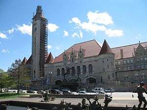 |
(#70000888) |
18th and Market Sts. 38°37′45″N 90°12′27″W / 38.629167°N 90.207500°W |
|
| 104 | St. Mary's Infirmary | Upload image | (#07000322) |
1536-1548 Papin St. 38°37′14″N 90°12′25″W / 38.620556°N 90.206944°W |
|
| 105 | St. Mary of Victories Church | Upload image | (#80004510) |
744 S. 3rd St. 38°37′05″N 90°11′26″W / 38.618056°N 90.190556°W |
|
| 106 | Scruggs-Vandervoort-Barney Warehouse |  |
(#85000320) |
917 Locust St. 38°37′48″N 90°11′38″W / 38.630000°N 90.193889°W |
|
| 107 | Security Building | 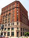 |
(#00000083) |
319 N. 4th St. 38°37′41″N 90°11′16″W / 38.628056°N 90.187778°W |
|
| 108 | Seven-Up Company Headquarters | Upload image | (#04000089) |
1300-1316 Convention Plaza 38°38′00″N 90°11′51″W / 38.633333°N 90.197500°W |
|
| 109 | Martin Shaughnessy Building | 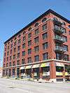 |
(#05001035) |
2201-2215 Washington 38°38′06″N 90°12′40″W / 38.635000°N 90.211111°W |
|
| 110 | Shell Building | 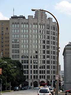 |
(#15000319) |
1221 Locust St. 38°37′51″N 90°11′52″W / 38.6308°N 90.1978°W |
|
| 111 | Silk Exchange Building | Upload image | (#82004742) |
501-511 N. Tucker Boulevard 38°37′53″N 90°11′50″W / 38.631389°N 90.197222°W |
Destroyed in a 1995 fire.[7] |
| 112 | South Fourth Street Commercial District | Upload image | (#06000245) |
740-908 S. 4th St., 319 Gratiot, and 317-321 Lombard 38°37′07″N 90°11′30″W / 38.618611°N 90.191667°W |
|
| 113 | Spool Cotton Co. Building | 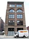 |
(#04000786) |
1113-15 Locust St. 38°37′50″N 90°11′45″W / 38.630556°N 90.195833°W |
|
| 114 | William A. Stickney Cigar Company Building | 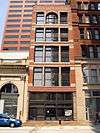 |
(#09000627) |
209 N. 4th St. 38°37′37″N 90°11′17″W / 38.627083°N 90.188167°W |
|
| 115 | Thiebe-Stierlin Music Company Building | 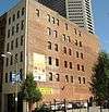 |
(#03001507) |
1006 Olive St. 38°37′44″N 90°11′43″W / 38.628889°N 90.195139°W |
|
| 116 | U.S. Customhouse and Post Office | 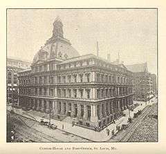 |
(#68000053) |
8th and Olive Sts. 38°37′44″N 90°11′34″W / 38.628889°N 90.192778°W |
|
| 117 | Union Market | _(18742949543).jpg) |
(#84002692) |
Broadway and Lucas Ave. 38°37′52″N 90°11′18″W / 38.631111°N 90.188333°W |
|
| 118 | Union Station Post Office Annex | 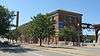 |
(#85002488) |
329 S. 18th St. 38°37′35″N 90°12′27″W / 38.626389°N 90.207500°W |
|
| 119 | Union Trust Company Building | 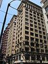 |
(#82004743) |
705 Olive St. 38°37′43″N 90°11′29″W / 38.628611°N 90.191389°W |
|
| 120 | United Shoe Machinery Building | 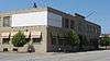 |
(#07000619) |
2200-2208 Washington Ave. 38°38′04″N 90°12′39″W / 38.634444°N 90.210833°W |
|
| 121 | Wainwright Building | 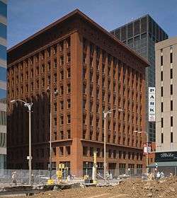 |
(#68000054) |
709 Chestnut St. 38°37′37″N 90°11′32″W / 38.626944°N 90.192222°W |
One of the first skyscrapers, designed by Louis Sullivan and others |
| 122 | Washington Avenue Historic District |  |
(#86003733) |
Roughly bounded by Delmar, Tucker, St. Charles, N. 15th, Olive, N. 18th, Washington Ave., and Lucas St. 38°37′57″N 90°12′00″W / 38.632500°N 90.200000°W |
|
| 123 | Washington Avenue: East of Tucker District |  |
(#87000458) |
Roughly bounded by Lucas, N. 9th, St. Charles, Locust, and Tucker Boulevard 38°37′53″N 90°11′42″W / 38.631389°N 90.195000°W |
|
| 124 | Weber Implement and Automobile Company Building |  |
(#04000343) |
1815 Locust St. 38°37′58″N 90°12′22″W / 38.632778°N 90.206111°W |
|
| 125 | John Weisert Tobacco Company | Upload image | (#04000602) |
1120 S. 6th St. 38°36′57″N 90°11′41″W / 38.615833°N 90.194722°W |
|
| 126 | Willys-Overland Building |  |
(#99001617) |
2300 Locust St. 38°38′01″N 90°12′45″W / 38.633611°N 90.212500°W |
|
| 127 | Winkelmeyer Building | 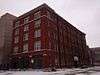 |
(#85001500) |
11th and Walnut Sts. 38°37′34″N 90°11′51″W / 38.626111°N 90.197500°W |
|
| 128 | Wrought Iron Range Company Building | 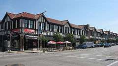 |
(#04000746) |
1901-1937 Washington Ave. 38°38′03″N 90°12′25″W / 38.634167°N 90.206944°W |
Former listings
| [1] | Name on the Register | Image | Date listed | Date removed | Location | Summary |
|---|---|---|---|---|---|---|
| 1 | Olive Street Terra Cotta District | Upload image | (#86000006) | 600-622 Olive St. 38°37′40″N 90°11′27″W / 38.627778°N 90.190833°W |
||
| 2 | USS INAUGURAL (fleet minesweeper) | 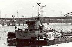 |
(#86000091) | 300 N Wharf St. |
Listed as a National Historic Landmark. Broke loose from her moorings during the Great Flood of 1993. Ran aground and sank a mile downriver. |
References
| Wikimedia Commons has media related to National Register of Historic Places in St. Louis, Missouri. |
- 1 2 Numbers represent an ordering by significant words. Various colorings, defined here, differentiate National Historic Landmarks and historic districts from other NRHP buildings, structures, sites or objects.
- ↑ The eight-digit number below each date is the number assigned to each location in the National Register Information System database, which can be viewed by clicking the number.
- ↑ http://www.builtstlouis.net/ambassador01.html
- ↑ McKee, Bradford (March 31, 2005). "When Preservation Equals Demolition". The New York Times. Retrieved July 29, 2011.
- ↑ http://www.dnr.mo.gov/shpo/StLouisCity.htm
- ↑ Josse, Lynn (April 22, 2002). "National Register of Historic Places Registration Form" (PDF). State Historic Preservation Office. Missouri Department of Natural Resources. Retrieved July 24, 2016.
- ↑ http://stlcin.missouri.org/history/structdetail.cfm?Master_ID=1976
| Topics | |
|---|---|
| Lists by states |
|
| Lists by insular areas | |
| Lists by associated states | |
| Other areas | |
| |
|