National Register of Historic Places listings in Rice County, Minnesota
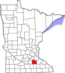
Location of Rice County in Minnesota
This is a list of the National Register of Historic Places listings in Rice County, Minnesota. It is intended to be a complete list of the properties and districts on the National Register of Historic Places in Rice County, Minnesota, United States. The locations of National Register properties and districts for which the latitude and longitude coordinates are included below, may be seen in an online map.[1]
There are 73 properties and districts listed on the National Register in the county, including two National Historic Landmarks. A supplementary list includes three additional sites that were formerly on the National Register.
- This National Park Service list is complete through NPS recent listings posted December 16, 2016.[2]
Current listings
| [3] | Name on the Register[4] | Image | Date listed[5] | Location | City or town | Description |
|---|---|---|---|---|---|---|
| 1 | Administration Building-Girls' Dormitory, Minnesota School for the Deaf | 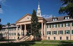 |
(#86003095) |
Minnesota Highway 299 44°17′51″N 93°15′35″W / 44.297394°N 93.259632°W |
Faribault | 1912 Georgian Revival campus center designed by Clarence H. Johnston, Sr., example of the monumental architecture used for Minnesota state social institutions.[6] |
| 2 | All Saints Church-Episcopal |  |
(#82003027) |
Washington and 5th Streets 44°27′19″N 93°09′30″W / 44.455319°N 93.158245°W |
Northfield | Highly intact example, built 1866, of the small Gothic Revival churches built from Richard Upjohn's published designs during Henry Benjamin Whipple's episcopate.[7] |
| 3 | W. Roby Allen Oral Home School | |
(#90001091) |
525 5th Street NE 44°17′44″N 93°15′34″W / 44.295635°N 93.259394°W |
Faribault | 1923 boarding school for the deaf founded by deaf education pioneer Bessie Blaker Allen.[8] |
| 4 | Archibald Mill | 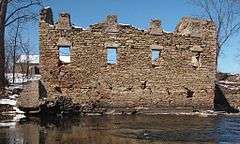 |
(#76001071) |
Railway Street 44°25′47″N 93°12′23″W / 44.429676°N 93.206444°W |
Dundas | 1857 and 1870 gristmill ruins of a progressive milling family that pioneered hard spring wheat, patent flour, and roller mills in the United States. Their "Dundas Straight" was considered the best flour in the nation.[9] |
| 5 | Edward T. Archibald House | 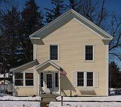 |
(#76001072) |
Hamilton and 2nd Streets 44°25′34″N 93°12′16″W / 44.426208°N 93.204369°W |
Dundas | House occupied 1867–1885 by one of the Archibald Mill founders.[10] |
| 6 | Ault Store | 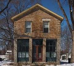 |
(#82003004) |
206 2nd Street 44°25′43″N 93°12′10″W / 44.428588°N 93.202684°W |
Dundas | Last surviving commercial building of Dundas' original business district, built in 1866, and an example of Rice County's earliest commercial buildings.[11] |
| 7 | Laura Baker School |  |
(#78001560) |
211 Oak Street 44°27′27″N 93°08′50″W / 44.457406°N 93.147281°W |
Northfield | Boarding school for students with mental retardation, founded in 1898 by special education pioneer Laura Baker. Also notable for its retention of the original 1880s building's Queen Anne architecture.[12] All original buildings razed.[13] |
| 8 | Batchelder's Block | 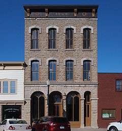 |
(#90001089) |
120 Central Avenue North 44°17′31″N 93°16′07″W / 44.292083°N 93.268611°W |
Faribault | Faribault's second-oldest commercial building, built 1868; also noted for its exceptional Italianate architecture.[14] |
| 9 | Frank A. and Elizabeth Berry House | |
(#90001172) |
319 3rd Street NW 44°17′36″N 93°16′26″W / 44.293353°N 93.273868°W |
Faribault | 1896 house designed by Olof Hanson, with transitional Queen Anne/Classical Revival architecture.[15] |
| 10 | Bonde Farmhouse | 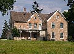 |
(#82003023) |
County Road 27 and Minnesota Highway 246 44°20′44″N 93°04′49″W / 44.345504°N 93.080262°W |
Nerstrand vicinity | 1875 farmhouse of a prominent Norwegian immigrant family; also listed for its local limestone construction and historic integrity.[16] |
| 11 | Bridge No. 8096 |  |
(#98000719) |
Minnesota Highway 19 over Spring Creek 44°27′51″N 93°09′14″W / 44.464032°N 93.153925°W |
Northfield | Unusual Gothic Revival masonry-veneer arch bridge stemming from a 1947 reconstruction of a 1914 bridge.[17] |
| 12 | Cassius Buck House |  |
(#82003007) |
124 1st Avenue SW 44°17′19″N 93°16′14″W / 44.288676°N 93.270442°W |
Faribault | 1895 house also known as "Buckeye", listed for its association with a notable local banker/politician and its Neoclassical architecture.[18] |
| 13 | Thomas Scott Buckham Memorial Library | 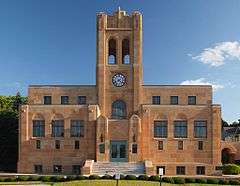 |
(#82003008) |
Central Avenue and Division Street 44°17′25″N 93°16′05″W / 44.290158°N 93.268001°W |
Faribault | 1930 Moderne library significant as an exemplary public building of that decade, as the longtime home of Faribault Public Library, and as a memorial to a notable local leader.[19] |
| 14 | Louis Carufel and E. LaRose House | |
(#90001160) |
425 3rd Street SW 44°17′13″N 93°16′32″W / 44.286878°N 93.275551°W |
Faribault | 1877 Gothic Revival house of local limestone, two aspects rare in Faribault, though modified in an 1883 Italianate remodeling.[20] |
| 15 | Cathedral of Our Merciful Saviour and Guild House | 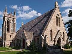 |
(#79001253) |
515 2nd Avenue NW 44°17′48″N 93°16′16″W / 44.296662°N 93.271053°W |
Faribault | Epicenter of the Episcopal Church in Minnesota and its first leader, Bishop Henry Benjamin Whipple, featuring an 1862 cathedral notably designed by James Renwick, Jr. and an 1894 staff residence (added to listing February 19, 1982).[21] |
| 16 | Chapel of the Good Shepherd | 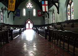 |
(#75001018) |
At Shattuck School 44°18′05″N 93°15′39″W / 44.301419°N 93.260893°W |
Faribault | Exemplary 1871 Gothic Revival church with medieval-style center-facing pews, designed by Henry Martyn Congdon for one of Bishop Henry Benjamin Whipple's first congregations, and the only surviving building from the original location of Whipple's Seabury Divinity School.[22] Also a contributing property to the Shattuck Historic District.[23] |
| 17 | Church of the Annunciation | 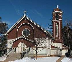 |
(#82003033) |
County Highway 46 44°30′56″N 93°17′13″W / 44.515475°N 93.287066°W |
Webster Township | 1913 church with an atypical American Craftsman design.[24] |
| 18 | Church of the Holy Cross-Episcopal |  |
(#82003005) |
2nd Street 44°25′33″N 93°12′14″W / 44.425749°N 93.203876°W |
Dundas | 1868 church sponsored by milltown promoter John S. Archibald; also notable for its Gothic Revival architecture from Richard Upjohn's published designs.[25] |
| 19 | Church of the Most Holy Trinity (Catholic) | |
(#97001424) |
4938 North Washington Street 44°30′57″N 93°27′37″W / 44.515696°N 93.460194°W |
Wheatland Township | 1905 church of a Catholic Czech American community.[26] |
| 20 | Gordon Cole and Kate D. Turner House |  |
(#90001150) |
111 2nd Street NW 44°17′32″N 93°16′14″W / 44.292254°N 93.270447°W |
Faribault | c. 1856 house enlarged and embellished into one of Faribault's most elaborate frame Italianate residences.[27] |
| 21 | Congregational Church of Faribault | 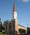 |
(#77000768) |
227 3rd Street NW 44°17′36″N 93°16′22″W / 44.293292°N 93.272803°W |
Faribault | 1867 stone Romanesque Revival church designed by Monroe Sheire for Rice County's oldest congregation, founded in 1856.[28] |
| 22 | John N. and Elizabeth Taylor Clinton Cottrell House | |
(#90001163) |
127 1st Street NW 44°17′28″N 93°16′15″W / 44.291194°N 93.270865°W |
Faribault | 1897 frame house, the only surviving example of Stick style architecture in Faribault.[29] |
| 23 | Den Svenska Evangeliska Lutherska Christdala Forsamlingen | 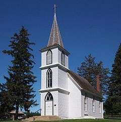 |
(#95000617) |
4695 Millersburg Rd. 44°25′57″N 93°21′27″W / 44.432492°N 93.357475°W |
Lonsdale vicinity | 1878 frame church of Rice County's first Swedish farming community, symbolizing the influence of the Swedish Lutheran Church and Swedish immigration in rural Minnesota.[30] |
| 24 | Reverend James Dobbin House |  |
(#90001090) |
1800 14th Street NE 44°18′41″N 93°15′51″W / 44.31133°N 93.264297°W |
Faribault | Exemplary 1874 Gothic Revival house of locally quarried limestone.[31] |
| 25 | Dodd Road Discontiguous District |  |
(#03000520) |
Former County Road 61 (Circle Lake Trail, Falls Trail, Garfield Avenue, and Groveland Trail) between Millersburg and Shieldsville 44°25′04″N 93°23′37″W / 44.417755°N 93.393745°W |
Lonsdale vicinity | 6.8-mile (10.9 km) segment of a privately funded road built between Mendota and St. Peter in 1853, a key transportation artery in early south-central Minnesota. Two other segments lie in Le Sueur County.[32] |
| 26 | Edwin S. Drake Farmhouse |  |
(#82003028) |
County Highway 22 44°25′32″N 93°09′44″W / 44.425434°N 93.162276°W |
Bridgewater Township | c. 1863 brick house of a prominent early settler, also notable as a well-preserved example of the farmhouses of the area's American-born settlers.[33] |
| 27 | Episcopal Rectory |  |
(#90001171) |
112 6th Street NW 44°17′50″N 93°16′14″W / 44.29735°N 93.270586°W |
Faribault | 1897 frame Colonial Revival rectory, Faribault's most intact structure designed by Olof Hanson.[34] |
| 28 | Faribault City Hall | 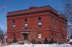 |
(#82003010) |
208 1st Avenue NW 44°17′34″N 93°16′13″W / 44.292843°N 93.270316°W |
Faribault | Renaissance Revival municipal facility built 1984–97, associated with Faribault's emergence as a regionally important city and with a period of civic development across Minnesota.[35] |
| 29 | Faribault Historic Commercial District |  |
(#82003011) |
Central Avenue and 2nd and 3rd Streets 44°17′35″N 93°16′06″W / 44.293077°N 93.268352°W |
Faribault | One-block central business district dating to Faribault's peak growth as a regional trade center. The 19 commercial buildings constructed between 1870 and 1898 are also notable for their Italianate and Queen Anne architecture.[36] |
| 30 | Faribault Viaduct |  |
(#89001848) |
Division Street over the Straight River 44°17′27″N 93°15′53″W / 44.290915°N 93.264592°W |
Faribault | Exemplary 1937 reinforced-concrete bridge with Art Deco/Classical Revival ornamentation, one of the last major examples built in Minnesota. Also notable as a civic project linking a city divided by a river and rail corridor.[37] |
| 31 | Faribault Water Works |  |
(#82003012) |
7th Street NW 44°17′54″N 93°16′57″W / 44.298422°N 93.282554°W |
Faribault | Pumping station juxtaposing two different eras of municipal water supply, with an 1883 building funded by a private company and later purchased by the city, and a 1938 building constructed by the Works Progress Administration as a federal project.[38] |
| 32 | Faribault Woolen Mill Company | 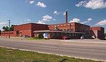 |
(#12000283) |
1500 2nd Ave., NW 44°18′25″N 93°16′21″W / 44.306891°N 93.272579°W |
Faribault | Minnesota's largest and longest-running woolen mill, beginning operations in 1892.[39] |
| 33 | Alexander Faribault House |  |
(#70000309) |
12 1st Avenue NE 44°17′28″N 93°16′01″W / 44.291042°N 93.267071°W |
Faribault | 1853 Greek Revival house of influential fur trader Alexander Faribault; the first wood-frame house built in Rice County.[40] Now managed by the Rice County Historical Society.[41] |
| 34 | Farmer Seed and Nursery Company |  |
(#82003013) |
818 4th Street NW 44°17′42″N 93°16′56″W / 44.294902°N 93.282128°W |
Faribault | Seed warehouse expanded several times between 1899 and the 1920s, symbolizing Faribault's importance as an agricultural distribution center.[42] |
| 35 | Goodsell Observatory--Carleton College | 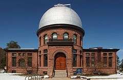 |
(#75001025) |
Off 1st Street East 44°27′43″N 93°09′09″W / 44.461903°N 93.152475°W |
Northfield | 1887 observatory and official regional timekeeping station, also notable for its collection of vintage scientific equipment and association with astronomer William W. Payne.[43] |
| 36 | M. P. Holman House |  |
(#90001162) |
107 3rd Avenue NW 44°17′30″N 93°16′22″W / 44.291631°N 93.272654°W |
Faribault | c. 1875 brick Italianate house.[44] |
| 37 | Hospital, State School for the Feeble Minded |  |
(#82003014) |
Off 6th Avenue SE 44°16′56″N 93°15′28″W / 44.282222°N 93.257778°W |
Faribault | 1900 mental retardation resource facility where pioneering psychologist A.R.T. Wiley had his laboratory.[45] Likely demolished (see talk page). |
| 38 | John Hutchinson House |  |
(#82003015) |
305 2nd Street NW 44°17′32″N 93°16′24″W / 44.292144°N 93.273396°W |
Faribault | 1892 frame Queen Anne house of a prosperous furniture factory owner.[46] Now a bed and breakfast.[47] |
| 39 | Johnston Hall-Seabury Divinity School |  |
(#75001022) |
1st and State Streets SE 44°17′21″N 93°15′26″W / 44.289048°N 93.25712°W |
Faribault | 1888 Romanesque Revival library/faculty residence, the best surviving building of the Seabury Divinity School established by Bishop Henry Benjamin Whipple that produced many Episcopal leaders and missionaries.[48] |
| 40 | Vincent and Elizabeth Lieb House | |
(#90001093) |
201 4th Avenue SW 44°17′18″N 93°16′27″W / 44.288253°N 93.274234°W |
Faribault | 1862 vernacular limestone house.[49] |
| 41 | Lonsdale Public School |  |
(#79001254) |
3rd Avenue SW 44°28′40″N 93°25′54″W / 44.477874°N 93.431738°W |
Lonsdale | 1908 public school notable for its role in local education and its juxtaposition of simple pattern architecture with ornate decoration.[50] |
| 42 | Drew H. Lord House |  |
(#82003029) |
201 East 3rd 44°27′27″N 93°09′30″W / 44.45763°N 93.15828°W |
Northfield | 1887 house of a prolific and successful local builder; also significant for its Eastlake Movement architecture.[51] |
| 43 | Wiliam Martin House |  |
(#82003006) |
Bridge and 1st Streets 44°25′41″N 93°12′15″W / 44.42795°N 93.204274°W |
Dundas | 1869 house dating to Dundas's economic peak as a regional milling center; also recognized for its transitional Greek Revival/Italianate architecture.[52] |
| 44 | Cormack McCall House |  |
(#90001149) |
817 Ravine Street NE 44°17′40″N 93°15′20″W / 44.294501°N 93.255575°W |
Faribault | c. 1871 house of a prominent local stonemason, also an example of vernacular stone architecture used in Faribault's early working class homes.[53] |
| 45 | Thomas McCall House |  |
(#90001159) |
102 4th Avenue SW 44°17′22″N 93°16′29″W / 44.289307°N 93.274806°W |
Faribault | One of Faribault's finest houses of local limestone, built for himself in 1868 by a notable local stonemason. Also recognized for its Italianate architecture from a 1908 remodelling.[54] |
| 46 | Timothy J. McCarthy Building | 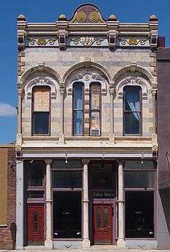 |
(#90001161) |
24 3rd Street NW 44°17′38″N 93°16′10″W / 44.293794°N 93.269467°W |
Faribault | Ornate 1884 Italianate commercial building featuring Faribault's only polished marble façade.[55] |
| 47 | Thomas and Bridget Shanahan McMahon House | 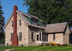 |
(#90001112) |
603 Division Street East 44°17′26″N 93°15′31″W / 44.290459°N 93.258747°W |
Faribault | 1871 vernacular stone house, a well-preserved example of Faribault's early working class homes.[56] |
| 48 | Nerstrand City Hall | 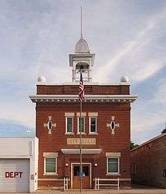 |
(#82003024) |
Main St. 44°20′30″N 93°04′04″W / 44.341683°N 93.067876°W |
Nerstrand | 1908 city hall representative of Nerstrand's early growth, and Rice County's best example of municipal buildings of the early 20th century.[57] |
| 49 | Northfield Commercial Historic District | |
(#79003125) |
Roughly bounded by Water, Division, 3rd, and 5th Sts. 44°27′23″N 93°09′39″W / 44.456398°N 93.160758°W |
Northfield | 4-block town center dating back to 1856 that preserves its historical mixed-use planning around a scenic riverway.[58] Contains 55 contributing properties.[59] |
| 50 | Noyes Hall, State School for the Deaf | 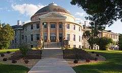 |
(#75001020) |
Off 6th Avenue NE 44°17′49″N 93°15′42″W / 44.296876°N 93.261531°W |
Faribault | Monumental deaf academy building constructed 1902–1910 with a Neoclassical rotunda, showing the emphasis placed on state-run special education institutions in Minnesota.[60] |
| 51 | Jonathon L. and Elizabeth H. Wadsworth Noyes House |  |
(#90001170) |
105 1st Ave., NW. 44°17′30″N 93°16′10″W / 44.291649°N 93.269488°W |
Faribault | 1896 Queen Anne/Shingle Style house designed by Olof Hanson, one of the most intact examples of his residential work.[61] |
| 52 | John C. Nutting House |  |
(#70000310) |
217 Union St. 44°27′28″N 93°09′24″W / 44.457688°N 93.156653°W |
Northfield | Northfield's only surviving large, brick house from the late 19th century, built 1887–8.[62] Now the official residence for the president of Carleton College.[63] |
| 53 | Old Main, Saint Olaf College |  |
(#76001073) |
St. Olaf College campus 44°27′34″N 93°10′49″W / 44.459328°N 93.180256°W |
Northfield | 1877 campus center, symbol of a school founded by Norwegian Lutheran immigrants to provide education and preserve their heritage, also notable for its Gothic Revival architecture.[64] |
| 54 | Osmund Osmundson House | 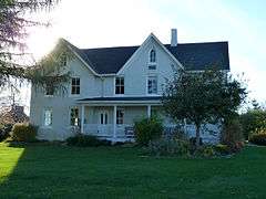 |
(#82003025) |
East Nerstrand and North Main Streets 44°20′38″N 93°03′54″W / 44.34396°N 93.065019°W |
Nerstrand | 1880 house of the Norwegian immigrant homesteader who founded Nerstrand.[65] |
| 55 | John Gottlieb Pfeiffer House |  |
(#90001151) |
931 3rd Avenue NW 44°18′05″N 93°16′23″W / 44.301408°N 93.272924°W |
Faribault | 1868 house of a prominent local stonemason, also an example of the vernacular stone architecture used in Faribault's working class homes.[66] |
| 56 | Phelps Library, Shattuck School |  |
(#75001021) |
Off Shumway Avenue 44°18′10″N 93°15′45″W / 44.302665°N 93.262623°W |
Faribault | 1869 Gothic Revival library, oldest surviving building of an Episcopal boys' boarding school established by Bishop Henry Benjamin Whipple.[67] Also a contributing property to the Shattuck Historic District.[23] |
| 57 | Rice County Courthouse and Jail | |
(#82003016) |
218 3rd St., NW. 44°17′38″N 93°16′17″W / 44.293889°N 93.271389°W |
Faribault | 1934 Art Deco courthouse and 1910 brick jail, both replacements for earlier structures, showing the continuity and evolution of Rice County government buildings.[68] |
| 58 | Rock Island Depot |  |
(#82003017) |
3rd Street and 1st Avenue NE 44°17′39″N 93°15′56″W / 44.29424°N 93.265434°W |
Faribault | 1902 passenger depot that completed Faribault's rail network—securing its development as a regional trade center—and the best-preserved trackside facility of Rice County's rail towns.[69] |
| 59 | O. E. Rolvaag House | 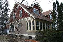 |
(#69000078) |
311 Manitou St. 44°27′46″N 93°10′21″W / 44.462837°N 93.172477°W |
Northfield | Home of author Ole Edvart Rølvaag from 1912 to his death in 1931, who portrayed the psychological cost of frontier life in novels like Giants in the Earth (1927).[70] |
| 60 | Saint Mary's Hall | 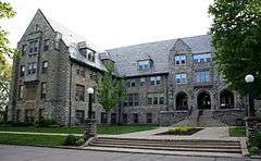 |
(#82003019) |
4th Street NE and 4th Avenue NE 44°17′43″N 93°15′47″W / 44.295394°N 93.263186°W |
Faribault | 1926 Gothic Revival school building designed by Clarence H. Johnston, Sr. for an Episcopal girls' boarding school established in 1866.[71] |
| 61 | Scriver Block Building |  |
(#78001561) |
Bridge Square and Division Street 44°27′21″N 93°09′38″W / 44.455829°N 93.16044°W |
Northfield | c. 1867 commercial building, site of the James-Younger Gang's failed bank robbery on September 7, 1876 that led to their downfall.[72] Now a Northfield Historical Society museum.[73] Also a contributing property to the Northfield Commercial Historic District.[74] |
| 62 | Scoville Memorial Library | 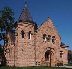 |
(#82003030) |
1st Street East and College Street 44°27′36″N 93°09′22″W / 44.460091°N 93.156057°W |
Northfield | Built in 1896 as one of the first standalone libraries for a small Midwestern college, and one of the few original campus buildings left at Carlton College. Also noted for its Richardsonian Romanesque architecture.[75] |
| 63 | Shattuck Historic District | 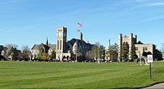 |
(#82003018) |
Shumway Avenue 44°18′08″N 93°15′37″W / 44.3021°N 93.260401°W |
Faribault | Central campus of Faribault's prominent Episcopal schools, with 20 contributing properties built 1869–1957. Also noted for its Gothic Revival architecture.[76][77] |
| 64 | Shumway Hall and Morgan Refectory-Shattuck School |  |
(#75001023) |
Off Shumway Avenue 44°18′09″N 93°15′36″W / 44.3025°N 93.26°W |
Faribault | 1887 and 1888 campus buildings of a renowned boys' boarding school, further noted for their Romanesque/Gothic Revival architecture.[78] Also a contributing property to the Shattuck Historic District.[23] |
| 65 | Skinner Memorial Chapel | 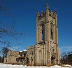 |
(#82003031) |
1st, Winona, and College Streets 44°27′37″N 93°09′17″W / 44.460185°N 93.154726°W |
Northfield | 1916 chapel significant for its late Gothic Revival architecture and visual contribution to the Carlton College campus.[79] |
| 66 | Steensland Library-Saint Olaf College |  |
(#82003020) |
Off Saint Olaf Avenue 44°27′35″N 93°10′50″W / 44.459662°N 93.180635°W |
Northfield | Built in 1902, a rare surviving building from St. Olaf College's early days; also a good example of Neoclassical architecture and early standalone college libraries.[80] |
| 67 | Theopold Mercantile Co. Wholesale Grocery Building |  |
(#82003021) |
1st Avenue and 3rd Street NE 44°17′38″N 93°15′59″W / 44.293839°N 93.266444°W |
Faribault | 1893 wholesale warehouse representing Faribault's importance as a regional distribution center.[81] |
| 68 | Trondhjem Norwegian Lutheran Church | 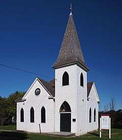 |
(#01000945) |
8501 Garfield Avenue 44°27′51″N 93°24′08″W / 44.464133°N 93.402162°W |
Lonsdale vicinity | 1899 church and cemetery, a prominent hilltop symbol of the surrounding Norwegian American pioneer community.[82] |
| 69 | Valley Grove | 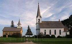 |
(#82003026) |
County Road 29 off Minnesota Highway 246 44°21′42″N 93°06′03″W / 44.36164°N 93.100843°W |
Nerstrand vicinity | Adjacent 1862 stone church and 1894 frame Gothic Revival church reflecting two phases of rural Norwegian American life in a dramatic hilltop tableau.[83] |
| 70 | Thorstein Veblen Farmstead |  |
(#75001024) |
Northeast of Nerstrand off Minnesota Highway 246 44°20′53″N 93°02′49″W / 44.348094°N 93.04685°W |
Nerstrand vicinity | c. 1875 family farm of influential social thinker Thorstein Veblen (1857–1929).[84] |
| 71 | Adam Weyer Wagon Shop |  |
(#90001088) |
32 2nd Street NE 44°17′34″N 93°16′01″W / 44.292718°N 93.266982°W |
Faribault | 1874 wagon and blacksmith shop, the most intact of Faribault's earliest stone industrial buildings.[85] |
| 72 | Willis Hall | 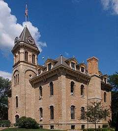 |
(#75001026) |
College Street 44°27′39″N 93°09′22″W / 44.460787°N 93.156031°W |
Northfield | Original building of Carlton College, built 1868–1872; also noted for its Second Empire architecture.[86] |
| 73 | Hudson Wilson House |  |
(#82003022) |
104 1st Avenue NW 44°17′30″N 93°16′13″W / 44.291655°N 93.27034°W |
Faribault | 1876 Second Empire house of an influential civic leader in early Faribault.[87] |
Former listings
| [3] | Name on the Register | Image | Date listed | Date removed | Location | City or town | Summary |
|---|---|---|---|---|---|---|---|
| 1 | Blind Department Building and Dow Hall, State School for the Blind | 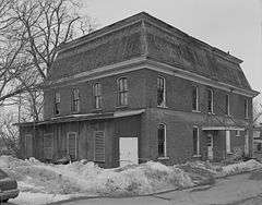 |
(#90001092) | 400 6th Avenue SE 44°17′12″N 93°15′36″W / 44.286761°N 93.260048°W |
Faribault | 1874 and 1883 buildings of the State School for the Blind, one of Minnesota's four early state-funded special education institutions.[88] Dow Hall was demolished and marked with a memorial.[89] | |
| 2 | Church of St. Patrick-Catholic | Upload image | (#82003032) | Co. Hwy. 10 (Dodd Rd.) |
Faribault vicinity | 1888 church of Minnesota's first Irish immigrant community.[90] Burned down in 2002.[91] | |
| 3 | Dump Road Bridge | Upload image | (#89001835) | Twp. Rd. 45 over Straight River |
Faribault vicinity | Exemplified a common style of Pratt through truss bridges and the work of notable Minnesotan bridge contractor A.Y. Bayne.[92] Demolished in 2001.[93] |
See also
- List of National Historic Landmarks in Minnesota
- National Register of Historic Places listings in Minnesota
References
- ↑ The latitude and longitude information provided in this table was derived originally from the National Register Information System, which has been found to be fairly accurate for about 99% of listings. For about 1% of NRIS original coordinates, experience has shown that one or both coordinates are typos or otherwise extremely far off; some corrections may have been made. A more subtle problem causes many locations to be off by up to 150 yards, depending on location in the country: most NRIS coordinates were derived from tracing out latitude and longitudes off of USGS topographical quadrant maps created under the North American Datum of 1927, which differs from the current, highly accurate WGS84 GPS system used by most on-line maps. Chicago is about right, but NRIS longitudes in Washington are higher by about 4.5 seconds, and are lower by about 2.0 seconds in Maine. Latitudes differ by about 1.0 second in Florida. Some locations in this table may have been corrected to current GPS standards.
- ↑ "National Register of Historic Places: Weekly List Actions". National Park Service, United States Department of the Interior. Retrieved on December 16, 2016.
- 1 2 Numbers represent an ordering by significant words. Various colorings, defined here, differentiate National Historic Landmarks and historic districts from other NRHP buildings, structures, sites or objects.
- ↑ National Park Service (2008-04-24). "National Register Information System". National Register of Historic Places. National Park Service.
- ↑ The eight-digit number below each date is the number assigned to each location in the National Register Information System database, which can be viewed by clicking the number.
- ↑ Ferguson, Robert (1985-09-30). "National Register of Historic Places Registration Form: Administration Building/ Girls' Dormitory, Minnesota School for the Deaf" (PDF). National Park Service. Retrieved 2013-04-13.
- ↑ Bloomberg, Britta (March 1981). "Minnesota Historic Properties Inventory Form: All Saints Church" (PDF). National Park Service. Retrieved 2013-04-13.
- ↑ Zahn, Thomas R.; Jacqueline Sluss (1989-07-31). "National Register of Historic Places Registration Form: Allen, W. Roby, Oral Home School" (PDF). National Park Service. Retrieved 2013-04-13.
- ↑ Lund, Marjorie A. (1976-01-09). "National Register of Historic Places Registration Form: Archibald/Dundas Mill Site" (PDF). National Park Service. Retrieved 2013-04-13.
- ↑ Lund, Marjorie A. (1976-01-09). "National Register of Historic Places Registration Form: Archibald, E.T., House" (PDF). National Park Service. Retrieved 2013-04-12.
- ↑ Bloomberg, Britta (February 1981). "Minnesota Historic Properties Inventory Form: Ault Store". Minnesota Historical Society.
- ↑ Nelson, Charles W.; Susan Zeik (1977-06-06). "National Register of Historic Places Registration Form: Laura Baker School" (PDF). National Park Service. Retrieved 2013-04-12.
- ↑ Hatler, Carrie (March 2015). "Laura Baker's School in Northfield". Forgotten Minnesota. Retrieved 2015-08-07.
- ↑ Zahn, Thomas R. (1988-12-07). "National Register of Historic Places Registration Form: Batchelder's Block" (PDF). National Park Service. Retrieved 2013-04-12.
- ↑ Zahn, Thomas R. (1988-12-10). "National Register of Historic Places Registration Form: Berry, Frank A., and Elizabeth, House" (PDF). National Park Service. Retrieved 2013-04-12.
- ↑ Bloomberg, Britta (February 1981). "Minnesota Historic Properties Inventory Form: Bonde Farmhouse" (PDF). National Park Service. Retrieved 2013-04-12.
- ↑ Hess, Jeffrey A. (September 1997). "National Register of Historic Places Registration Form: Bridge No. 8096" (PDF). National Park Service. Retrieved 2013-04-12.
- ↑ Bloomberg, Britta (April 1981). "Minnesota Historic Properties Inventory Form: Buck, Cassius, House" (PDF). National Park Service. Retrieved 2013-04-12.
- ↑ Bloomberg, Britta (April 1981). "Minnesota Historic Properties Inventory Form: Thomas Scott Buckham Memorial Library" (PDF). National Park Service. Retrieved 2013-04-12.
- ↑ Zahn, Thomas R. (1988-12-07). "National Register of Historic Places Registration Form: Carufel, Louise, and E. LaRose House" (PDF). National Park Service. Retrieved 2013-04-12.
- ↑ Nelson, Charles W.; Britta Bloomberg (April 1981). "National Register of Historic Places Registration Form: Cathedral of Our Merciful Saviour and Guild House" (PDF). National Park Service. Retrieved 2013-04-12.
- ↑ Lutz, Thomas (1974-12-23). "National Register of Historic Places Registration Form: Chapel of the Good Shepherd" (PDF). National Park Service. Retrieved 2013-04-12.
- 1 2 3 "Shattuck Historic District". Minnesota National Register Properties Database. Minnesota Historical Society. 2009. Retrieved 2013-09-09.
- ↑ Bloomberg, Britta (February 1981). "Minnesota Historic Properties Inventory Form: Annunciation Church of Hazelwood" (PDF). National Park Service. Retrieved 2013-04-12.
- ↑ Bloomberg, Britta (February 1981). "Minnesota Historic Properties Inventory Form: Church of the Holy Cross" (PDF). National Park Service. Retrieved 2013-04-12.
- ↑ Anderson, David C. (1997-05-28). "National Register of Historic Places Registration Form: Church of the Most Holy Trinity (Catholic)" (PDF). National Park Service. Retrieved 2013-04-12.
- ↑ Zahn, Thomas R. (1988-12-07). "National Register of Historic Places Registration Form: Cole, Gordon and Kate D. Turner, House" (PDF). National Park Service. Retrieved 2013-04-12.
- ↑ Larson, Oliver N.; Charles W. Nelson (1975). "National Register of Historic Places Registration Form: Plymouth Church/The Congregational Church of Faribault" (PDF). National Park Service. Retrieved 2013-04-02.
- ↑ Zahn, Thomas (1988-12-07). "National Register of Historic Places Registration Form: Cottrell, John N. and Elizabeth Taylor Clinton, House" (PDF). National Park Service. Retrieved 2013-04-02.
- ↑ Quist, B. Wayne (1994-04-25). "National Register of Historic Places Registration Form: Den Svenska Evangeliska Lutherska Christdala Forsamlingen" (PDF). National Park Service. Retrieved 2013-04-02.
- ↑ Zahn, Thomas R.; Jacqueline Sluss (1989-07-31). "National Register of Historic Places Registration Form: Dobbin, Reverend James, House/St. James School for Boys" (PDF). National Park Service. Retrieved 2013-04-02.
- ↑ Godfrey, Anthony (2002-09-30). "National Register of Historic Places Registration Form: Dodd Road" (PDF). National Park Service. Retrieved 2013-08-21.
- ↑ Bloomberg, Britta (April 1981). "Minnesota Historic Properties Inventory Form: Drake Farmhouse" (PDF). National Park Service. Retrieved 2013-04-02.
- ↑ Zahn, Thomas R. (1988-12-10). "National Register of Historic Places Registration Form: Episcopal Rectory" (PDF). National Park Service. Retrieved 2013-04-02.
- ↑ Bloomberg, Britta (April 1981). "Minnesota Historic Properties Inventory Form: Faribault City Hall" (PDF). National Park Service. Retrieved 2015-06-21.
- ↑ Bloomberg, Britta (April 1981). "Minnesota Historic Properties Inventory Form: Faribault Commercial Historic District" (PDF). National Park Service. Retrieved 2013-04-02.
- ↑ Frame III, Robert M. (1988-08-15). "National Register of Historic Places Registration Form: Faribault Viaduct" (PDF). National Park Service. Retrieved 2013-04-02.
- ↑ Bloomberg, Britta (April 1981). "Minnesota Historic Properties Inventory Form: Faribault Water Works" (PDF). National Park Service. Retrieved 2013-04-02.
- ↑ Gales, Elizabeth (2011-12-30). "National Register of Historic Places Registration Form: Faribault Woolen Mills" (PDF). National Park Service. Retrieved 2013-04-03.
- ↑ Grossman, John (1970-03-17). "National Register of Historic Places Registration Form: Alexander Faribault House" (PDF). National Park Service. Retrieved 2013-04-03.
- ↑ "Alexander Faribault House". Rice County Historical Society. Retrieved 2013-04-03.
- ↑ Bloomberg, Britta (April 1981). "Minnesota Historic Properties Inventory Form: Farmer Seed and Nursery Company" (PDF). National Park Service. Retrieved 2013-04-02.
- ↑ Lutz, Thomas; Ruthmary Penick (1975-03-17). "National Register of Historic Places Registration Form: Goodsell Observatory (New Observatory)" (PDF). National Park Service. Retrieved 2013-04-03.
- ↑ Zahn, Thomas (1988-12-07). "National Register of Historic Places Registration Form: Holman, M.P., House" (PDF). National Park Service. Retrieved 2013-04-03.
- ↑ Bloomberg, Britta (April 1981). "Minnesota Historic Properties Inventory Form: Hospital" (PDF). National Park Service. Retrieved 2013-04-03.
- ↑ Bloomberg, Britta (April 1981). "Minnesota Historic Properties Inventory Form: Hutchinson, John, House" (PDF). National Park Service. Retrieved 2013-04-03.
- ↑ "Historic Hutchinson House". 2015. Retrieved 2015-06-26.
- ↑ Lutz, Thomas J. (1974-12-20). "National Register of Historic Places Registration Form: Johnston Hall - Seabury Divinity School" (PDF). National Park Service. Retrieved 2013-04-03.
- ↑ Zahn, Thomas R.; Jacqueline Sluss (1989-07-31). "National Register of Historic Places Registration Form: Lieb, Vincent and Elizabeth, House" (PDF). National Park Service. Retrieved 2013-04-03.
- ↑ City Council of Lonsdale. "National Register of Historic Places Registration Form: Lonsdale Public School" (PDF). National Park Service. Retrieved 2013-04-04.
- ↑ Bloomberg, Britta (March 1981). "Minnesota Historic Properties Inventory Form: Lord, Drew H., House" (PDF). National Park Service. Retrieved 2013-04-04.
- ↑ Bloomberg, Britta (February 1981). "Minnesota Historic Properties Inventory Form: Martin House" (PDF). National Park Service. Retrieved 2013-04-04.
- ↑ Zahn, Thomas (1988-12-07). "National Register of Historic Places Registration Form: McCall, Cormack, House" (PDF). National Park Service. Retrieved 2013-04-04.
- ↑ Zahn, Thomas (1988-12-07). "National Register of Historic Places Registration Form: McCall, Thomas, House" (PDF). National Park Service. Retrieved 2013-04-04.
- ↑ Zahn, Thomas (1988-12-07). "National Register of Historic Places Registration Form: McCarthy, Timothy J., Building" (PDF). National Park Service. Retrieved 2013-04-04.
- ↑ Zahn, Thomas R.; Jacqueline Sluss (1989-07-31). "National Register of Historic Places Registration Form: McCall, Cormack, House" (PDF). National Park Service. Retrieved 2013-04-04.
- ↑ Bloomberg, Britta (February 1981). "Minnesota Historic Properties Inventory Form: Nerstrand City Hall" (PDF). National Park Service. Retrieved 2013-04-05.
- ↑ Oschwald, Brian (1978-07-15). "National Register of Historic Places Registration Form: Northfield Historic District" (PDF). National Park Service. Retrieved 2013-04-05.
- ↑ "Northfield Commercial Historic District". Minnesota Historical Society. 2009. Retrieved 2013-03-01.
- ↑ Lutz, Thomas (1975-03-18). "National Register of Historic Places Registration Form: Noyes Hall" (PDF). National Park Service. Retrieved 2013-04-08.
- ↑ Zahn, Thomas (1988-12-10). "National Register of Historic Places Registration Form: Noyes, Jonathon L. and Elizabeth H. Wadsworth, House" (PDF). National Park Service. Retrieved 2013-04-08.
- ↑ Cavin, Brooks (1970-06-12). "National Register of Historic Places Registration Form: Nutting House" (PDF). National Park Service. Retrieved 2013-04-08.
- ↑ "President's House". Carleton College. 2013-02-26. Retrieved 2015-06-26.
- ↑ Olson, Joan R.; Lynne VanBrocklin (1976-02-23). "National Register of Historic Places Registration Form: Old Main - St. Olaf College" (PDF). National Park Service. Retrieved 2013-04-09.
- ↑ Bloomberg, Britta (February 1981). "Minnesota Historic Properties Inventory Form: Osmundson, Osmund, House" (PDF). National Park Service. Retrieved 2013-04-09.
- ↑ Zahn, Thomas R.; Jacqueline Sluss (1989-07-31). "National Register of Historic Places Registration Form: Pfeiffer, John Gottlieb, House" (PDF). National Park Service. Retrieved 2013-04-09.
- ↑ Lutz, Thomas (1974-12-23). "National Register of Historic Places Registration Form: Old Phelps Cottage" (PDF). National Park Service. Retrieved 2013-04-09.
- ↑ Bloomberg, Britta (April 1981). "Minnesota Historic Properties Inventory Form: Rice County Courthouse and Jail" (PDF). National Park Service. Retrieved 2013-04-09.
- ↑ Bloomberg, Britta (April 1981). "Minnesota Historic Properties Inventory Form: Rock Island Depot" (PDF). National Park Service. Retrieved 2013-04-10.
- ↑ "Rolvaag, O.E., House". National Historic Landmarks Program. National Park Service. Retrieved 2013-04-11.
- ↑ Bloomberg, Britta (April 1981). "Minnesota Historic Properties Inventory Form: St. Mary's Hall" (PDF). National Park Service. Retrieved 2013-04-11.
- ↑ Dunwiddie, Foster W. (1977-05-27). "National Register of Historic Places Registration Form: Scriver Block Building" (PDF). National Park Service. Retrieved 2013-04-09.
- ↑ "Bank Site". Northfield Historical Society. Retrieved 2013-04-11.
- ↑ "Northfield Commercial Historic District". Minnesota National Register Properties Database. Minnesota Historical Society. 2009. Retrieved 2013-09-09.
- ↑ Bloomberg, Britta (April 1981). "Minnesota Historic Properties Inventory Form: Scoville Memorial Library" (PDF). National Park Service. Retrieved 2013-04-11.
- ↑ Bloomberg, Britta (April 1981). "Minnesota Historic Properties Inventory Form: Shattuck Historic District" (PDF). National Park Service. Retrieved 2013-04-11.
- ↑ "Shattuck Historic District". Minnesota Historical Society. 2009. Retrieved 2013-04-11.
- ↑ Lutz, Thomas (1974-12-23). "National Register of Historic Places Registration Form: Shumway Hall and Morgan Refectory" (PDF). National Park Service. Retrieved 2013-04-11.
- ↑ Bloomberg, Britta (April 1981). "Minnesota Historic Properties Inventory Form: Skinner Memorial Chapel" (PDF). National Park Service. Retrieved 2013-04-11.
- ↑ Bloomberg, Britta (April 1981). "Minnesota Historic Properties Inventory Form: Steensland Library" (PDF). National Park Service. Retrieved 2013-04-11.
- ↑ Bloomberg, Britta (April 1981). "Minnesota Historic Properties Inventory Form: Theopold Mercantile Co. Wholesale Grocery Building". Minnesota Historical Society.
- ↑ Anderson, David C. (2001-04-02). "National Register of Historic Places Registration Form: Trondhjem Norwegian Lutheran Church" (PDF). National Park Service. Retrieved 2013-04-11.
- ↑ Bloomberg, Britta (February 1981). "Minnesota Historic Properties Inventory Form: Valley Grove" (PDF). National Park Service. Retrieved 2013-04-11.
- ↑ Sheire, James W. (1981-05-21). "National Register of Historic Places Registration Form: Thorstein Veblen Farmstead" (PDF). National Park Service. Retrieved 2013-04-11.
- ↑ Zahn, Thomas R. (1988-12-07). "National Register of Historic Places Registration Form: Weyer, Adam, Wagon Shop" (PDF). National Park Service. Retrieved 2013-04-11.
- ↑ Lutz, Thomas; Rosemary Penick (1975-03-11). "National Register of Historic Places Registration Form: Willis Hall (New Hall)" (PDF). National Park Service. Retrieved 2013-04-11.
- ↑ Bloomberg, Britta (April 1981). "Minnesota Historic Properties Inventory Form: Wilson, Hudson, House" (PDF). National Park Service. Retrieved 2013-04-11.
- ↑ Zahn, Thomas R.; Jacqueline Sluss (1989-07-31). "National Register of Historic Places Registration Form: Blind Department Building and Dow Hall, State School for the Blind" (PDF). National Park Service. Retrieved 2013-04-12.
- ↑ {{See photo}}
- ↑ "Church of Saint Patrick (Catholic) (removed)". Minnesota National Register Properties Database. Minnesota Historical Society. 2009. Retrieved 2013-04-11.
- ↑ "Changes to the National Register of Historic Places in Minnesota, 2003-2010". Minnesota State Historic Preservation Office. 2011-02-01. Retrieved 2013-04-11.
- ↑ "Dump Road Bridge: Historic Significance". Minnesota's Historic Bridges. Retrieved 2013-04-12.
- ↑ Nord, Mary Ann (2003). The National Register of Historic Places in Minnesota. Minnesota Historical Society. ISBN 0-87351-448-3.
External links
| Wikimedia Commons has media related to National Register of Historic Places in Rice County, Minnesota. |
- Minnesota National Register Properties Database—Minnesota Historical Society
- Faribault Heritage Preservation Commission
This article is issued from Wikipedia - version of the 11/24/2016. The text is available under the Creative Commons Attribution/Share Alike but additional terms may apply for the media files.