Nord-Fugløya
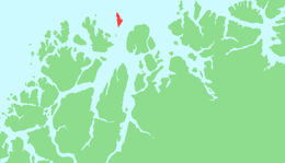
 Map of Nord-Fugløya | |
| Geography | |
|---|---|
| Location | Northern Norway |
| Area | 21.3 km2 (8.2 sq mi) |
| Highest elevation | 750 m (2,460 ft) |
| Highest point | Fugløykallen |
| Administration | |
|
Norway | |
| County | Troms |
| Municipalities | Karlsøy |
Nord-Fugløya or Fugløya is an uninhabited island in the municipality of Karlsøy in Troms, Norway. The island has an area of 21.3 square kilometers, and is protected as a nature reserve. The highest mountain is Fugløykallen, with a height of 750 m.a.s.l.. Fugløykalven Lighthouse is located north of the island.[1][2]
References
- ↑ Evensen, Knut Harald, ed. (2010). NAF Veibok 2010-2012 (in Norwegian) (29th ed.). Oslo: Norges Automobil-Forbund. p. 134.
- ↑ Godal, Anne Marit (ed.). "Nord-Fugløya". Store norske leksikon (in Norwegian). Oslo: Norsk nettleksikon. Retrieved 2 August 2013.
Coordinates: 70°16′N 20°15′E / 70.267°N 20.250°E
This article is issued from Wikipedia - version of the 7/15/2016. The text is available under the Creative Commons Attribution/Share Alike but additional terms may apply for the media files.