North Dakota Highway 8
| ||||
|---|---|---|---|---|
| Route information | ||||
| Maintained by NDDOT | ||||
| Length: | 211.321 mi[1] (340.088 km) | |||
| Major junctions | ||||
| South end: |
| |||
|
| ||||
| North end: |
| |||
| Highway system | ||||
| ||||

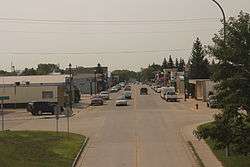
ND 8 in Stanley
North Dakota Highway 8 is a north–south highway in North Dakota. The highway is split into two segments. The northern segment is 78 miles (126 km) long and runs from SK 9 in Northgate on the Canada–US border to ND 23 near New Town. The southern segment is 133 miles (214 km) long and runs from Lake Sakakawea near Twin Buttes to SD-75 near Hettinger. Together, the segments are 211 miles (340 km) long. The highway was originally continuous but was separated by the creation of Lake Sakakawea in the 1950s.
References
- ↑ "Route and Mileage Map Insets" (PDF). North Dakota Department of Transportation. North Dakota Department of Transportation. Retrieved June 20, 2016.
External links
- The North Dakota Highways Page by Chris Geelhart
- North Dakota Signs by Mark O'Neil
This article is issued from Wikipedia - version of the 8/13/2016. The text is available under the Creative Commons Attribution/Share Alike but additional terms may apply for the media files.
.svg.png)