Norwegian County Road 17
| County Road 17 | |
|---|---|
|
Norwegian: Fylkesvei 17 Nynorsk: Fylkesveg 17 | |
| Kystriksveien (Coastal Highway) | |
|
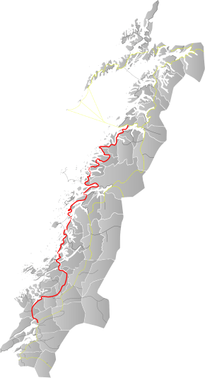
Map of the road | |
| Route information | |
| Length: | 630 km (390 mi) |
| Major junctions | |
| North end: | 80 Bodø, Nordland |
| South end: | E6 Steinkjer, Nord-Trøndelag |
| Highway system | |
| County Roads in Norway | |
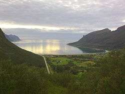
County Road 17 (Norwegian: Fylkesvei 17), also known as the Coastal Highway (Norwegian: Kystriksveien), is a Norwegian highway that runs from Bodø in Nordland county (in the north) to Steinkjer in Nord-Trøndelag county (in the south). It is 630 kilometres (390 mi) long and includes six ferry crossings. The road runs along the coast of Nordland and Nord-Trøndelag counties through 28 different municipalities. This road is a much more scenic, albeit longer and more time-consuming, route than the inland European Route E6 highway.[1]
Prior to 1 January 2010, this was National Road 17 (Norwegian: Riksvei 17), but control and maintenance of the road was transferred to the counties from the national government on that date, so now it is a county road.
Media gallery
- Fv17 crosses Saltstraumen
 The Helgeland Bridge north of Sandnessjøen
 Storvik bay
- Sjona tunnel in Rana
References
- ↑ "Kystriksveien - the coastal route". Retrieved 2011-07-17.
External links
 Media related to Fylkesvei 17 at Wikimedia Commons
- Kystriksveien (VisitNorway.com)
Coordinates: 64°01′N 11°31′E / 64.017°N 11.517°E

