Nova Scotia Route 358
| ||||
|---|---|---|---|---|
| Route information | ||||
| Maintained by Nova Scotia Department of Transportation and Infrastructure Renewal | ||||
| Length: | 30 km[1] (19 mi) | |||
| Major junctions | ||||
| South end: |
| |||
|
| ||||
| North end: | Rogers Rd. in Scot's Bay | |||
| Highway system | ||||
|
Provincial highways in Nova Scotia
| ||||
Route 358 is a collector road in the Canadian province of Nova Scotia.
It is located in Kings County and connects Greenwich at Trunk 1 with Scot's Bay. Between Port Williams and Canard, the highway crosses the Canard River and the low fields of the riverbank in a wide curve, tracing the path of the Grand Dyke, built by the Acadians about 1750.[2]
Communities
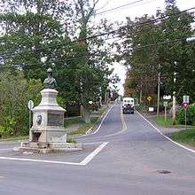
Route 358 in Canning
Parks
- Scots Bay Provincial Park
- Blomidon Provincial Park
- Cape Split Provincial Park Reserve
History
The section of the Collector Highway 358 from Canard to Canning was designated as part of the Trunk Highway 41.
See also
References
This article is issued from Wikipedia - version of the 6/19/2016. The text is available under the Creative Commons Attribution/Share Alike but additional terms may apply for the media files.