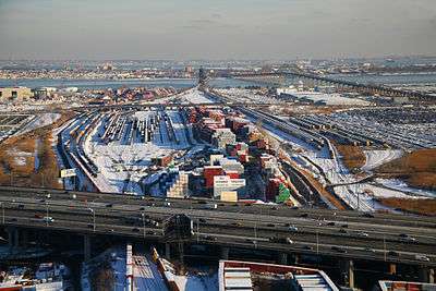
Oak Island Yard

Oak Island Yard is a freight rail yard located north of Port Newark-Elizabeth Marine Terminal and Newark International Airport in an industrial area of Ironbound, Newark, New Jersey, United States. The sprawling complex includes engine house, classification yard, auto unloading terminal, and maintenance facilities. It has ten reception tracks, an automated hump, 30 relatively short classification tracks, and nine departure tracks. In 1999, it classified 800 to 1000 cars per day.
The yard was built by the Lehigh Valley Railroad and opened 1903. After construction of the Upper Bay Bridge in 1929 vast amounts of landfill were used to raise the yard to accommodate the new grade.[1] It become part of the Consolidated Rail Corporation (Conrail) in 1976, and in 1981 Conrail greatly expanded it.[2] Currently it is jointly owned as part of North Jersey Shared Assets Area by the Norfolk Southern Railway and CSX, which took over Conrail operations in 1999.[3][4] It is a support yard for the Port of New York and New Jersey ExpressRail system.
Several lines converge at the yard.
- The Lehigh Line travels to the west passing over the Northeast Corridor to run parallel Raritan Valley Line just west of the Hunter Connection.
- The Passaic and Harsimus Line runs through the yard and heads north to cross the Passaic River and Hackensack River to Marion Junction.
- The Chemical Coast, known as the Garden State Secondary line heads south between the port and the airport.
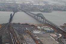
- To the east lies the Lehigh Valley Railroad Bridge which spans Newark Bay to the National Docks Secondary to the Upper New York Bay.
The yard is listed on the New Jersey Register of Historic Places.[5]
See also

- List of rail yards
- Crescent Corridor
- Lehigh Valley Terminal Railway
- Timeline of Jersey City area railroads
- List of bridges, tunnels, and cuts in Hudson County, New Jersey
References
- ↑ Marketing Department Inspection Train (PDF). Conrail. May 11, 1984. Retrieved 2010-12-07.
- ↑ Timothy Scott Doherty, Brian Solomon MBI Publishing Company, 2004, p93-94
- ↑ Rival-railroads-agree-on-Conrail's-assets, New York Times, April 4, 1997
- ↑ Salpukas, Agis (June 1, 1999). "Conrail Chugs Off Into the Sunset; CSX and Norfolk Southern Take Over". New York Times. Retrieved 2010-11-20.
- ↑ "New Jersey and National Registers of Historic Places - Essex County" (PDF). NJ DEP - Historic Preservation Office. January 10, 2010. p. 3. Archived from the original (PDF) on March 27, 2009. Retrieved 2010-12-05.
External links
- Cross harbor freight project Oak Island map
Coordinates: 40°42′31″N 74°08′17″W / 40.708670°N 74.138103°W