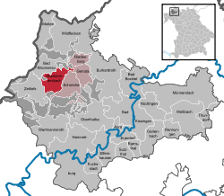
Oberleichtersbach
| Oberleichtersbach | ||
|---|---|---|
| ||
 Oberleichtersbach | ||
Location of Oberleichtersbach within Bad Kissingen district  | ||
| Coordinates: 50°17′N 9°48′E / 50.283°N 9.800°ECoordinates: 50°17′N 9°48′E / 50.283°N 9.800°E | ||
| Country | Germany | |
| State | Bavaria | |
| Admin. region | Unterfranken | |
| District | Bad Kissingen | |
| Municipal assoc. | Bad Brückenau | |
| Government | ||
| • Mayor | Walter Müller (CSU/ Freie Christl. Wählergr.) | |
| Area | ||
| • Total | 27.60 km2 (10.66 sq mi) | |
| Population (2015-12-31)[1] | ||
| • Total | 2,062 | |
| • Density | 75/km2 (190/sq mi) | |
| Time zone | CET/CEST (UTC+1/+2) | |
| Postal codes | 97789 | |
| Dialling codes | 09741 | |
| Vehicle registration | KG | |
| Website | www.Oberleichtersbach.de | |
Oberleichtersbach is a municipality in the district of Bad Kissingen in Bavaria in Germany.
Divisions of the municipality
The municipality includes the following towns:
- Oberleichtersbach
- Unterleichtersbach
- Modlos
- Breitenbach
- Mitgenfeld
History
Motten originally belonged to the Bishop of Fulda, and was secularized in 1803 and given to Archduke Ferdinand of Orange. In 1806, it became part of the Province of Fulde in France. In the Congress of Vienna in 1815, it was given to Austria. Since 1818, it has belonged to Bavaria.
Population
| Year | Population |
| 1970 | 1653 |
| 1987 | 1787 |
| 2000 | 2046 |
| 2005 | 2114 |
Coat of arms
Quartered with 1 and 4 in silver with a cross; 2 and 3 divided diagonally gold and red.
Economy
In 1998, there were 428 businesses in the municipality. In 1999, there were 84 agricultural businesses, with 2091 ha under cultivation, 788 ha in fields, and 1296 ha in pasture.
External links
References
- ↑ "Fortschreibung des Bevölkerungsstandes". Bayerisches Landesamt für Statistik und Datenverarbeitung (in German). June 2016.
This article is issued from Wikipedia - version of the 6/21/2015. The text is available under the Creative Commons Attribution/Share Alike but additional terms may apply for the media files.
