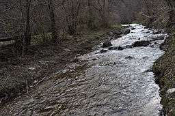
Ocolișel River
| Ocolișel River | |
| River | |
 The Ocolișel River | |
| Countries | Romania |
|---|---|
| Counties | Cluj County |
| Tributaries | |
| - left | Valea Vadului |
| Villages | Valea Vadului, Ocolișel |
| Source | |
| - location | Mount Bușcat |
| - elevation | 1,515 m (4,970 ft) |
| - coordinates | 46°31′41″N 23°16′43″E / 46.52806°N 23.27861°E |
| Mouth | Arieș |
| - location | Lungești |
| - elevation | 387 m (1,270 ft) |
| - coordinates | 46°29′57″N 23°31′50″E / 46.49917°N 23.53056°ECoordinates: 46°29′57″N 23°31′50″E / 46.49917°N 23.53056°E |
| Length | 25 km (16 mi) |
| Basin | 51 km2 (20 sq mi) |
| Progression | Arieș→ Mureș→ Tisza→ Danube→ Black Sea |
The Ocolișel River is a small river in the Apuseni Mountains, Cluj County, western Romania. It is a left tributary of the river Arieș. It flows through the commune of Iara, and joins the Arieș near the village Lungești. It is fed by several smaller streams, including Valea Vadului River.
References
- Administrația Națională Apelor Române - Cadastrul Apelor - București
- Institutul de Meteorologie și Hidrologie - Rîurile României - București 1971
- Capitolul 3 Apa
This article is issued from Wikipedia - version of the 6/18/2016. The text is available under the Creative Commons Attribution/Share Alike but additional terms may apply for the media files.