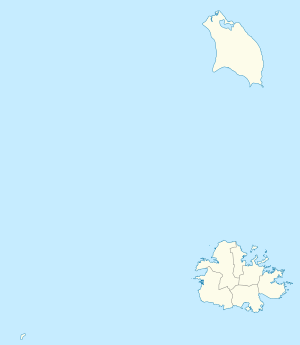
Pares, Antigua and Barbuda
| Pares | |
|---|---|
| Town | |
 Pares | |
| Coordinates: 17°05′N 61°45′W / 17.083°N 61.750°WCoordinates: 17°05′N 61°45′W / 17.083°N 61.750°W | |
| Country | Antigua and Barbuda |
| Island | Antigua |
| Population (2012) | |
| • Total | 763 |
| Time zone | AST (UTC-4) |
Pares is a small township in central Antigua. it is located to the north of Potworks Dam and south of the township of Parham on the road between Freemans and Willikies.
References
- Miller, D. (ed.) (2005) Caribbean Islands. (4th edition). Footscray, VIC: Lonely Planet.
- Scott, C. R. (ed.) (2005) Insight guide: Caribbean (5th edition). London: Apa Publications.
 |
Parham |  | ||
| |
||||
| ||||
| | ||||
| Potworks Dam |
This article is issued from Wikipedia - version of the 1/1/2015. The text is available under the Creative Commons Attribution/Share Alike but additional terms may apply for the media files.