Peña Blanca Lake
| Peña Blanca Lake | |
|---|---|
 | |
| Location | Santa Cruz County, Arizona, United States |
| Coordinates | 31°24′1″N 111°5′16″W / 31.40028°N 111.08778°WCoordinates: 31°24′1″N 111°5′16″W / 31.40028°N 111.08778°W |
| Type | reservoir |
| Primary inflows | Pajarito Wash |
| Basin countries | United States |
| Surface area | 45 acres (18 ha) |
| Average depth | 65 ft (20 m) |
| Surface elevation | 4,000 ft (1,200 m) |

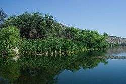
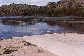
Peña Blanca Lake is a reservoir in Arizona, United States, located 18 miles (29 km) northwest of Nogales.[1] The facilities are maintained by the Coronado National Forest division of the USDA Forest Service. The lake was created in 1957 by the Arizona Game and Fish Department.[2] In 2008, the lake was closed to clean mercury contamination within the sediment, thought to be from old mines in the area. [3] The lake was reopened in August 2009.[4] In 2013, an Arizona Department of Environmental Quality report showed that mercury levels were similar to those before the lake was drained and dredged. One potential cause for the high mercury could be naturally occurring mercury seeping through the faults or a spring in the lake, though these claims are still under investigation. [5]
Fish species
- Rainbow Trout - Stocked in winter
- Largemouth Bass
- Sunfish
- Catfish (Channel)
- Gila Longfin Dace
References
- ↑ "Coronado National Forest - Pena Blanca Lake". USDA Forest Service.
- ↑ http://www.fs.usda.gov/recarea/coronado/recreation/recarea/?recid=25524&actid=42
- ↑ http://www.tucsonnewsnow.com/story/9162061/pena-blanca-lake-closed-indefinitely
- ↑ http://tucson.com/news/local/pe-a-blanca-lake-features-more-trout-new-boat-ramp/article_bd3b83bb-17b9-5961-82ff-c6b588fb2122.html
- ↑ http://www.nogalesinternational.com/news/hunt-is-on-for-source-of-mercury-at-pe-a/article_c07d92fa-4215-11e5-b475-43b4af06eb0a.html
- "Arizona Fishin' Holes". Phoenix, AZ: Arizona Game and Fish Department. 2007.
|first1=missing|last1=in Authors list (help) - U.S. Geological Survey Geographic Names Information System: Peña Blanca Lake