Pont Street


Pont Street is a fashionable street in Knightsbridge and Belgravia, central London, England, not far from the Knightsbridge department store Harrods to the north-west. The street crosses Sloane Street in the middle, with Beauchamp Place to the west and Cadogan Place, and Chesham Place, to the east, eventually leading to Belgrave Square. On the west side Hans Place leads off the street to the north and Cadogan Square to the south.
History
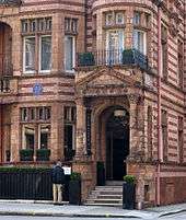
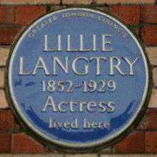
The actress Lillie Langtry (1852–1929) lived at 21 Pont Street from 1892 to 1897, recorded since 1980 by a blue plaque. The building became part of the Cadogan Hotel in 1895, but she still stayed in her old bedroom even after this. Oscar Wilde was arrested in room number 118 of the Cadogan Hotel on 6 April 1895.
Politician Harry Crookshank, 1st Viscount Crookshank (1893-1961) lived from 1937 until his death at 51 Pont Street.[1]
St Columba's Church in Pont Street was designed in the 1950s by the architect Sir Edward Maufe (1883–1974), who also designed the brick Guildford Cathedral. It is one of the two London congregations of the Church of Scotland. The original St Columba's Church building of 1884 was destroyed during the Blitz of World War II on the night of 10 May 1941.
Portmeirion had an antiques shop in Pont Street, later to become the headquarters of Portmeirion Pottery. A section of railing from the Liverpool Sailors' Home was installed outside the shop by Clough Williams-Ellis.
The Challoner Club, an exclusively Catholic gentleman's club, was based in Pont Street.
A restaurant called Drones is located at 1 Pont Street (not to be confused with the fictional Drones Club of P. G. Wodehouse).
Transport
The nearest tube stations are Knightsbridge to the north and Sloane Square to the south.
Fictional references
- In P.G. Wodehouse's The Code of the Woosters (1938), Mrs. Wintergreen, widow of the late Colonel H. H. Wintergreen and fiancée of Sir Watkyn Bassett, lives in Pont Street.
- Pont Street is referred to in Evelyn Waugh's novel Brideshead Revisited (1945), as a place related to typical English snobbery. In the novel, the character Julia and her friends say that "it was 'Pont Street' to wear a signet ring and to give chocolates at the theatre; it was 'Pont Street' at a dance to say, 'Can I forage for you?'".
- In Nancy Mitford's Love in a Cold Climate (1949), the heroine's aunt, who is bringing her up to mix in the best society, is said to "keep her nose firmly to Pont Street".
References
- ↑ Oxford Dictionary of National Biography, Volume 14. Oxford University Press. 2004. p. 402.Article by S.J. Ball.
External links
Coordinates: 51°29′49″N 0°09′37″W / 51.49702°N 0.16019°W