Pyrocumulus cloud
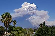
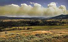
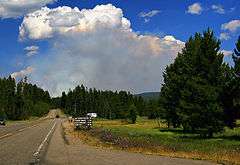
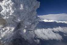
A pyrocumulus cloud, or fire cloud, is a dense cumuliform cloud associated with fire or volcanic eruptions [1] that may produce dry lightning (lightning without rain).
A pyrocumulus is similar dynamically in some ways to a firestorm, and the two phenomena may occur in conjunction with each other. However, one may occur without the other.
Formation

A pyrocumulus cloud is produced by the intense heating of the air from the surface. The intense heat induces convection, which causes the air mass to rise to a point of stability, usually in the presence of moisture. Phenomena such as volcanic eruptions, forest fires, and occasionally industrial activities can induce formation of this cloud. The detonation of a nuclear weapon in the atmosphere will also produce a pyrocumulus, in the form of a mushroom cloud, which is made by the same mechanism. The presence of a low-level jet stream can enhance its formation. Condensation of ambient moisture (moisture already present in the atmosphere), as well as moisture evaporated from burnt vegetation or volcanic outgassing (water vapour is a dominant component of volcanic eruptive gasses), occurs readily on particles of ash.

Pyrocumuli contain severe turbulence, manifesting as strong gusts at the surface, which can exacerbate a large conflagration. A large pyrocumulus, particularly one associated with a volcanic eruption, may also produce lightning. This is a process not yet fully understood, but is probably in some way associated with charge separation induced by severe turbulence, and perhaps, by the nature of the particles of ash in the cloud. Large pyrocumuli can contain temperatures well below freezing, and the electrostatic properties of any ice that forms may also play a role. A pyrocumulus that produces lightning is actually a type of cumulonimbus, a thundercloud, and is called pyrocumulonimbus. The World Meteorological Organization does not recognize pyrocumulus or pyrocumulonimbus as distinct cloud types, but rather classifies them respectively as cumulus (mediocris or congestus) and cumulonimbus.
Appearance


Pyrocumulus is often grayish to brown in color, because of the ash and smoke associated with the fire. It also tends to expand because the ash involved in the cloud's formation increases the amount of condensation nuclei. This poses a problem, as the cloud can trigger a thunderstorm, from which the lightning can start another fire.
Effects on wildfires
A pyrocumulus cloud can help or hinder a fire. Sometimes, the moisture from the air condenses in the cloud and then falls as rain, often extinguishing the fire. There have been numerous examples where a large firestorm has been extinguished by the pyrocumulus that it created.[2] However, if the fire is large enough, then the cloud may continue to grow, and become a type of cumulonimbus cloud known as a pyrocumulonimbus cloud, which may produce lightning and start another fire.[3]
References
- ↑ Pyrocumulus entry in the AMS Glossary
- ↑ Csifo, Noemi. "Fire Cloud Cumulus Cumulonimbus Weather". Sciences 360. R R Donelley. Retrieved 22 October 2013.
- ↑ "Pyrocumulus by The Airline Pilots".
External links
-
 Media related to Pyrocumulus clouds at Wikimedia Commons