Rhode Island Route 5
| |||||||
|---|---|---|---|---|---|---|---|
 | |||||||
| Route information | |||||||
| Maintained by RIDOT | |||||||
| Length: | 25.7 mi[1] (41.4 km) | ||||||
| Existed: | by 1934 – present | ||||||
| Major junctions | |||||||
| South end: |
| ||||||
|
| |||||||
| North end: | Central Street in Millville, MA | ||||||
| Location | |||||||
| Counties: | Kent, Providence | ||||||
| Highway system | |||||||
| |||||||

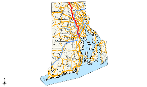
Route 5 is a state highway in the U.S. state of Rhode Island. It runs approximately 26 miles (42 km) from US 1 in Warwick to the Massachusetts state line in North Smithfield.
Route description
Route 5 starts at US 1 in Warwick near Gorton Pond. It runs north over I-95 without an interchange before intersecting Route 2 in Cranston. It continues north, generally paralleling I-295. After passing US 44 near Greenville, Route 5 crosses the Stillwater Reservoir on a short causeway. Continuing north, Route 5 has a short concurrency with Route 7, and it continues to North Smithfield. Route 5 crosses the Route 146 expressway without an interchange and terminates at the Massachusetts state line, though the northernmost Route 5 shields are around Route 102 at the south end of the Route 146A concurrency.
History

Route 5 was once numbered Route 1C along the 3.0 miles (4.8 km) between its south end at U.S. Route 1 (New England Interstate Route 1 before 1926) and Route 2 (originally Route 1A). It was renumbered Route 5 and extended north by 1934.
Major intersections
| County | Location | mi[1] | km | Destinations | Notes |
|---|---|---|---|---|---|
| Kent | Warwick | 0.0 | 0.0 | Southern terminus | |
| 1.2 | 1.9 | ||||
| Providence | Cranston | 3.0 | 4.8 | Interchange | |
| 5.7 | 9.2 | Cranston Street | Roundabout | ||
| 6.1 | 9.8 | ||||
| 7.4 | 11.9 | ||||
| Johnston | 9.1 | 14.6 | Interchange | ||
| 9.6 | 15.4 | ||||
| Greenville | 13.8 | 22.2 | |||
| Smithfield | 14.8 | 23.8 | South end of concurrency with Route 116 | ||
| 16.6 | 26.7 | South end of concurrency with Route 104 | |||
| 16.8 | 27.0 | North end of concurrency with Route 116 | |||
| North Smithfield | 19.4 | 31.2 | South end of concurrency with Route 7 | ||
| 19.6 | 31.5 | North end of concurrency with Route 7 | |||
| 20.9 | 33.6 | North end of concurrency with Route 104 | |||
| 25.1 | 40.4 | South end of concurrency with Route 146A | |||
| 25.3 | 40.7 | North end of concurrency with Route 146A | |||
| 25.7 | 41.4 | Massachusetts border | |||
1.000 mi = 1.609 km; 1.000 km = 0.621 mi
| |||||
References
- 1 2 Google (December 23, 2013). "Route 5" (Map). Google Maps. Google. Retrieved December 23, 2013.