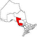
St. Joseph, Ontario
| St. Joseph | |
|---|---|
| Township (single-tier) | |
| Township of St. Joseph | |
|
Town hall in Richards Landing | |
 St. Joseph | |
| Coordinates: 46°16′N 84°00′W / 46.267°N 84.000°WCoordinates: 46°16′N 84°00′W / 46.267°N 84.000°W | |
| Country |
|
| Province |
|
| District | Algoma |
| Government | |
| • Type | Township |
| • Mayor | Joseph (Jody) Wildman |
| • Governing Body | St. Joseph Township Council |
| • MP | Bryan Hayes (CPC) |
| • MPP | Michael Mantha (NDP) |
| Area[1] | |
| • Land | 129.36 km2 (49.95 sq mi) |
| Population (2011)[1] | |
| • Total | 1,201 |
| • Density | 9.3/km2 (24/sq mi) |
| Time zone | EST (UTC-5) |
| • Summer (DST) | EDT (UTC-4) |
| Postal code | P0R 1G0 |
| Area code(s) | 705 |
| Website | www.stjosephtownship.com |
St. Joseph is a township in the Canadian province of Ontario, the largest of four municipalities on St. Joseph Island. It had a population of 1,201 in the Canada 2011 Census.
The mayor of the township is Jody Wildman.
Communities
The township's main population centre is Richards Landing. It also includes the smaller communities of Harmony and Sailors Encampment.
Richards Landing
The hamlet of Richards Landing has a view of the Highway 548 bridge at the pier on the northern tip of town. Highway 548 leads through the centre of the town and is its main thoroughfare. "The Landing" is St. Joseph Island's business centre, offering a grocery store, liquor/beer store, gift shops and galleries, restaurants, accommodation, marina/boat re-fuelling, 24-hour Emergency Department/hospital, medical centre, pharmacy and physiotherapy (physical therapy) clinic, bank, parks, public swimming, beach and tennis courts, variety store and movie rentals.
Main street of Richards Landing |
Marina of Richards Landing |
Demographics
| Canada census – St. Joseph, Ontario community profile | |||
|---|---|---|---|
| 2011 | 2006 | 2001 | |
| Population: | 1201 (6.4% from 2006) | 1129 (-6.0% from 2001) | 1201 (-2.8% from 1996) |
| Land area: | 129.36 km2 (49.95 sq mi) | 129.18 km2 (49.88 sq mi) | 129.25 km2 (49.90 sq mi) |
| Population density: | 9.3/km2 (24/sq mi) | 8.7/km2 (23/sq mi) | 9.3/km2 (24/sq mi) |
| Median age: | 52.2 (M: 51.9, F: 52.5) | 45.7 (M: 44.7, F: 46.1) | |
| Total private dwellings: | 893 | 919 | 902 |
| Median household income: | $53,177 | $48,823 | |
| References: 2011[2] 2006[3] 2001[4] | |||
See also
References
- 1 2 "St. Joseph, Ontario census profile". 2011 Census of Population. Statistics Canada. Retrieved 2012-02-17.
- ↑ "2011 Community Profiles". Canada 2011 Census. Statistics Canada. July 5, 2013. Retrieved 2012-02-17.
- ↑ "2006 Community Profiles". Canada 2006 Census. Statistics Canada. March 30, 2011. Retrieved 2012-02-17.
- ↑ "2001 Community Profiles". Canada 2001 Census. Statistics Canada. February 17, 2012. Retrieved 2012-02-17.
External links
| Wikimedia Commons has media related to St. Joseph, Ontario. |
 |
Laird St. Joseph Channel |
Tarbutt and Tarbutt Additional St. Joseph Channel |
Johnson St. Joseph Channel |
 |
| |
|
Hilton Beach Hilton | ||
| ||||
| | ||||
| Jocelyn |
