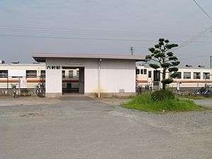
Rokken Station (Mie)
Rokken Station 六軒駅 | |
|---|---|
 Rokken Station | |
| Location |
Ozu-cho, Matsusaka, Mie (三重県松阪市小津町) Japan |
| Operated by | JR Central |
| Line(s) | Kisei Main Line |
| History | |
| Opened | 1894 |
| Traffic | |
| Passengers (FY2010) | 84 daily |
Rokken Station (六軒駅 Rokken-eki) is a railway station in Matsusaka, Mie Prefecture, operated by Central Japan Railway Company (JR Central). The station is 29.1 rail kilometers from the terminus of the line at Kameyama Station.
History
The Sangū Railway started service with its initial line between Tsu Station and Miyagawa Station on December 31, 1893. However, Rokken Station was not completed by that date, and only began operations on January 10, 1894.[1] The line was nationalized on October 1, 1907, becoming the Sangu Line of the Japanese Government Railways (JGR) on October 12, 1909.
On October 15, 1956, a crash involving two passenger trains occurred at the station. The Rokken rail accident killed 42 people.[2] The station was transferred to the control of the Japan National Railways (JNR) Kisei Main Line on July 15, 1959. All freight operations were discontinued in 1962. The station has been unattended since December 21, 1983. The station was absorbed into the JR Central network upon the privatization of the (JNR) on April 1, 1987.
Lines
- Central Japan Railway Company (JR Central)
Station layout
Rokken Station has two opposed side platforms connected by an overpass. There is no station building, but only a small weather shelter built onto the platform.
Platforms
| 1 | ■ Kisei Main Line | For Kameyama, Nagoya |
| 2 | ■ Kisei Main Line | ForIseshi, Shingū |
Adjacent stations
| « | Service | » | ||
|---|---|---|---|---|
| Central Japan Railway Company (JR Central) | ||||
| Kisei Main Line | ||||
| Rapid: Does not stop at this station | ||||
| Takachaya | Local | Matsusaka | ||
External links
| Wikimedia Commons has media related to Rokken Station (Mie). |
- JR Central timetable (Japanese)
References
- ↑ Ishino, Tetsu et al. (eds.) (1998). 停車場変遷大事典 国鉄・JR編 [Station Transition Directory - JNR/JR] (in Japanese). II. Tokyo: JTB Corporation. p. 371. ISBN 4533029809.
- ↑ Matsumoto, Masayuki. "Learning from Past Railway Accidents—Progress of Train Control". Retrieved 2008-08-22..
Coordinates: 34°37′03″N 136°30′27″E / 34.61750°N 136.50750°E