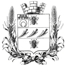
Semirechye Oblast
| Semirechye Oblast Семиреченская область Semirechyenskaya oblast' | ||||||
| Oblast of Russia | ||||||
| ||||||
| ||||||
| Capital | Verniy | |||||
| History | ||||||
| • | Established | 1854 | ||||
| • | Russian Revolution | 1917 | ||||
| Today part of | | |||||

The Semirechye Oblast (Russian: Семиреченская область, literally "Seven Rivers land") was an oblast (province) of the Russian Empire. It roughly corresponded to most of present-day southeastern Kazakhstan and northeastern Kyrgyzstan. It was created out of the territories of the northern part of Khanate of Kokand that had been part of Kazakh Khanate. Its center was Verniy, now Almaty. It was founded in 1854 and was ruled as part of Governor-Generalship of the Steppes (before 1882 it was known as Governor-Generalship of the Western Siberia) between 1854 and 1867 and again between 1882 and 1899 and part of Russian Turkistan between 1867 and 1882 and again between 1899 and 1917. Russia seized the Zhetysu region in 1854[1] and control over the region was recognized in the Treaty of Saint Petersburg (1881) between Russia and China.
Administrative division
As of 1897, the Semirechye Oblast was divided into 6 uyezds:
| Uyezd | Uyezd city (pop.) | Area, sq versta |
Population[2] |
|---|---|---|---|
| Verniy | Verniy (22,744) | 58330 | 223,883 |
| Dzharkent | Dzharkent (16,094) | 5160 | 122,636 |
| Kopal | Kopal (6,183) | 69100 | 136,421 |
| Lepsinsk | Lepsinsk (3,230) | 87080 | 180,829 |
| Pishpek | Pishpek (6,615) | 80480 | 176,577 |
| Przhevalsk | Przhevalsk (8,108) | 47760 | 147,517 |
Demographics
As of 1897, 987,863 people populated the oblast. Kazakhs constituted the majority of the population. Significant minorities consisted of Russians and Taranchi. Total Turkic speaking were 878,209 (88,9%).
Ethnic groups in 1897
| TOTAL | 987,863 | 100% |
|---|---|---|
| Kazakhs | 794,815 | 80,5% |
| Russians | 76,839 | 7,8% |
| Taranchi | 55,999 | 6,2% |
| Sart | 14,895 | 1,5% |
| Chinese | 14.130 | 1,4% |
See also
References
- ↑ Historical Atlas of the 19th Century World, 1783-1914. Barnes & Noble Books. 1998. p. 5.19. ISBN 978-0-7607-3203-8.
- ↑ demoscope.ru 1897 census results.
- ↑ demoscope.ru 1897 census results, languages
Coordinates: 43°15′00″N 76°54′00″E / 43.2500°N 76.9000°E

