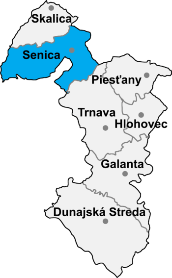
Senica District
| Senica District | |
|---|---|
| District | |
 | |
| Country | Slovakia |
| Region (kraj) | Trnava Region |
| Area | |
| • Total | 684 km2 (264 sq mi) |
| Population (2001) | |
| • Total | 60,891 |
| • Density | 89/km2 (230/sq mi) |
| Time zone | CET (UTC+1) |
| • Summer (DST) | CEST (UTC+2) |
| Telephone prefix | 34 |
Senica District (okres Senica) is a district in the Trnava Region of western Slovakia.[1] The district is relatively rich in natural resources oil, gas, lignite. It is industrial district, in the late period had been established here new industrial facilities. Senica District in its present borders had been established in 1996. Administrative, cultural and economic center is its seat and largest town Senica. In Senica District is located spa Smrdáky and of cultural importance is also basilica in Šaštín.
Municipalities
- Bílkove Humence
- Borský Mikuláš
- Borský Svätý Jur
- Cerová
- Čáry
- Častkov
- Dojč
- Hlboké
- Hradište pod Vrátnom
- Jablonica
- Koválov
- Kuklov
- Kúty
- Lakšárska Nová Ves
- Moravský Svätý Ján
- Osuské
- Plavecký Peter
- Podbranč
- Prietrž
- Prievaly
- Rohov
- Rovensko
- Rybky
- Sekule
- Senica
- Smolinské
- Smrdáky
- Sobotište
- Šajdíkove Humence
- Šaštín-Stráže
- Štefanov
References
- ↑ Ústredný portál verejnej správy Slovenskej republiky. "Okres Senica". Ministry of Finance of the Slovak Republic. Retrieved 2012-08-16.
Coordinates: 48°40′35″N 17°21′50″E / 48.67639°N 17.36389°E
This article is issued from Wikipedia - version of the 6/5/2013. The text is available under the Creative Commons Attribution/Share Alike but additional terms may apply for the media files.