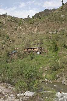
Siran Valley

Siran Valley, is a little-known valley, situated[1] in Mansehra District, Khyber-Pakhtunkhwa, Pakistan. Like the neighbouring areas, this valley also suffered greatly from the earthquake which hit the region on 8 October 2005.[2]
Name
The valley gets it name from the River Siran which flows through it. The main villages and localities in this valley are:
- Bhogarmang
- Bajna
- Baffa
- Dhodial
- Dadar
- Devli
- Giyar Sachan
- Inayatabad
- Jabbar
- Jabori
- Kodar Bala
- Kodar Paein
- Mundagucha
- Kotli
- Old Bhogarmang
- Panjul
- Sachan Kalan
- Sachan Khurd
- Sathian Gali
- Shinkiari
- Kodar
- Tanda
- Jacha
- Dahrial
- Sum elahimong
- Richmora
- Timmri
- Kund Bangla
- Sheed Pani
- Dholgali
- Tipran
- Jhangi
- Kalas Nawaz Abad
- Sumang Kiasa
- Mail But
- Nulla
- Shangreela
Geography
The Siran river is originates from the Manda Gucha Glacier and merges into the Indus River. The Siran issues from Panjool and flows through the western plain of Pakhli. Two canals have been taken out from the Siran river, the upper Siran canal at Dharial and lower Siran canal at Shinkiari. From Pakhli the Siran runs into the Tanawal hills and joins the Indus at Tarbela in the north west. Its total course is between 70 to 80 miles, and it irrigates 6,273 acres of land.[3]
References
- ↑ https://web.archive.org/web/20110718001117/http://www.nrb.gov.pk/lg_election/union.asp?district=73&dn=Mansehra. Missing or empty
|title=(help) - ↑ https://www.theguardian.com/world/2007/jul/18/topstories3.pakistan. Missing or empty
|title=(help) - ↑ Empty citation (help)