Skottinden
| Skottinden | |
|---|---|
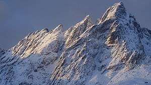 Skottinden on Vestvågøya | |
| Highest point | |
| Elevation | 671 m (2,201 ft) [1] |
| Prominence | 663 m (2,175 ft) [1][2] |
| Coordinates | 68°04′54″N 13°29′32″E / 68.08167°N 13.49222°ECoordinates: 68°04′54″N 13°29′32″E / 68.08167°N 13.49222°E |
| Geography | |
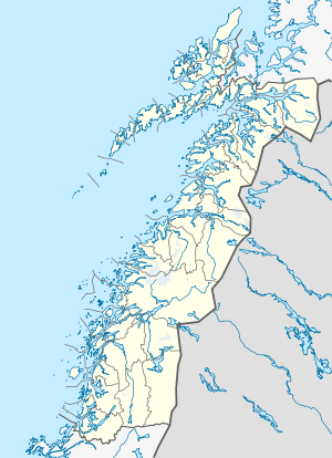 Skottinden Location in Nordland | |
| Location | Vestvågøy, Nordland, Norway |
| Topo map | 1031-II Leknes |
Skottinden is a mountain in the Lofoten archipelago, in Nordland county, Norway. It is located on the southwestern part of the island of Vestvågøya. The 671-metre (2,201 ft) tall mountain is situated about 2 kilometres (1.2 mi) northwest of the village of Ballstad and about 1 kilometre (0.62 mi) east of the Nappstraumen strait separating the islands of Vestvågøya and Flakstadøya.
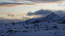
Skottinden from Storeid near Leknes, from the northeast
The southern ridge of Skottinden has several lesser summits: Sengestokken, Blåtinden, and Munkan.[3]
References
- 1 2 "The Major Mountains of Nordland". Retrieved 2012-06-22.
- ↑ "Skottinden". haramfjell.no. Retrieved 2012-06-22.
- ↑ Vestvågøy, Turkart 1:50 000 (Map) (2007 ed.). Cartography by Statens Kartverk, Norway. Den Norske Turistforening.
This article is issued from Wikipedia - version of the 12/7/2015. The text is available under the Creative Commons Attribution/Share Alike but additional terms may apply for the media files.