Maine State Route 5
| ||||
|---|---|---|---|---|
| Route information | ||||
| Maintained by MaineDOT | ||||
| Length: | 118.54 mi[1] (190.77 km) | |||
| Existed: | 1925 – present | |||
| Major junctions | ||||
| South end: |
| |||
|
| ||||
| North end: |
| |||
| Location | ||||
| Counties: | York, Cumberland, Oxford | |||
| Highway system | ||||
| ||||

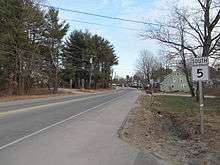
State Route 5 (abbreviated SR 5) is part of Maine's system of numbered state highways, located in the southern and western parts of the state. It is a major regional route, running 118.54 miles (190.77 km) from an intersection with State Route 9 in Old Orchard Beach, to an intersection with State Route 120 in Andover.
Route description
Old Orchard Beach to Waterboro
From its southern terminus near the Pier in Old Orchard Beach, SR 5 leaves the town to the west, going towards the neighboring city of Saco. The route runs northwest from Saco, passes very briefly through a Northwest corner of Biddeford, and intersects US 202 near the Lyman-Waterboro line. SR 5 runs concurrently with US 202 for a short distance to East Waterboro.
Waterboro to Andover
Between Waterboro and Cornish, SR 5 is known as the Sokokis Trail. North of Cornish, the highway follows the Saco River, crossing it at Hiram, to the town of Fryeburg. SR 5 continues north through Lovell to Bethel, where it intersects US 2. The two routes run together along the Androscoggin River to Rumford Point in the town of Rumford, where SR 5 leaves to the north. It follows parallel to the west bank of the Ellis River to the route's end in Andover.
History
As designated in 1925, SR 5 was a longer route than it is today, originally terminating in South Arm near the southern part of Lower Richardson Lake. In 1980, it was cut back to its current northern terminus in Andover at the intersection with SR 120.
In the early 1980s, I-195 was being constructed in Saco, partially over the existing alignment of SR 5. The route was shifted alongside I-195 and partially cosigned with US 1. This remains the routing today.
Junction list
| County | Location | mi | km | Destinations | Notes |
|---|---|---|---|---|---|
| York | Old Orchard Beach | 0.0 | 0.0 | Southern terminus of SR 5 | |
| 0.2 | 0.32 | Eastern terminus of SR 98 | |||
| 2.3 | 3.7 | Eastern terminus of I-195; SR 5 north goes under a concurrency with I-195 West until US 1. | |||
| Saco | 3.2 | 5.1 | Northern terminus of US 1 / SR 5 concurrency I-195 exit 2, no access to I-195 east | ||
| 4.1 | 6.6 | Southern terminus of US 1 / SR 5 concurrency Southern terminus of SR 112 | |||
| 4.5 | 7.2 | Northern terminus of SR 5 / SR 112 concurrency | |||
| Biddeford | No major junctions | ||||
| Dayton | 13.0 | 20.9 | |||
| Lyman | 16.5 | 26.6 | Eastern terminus of US 202 / SR 4 / SR 5 concurrency | ||
| Waterboro | 18.4 | 29.6 | Western terminus of US 202 / SR 4 / SR 5 concurrency | ||
| Limerick | 28.5 | 45.9 | Southern terminus of SR 5 / SR 11 concurrency | ||
| 28.7 | 46.2 | Southern terminus of SR 5 / SR 11 concurrency | |||
| 28.8 | 46.3 | Southern terminus of SR 160 | |||
| Cornish | 37.4 | 60.2 | Western terminus of SR 5 / SR 25 concurrency | ||
| 38.2 | 61.5 | Eastern terminus of SR 5 / SR 25 concurrency. Southern terminus of SR 5 / SR 117 concurrency | |||
| Cumberland | Baldwin | 40.1 | 64.5 | Southern terminus of SR 5 / SR 113 / SR 117 concurrency | |
| Oxford | Hiram | 44.1 | 71.0 | Northern terminus of SR 5 / SR 117 concurrency | |
| Brownfield | 51.2 | 82.4 | |||
| Fryeburg | 58.3 | 93.8 | Northern terminus of SR 5 / SR 113 concurrency Southern terminus of US 302 / SR 5 concurrency | ||
| 58.7 | 94.5 | Northern terminus of US 302 / SR 5 concurrency | |||
| Lovell | 67.8 | 109.1 | Northern terminus of SR 93 | ||
| South Oxford | 81.8 | 131.6 | Southern terminus of SR 5 / SR 35 concurrency | ||
| Bethel | 94.6 | 152.2 | Northern terminus of SR 35 Southern terminus of US 2 / SR 5 concurrency | ||
| 95.0 | 152.9 | Southern terminus of US 2 / SR 5 concurrency with SR 26 | |||
| Newry | 100.7 | 162.1 | Northern terminus of US 2 / SR 5 concurrency with SR 26 | ||
| Rumford | 106.9 | 172.0 | Northern terminus of US 2 / SR 5 concurrency | ||
| Andover | 118.5 | 190.7 | Northern terminus of SR 5 Western terminus of SR 120 | ||
1.000 mi = 1.609 km; 1.000 km = 0.621 mi
| |||||
Concurrent routings
- U.S. Route 202 / State Route 4: 1.9 miles (3.1 km), Lyman to Waterboro
- State Route 117: 6.3 miles (10.1 km), Cornish to Hiram
- State Route 113: 18 miles (29 km), Baldwin to Fryeburg
- State Route 35: 6.2 miles (10.0 km), Albany Township to Bethel
- U.S. Route 2: 12 miles (19 km), Bethel to Rumford
- State Route 26: 5.8 miles (9.3 km), Bethel to Newry
Former routes
| |
|---|---|
| Location: | Lovell |
| Length: | 2.1 mi (3.4 km) |
| Existed: | 1960–2003 |
State Route 5A was a short 2.1-mile (3.4 km) loop off Route 5 in Lovell. It functioned as an eastern bypass of downtown and connected to SR 5 at both ends. It was designated in 1960 and was removed from the route logs in 2003. It is now an unnumbered road.