Stone, Kent
| Stone | |
 View from Military Road towards Stone Church |
|
 Stone |
|
| Population | 6,100 (2005)[1] 10,778 (2011)[2] |
|---|---|
| OS grid reference | TQ575745 |
| District | Dartford |
| Shire county | Kent |
| Region | South East |
| Country | England |
| Sovereign state | United Kingdom |
| Post town | Dartford |
| Postcode district | DA2 |
| Post town | Greenhithe |
| Postcode district | DA9 |
| Dialling code | 01322 |
| Police | Kent |
| Fire | Kent |
| Ambulance | South East Coast |
| EU Parliament | South East England |
| UK Parliament | Dartford |
Coordinates: 51°26′53″N 0°15′57″E / 51.4480°N 0.2658°E
Stone, is a village in the Dartford Borough of Kent. It is located east of Dartford.
History
Iron Age pottery and artefacts have been found here[3] proving it to be an ancient settlement site. The 13th-century parish church, dedicated to St Mary the Virgin at Stone, was known as the "Lantern of Kent" from its beacon light known to all sailors on the river. It is one of Kent's most dramatic churches and is renowned for its Gothic sculpture made by the masons who built Westminster Abbey.[3] The Grade I listing entry narrates each spandrel is either identical or almost identical to those at Westminster Abbey and therefore also dates to 1260, it also describes the North Chapel built for Sir Richard Wiltshire's death in 1527 [4]
The parish (including Bean) was part of Axstane Hundred and later Dartford Rural District.
Stone Castle
Located about a mile to the south of Greenhithe and just north of the Roman Watling Street, Stone Castle dates from the mid-11th century, and is thought to have been constructed without licence during the reign of King Stephen, but was later permitted to remain by King Henry II after his accession to the throne.
The castle was built almost entirely of flint. The only surviving portion of the original medieval castle intact is its large rectangular tower, rising 40 feet in height. An adjoining Georgian house was built onto the tower by Sir Richard Wiltshire; in 1527 Cardinal Wolsey stayed at his house while passing through the district. In more recent times the property has belonged to the Church of England.
Stone today
Stone Castle is now the regional office of a large cement manufacturer. The cement works which once stood here have now been demolished.
The disused John's Hole Quarry at Stone was used as a filming location for the mine scenes in the Doctor Who television story The Dalek Invasion of Earth. This was the first of many quarries to be used in the series.[5]
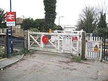
Stone Crossing railway station is located on the North Kent Line.[6] Stone has a village cricket team that was established in 1888.[7]
Demography
| Stone compared | |||
|---|---|---|---|
| 2001 UK Census | Stone | Dartford District | England |
| Total population | 6,252 | 85,911 | 49,138,831 |
| Foreign born | 5.2% | 5.8% | 9.2% |
| White | 95.9% | 94.5% | 90.9% |
| Asian | 1.6% | 3.2% | 4.6% |
| Black | 1.3% | 0.9% | 2.3% |
| Christian | 71% | 73.3% | 72% |
| Muslim | 0.3% | 0.7% | 3.1% |
| Hindu | 0.4% | 0.8% | 1.1% |
| No religion | 17.4% | 15.1% | 15% |
| Unemployed | 3.1% | 2.5% | 3.3% |
At the 2001 UK census, the Stone electoral ward had a population of 6,252.[8]
The ethnicity was 95.9% white, 0.9% mixed race, 1.6% Asian, 1.3% black and 0.3% other. The place of birth of residents was 94.8% United Kingdom, 0.8% Republic of Ireland, 0.9% other Western European countries, and 3.5% elsewhere. Religion was recorded as 71% Christian, 0.2% Buddhist, 0.4% Hindu, 0.5% Sikh and 0.3% Muslim. 17.4% were recorded as having no religion, 0.2% had an alternative religion and 9.9% did not state their religion.[8]
The economic activity of residents aged 16–74 was 49.7% in full-time employment, 10.8% in part-time employment, 6.9% self-employed, 3.1% unemployed, 1.8% students with jobs, 1.6% students without jobs, 10.1% retired, 7.7% looking after home or family, 4.8% permanently sick or disabled and 3.5% economically inactive for other reasons. The industry of employment of residents was 22% retail, 14.6% manufacturing, 10% construction, 10.6% real estate, 10.2% health and social work, 5.6% education, 9% transport and communications, 3.8% public administration, 3.4% hotels and restaurants, 4.5% finance, 0.6% agriculture and 5.7% other. Of the ward's residents aged 16–74, 12% had a higher education qualification or the equivalent, compared with 19.9% nationwide.[8]
Transport

Stone Crossing station serves the area with services to London Charing Cross both via Sidcup and via Woolwich Arsenal station, Gravesend and Gillingham station. Stone is served by the Transport for London bus service 492 with services to Sidcup via Bexleyheath and Dartford and to Bluewater, Arriva Kent routes 455 to Dartford and to Gravesend via Swanscombe and Greenhithe and 480/490 to Dartford and to Gravesend via Swanscombe and Bluewater.
The Thames Europort is situated in Stone. This is a ro-ro facility for sea freight traffic.
References
- ↑ "2005 Ward Level Population Estimates" (PDF). Kent County Council. September 2006. Retrieved 2007-08-20.
- ↑ "Civil Parish population 2011". Neighbourhood Statistics. Office for National Statistics. Retrieved 11 September 2016.
- 1 2 Newman, John (1969). West Kent and the Weald. Harmondsworth: Penguin Books. pp. 19, 525.
- ↑ Historic England. "Details from listed building database (1085810)". National Heritage List for England.
- ↑ Gary Russell (2003). Doctor Who – The Dalek Invasion Of Earth (DVD). BBC. Event occurs at 6:14–6:41 of "Now and Then" feature on Disc 2. ASIN B00009PBAN.
This was the first ever quarry to be used in the making of Doctor Who.
- ↑ "Stone Crossing". kentrail.org.uk. Retrieved 10 September 2015.
- ↑ "Stone CC". Stone Cricket Club. Retrieved 10 September 2015.
- 1 2 3 "Neighbourhood Statistics". Statistics.gov.uk. Retrieved 2008-02-21.
External links
| Wikimedia Commons has media related to Stone, Kent. |
