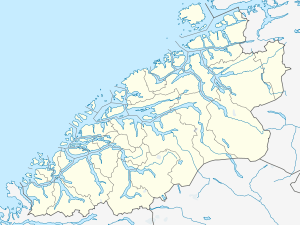
Storholmen Lighthouse
 Møre og Romsdal | |
| Location |
Giske Møre og Romsdal l Norway |
|---|---|
| Coordinates | 62°38′34″N 05°55′25″E / 62.64278°N 5.92361°ECoordinates: 62°38′34″N 05°55′25″E / 62.64278°N 5.92361°E |
| Year first lit | 1920 |
| Automated | 1980 |
| Foundation | concrete basement |
| Construction | cast iron tower |
| Tower shape | cylindrical tower with balcony and lantern |
| Markings / pattern | white basement, red tower with an orange lower band |
| Height | 22 m (72 ft) |
| Focal height | 35.6 m (117 ft) |
| Intensity | 58800 cd |
| Range | 17 nmi (31 km; 20 mi) |
| Characteristic | Oc WRG |
| Admiralty number | L0854 |
| NGA number | 6224 |
| ARLHS number | NOR-231 |
| Norway number | NF-3420 |
Storholmen Lighthouse (Norwegian: Storholmen fyr) is an active lighthouse in the municipality of Giske in Møre og Romsdal county on the west coast of Norway. This remote lighthouse is located on a tiny skerry about 6 kilometres (3.7 mi) due north of the tiny island of Erkna and 8 kilometres (5.0 mi) northwest of the populated island of Vigra. The light is lit from the 16th of July until the 21st of May. It is not lit during the summer because it is unnecessary due to the midnight sun in this part of the world.[1]
The lighthouse was only accessible by boat in calm seas during the summer, since boats cannot land on the tiny island. Goods and people had to be hoisted onto the island from the sea. From 1970 and until the lighthouse was automated in 1980, transport to the lighthouse was done by helicopter. The narrow 4-by-4-metre (13 ft × 13 ft) landing pad could only be used by very experienced pilots.
See also
References
- ↑ Store norske leksikon. "Storholmen fyr" (in Norwegian). Retrieved 2010-09-26.
External links
- Norsk Fyrhistorisk Forening (Norwegian)
- Picture of Storholmen Lighthouse Panoramio