Tempe, Arizona
| Tempe, Arizona | ||
|---|---|---|
| City | ||
| City of Tempe | ||
 | ||
| ||
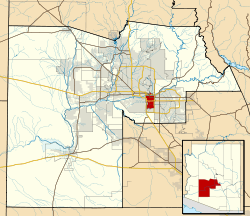 Location in Maricopa County and the state of Arizona | ||
 Tempe, Arizona Location in the United States | ||
| Coordinates: 33°25′46″N 111°56′35″W / 33.42944°N 111.94306°WCoordinates: 33°25′46″N 111°56′35″W / 33.42944°N 111.94306°W | ||
| Country | United States | |
| State | Arizona | |
| County | Maricopa | |
| Incorporated | November 29, 1894 | |
| Government | ||
| • Mayor | Mark Mitchell (D) | |
| Area | ||
| • City | 40.2 sq mi (102.30 km2) | |
| • Land | 40.1 sq mi (103.8 km2) | |
| • Water | 0.1 sq mi (0.3 km2) | |
| Elevation | 1,140 - 1,495 ft (347.47 - 455.68 m) | |
| Population (2010)[1] | ||
| • City | 161,719 | |
| • Estimate (2015)[2] | 175,826 | |
| • Rank | US: 138th | |
| • Density | 4,385/sq mi (1,694/km2) | |
| • Metro | 4,574,531 (US: 12th) | |
| Time zone | MST (no DST) (UTC-7) | |
| ZIP code | 85281, 85282, 85283, 85284, 85285, 85287 | |
| Area code(s) | 480 and 602 | |
| FIPS code | 04-73000 | |
| Website |
www | |
Tempe (/tɛmˈpiː/, US dict: tem-ˈpē;[3] Oidbaḍ in Pima), also known as Hayden's Ferry during the territorial times of Arizona, is a city in Maricopa County, Arizona, United States, with the Census Bureau reporting a 2010 population of 161,719.[1] The city is named after the Vale of Tempe in Greece. Tempe is located in the East Valley section of metropolitan Phoenix; it is bordered by Phoenix and Guadalupe on the west, Scottsdale on the north, Chandler on the south, and Mesa on the east. Tempe was the location of US Airways Group's corporate headquarters until December 9, 2013, when US Airways and American Airlines merged to form American Airlines Group. The headquarters for the combined airline moved to American's headquarters in Fort Worth, Texas. Tempe is also the home of Arizona State University.
History
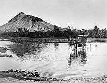
The Hohokam lived in this area and built canals to support their agriculture. They abandoned their settlements during the 15th century, with a few individuals and families remaining nearby.
Fort McDowell was established approximately 25 mi (40 km) northeast of present downtown Tempe on the upper Salt River in 1865 allowing for new towns to be built farther down the Salt River. US military service members and Hispanic workers were hired to grow food and animal feed to supply the fort, and less than a year later, had set up small camps near the river that were the first permanent communities in the Valley after the fall of the Hohokam. (Phoenix was settled shortly afterward, by 1867–68.) The two settlements were 'Hayden's Ferry', named after a ferry service operated by Charles T. Hayden, and 'San Pablo', and were located west and east of Hayden Butte respectively. The ferry became the key river crossing in the area. The Tempe Irrigating Canal Company was soon established by William Kirkland and James McKinney to provide water for alfalfa, wheat, barley, oats, and cotton.
Pioneer Darrell Duppa is credited with suggesting Tempe's name, adopted in 1879, after comparing the Salt River valley near a 300-foot (91 m)-tall butte, to the Vale of Tempe near Mount Olympus in Greece.[4]
In 1885, the 13th Arizona Territorial Legislature chose Tempe for the site of the Territorial Normal School, which became Arizona Normal School, Arizona State Teachers College, Arizona State College and finally Arizona State University.
The Maricopa and Phoenix Railroad, built in 1887, crossed the Salt River at Tempe, linking the town to the nation's growing transportation system. The Tempe Land and Improvement Company was formed to sell lots in the booming town. Tempe became an economic hub for the surrounding agricultural area. The city incorporated in 1894.
The completion of Roosevelt Dam in 1911 guaranteed enough water to meet the growing needs of Valley farmers. On his way to dedicate the dam, former President Theodore Roosevelt applauded the accomplishments of the people of central Arizona and predicted that their towns would be prosperous cities in the future. Less than a year later, Arizona was admitted as the 48th state, and the Salt River Valley continued to develop.
In the 20th and 21st centuries, Tempe has expanded as a suburb of Phoenix, and as a center of education and commerce.
Economy

Tempe is the headquarters and executive office of one Fortune 500 company: Insight Enterprises. Limelight Networks,[5] LifeLock,[6] First Solar,[7][8] the Salt River Project, Circle K, Fulton Homes and Mobile Mini are also headquartered in Tempe. Cold Stone Creamery was originally headquartered in Tempe and location #0001 is still in operation today at 3330 S McClintock Drive in Tempe, Arizona. Tempe is also home to the first and largest campus of Arizona State University. It was the longtime host of the Fiesta Bowl, although the BCS game moved to University of Phoenix Stadium, located in Glendale, in 2007. It then began hosting the Insight Bowl which is now known as the Cactus Bowl. Edward Jones Investments has a regional headquarters in Tempe.[9] China Airlines operates the Phoenix office in Tempe.[10]
Tempe houses several great performance venues including Gammage Auditorium and the Tempe Center for the Arts.
On New Year's Eve, the city hosts the Fiesta Bowl Block Party, one of the nation's largest New Year's Eve parties. The event typically has a national band heading a concert, along with several other local and national bands. Gammage Auditorium was also the site of one of the three Presidential debates in 2004, and Super Bowl XXX was played at Sun Devil Stadium. Additionally, Tempe is the spring training host city of the Los Angeles Angels of Anaheim.
One of Arizona's largest shopping malls, Arizona Mills, sits near the border with the town of Guadalupe. The city also serves as the first Arizona IKEA branch location, also near the southern boundary. Tempe Marketplace a large open air mall featuring live music and water and laser shows is located just southeast of Tempe Town Lake. Tempe can boast an array of wholesalers and manufacturers including Gummow Manufacturing, specializing in handcrafted wholesale Native American Jewelry,
Mill Avenue, located just west of Hayden Butte, is a shopping and entertainment area in the city popular with pedestrians and students. With the completion of Tempe Town Lake, commercial and high-rise development along the reservoir quickly transformed the cityscape of Mill Avenue and the skyline of downtown Tempe.
Top employers

According to Tempe's 2012 Comprehensive Annual Financial Report,[11] the top employers in the city are:
| # | Employer | # of Employees |
|---|---|---|
| 1 | Arizona State University | 11,185 |
| 2 | Maricopa County Community College District | 4,611 |
| 3 | Salt River Project | 4,374 |
| 4 | Safeway | 3,996 |
| 5 | Wells Fargo | 3,576 |
| 6 | Freescale Semiconductor | 3,000 |
| 7 | Honeywell Aerospace | 3,000 |
| 8 | Kyrene School District | 2,401 |
| 9 | JPMorgan Chase | 2,377 |
| 10 | US Airways | 1,898 |
Education
Tempe is served by multiple school districts.
Most of Tempe is within the Tempe Elementary School District and the Tempe Union High School District; however, other portions are served by the Kyrene School District (K–8), Scottsdale Unified School District (K–12), and Mesa Public Schools (K–12). James Madison Preparatory School and Tempe Preparatory Academy are also located in the area.
Tempe also contains one of the state's three major universities, Arizona State University, the Maricopa County Community College District administrative offices and the headquarters of Rio Salado Community College. Tempe is also the home of several career schools, including the University of Phoenix, Brookline College, Southwest College of Naturopathic Medicine, Southwest Institute of Healing Arts, Bryan University and Lamson Junior College.
Public libraries
Tempe Public Library serves Tempe. The children's library is now 18,816 square feet large.[12]
Demographics
| Historical population | |||
|---|---|---|---|
| Census | Pop. | %± | |
| 1880 | 135 | — | |
| 1890 | 897 | 564.4% | |
| 1900 | 885 | −1.3% | |
| 1910 | 1,473 | 66.4% | |
| 1920 | 1,963 | 33.3% | |
| 1930 | 2,495 | 27.1% | |
| 1940 | 2,906 | 16.5% | |
| 1950 | 7,684 | 164.4% | |
| 1960 | 24,897 | 224.0% | |
| 1970 | 63,550 | 155.3% | |
| 1980 | 106,919 | 68.2% | |
| 1990 | 141,865 | 32.7% | |
| 2000 | 158,945 | 12.0% | |
| 2010 | 161,719 | 1.7% | |
| Est. 2015 | 175,826 | [13] | 8.7% |
| U.S. Decennial Census[14] 2015 Estimate[2] | |||

As of the 2010 census, there were 161,719 people, 63,602 households, and 33,645 families residing in the city. The population density was 3,959.4 people per square mile (1,528.8/km²). There were 67,068 housing units at an average density of 1,674.1 per square mile (646.4/km²). The racial makeup of the city was 77.51% White, 3.66% Black or African American, 2.01% Native American, 4.75% Asian, 0.29% Pacific Islander, 8.49% from other races, and 3.30% from two or more races. 17.95% of the population were Hispanic or Latino of any race.
There were 63,602 households out of which 24.4% had children under the age of 18 living with them, 38.4% were married couples living together, 9.7% had a female householder with no husband present, and 47.1% were non-families. 28.5% of all households were made up of individuals and 4.6% had someone living alone who was 65 years of age or older. The average household size was 2.41 and the average family size was 3.05.
In the city the population was spread out with 19.8% under the age of 18, 21.3% from 18 to 24, 33.2% from 25 to 44, 18.5% from 45 to 64, and 7.2% who were 65 years of age or older. The median age was 29 years. For every 100 females there were 106.9 males. For every 100 females age 18 and over, there were 107.1 males.
The median income for a household in the city was $42,361, and the median income for a family was $55,237. Males had a median income of $36,406 versus $28,605 for females. The per capita income for the city was $22,406. About 7.5% of families and 14.3% of the population were below the poverty line, including 13.6% of those under age 18 and 5.1% of those age 65 or over.
Geography
Tempe is an inner suburb, located between the core city of Phoenix and the rest of the East Valley. Due to this as well as being the home of the main campus of Arizona State University, Tempe has a fairly dense, urbanized development pattern in the northern part of the city with a growing skyline. Going south, development becomes less dense, consisting of single-family homes, strip malls and lower-density office parks.
Within Tempe are the Tempe Buttes. The Salt River runs west through the northern part of Tempe; part of the river is dammed in two places to create Tempe Town Lake.
According to the United States Census Bureau, the landlocked city has a total area of 40.2 square miles (104 km2). The city of Tempe is bordered by Mesa to the east, Scottsdale to the north, Phoenix and Guadalupe to the west, and Chandler to the south. 40.1 square miles (104 km2) of it is land and 0.1 square miles (0.26 km2) of it is water. The total area is 0.32% water including Tempe Town Lake.
Tempe is generally flat, except for Hayden Butte (generally known as A-Mountain for Arizona State University's "A" logo located on its south face), located next to Sun Devil Stadium, Twin Buttes and Bell Butte on the western edge of Tempe, and Papago Park northwest of Tempe, inside Phoenix. Elevation ranges from 1,140 feet (350 m) at Tempe Town Lake to 1,495 feet (456 m) atop Hayden Butte.
.jpg)
Climate
| Climate data for Tempe, Arizona | |||||||||||||
|---|---|---|---|---|---|---|---|---|---|---|---|---|---|
| Month | Jan | Feb | Mar | Apr | May | Jun | Jul | Aug | Sep | Oct | Nov | Dec | Year |
| Average high °F (°C) | 69 (21) |
73 (23) |
78 (26) |
86 (30) |
95 (35) |
103 (39) |
105 (41) |
103 (39) |
100 (38) |
89 (32) |
78 (26) |
68 (20) |
87.3 (30.8) |
| Average low °F (°C) | 39 (4) |
42 (6) |
46 (8) |
52 (11) |
60 (16) |
68 (20) |
75 (24) |
75 (24) |
68 (20) |
56 (13) |
45 (7) |
38 (3) |
55.3 (13) |
| Average precipitation inches (mm) | 1.08 (27.4) |
1.20 (30.5) |
1.11 (28.2) |
0.28 (7.1) |
0.14 (3.6) |
0.03 (0.8) |
1.06 (26.9) |
1.36 (34.5) |
0.68 (17.3) |
0.64 (16.3) |
0.69 (17.5) |
1.10 (27.9) |
9.37 (238) |
| Source: The Weather Channel[15] | |||||||||||||
Culture
The Public Art program coordinates artists with building designers to install permanent and temporary public art projects. Since 1988, more than 50 projects have been commissioned by the Tempe's Cultural Services Division. The Art in Private Development ordinance of 1991 has helped add more than 60 privately owned pieces of art to the city, accessible by the public.[16]
Performing arts
Tempe enjoyed a thriving alternative music scene throughout the 1980s and 90s, producing such acts as the Gin Blossoms, Meat Puppets, Dead Hot Workshop, The Refreshments, Roger Clyne and the Peacemakers, Hans Olson, Gloritone, and The Maine.
Media
- KBAQ, a 24/7 member-supported classical radio station, is the only such service in the Phoenix metropolitan area.
- KUPD, an active rock radio station.
- College Times, a weekly entertainment magazine serving the Phoenix metropolitan area and 20 Maricopa County colleges, including Arizona State University.
Tourism
Many of the reasons people visit Tempe are events like P.F. Chang's Rock 'n' Roll Arizona Marathon & 1/2 Marathon, Tempe Marketplace, Arizona Mills, Mill Avenue, and Tempe Town Lake.[17] Downtown Tempe offers more than 175 restaurants, nightclubs and retail shops to cater to city guests.[18]
Mill Ave is a famous Arizona bar district here containing several bars and restaurants that cater to the growing university crowd. Along with bars and restaurants are business complexes and university buildings. Several long time bar establishments include Mill Ave Cue Club and Rula Bula Irish Pub, among others.
The Tempe Tourism Office, located on Mill Avenue's downtown district, provides maps and additional information about hotels and upcoming city events.[19]
Sports

There are currently no major league professional sports teams playing in Tempe. However, from 1988 to 2006, Sun Devil Stadium hosted the Arizona Cardinals of the National Football League. They have since moved to the University of Phoenix Stadium in Glendale for games, but maintain their headquarters and training facility in Tempe. Many residents follow the teams in nearby Phoenix and Glendale. (For more information, read the sports section on the Phoenix page)[20]
The Arizona State University Sun Devils compete in football, basketball, baseball, as well as a number of other sports in the Pac-12 Conference of the NCAA. The Sun Devils football team plays their games at Sun Devil Stadium. Their nearest rival is the University of Arizona Wildcats, in Tucson. The two teams compete in the "Duel in the Desert" for control of the Territorial Cup. The Sun Devil Stadium had hosted the annual Fiesta Bowl, until the 2007 game moved to the new University of Phoenix Stadium in Glendale.
The Los Angeles Angels of Anaheim have their spring training at Tempe Diablo Stadium. Tempe Diablo Stadium was built in 1968 and holds 9,785 people. The Angels moved here in 1993 from Palm Springs, California.
The city also hosts the Buffalo Wild Wings Bowl at Sun Devil Stadium (since 2006).
Tempe is home to Arizona Combat Sports, a mixed martial arts training organization as well as a Rage in the Cage training center.
Rugby union is a developing sport in Tempe as well as in the Phoenix metropolitan area. The multiple clubs, ranging from men's and women's clubs to collegiate and Under 19, are part of the Arizona Rugby Union.[21] Notable clubs are Arizona State University Rugby Football Club and the Tempe "Old Devils" Rugby Club.[22]
Outdoor activities
Tempe is home to many outdoor activities. Tempe Town Lake is a publicly accessible lake that is run by City of Tempe. The lake provides recreation activities to residents and tourists, but also helps protect the surrounding area from flooding. The City of Tempe estimated that 2.7 million people visited the lake in 2013.[23] Papago and South Mountain Parks offer hiking, mountain and road biking, rock climbing, frisbee golf, and equestrian activities. Tempe is also home to the annual Ironman Triathlon, which takes place in late November.
Transportation
.jpg)
Tempe is one of the most densely populated cities in the state and serves as a crossroads for the area's largest communities.
Freeways make up the major transportation system for the Valley. Included in the system surrounding Tempe are Interstate 10 near the western edge as it traverses the Broadway Curve, Loop 202 crossing the northern side, Loop 101 following the eastern border, and U.S. Route 60 running east–west through the geographic center of the city.
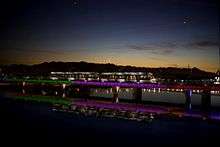
Valley Metro operates bus routes and the Valley Metro Rail system that serves Downtown Tempe and Arizona State University, providing service to Phoenix and Mesa. The City of Tempe operates a free neighborhood circulator service called Orbit involving five free shuttle routes near Arizona State University that operate on a regular basis seven days a week.[24] Three other FLASH (Free Local Area Shuttle) circulate in northern Tempe around the university. Tempe residents and commuters make extensive use of public transit and service is offered on a more frequent basis than elsewhere in the state. Most Tempe buses offer 15 minute service during rush hour and 30 minute service throughout the rest of the day.
Sky Harbor Phoenix International Airport, located 2 miles (3.2 km) northwest of Tempe, provides extensive air service to points throughout North America and to London, England, and various cities in Hawaii.
Phoenix-Mesa Gateway Airport is located in Mesa, and offers air service to many additional destinations.
Government
|
|
The city has had 31 mayors since 1894.
|
|
Tempe is in Arizona's 9th Congressional District, served by Representative Kyrsten Sinema (D). |
Notable people
- Jules Asner – television personality, model[25]
- Cecelia Cichan – sole survivor of Northwest Airlines Flight 255
- Eric Crown – co-founder of Insight Enterprises[26]
- Tim Crown – co-founder of Insight Enterprises[26]
- Roger Clyne – musician[27]
- Dead Hot Workshop – rock band
- Norman Dubie – poet
- Gin Blossoms- rock band
- Gabe Freeman – professional basketball player[28]
- Grady Gammage – educator, president ASU and NAU
- Margaret Gisolo – baseball pioneer, dance educator
- Carl Hayden – a famous Arizona senator, and its first Representative in the House, was born in Tempe on October 2, 1877[29]
- Joe Jackson – gridiron football player
- Frank Kush – college football coach
- Aaron McCreary – college baseball, basketball and football coach
- Harry E. Mitchell is a former U.S. Representative who represented Arizona's 5th Congressional District from 2007 until 2011.
- Paul "P.H." Naffah – musician
- John H. Pyle – Governor of Arizona from 1951 to 1955.[30]
- Mike Pollak – professional football player
- Alberto Ríos – poet
- The Refreshments – alternative rock band
- Charli Turner Thorne – college basketball coach
- Meat Puppets – alternative rock band
- The Maine – indie rock band
Historic properties in Tempe
There are numerous properties in the city of Tempe which are considered to be historical and have been included either in the National Register of Historic Places.[31]
Twin towns – Sister cities
Tempe has eight sister cities, as designated by Sister Cities International: [32]
-
 Beaulieu-sur-Mer, Alpes-Maritimes, Provence-Alpes-Côte d'Azur, France
 -
 Carlow, Carlow, Ireland
 -
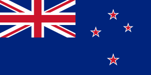 Lower Hutt, New Zealand
 -
 Regensburg, Bavaria, Germany
 -
 Skopje, Macedonia[33]
 -
 Zhenjiang, China
 -
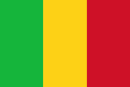 Timbuktu, Mali
 -
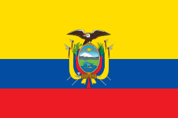 Cuenca, Ecuador
 -
 Cuzco, Peru
Tempe has had a Sister City with Skopje, Macedonia, since 1971. The newest sister city is Cusco, Peru, in 2012. Tempe has been voted "Best Overall Sister City Program" in 1998, 2004 and 2008.[34] This year, 32 candidates are to be given the opportunity to travel to one of the sister cities. Candidates undergo a rigorous interview process to travel to one of these countries completely free of charge. The Tempe Sister Cities Corporation is one made up of volunteers, and is one of the few Sister Cities programs in the United States that pays the full travel expenses for the trip.
See also
- List of historic properties in Tempe, Arizona
- List of historic properties in Glendale, Arizona
- List of historic properties in Chandler, Arizona
- List of historic properties in Phoenix, Arizona
- Double Butte Cemetery
References
- 1 2 "American FactFinder". United States Census Bureau. Retrieved 2012-06-18.
- 1 2 "Population Estimates". United States Census Bureau. Retrieved June 18, 2016.
- ↑ "'Tempe' definition and pronunciation". Merriam-Webster Dictionary. merriamwebster.com. Retrieved Sep 16, 2011.
- ↑ Blanton, Shirley R. (2007). Tempe. Arcadia Publishing. p. 8. ISBN 978-0-7385-4888-3.
- ↑ "Limelight Networks: #1 Ranked CDN for fast, secure, reliable delivery". Limelightnetworks.com. Retrieved 21 April 2016.
- ↑ "Identity Theft Protection From ID & Credit Fraud - LifeLock". Lifelock.com. Retrieved 21 April 2016.
- ↑ "Vertically Integrated Utility-Scale PV Power Solutions Provider - First Solar". Firstsolar.com. Retrieved 21 April 2016.
- ↑ "Honeywell CEO resigns, will head Tempe-based First Solar". Azcentral.com. Retrieved 21 April 2016.
- ↑ "Headquarters & Campus Locations." Edward Jones Investments. Retrieved on August 19, 2009.
- ↑ "North America." China Airlines. Retrieved on August 30, 2011. "Phoenix 2111E. Baseline Rd., Suite E2 Tempe, AZ 85283, U.S.A."
- ↑ "City of Tempe CAFR". Retrieved 2013-01-22.
- ↑ "About Tempe Public Library". City of Tempe. Retrieved January 11, 2010.
- ↑ "Annual Estimates of the Resident Population for Incorporated Places: April 1, 2010 to July 1, 2015". Retrieved July 2, 2016.
- ↑ "U.S. Decennial Census". Census.gov. Archived from the original on May 11, 2015. Retrieved May 7, 2014.
- ↑ "Monthly Averages for Tempe, AZ". Weather.com. 2010. Retrieved 2010-08-17.
- ↑ "Archived copy". Archived from the original on October 14, 2010. Retrieved November 6, 2010.
- ↑ "News from Tempe Convention & Visitors Bureau". Archive.constantcontact.com. Retrieved 2013-01-22.
- ↑ "Archived copy". Archived from the original on July 29, 2010. Retrieved November 6, 2010.
- ↑ "Tempe Tourism Tempe, AZ Tourism Office - Welcome to Tempe!". Tempe Tourism. Retrieved 21 April 2016.
- ↑ "Arizona Cardinals Franchise". The Official Site of the Arizona Cardinals. Arizona Cardinals. Retrieved 6 October 2014.
- ↑ "Arizona Rugby Union". Arizona Rugby Union. Retrieved 2013-01-22.
- ↑ East Valley Tribune. Rugby, E.V. style: No wimps allowed. Tuesday, 21 September 2004.
- ↑ "Tempe Town Lake". City of Tempe, AZ. 2014. Retrieved 6 October 2014.
- ↑ "Neighborhood Circulator Expansion". City of Tempe. Archived from the original on May 9, 2008. Retrieved 2008-07-23.
- ↑
- 1 2 Kress, Adam (May 22, 2005). "Insight Enterprises shifting focus to IT services". Phoenix Business Journal. Archived from the original on December 18, 2013. Retrieved September 19, 2014.
- ↑ Leatherman, Benjamin (Aug 6, 2014). "The 15 Biggest Rock Stars Who Live in Arizona". Phoenix New Times. Archived from the original on August 8, 2014. Retrieved September 15, 2014.
- ↑ "Gabe Freeman profile". scout.com. Retrieved March 24, 2013.
- ↑ "HAYDEN, Carl Trumbull, (1877–1972)". United States Congress. Archived from the original on February 26, 2014. Retrieved September 6, 2014.
- ↑ "Pyle, John Howard (1906–1987)". The Political Graveyard. Retrieved November 18, 2012.
- ↑ "National Register of Historical Places - ARIZONA (AZ), Maricopa County". Nationalregisterofhistoricplaces.com. Retrieved 21 April 2016.
- ↑ Stay with me. Medicine blog. "Official Tempe Sister Cities Website". Tempesistercity.org. Retrieved 2013-01-22.
- ↑ "Skopje - Twin towns & Sister cities". Official portal of City of Skopje. © Grad Skopje - 2006 - 2013, www.skopje.gov.mk. Archived from the original on 2013-10-24. Retrieved 2013-11-04.
- ↑ Tempe Sister City Corporation Membership Directory 2009
External links
| Wikimedia Commons has media related to Tempe, Arizona. |
| Wikivoyage has a travel guide for Tempe. |
- Official government website
- Tempe news, sports and things to do from The Tempe Republic newspaper
- Official Tempe Convention & Visitors Bureau Website
-
 Tempe travel guide from Wikivoyage
 - List of Tempe Neighborhoods


