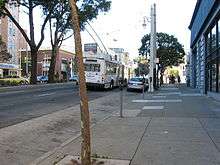
Van Ness Avenue
| Maintained by | San Francisco DPW, Caltrans |
|---|---|
| Length | 4.2 mi[1] (6.8 km) |
| South end | Cesar Chavez (Army) Street |
| Major junctions |
|
| North end | McDowell Avenue |


Van Ness Avenue is a north-south thoroughfare in San Francisco, California, running from Market St north to the Bay. Originally named Marlette Street, the street was renamed Van Ness Avenue in honor of the city's seventh mayor, James Van Ness.[2][3] Van Ness Avenue begins at Market Street near the Civic Center, and extends north to end at Bay Street at Fort Mason. Of the more striking landmarks along the route are the San Francisco City Hall, the War Memorial Opera House, and Louise M. Davies Symphony Hall.
South Van Ness Avenue is the portion of Van Ness south of Market Street, continuing through the city's South of Market and Mission districts to end at Cesar Chavez Street. It was formerly a continuation of Howard Street, having been renamed by resolution of the Board of Supervisors on August 22, 1932.[4]
The route is designated US 101 from the Central Freeway at the convergence of South Van Ness, Howard Street, and 13th Street, north to Lombard Street.[5]
History
Originally a quiet residential neighborhood of mansions, the street was used as a firebreak by the U.S. Army during the 1906 earthquake and fire that destroyed most of San Francisco. Many of the buildings were dynamited along the street by soldiers in an ultimately successful attempt to prevent the firestorm from spreading west to the entire city. Following the quake, Van Ness served as the temporary commercial center and main thoroughfare of San Francisco, as it ultimately evolved into a busy commercial district in its own right, attracting many car dealerships that exist to this day as the majority of the city's car and scooter dealerships line the street. It still remains a generally upscale area with large and grand apartment buildings, restaurants, and movie theaters.
Streetcar service started on Van Ness in 1915 for the opening of the Panama–Pacific International Exposition. The rail lines were removed in the 1950's and replaced with a tree-lined median.[6]
Major intersections
The entire route is within the borders of the City and County of San Francisco.
| Destinations | Notes |
|---|---|
| Cesar Chavez (Army Street) | |
| South end of US 101 overlap; interchange | |
| North end of US 101 overlap | |
| Bay Street | "Three Corners" |
See also
References
| Wikimedia Commons has media related to Van Ness Avenue (San Francisco). |
- ↑ Google Maps Driving Directions
- ↑ San Francisco Planning Department (2009). "Area Plan: Van Ness Avenue". City & County of San Francisco. Retrieved 2010-02-01.
- ↑ "Early San Francisco Street Names: 1846-1849". San Francisco Museum. Retrieved 2010-02-01.
- ↑ http://foundsf.org/index.php?title=LIFE_IN_THE_MISSION_by_Frank_R._Quinn
- ↑ The location of Van Ness Avenue, Google Map
- ↑ Rodriguez, Joe Fitzgerald (January 15, 2016). "Trees, historic trolley poles to be removed for bus project". The San Francisco Examiner. Retrieved 22 May 2016.
Coordinates: 37°48′29″N 122°25′36″W / 37.80802°N 122.42659°W
