Venediger Group
| Venediger Group | |
|---|---|
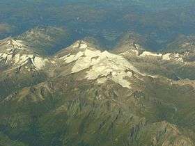
 The Venediger Group from the air | |
| Highest point | |
| Peak | Großvenediger |
| Elevation | 3,666 m (12,028 ft) |
| Geography | |
.png) Venediger Group (in red) within the Alps. | |
| Countries | Austria and Italy |
| States | Tyrol, Salzburg and South Tyrol |
| Range coordinates | 47°05′N 12°19′E / 47.09°N 12.31°ECoordinates: 47°05′N 12°19′E / 47.09°N 12.31°E |
| Parent range | High Tauern |
The Venediger Group (German: Venedigergruppe) is a sub-group of the Austrian Central Alps in the Eastern Alps. Together with the Ankogel Group, the Goldberg Group, the Glockner Group, the Schober Group, the Kreuzeck Group, the Granatspitze Group, the Villgraten Mountains and the Rieserferner Group the Venediger Group forms the main range known as the High Tauern. The Venediger Group is located in Austria in the federal states of Salzburg and Tyrol, and also in Italy in the region of Trentino-South Tyrol. However the greater part of the range lies in Tyrol (East Tyrol). The highest peak in the Venediger Group is the Großvenediger (3,666 m (AA)) which gives its name to the group.
The Venediger Group includes the western part of the main chain of the High Tauern. The Felbertauern Road runs over the eastern side of the group. The Venediger Group is the most glaciated mountain range in the High Tauern. The renown of the main summit in the group, the Großvenediger, rather overshadows the other regions and mountains. Nevertheless the group has a great number of peaks, mountain paths and Alpine huts. The origin of its name is unclear. According to a legend, when local shepherds saw the giant, glistening mass of ice for the first time they thought they were looking at the surface of the sea with a town (“Venice”), the name however goes back to the Venediger (Venetian).
Neighbouring ranges

The Venediger Group borders on the following other ranges in the Alps:
- Kitzbühel Alps (to the north)
- Granatspitze Group (to the east)
- Villgraten Mountains (to the south)
- Rieserferner Group (to the southwest)
- Zillertal Alps (to the west)
Boundaries
To the north the Oberpinzgau forms the boundary from Krimml on the Salzach downstream as far as Mittersill. To the east the boundary runs from Mittersill southwards along the Felberbach, over the Felber Tauern and continues along the Tauernbach to Matrei in Osttirol. From there it continues southwards along the Isel to the village of Huben. To the south the valley of Defereggental delineates the boundary from Huben along the Schwarzach heading downstream as far as Jagdhausalm and the Klammljoch. From the Klammljoch it runs downhill along the Klammlbach and through the Reintal valley to Sand in Taufers. In the west its perimeter runs along the Ahrntal valley from Sand in Taufers as far as Birnlücke and through the Krimmler Achental to Krimml.
The Birnlücke links the Venediger Group with the Zillertal Alps. The Klammljoch is its junction with the Rieserferner Group. The Felber Tauern join the Venediger Group to the Granatspitze Group.
Whilst clearly defined side ridges regularly branch off northwards from the main chain of the Venediger Group, towards the south the mountain tend to sprawl over a larger area forming their own subgroups: the Durreck Group, the Panargenkamm and the Lasörling Group.
Between the heavily glaciated main crest and the Lasörling Group is the Virgental, the only permanently settled valley in the middle of the Venediger Group.
Considerable parts of the Venediger Group belong to the core zone of the High Tauern National Park.
Peaks
All the named three-thousanders in The Venediger Group:[1]
|
|
Panargenkamm:
Lasörling Group:
|
Tourism
The Venediger Group is well developed for tourism. In addition to a myriad managed Alpine pastures and restaurants there is also a large number of Alpine Club huts:
|
|
|
Gallery
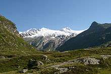
 The Großvenediger from the Johannis Hut to the south (The highest point, rear left),
to the right: Hohes Aderl, Rainertörl and Rainerhorn View from Innergschlöss looking west
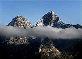
 The Schlatenkees from the Alte Prager Hut; centre rear: the Kristallwand, 3,310 m
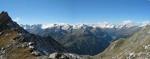
- The central Venediger Group from the Wildenkogel

References
- ↑ ÖK50 www.austrianmap.at
External links
| Wikimedia Commons has media related to Venediger Group. |

