Villers-Guislain
| Villers-Guislain | |
|---|---|
 Villers-Guislain | |
|
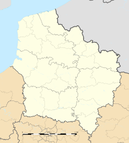
Location within Hauts-de-France region  Villers-Guislain | |
| Coordinates: 50°02′27″N 3°09′23″E / 50.0408°N 3.1564°ECoordinates: 50°02′27″N 3°09′23″E / 50.0408°N 3.1564°E | |
| Country | France |
| Region | Hauts-de-France |
| Department | Nord |
| Arrondissement | Cambrai |
| Canton | Marcoing |
| Intercommunality | Hauts du Cambrésis |
| Government | |
| • Mayor (2008–2014) | Gérard Allart |
| Area1 | 11.27 km2 (4.35 sq mi) |
| Population (1999)2 | 641 |
| • Density | 57/km2 (150/sq mi) |
| Time zone | CET (UTC+1) |
| • Summer (DST) | CEST (UTC+2) |
| INSEE/Postal code | 59623 / 59297 |
| Elevation |
86–141 m (282–463 ft) (avg. 136 m or 446 ft) |
|
1 French Land Register data, which excludes lakes, ponds, glaciers > 1 km² (0.386 sq mi or 247 acres) and river estuaries. 2 Population without double counting: residents of multiple communes (e.g., students and military personnel) only counted once. | |
Villers-Guislain is a commune in the Nord department in northern France. The graveyard at Gauche Wood contains the casualties who died during the Battle of Epehy when British troops were deployed between Gouzeaucourt and Villers-Guislain.
Heraldry
 |
The arms of Villers-Guislain are blazoned : Tierced per pale 1: Azure, a ?fleur de? lys argent; 2: Gules, a demi- doubleheaded eagle and a demi-cross potenty argent, both issuant from the dexter line of division; 3: Or, 3 fesses azure. |
See also
References
| Wikimedia Commons has media related to Villers-Guislain. |
This article is issued from Wikipedia - version of the 12/21/2014. The text is available under the Creative Commons Attribution/Share Alike but additional terms may apply for the media files.