Vine Street (Philadelphia)
Vine Street is a major east-west street in Center City, Philadelphia, Pennsylvania. It begins at the Delaware River, and proceeds west until 20th Street, where it merges with the Benjamin Franklin Parkway. In West Philadelphia, it begins again near the intersection of 52nd Street & Haverford Avenue, and ends just past 66th Street, in Cobbs Creek Park. Vine Street is non-continuous between 5th and 7th Streets, because of the Vine Street Expressway and the approach to the Benjamin Franklin Bridge.

It was part of Philadelphia's original street plan, laid out by William Penn and Thomas Holme in 1682, and remained the northern border of the City of Philadelphia until 1854.[1]
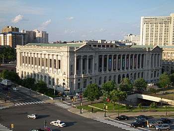
It forms the northern border of Franklin Square and Logan Circle. The main branch of the Free Library of Philadelphia and the (now-vacant) Family Court Building both have their main entrances on Vine Street.
 Philadelphia Fire Department Memorial, Franklin Square. Vine Street is in the background.
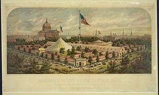
 Great Sanitary Fair, Logan Square (now Logan Circle), June 1864. Vine Street is in the foreground, left.
 Family Court Building, 1801 Vine Street.
 Free Library of Philadelphia, 1901 Vine Street.
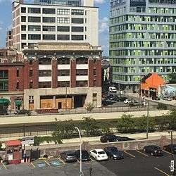
 Vine Street between 12th and 13th Streets
 Vine Street at 12th Street
References
- ↑ William Penn plans the City, from University of Virginia.
| Wikimedia Commons has media related to Vine Street (Philadelphia). |