Xinhua County
| Xinhua County 新化县 | |
|---|---|
| County | |
|
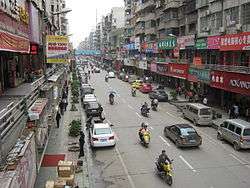
Tianhua South Road (天华南路; 天華南路) | |
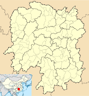 Xinhua Location in Hunan | |
| Coordinates: 27°44′13″N 111°18′29″E / 27.737°N 111.308°ECoordinates: 27°44′13″N 111°18′29″E / 27.737°N 111.308°E[1] | |
| Country | People's Republic of China |
| Province | Hunan |
| Prefecture-level city | Loudi |
| Area[2] | |
| • Total | 3,634.98 km2 (1,403.47 sq mi) |
| Population (2010)[3] | |
| • Total | 1,110,910 |
| • Density | 310/km2 (790/sq mi) |
| Time zone | China Standard (UTC+8) |
| Postal code | 4176XX |
Xinhua County (simplified Chinese: 新化县; traditional Chinese: 新化縣; pinyin: Xīnhuà Xiàn) is under the administration of Loudi, Hunan province, China, located along the middle reaches of the Zi River. It covers 3,635 square kilometers and has a population of 1,291,626 (2002). Xinhua shares the border with Lengshuijiang, Lianyuan, Xinshao, Xupu and Longhui counties and cities. As a county, it was founded at 1072 (Northern Song Dynasty) and now it is under jurisdiction of the Loudi City and subdivided into 7 townships and 19 towns, Shangmei Town (上梅镇; 上梅鎮; Shàngméi zhèn) is the county seat.
In 2011, media attention was attracted by a construction project started by the county's government. In the hope of attracting tourists, the officials wanted to build a lavish temple (Xiongshan Si - 熊山寺; "Bear Mountain Temple"), diverting funds from more essential projects.[4][5]
References
- ↑ Google (2014-07-02). "Xinhua" (Map). Google Maps. Google. Retrieved 2014-07-02.
- ↑ Loudi City Land Use Plan (2006–20)/《娄底市土地利用总体规划(2006-2020年)》.(Chinese) Accessed 8 July 2014.
- ↑ 娄底市2010年第六次全国人口普查主要数据公报 (in Chinese). Loudi People's Government. Archived from the original on July 14, 2014. Retrieved 9 July 2014.
- ↑ Poor Chinese county used relief fund to build temple. Reuters, 2011-09-26
- ↑ 湖南新化回应媒体曝“强扣水利款建旅游区”事宜 (Hunan's Xinhua [County] responds to media's claims of the diversion of irrigation funds to the construction of a tourist area).