Yuba, Michigan

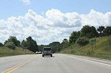
Yuba is a small unincorporated community in the Lower Peninsula of the U.S. state of Michigan. Yuba is a part of Grand Traverse County, and is located in Acme Township along U.S. Highway 31. Yuba rests on the eastern shore of Lake Michigan's Grand Traverse Bay. North of Yuba is the village of Elk Rapids. East of Yuba is the village of Williamsburg. South of Yuba is the village of Acme.
Size
Yuba has a small population and almost no businesses. There is no post office, school or grocery store. An old schoolhouse, built in 1860, still stands in Yuba, but is no longer in use. Because of these factors, Yuba is often considered to be a ghost town, but this is not technically accurate as Yuba has never been abandoned by its populace, having only declined in economic and civic activities.
On Walkscore.com, Yuba receives a 6 out of 100, meaning it is not a good place to live without a car, truck, bus or motorized vehicle of some sort.
Recreational Areas
The town of Yuba has two notable recreational areas:
The Yuba Creek Natural Area is a large section of preserved wetlands surrounding Yuba Creek. There are two roadside access points to the area, leading to extensive walking trails. The Yuba Creek Natural Area is known for its diversity of birds and wildflowers. Some local legends also claim that the grounds of the Natural Area are haunted.
Sayler Park is a public park located on the western edge of Yuba, along Grand Traverse Bay. The park has a small swimming area, a few playground items, and numerous picnic tables and grills. There are also three large, covered picnic shelters that may be reserved. Horses are not allowed in the park, and dogs are not permitted on the beach.
Landmarks
The oldest known Caucasian grave in the northwestern region of Michigan's Lower Peninsula is located in Yuba. It is not inside the Yuba Cemetery, but can be found across the highway along a turnoff just south of Yuba Park Road.
References
- Conklin, Bob "Community Forum, Letter to the Editor, The Yuba Post, September 1, 2007.
Coordinates: 44°49′24″N 85°27′33″W / 44.82333°N 85.45917°W