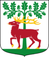
Alingsås Municipality
| Alingsås kommun | ||
|---|---|---|
| Municipality | ||
| ||
 | ||
| Country | Sweden | |
| County | Västra Götaland County | |
| Seat | Alingsås | |
| Area[1] | ||
| • Total | 551.17 km2 (212.81 sq mi) | |
| • Land | 472.03 km2 (182.25 sq mi) | |
| • Water | 79.14 km2 (30.56 sq mi) | |
| Area as of January 1, 2014. | ||
| Population (June 30, 2016)[2] | ||
| • Total | 39,837 | |
| • Density | 72/km2 (190/sq mi) | |
| Time zone | CET (UTC+1) | |
| • Summer (DST) | CEST (UTC+2) | |
| ISO 3166 code | SE | |
| Province | Västergötland | |
| Municipal code | 1489 | |
| Website | www.alingsas.se | |
| Density is calculated using land area only. | ||
Alingsås Municipality (Alingsås kommun) is a municipality in Västra Götaland County in western Sweden. Its seat is located in the city of Alingsås.
The present municipality was formed in 1974 then the former City of Alingsås (itself a municipality of unitary type since the subdivision reform of 1971) was amalgamated with Bjärke and Hemsjö.
Location, population
Alingsås is part (together with 12 other municipalities) of the Gothenburg Metropolitan Area with 900 000 inhabitants. Alingsås municipality has today (2011-01-01) 37 825 inhabitants. Most people live in Alingsås city (ca 25 000 inhab).
Sister cities
Alingsås has seven sister cities:
- Leisi, Estonia
- Karis, Finland
- Kartong, Gambia
- Mont-de-Marsan, France
- Ocatal, Nicaragua
- Skedsmo, Norway
- Tårnby, Denmark
Politics
Result of the 2010 election
Moderate Party 27,90%
Centre Party 6,18%
Liberal People's Party 9,99%
Christian Democrats 8,74%
Swedish Social Democratic Party 25,72%
Left Party 6,16%
Green Party 9,49%
Sweden Democrats 4,75%
Other Parties 1,06%
References
- ↑ "Statistiska centralbyrån, Kommunarealer den 1 januari 2014" (Microsoft Excel) (in Swedish). Statistics Sweden. Retrieved 2014-04-18.
- ↑ "Folkmängd i riket, län och kommuner 30 juni 2016" (in Swedish). Statistics Sweden. August 17, 2016. Retrieved August 17, 2016.
External links
- Alingsås Municipality - Official site
- (Swedish) Articles Alingsås and Alingsås manufakturverk - From Nordisk familjebok
Coordinates: 57°56′N 12°32′E / 57.933°N 12.533°E
