Arlington, Staten Island
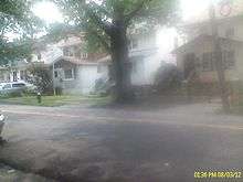
Arlington is a neighborhood on the North Shore of Staten Island, in New York City. It is a subsection of the Mariners' Harbor neighborhood, located north of the North Shore Rail Line ROW, and west of Harbor Road. Arlington was given its name by Civil War veteran and resident Commander Moses Henry Leman.
Arlington is the location of the Arlington Terrace Apartments on Holland Avenue.
Transportation
Until March 31, 1953, Arlington was served by the Arlington station of the Staten Island Railway. As of 2013, Arlington is served by the S40, S46, S48 local bus routes (and their rush-hour-only limited-stop counterparts, which are S90, S96, S98 respectively); express bus routes in Arlington are the X12, X42[1]
Education
Arlington residents are generally zoned for P.S. 44 (in Mariners' Harbor) and I.S. 72 in Heartland Village. Nearby schools also include P.S. 22 and I.S. 51. The local high school is Port Richmond High School.
A branch of the New York Public Library is planned for the community, to be located at 206 South Avenue. It is scheduled for completion in 2011.
Demographics
Arlington consists of the census tract 319.02. As of the 2010 census, the demographics were 54% Black or African American, 9% Nonhispanic White, 2% Asian, and 2% Multiracial. Hispanics of any race made up 31% of the population.[2]
According to City-data,[3] the median household income in Arlington was $36,577 in 2009. 25.7% of the population lives below the poverty line, making it one of the poorer communities in Staten Island, though a more working-class area compared to the rest of the city.


Notable residents
References
- ↑ "Staten Island Bus Map January 2013" (PDF). Metropolitan Transportation Authority. January 2013. Retrieved February 18, 2013.
- ↑ "Mapping the 2010 U.S. Census - NYTimes.com". Projects.nytimes.com. Retrieved 2011-11-25.
- ↑ "Arlington neighborhood in Staten Island, New York (NY), 10303 subdivision profile - real estate, apartments, condos, homes, community, population, jobs, income, streets". City-data.com. Retrieved 2011-11-25.
- ↑ http://www.silive.com/news/index.ssf/2009/10/council_candidates_historic_ru.html
Coordinates: 40°38′09″N 74°09′58″W / 40.63583°N 74.16611°W