Càrn Dearg, Monadh Liath
For other uses, see Càrn Dearg (disambiguation).
| Càrn Dearg | |
|---|---|
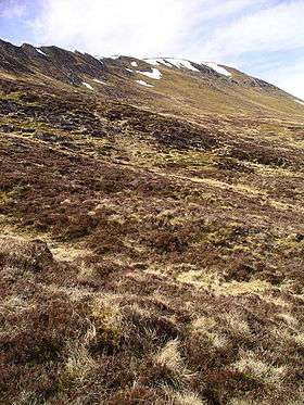
 Slopes of Càrn Dearg, from the south-east | |
| Highest point | |
| Elevation | 945 m (3,100 ft) [1] |
| Prominence | 590 m (1,940 ft) |
| Parent peak | Creag Meagaidh |
| Listing | Munro, Marilyn |
| Coordinates | 57°05′31″N 4°15′08″W / 57.092051°N 4.252186°WCoordinates: 57°05′31″N 4°15′08″W / 57.092051°N 4.252186°W |
| Naming | |
| Translation | red cairn (Gaelic) |
| Pronunciation | Scottish Gaelic: [ˈkʰaːrˠn ˈtʲɛɾɛk] |
| Geography | |
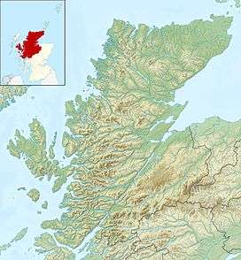
 Càrn Dearg Scotland | |
| Location | Highland, Scotland |
| Parent range | Monadh Liath |
| OS grid | NH635023 |
| Topo map | OS Landranger 35 |
Càrn Dearg is the highest peak of the Monadh Liath mountains in the Highlands of Scotland. Its eastern flanks slope steeply down into Glen Ballach, while to the north, the large plateau of the Monadh Liath extends for many miles. The nearest settlements are Newtonmore and Kingussie in the Spey valley. The rocky slopes of Carn Dearg and A' Chailleach contrast with the remainder of the Monadh Liath, which are described by Cameron McNeish as "sprawling, undistinguished affairs .[2]
References
| Wikimedia Commons has media related to Càrn Dearg (Monadh Liath). |
- ↑ "walkhighlands Carn Dearg (Monadhliath)". walkhighlands.co.uk. 2013. Retrieved 21 December 2013.
- ↑ Cameron McNeish (2005-05-22). "Taking the high road to some dazzling lochs". Sunday Herald.
This article is issued from Wikipedia - version of the 8/9/2015. The text is available under the Creative Commons Attribution/Share Alike but additional terms may apply for the media files.

