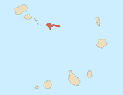
Cabeçalinho
| Cabeçalinho | |
|---|---|
 | |
| Coordinates: 16°35′56″N 24°19′19″W / 16.599°N 24.322°WCoordinates: 16°35′56″N 24°19′19″W / 16.599°N 24.322°W | |
| Country | Cape Verde |
| Island | São Nicolau |
| Municipality | Tarrafal de São Nicolau |
| Civil parish | São Francisco de Assis |
| Population (2010)[1] | |
| • Total | 155 |
Cabeçalinho is a settlement in the western part of the island of São Nicolau, Cape Verde. Its 2010 population was 155. It is situated 3 km southwest of Ribeira Brava.
Subdivisions
Its subdivisons are divided into neighborhoods (bairros) including:
- Cachaçinho
- Caldeira
- Chamiço de Cima
- Ribeira de Fonte
- Assomada Caleijão/Assomada de Estancha
- Chã
- Lombo Cabeçalinho
- Missemirinha
- Lombo Ferreira
- Coxo de Cabeçalinho
- Curva de Barraquinha
- Lombo Colo/Lombo Loteiro
- Mato Fort (Cape Verdean Creole variant form of Mato Forte)
- Titeia
- Alto Cacáco
See also
References
- ↑ "2010 Census results". Instituto Nacional de Estatística Cabo Verde (in Portuguese). 17 March 2014.
This article is issued from Wikipedia - version of the 4/14/2016. The text is available under the Creative Commons Attribution/Share Alike but additional terms may apply for the media files.
