Cann, Dorset
For other uses, see Cann (disambiguation).
Coordinates: 50°59′25″N 2°11′02″W / 50.9904°N 2.1839°W
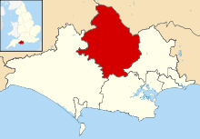
Cann is a village and civil parish in the county of Dorset in southern England. It is situated on the A350 road in the North Dorset administrative district, 1 mile (1.6 km) south of Shaftesbury. The civil parish covers 2,600 acres (1,100 ha) and has an underlying geology of Kimmeridge clay, greensand and gault clay.[2] In the 2011 census the parish—which includes HM Prison Guys Marsh—had a population of 822.[1]
References
- 1 2 "Area: Cann (Parish), Key Figures for 2011 Census: Key Statistics". Neighbourhood Statistics. Office for National Statistics. Retrieved 29 June 2014.
- ↑ "'Cann', An Inventory of the Historical Monuments in Dorset, Volume 4: North (1972), pp. 9-10". British History Online. University of London & History of Parliament Trust. November 2013. Retrieved 29 June 2014.
External links
![]() Media related to Cann, Dorset at Wikimedia Commons
Media related to Cann, Dorset at Wikimedia Commons
This article is issued from Wikipedia - version of the 5/11/2016. The text is available under the Creative Commons Attribution/Share Alike but additional terms may apply for the media files.


