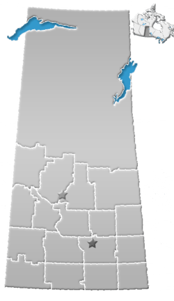
Division No. 9, Saskatchewan
Division No. 9, Saskatchewan, Canada, is one of the eighteen census divisions within the province, as defined by Statistics Canada. It is located in the eastern part of the province, bordering Manitoba. The most populous community in this division is Yorkton.
According to the 2006 census, 34,736 people lived in this division. It has a land area of 15,270.84 km² (5,896.10 sq mi).
Communities
City
Towns
Villages
Rural municipalities
- RM No. 241 Calder
- RM No. 243 Wallace
- RM No. 244 Orkney
- RM No. 245 Garry
- RM No. 271 Cote
- RM No. 273 Sliding Hills
- RM No. 274 Good Lake
- RM No. 275 Insinger
- RM No. 301 St. Philips
- RM No. 303 Keys
- RM No. 304 Buchanan
- RM No. 305 Invermay
- RM No. 331 Livingston
- RM No. 333 Clayton
- RM No. 334 Preeceville
- RM No. 335 Hazel Dell
Indian Reserves
- Indian Reserve --Cote 64
- Indian Reserve --Keeseekoose 66
- Indian Reserve --Keeseekoose 66A
- Indian Reserve --Keeseekoose 66-CA-04
- Indian Reserve --Keeseekoose 66-CA-05
- Indian Reserve --Keeseekoose 66-CA-06
- Indian Reserve --Keeseekoose 66-KE-04
- Indian Reserve --Keeseekoose 66-KE-05
- Indian Reserve --The Key 65
Footnotes
- 1 2 Statistics Canada. 2002 2001 Community Profiles. Released June 27, 2002. Last modified: 2005-11-30. Statistics Canada Catalogue no. 93F0053XIE. Page accessed January 5, 2007
References
- Division No. 9, Saskatchewan Statistics Canada
Coordinates: 51°34′12″N 101°54′00″W / 51.57000°N 101.90000°W
This article is issued from Wikipedia - version of the 8/17/2014. The text is available under the Creative Commons Attribution/Share Alike but additional terms may apply for the media files.
