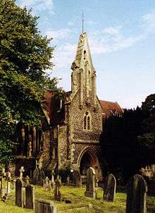
Grade II* listed buildings in Berkshire

Berkshire has 252 Grade II* listed buildings.

Buildings

Bracknell Forest

Name Location Type Completed [note 1]Date designated Grid ref.[note 2]
Geo-coordinates
Entry number [note 3]Image
Binfield Lodge Binfield House Extended and altered 1912 7 December 1966 SU8435273136
51°27′03″N 0°47′15″W / 51.450935°N 0.787485°W / 51.450935; -0.787485 (Binfield Lodge)
1390315
Binfield Park Binfield Country house 1775 7 December 1966 SU8458571621
51°26′14″N 0°47′04″W / 51.437282°N 0.784495°W / 51.437282; -0.784495 (Binfield Park)
1390299
Binfield Place Binfield House Mid-16th century 7 December 1966 SU8403070953
51°25′53″N 0°47′33″W / 51.431359°N 0.792635°W / 51.431359; -0.792635 (Binfield Place)
1390270
Church of All Saints Binfield Parish church 14th century 7 December 1966 SU8454772148
51°26′31″N 0°47′06″W / 51.442025°N 0.784915°W / 51.442025; -0.784915 (Church of All Saints)
1390256
Wellington College, main blocks and front walls Crowthorne College 1856–59 20 December 1972 SU8317563408
51°21′49″N 0°48′24″W / 51.363658°N 0.806698°W / 51.363658; -0.806698 (Wellington College, main blocks and front walls)
1390356
Church of St Michael Sandhurst Parish church 1853 20 December 1972 SU8258161862
51°20′59″N 0°48′56″W / 51.349846°N 0.815586°W / 51.349846; -0.815586 (Church of St Michael)
1390382
Old Building with attached lamps, Royal Military Academy Royal Military Academy, Sandhurst Barracks 1807–12 20 December 1972 SU8585660868
51°20′26″N 0°46′08″W / 51.340426°N 0.76881°W / 51.340426; -0.76881 (Old Building with attached lamps, Royal Military Academy)
1390376
Church of St Michael and All Angels Warfield Parish church 13th century 7 December 1979 SU8800672204
51°26′31″N 0°44′07″W / 51.442002°N 0.735146°W / 51.442002; -0.735146 (Church of St Michael and All Angels)
1390393
Church of St Mary Winkfield Parish church 14th century 7 December 1966 SU9042172437
51°26′37″N 0°42′01″W / 51.443717°N 0.700348°W / 51.443717; -0.700348 (Church of St Mary)
1390428
New Lodge Winkfield Country house c.1857 2 May 1989 SU9118075029
51°28′01″N 0°41′20″W / 51.466895°N 0.688763°W / 51.466895; -0.688763 (New Lodge)
1319407

Reading

Name Location Type Completed [note 1]Date designated Grid ref.[note 2]
Geo-coordinates
Entry number [note 3]Image
Albion Place Reading Terrace c.1825–35 22 March 1957 SU7218872994
51°27′05″N 0°57′45″W / 51.451338°N 0.962532°W / 51.451338; -0.962532 (Albion Place)
1113506
Archway connecting Forbury Gardens to Abbey Ruins, including retaining walls flanking path to Abbey Ruins Reading Arch Mid-19th century 14 December 1978 SU7197073585
51°27′24″N 0°57′56″W / 51.456679°N 0.965549°W / 51.456679; -0.965549 (Archway connecting Forbury Gardens to Abbey Ruins, including retaining walls flanking path to Abbey Ruins)
1113478
Chazey Farmhouse Reading House Early 19th century 24 October 1951 SU6910975208
51°28′18″N 1°00′23″W / 51.471626°N 1.006403°W / 51.471626; -1.006403 (Chazey Farmhouse)
1157139
Christ Church Reading Anglican church 1875 14 December 1978 SU7221272175
51°26′38″N 0°57′44″W / 51.443972°N 0.962354°W / 51.443972; -0.962354 (Christ Church)
1113441
Church of Saint Mary Reading Church 1798 22 March 1957 SU7133473246
51°27′13″N 0°58′29″W / 51.453711°N 0.974769°W / 51.453711; -0.974769 (Church of Saint Mary)
1113427
Church of St Peter Caversham Church From 12th century 22 March 1957 SU7088974892
51°28′07″N 0°58′51″W / 51.468565°N 0.980843°W / 51.468565; -0.980843 (Church of St Peter)
1303560
Culvert on Holy Brook running south-westwards from SU71441/73234 to 71327/73133 Reading Culvert Late 16th century 24 October 1984 SU7137973183
51°27′11″N 0°58′27″W / 51.453139°N 0.974134°W / 51.453139; -0.974134 (Culvert on Holy Brook running south-westwards from SU71441/73234 to 71327/73133)
1321866
Holybrook House Reading House c.1750 22 March 1957 SU7118773068
51°27′08″N 0°58′37″W / 51.45213°N 0.97692°W / 51.45213; -0.97692 (Holybrook House)
1113420
Main block and flanking wings at Royal Berkshire Hospital Reading Hospital 1882 19 March 1975 SU7241272955
51°27′03″N 0°57′34″W / 51.450959°N 0.959317°W / 51.450959; -0.959317 (Main block and flanking wings at Royal Berkshire Hospital)
1156091
Nos 154 to 160 (even) and railings to street Castle Hill, Reading House 18th century 22 March 1957 SU7085973015
51°27′06″N 0°58′54″W / 51.451694°N 0.98165°W / 51.451694; -0.98165 (Nos 154 to 160 (even) and railings to street)
1113431
Old Grove House Reading Timber-framed house Probably early to mid-17th century 22 March 1957 SU7131876676
51°29′04″N 0°58′28″W / 51.484549°N 0.974308°W / 51.484549; -0.974308 (Old Grove House)
1302576
St David's Hall Reading Terrace 1830s 22 March 1957 SU7218572944
51°27′03″N 0°57′45″W / 51.450889°N 0.962586°W / 51.450889; -0.962586 (St David's Hall)
1303031
The Simeon Monument Reading Obelisk 1804 22 March 1957 SU7169773462
51°27′20″N 0°58′10″W / 51.45561°N 0.96950°W / 51.45561; -0.96950 (The Simeon Monument)
1113534
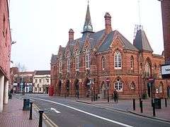
Town Council chamber and offices with clock tower Reading Local government office 1872–75 22 March 1957 SU7167473578
51°27′24″N 0°58′11″W / 51.456653°N 0.96981°W / 51.456653; -0.96981 (Town Council chamber and offices with clock tower)
1113400
Watlington House Reading House Probably earlier than 1763 22 March 1957 SU7224773167
51°27′10″N 0°57′42″W / 51.452886°N 0.961648°W / 51.452886; -0.961648 (Watlington House)
1321898
19 Castle Street Reading House Early 18th century 22 March 1957 SU7132973205
51°27′12″N 0°58′29″W / 51.453343°N 0.974849°W / 51.453343; -0.974849 (19 Castle Street)
1113414
78–84 Southampton Street Reading Terrace 1810 22 March 1957 SU7165272846
51°27′00″N 0°58′13″W / 51.450075°N 0.970274°W / 51.450075; -0.970274 (78–84 Southampton Street)
1113584
173–183 Kings Road Reading House After 1832 22 March 1957 SU7250473303
51°27′15″N 0°57′29″W / 51.454076°N 0.957922°W / 51.454076; -0.957922 (173–183 Kings Road)
1155954
73 and 75 London Street Reading House 1748 22 March 1975 SU7185373036
51°27′06″N 0°58′02″W / 51.451758°N 0.967344°W / 51.451758; -0.967344 (73 and 75 London Street)
1156168
15 Castle Street Reading Jettied house 16th century 22 March 1957 SU7134873216
51°27′12″N 0°58′28″W / 51.45344°N 0.974574°W / 51.45344; -0.974574 (15 Castle Street)
1303734
17 Castle Street Reading House 16th century 22 March 1957 SU7133873211
51°27′12″N 0°58′29″W / 51.453396°N 0.974719°W / 51.453396; -0.974719 (17 Castle Street)
1113413
Royal Berkshire Regiment Cenotaph Reading War memorial 1921 22 December 1975 SU6926773725
51°27′30″N 1°00′16″W / 51.458274°N 1.004418°W / 51.458274; -1.004418 (Royal Berkshire Regiment Cenotaph)
1321912

Slough

Name Location Type Completed [note 1]Date designated Grid ref.[note 2]
Geo-coordinates
Entry number [note 3]Image
King Johns Palace Colnbrook, Colnbrook with Poyle Jettied house c.1600 11 August 1952 TQ0281876974
51°28′57″N 0°31′15″W / 51.482385°N 0.520713°W / 51.482385; -0.520713 (King Johns Palace)
1280920
The Ostrich Public House Colnbrook, Colnbrook with Poyle Public house 16th century 23 September 1955 TQ0265277095
51°29′01″N 0°31′23″W / 51.483503°N 0.523068°W / 51.483503; -0.523068 (The Ostrich Public House)
1124367
Church of St Mary Slough Church 1876–78 29 September 1950 SU9763479581
51°30′24″N 0°35′41″W / 51.506737°N 0.594623°W / 51.506737; -0.594623 (Church of St Mary)
1321977
Church of St Peter Chalvey Church 1860–61 29 September 1950 SU9668479569
51°30′24″N 0°36′30″W / 51.506792°N 0.60831°W / 51.506792; -0.60831 (Church of St Peter)
1113376
Upton Court Slough House 17th century 29 September 1950 SU9803779058
51°30′07″N 0°35′20″W / 51.501966°N 0.588963°W / 51.501966; -0.588963 (Upton Court)
1251585
2, 4, 6, 8 St Mary's Road (Kederminster Almshouses) Langley Almshouse 1617 29 September 1950 TQ0047179491
51°30′20″N 0°33′14″W / 51.505431°N 0.553785°W / 51.505431; -0.553785 (2, 4, 6, 8 St Mary's Road (Kederminster Almshouses))
1113384
12, 14, 16, 18, 20, 22 St Mary's Road (Seymour Almshouses) Langley Almshouse 1687 29 September 1950 TQ0046679595
51°30′23″N 0°33′14″W / 51.506367°N 0.553827°W / 51.506367; -0.553827 (12, 14, 16, 18, 20, 22 St Mary's Road (Seymour Almshouses))
1113387

West Berkshire

Name Location Type Completed [note 1]Date designated Grid ref.[note 2]
Geo-coordinates
Entry number [note 3]Image
Aldermaston Court Aldermaston House 1636 14 April 1967 SU5965764807
51°22′45″N 1°08′39″W / 51.379188°N 1.144217°W / 51.379188; -1.144217 (Aldermaston Court)
1117317
North-east lodges and gates to Aldermaston Court Aldermaston House c.1636 25 October 1951 SU5913665086
51°22′54″N 1°09′06″W / 51.381751°N 1.151656°W / 51.381751; -1.151656 (North-east lodges and gates to Aldermaston Court)
1117332
Oxford Lodges to Basildon Park with gates, gatepiers and flanking walls Basildon Gate 1776–87 19 June 1984 SU6124478495
51°30′07″N 1°07′09″W / 51.502082°N 1.119054°W / 51.502082; -1.119054 (Oxford Lodges to Basildon Park with gates, gatepiers and flanking walls)
1210340
Church of St Mary the Virgin Beech Hill Parish church 1867 14 April 1967 SU6979764397
51°22′28″N 0°59′55″W / 51.374348°N 0.998625°W / 51.374348; -0.998625 (Church of St Mary the Virgin)
1117135
The Priory including adjoining wall on the north-east Beech Hill Country house 16th century 14 April 1947 SU7081764340
51°22′25″N 0°59′02″W / 51.37371°N 0.983985°W / 51.37371; -0.983985 (The Priory including adjoining wall on the north-east)
1117130
Church of St Mary Beenham Church 1794 14 April 1967 SU5908068480
51°24′44″N 1°09′07″W / 51.412271°N 1.151896°W / 51.412271; -1.151896 (Church of St Mary)
1303517
White Cottage Beenham House 17th century 10 November 1983 SU5972569492
51°25′17″N 1°08′33″W / 51.421302°N 1.142453°W / 51.421302; -1.142453 (White Cottage)
1117296
Parish Church of St Andrew Boxford Parish church 13th century 6 April 1967 SU4287171632
51°26′31″N 1°23′04″W / 51.442065°N 1.384563°W / 51.442065; -1.384563 (Parish Church of St Andrew)
1219764
Bradfield Hall, adjoining kitchen block and adjoining garden wall Rotten Row, Bradfield House c.1700 25 October 1951 SU5886371603
51°26′25″N 1°09′16″W / 51.440371°N 1.154498°W / 51.440371; -1.154498 (Bradfield Hall, adjoining kitchen block and adjoining garden wall)
1289492
Church of St Andrew Bradfield Church 16th century 14 April 1967 SU6033272580
51°26′56″N 1°08′00″W / 51.449001°N 1.133199°W / 51.449001; -1.133199 (Church of St Andrew)
1289580
Chapel approximately 10 metres to east of Manor Farmhouse Brimpton Chapel c.1100 6 April 1967 SU5582265272
51°23′02″N 1°11′57″W / 51.383758°N 1.199241°W / 51.383758; -1.199241 (Chapel approximately 10 metres to east of Manor Farmhouse)
1303413
Church of St Mary Marlston, Bucklebury Church 12th century 7 December 1971 SU5290971967
51°26′39″N 1°14′24″W / 51.44423°N 1.240099°W / 51.44423; -1.240099 (Church of St Mary)
1212896
Marlston House and surrounding terrace Marlston, Bucklebury House 1895–99 29 November 1983 SU5299071882
51°26′36″N 1°14′20″W / 51.443459°N 1.238946°W / 51.443459; -1.238946 (Marlston House and surrounding terrace)
1212898
The Old Vicarage Bucklebury House Early 18th century 25 October 1951 SU5533870868
51°26′03″N 1°12′19″W / 51.434118°N 1.205323°W / 51.434118; -1.205323 (The Old Vicarage)
1212777
Garston Lock at SU656708 Kennet and Avon Canal, Burghfield Lock Early 18th century 6 December 1990 SU6558270746
51°25′55″N 1°03′29″W / 51.43193°N 1.058°W / 51.43193; -1.058 (Garston Lock at SU656708)
1117125
The Old Rectory Burghfield Country house Late 16th century 25 October 1951 SU6659168593
51°24′45″N 1°02′38″W / 51.412456°N 1.043892°W / 51.412456; -1.043892 (The Old Rectory)
1135782
Catmore Farm House Catmore Farmhouse 14th century 21 October 1951 SU4536380168
51°31′07″N 1°20′51″W / 51.518618°N 1.347617°W / 51.518618; -1.347617 (Catmore Farm House)
1210996
Barn with corn mill and attached stable forming north-east side of former farmyard at Woolley House Woolley Park, Chaddleworth Corn mill Probably Early 19th century 5 November 1990 SU4106080134
51°31′07″N 1°24′35″W / 51.518641°N 1.409632°W / 51.518641; -1.409632 (Barn with corn mill and attached stable forming north-east side of former farmyard at Woolley House)
1290292
Woolley Park Woolley Park, Chaddleworth Country house Late 17th century 25 October 1951 SU4101480060
51°31′05″N 1°24′37″W / 51.517979°N 1.410304°W / 51.517979; -1.410304 (Woolley Park)
1290345
Chieveley House Chieveley House 18th century 6 April 1967 SU4759273984
51°27′46″N 1°18′59″W / 51.462836°N 1.316326°W / 51.462836; -1.316326 (Chieveley House)
1291142
Church of St Mary Chieveley Church 13th century 6 April 1967 SU4744474096
51°27′50″N 1°19′06″W / 51.463855°N 1.318442°W / 51.463855; -1.318442 (Church of St Mary)
1220107
Prior's Court School Chieveley House Late 18th century 6 April 1967 SU4883473677
51°27′36″N 1°17′55″W / 51.45997°N 1.298492°W / 51.45997; -1.298492 (Prior's Court School)
1291103
Garden house at Manor Farm in south-west corner of garden wall Combe Garden house c.1670 10 September 1951 SU3673860697
51°20′39″N 1°28′26″W / 51.344176°N 1.473928°W / 51.344176; -1.473928 (Garden house at Manor Farm in south-west corner of garden wall)
1290619
Wrights Farm House Combe Farmhouse 14th century 8 June 1984 SU3666761465
51°21′04″N 1°28′30″W / 51.351086°N 1.474869°W / 51.351086; -1.474869 (Wrights Farm House)
1221121
Church of St Mary and St Nicholas Compton Church 18th century 24 November 1966 SU5262579670
51°30′49″N 1°14′35″W / 51.513512°N 1.243039°W / 51.513512; -1.243039 (Church of St Mary and St Nicholas)
1135775
Church of All Saints East Garston Church 12th century 6 February 1982 SU3612277068
51°29′29″N 1°28′52″W / 51.49141°N 1.481109°W / 51.49141; -1.481109 (Church of All Saints)
1321874
Mask Cottage East Garston House 18th century 11 July 1983 SU3667276542
51°29′12″N 1°28′24″W / 51.486646°N 1.473242°W / 51.486646; -1.473242 (Mask Cottage)
1321873
Kennet House East Ilsley House Early 18th century 25 October 1951 SU4929281024
51°31′34″N 1°17′27″W / 51.525986°N 1.290877°W / 51.525986; -1.290877 (Kennet House)
1319564
Englefield House and entrance courtyard adjoining to north-east Englefield House 1590–1600 19 June 1984 SU6222871943
51°26′35″N 1°06′22″W / 51.443069°N 1.106031°W / 51.443069; -1.106031 (Englefield House and entrance courtyard adjoining to north-east)
1289194
Fawley Manor House South Fawley Manor house c.1600 25 October 1951 SU3914780105
51°31′07″N 1°26′14″W / 51.518515°N 1.437204°W / 51.518515; -1.437204 (Fawley Manor House)
1210771
Church of St Frideswide Frilsham Church 12th century 29 November 1983 SU5380473195
51°27′19″N 1°13′37″W / 51.455187°N 1.227036°W / 51.455187; -1.227036 (Church of St Frideswide)
1213105
Church of St Mary Great Shefford Church 19th century 6 February 1962 SU3801775375
51°28′34″N 1°27′14″W / 51.476065°N 1.453997°W / 51.476065; -1.453997 (Church of St Mary)
1113644
Manor Farmhouse Great Shefford Farmhouse 16th century 10 September 1951 SU3802075326
51°28′32″N 1°27′14″W / 51.475624°N 1.453959°W / 51.475624; -1.453959 (Manor Farmhouse)
1113648
Church of St Mary Greenham Church 1875–76 6 April 1967 SU4859865711
51°23′18″N 1°18′11″W / 51.388369°N 1.302979°W / 51.388369; -1.302979 (Church of St Mary)
1291027
Greenham Lodge Greenham Apartment 1969 9 September 1969 SU4898765615
51°23′15″N 1°17′51″W / 51.387472°N 1.297402°W / 51.387472; -1.297402 (Greenham Lodge)
1291019
Building 50 metres north-west of Morewood House Hampstead Marshall Orangery c.1705–18 6 April 1967 SU4159166724
51°23′53″N 1°24′13″W / 51.398032°N 1.403553°W / 51.398032; -1.403553 (Building 50 metres north-west of Morewood House)
1136066
Church of St Mary Hampstead Marshall Church 14th century 6 May 1967 SU4200066746
51°23′54″N 1°23′52″W / 51.3982°N 1.397671°W / 51.3982; -1.397671 (Church of St Mary)
1117223
Pair of gate piers and approximately 2 metres of wall to east and west of piers on edge of Park Lane 162 metres west of entrance to churchyard Hampstead Marshall Gate pier Early 18th century 6 March 1985 SU4180966703
51°23′52″N 1°24′02″W / 51.397827°N 1.400422°W / 51.397827; -1.400422 (Pair of gate piers and approximately 2 metres of wall to east and west of piers on edge of Park Lane 162 metres west of entrance to churchyard)
1117222
Lowsley Tomb, approximately 3 metres south of south wall of Church of St Mary Hampstead Norreys Tomb Late 19th century 5 June 1986 SU5293676246
51°28′58″N 1°14′21″W / 51.482699°N 1.239071°W / 51.482699; -1.239071 (Lowsley Tomb, approximately 3 metres south of south wall of Church of St Mary)
1117158
Holybrook Cottage Holybrook House 17th century 19 June 1984 SU6703271406
51°26′16″N 1°02′13″W / 51.437694°N 1.037021°W / 51.437694; -1.037021 (Holybrook Cottage)
1215618
Chilton Lodge Leverton, Hungerford Country house 1890 10 September 1951 SU3296570553
51°25′59″N 1°31′38″W / 51.433025°N 1.527184°W / 51.433025; -1.527184 (Chilton Lodge)
1211296
Church of St Lawrence Hungerford Church 1816 6 February 1962 SU3341868713
51°24′59″N 1°31′15″W / 51.416454°N 1.520841°W / 51.416454; -1.520841 (Church of St Lawrence)
1289541
24 High Street Hungerford House 1951 10 September 1951 SU3376168517
51°24′53″N 1°30′57″W / 51.414672°N 1.515928°W / 51.414672; -1.515928 (24 High Street)
1210596
Church of St Michael Lower Green, Inkpen Church 13th century 6 February 1952 SU3577063776
51°22′19″N 1°29′15″W / 51.371921°N 1.487517°W / 51.371921; -1.487517 (Church of St Michael)
1290597
Inkpen House Lower Green, Inkpen House 1984 10 September 1951 SU3580463731
51°22′17″N 1°29′13″W / 51.371515°N 1.487033°W / 51.371515; -1.487033 (Inkpen House)
1290598
Kirby House Inkpen Country house 18th century 10 September 1951 SU3753163209
51°22′00″N 1°27′44″W / 51.36671°N 1.462279°W / 51.36671; -1.462279 (Kirby House)
1221220
Church of St Mary Kintbury Church 12th century 6 February 1962 SU3832767005
51°24′03″N 1°27′02″W / 51.400788°N 1.450437°W / 51.400788; -1.450437 (Church of St Mary)
1117242
Bockhampton Lambourn House 17th century 10 September 1951 SU3354478030
51°30′01″N 1°31′05″W / 51.500218°N 1.518148°W / 51.500218; -1.518148 (Bockhampton)
1113654
College House Lambourn House 18th century 10 September 1951 SU3259578809
51°30′26″N 1°31′54″W / 51.507278°N 1.531748°W / 51.507278; -1.531748 (College House)
1136235
Ivy House Lambourn House Late 18th century 10 September 1951 SU3275178831
51°30′27″N 1°31′46″W / 51.507466°N 1.529498°W / 51.507466; -1.529498 (Ivy House)
1136363
Manor Farmhouse Eastbury, Lambourn Farmhouse 16th century 10 September 1951 SU3452177312
51°29′37″N 1°30′15″W / 51.493704°N 1.504144°W / 51.493704; -1.504144 (Manor Farmhouse)
1113661
Market Cross Lambourn Market cross Medieval 10 September 1951 SU3265578936
51°30′30″N 1°31′51″W / 51.508416°N 1.530872°W / 51.508416; -1.530872 (Market Cross)
1312843
Parsonage House Lambourn House 16th century 10 September 1951 SU3252778936
51°30′30″N 1°31′58″W / 51.508423°N 1.532716°W / 51.508423; -1.532716 (Parsonage House)
1113704
Pigeon House Eastbury, Lambourn Farmhouse 1620 10 September 1951 SU3491377076
51°29′30″N 1°29′55″W / 51.491558°N 1.498521°W / 51.491558; -1.498521 (Pigeon House)
1136193
The Pigeonhouse Eastbury, Lambourn Dovecote Early 17th century 10 September 1951 SU3488777128
51°29′31″N 1°29′56″W / 51.492027°N 1.498891°W / 51.492027; -1.498891 (The Pigeonhouse)
1113675
The Village Cross Eastbury, Lambourn Cross 15th century 10 September 1951 SU3465277225
51°29′34″N 1°30′08″W / 51.492914°N 1.502266°W / 51.492914; -1.502266 (The Village Cross)
1113669
21 Newbury Street Lambourn House 18th century 10 September 1951 SU3276578817
51°30′26″N 1°31′45″W / 51.50734°N 1.529298°W / 51.50734; -1.529298 (21 Newbury Street)
1113701
Church of St James Leckhampstead Church c.1858–60 6 April 1967 SU4393675958
51°28′51″N 1°22′07″W / 51.480879°N 1.368704°W / 51.480879; -1.368704 (Church of St James)
1313057
Bridge over River Kennet Newbury Bridge 1726 29 September 1950 SU4710567167
51°24′06″N 1°19′27″W / 51.401585°N 1.324241°W / 51.401585; -1.324241 (Bridge over River Kennet)
1290920
Corn Stores Newbury Shop 1970 29 September 1950 SU4728867144
51°24′05″N 1°19′18″W / 51.401363°N 1.321613°W / 51.401363; -1.321613 (Corn Stores)
1211914
Falkland Garth Newbury Farmhouse 17th century 29 September 1950 SU4580765024
51°22′57″N 1°20′35″W / 51.382423°N 1.343174°W / 51.382423; -1.343174 (Falkland Garth)
1290696
Litten Chapel (part of the Newbury Commercial School) Newbury School 1983 29 September 1950 SU4693866605
51°23′48″N 1°19′36″W / 51.396546°N 1.326715°W / 51.396546; -1.326715 (Litten Chapel (part of the Newbury Commercial School))
1210610
Methodist Chapel Newbury Methodist chapel 1837–38 30 September 1977 SU4702667501
51°24′17″N 1°19′31″W / 51.404595°N 1.325332°W / 51.404595; -1.325332 (Methodist Chapel)
1211202
North gateway to churchyard of St Nicholas' Church adjoining Bartholomew Street Newbury Gate c.1770 10 June 1969 SU4710367115
51°24′04″N 1°19′27″W / 51.401118°N 1.324276°W / 51.401118; -1.324276 (North gateway to churchyard of St Nicholas' Church adjoining Bartholomew Street)
1291318
South gateway to churchyard of St Nicholas' Church adjoining Bartholomew Street Newbury Gate c.1770 10 June 1969 SU4709767092
51°24′03″N 1°19′28″W / 51.400911°N 1.324365°W / 51.400911; -1.324365 (South gateway to churchyard of St Nicholas' Church adjoining Bartholomew Street)
1291423
St Bartholomew's Hospital Newbury Almshouse c.1618 10 June 1969 SU4692966576
51°23′47″N 1°19′37″W / 51.396286°N 1.326848°W / 51.396286; -1.326848 (St Bartholomew's Hospital)
1219550
St Mary's Vicarage Newbury Vicarage c.1830 2 September 1983 SU4722167688
51°24′23″N 1°19′21″W / 51.40626°N 1.322504°W / 51.40626; -1.322504 (St Mary's Vicarage)
1221172
St Nicolas House West Mills, Newbury Town house early-mid 18th century 29 September 1950 SU4697967067
51°24′03″N 1°19′34″W / 51.400696°N 1.326065°W / 51.400696; -1.326065 (St Nicolas House)
1289887
The Chestnuts Newbury House Early–mid-18th century 29 September 1950 SU4687767683
51°24′22″N 1°19′39″W / 51.406243°N 1.32745°W / 51.406243; -1.32745 (The Chestnuts)
1219909
Wessex Home Newbury Villa Early–mid-19th century 10 June 1969 SU4686267767
51°24′25″N 1°19′40″W / 51.407°N 1.327654°W / 51.407; -1.327654 (Wessex Home)
1211380
42 Northbrook Street Newbury House c.1724 29 September 1950 SU4709467496
51°24′16″N 1°19′28″W / 51.404544°N 1.324355°W / 51.404544; -1.324355 (42 Northbrook Street)
1211030
91 and 92 Northbrook Street Newbury House c.1740 2 September 1983 SU4707867262
51°24′09″N 1°19′29″W / 51.402441°N 1.324616°W / 51.402441; -1.324616 (91 and 92 Northbrook Street)
1211267
24 Northbrook Street Newbury House Early 16th century 29 September 1950 SU4711067355
51°24′12″N 1°19′27″W / 51.403275°N 1.324144°W / 51.403275; -1.324144 (24 Northbrook Street)
1290211
63 Cheap Street Newbury Town house c.1796 29 September 1950 SU4731266842
51°23′55″N 1°19′17″W / 51.398646°N 1.321308°W / 51.398646; -1.321308 (63 Cheap Street)
1290759
28 Bartholomew Street Newbury Town house Mid-18th century 2 September 1983 SU4700766929
51°23′58″N 1°19′32″W / 51.399453°N 1.325681°W / 51.399453; -1.325681 (28 Bartholomew Street)
1219756
6–12 Northbrook Street Newbury House c.1669 29 September 1950 SU4711367253
51°24′08″N 1°19′27″W / 51.402358°N 1.324114°W / 51.402358; -1.324114 (6–12 Northbrook Street)
1290298
5 Wharf Street Newbury Town house Early–mid-18th century 29 September 1950 SU4720967142
51°24′05″N 1°19′22″W / 51.401352°N 1.322749°W / 51.401352; -1.322749 (5 Wharf Street)
1211738
Padworth House Padworth House 17th century 25 October 1951 SU6132166252
51°23′31″N 1°07′12″W / 51.392003°N 1.120062°W / 51.392003; -1.120062 (Padworth House)
1117314
Church of St James the Less Pangbourne Church 1718 14 April 1967 SU6342076420
51°28′59″N 1°05′17″W / 51.483187°N 1.088081°W / 51.483187; -1.088081 (Church of St James the Less)
1213980
Devitt House, Pangbourne College Pangbourne House 1897–98 19 June 1984 SU6191575545
51°28′32″N 1°06′36″W / 51.475487°N 1.109904°W / 51.475487; -1.109904 (Devitt House, Pangbourne College)
1213514
Hill House/Little Court/Pangbourne English Centre Pangbourne House 1971 7 December 1971 SU6310876764
51°29′11″N 1°05′33″W / 51.486315°N 1.092512°W / 51.486315; -1.092512 (Hill House/Little Court/Pangbourne English Centre)
1214033
The Junior School, Pangbourne College Pangbourne House 1901 19 June 1984 SU6155776054
51°28′48″N 1°06′54″W / 51.480102°N 1.11497°W / 51.480102; -1.11497 (The Junior School, Pangbourne College)
1288792
Church of St Mary Purley on Thames Church 1626 14 April 1967 SU6674276059
51°28′46″N 1°02′25″W / 51.47956°N 1.040316°W / 51.47956; -1.040316 (Church of St Mary)
1288375
Purley Hall including stable yard adjoining to east Purley on Thames House 1609 25 October 1951 SU6461775776
51°28′38″N 1°04′15″W / 51.477262°N 1.070963°W / 51.477262; -1.070963 (Purley Hall including stable yard adjoining to east)
1214696
Purley Park Purley on Thames House Designed 1795 25 October 1951 SU6652575857
51°28′40″N 1°02′37″W / 51.47777°N 1.043478°W / 51.47777; -1.043478 (Purley Park)
1288453
Donnington Grove Donnington, Shaw-cum-Donnington House c.1782 6 June 1952 SU4585268959
51°25′04″N 1°20′31″W / 51.417799°N 1.34202°W / 51.417799; -1.34202 (Donnington Grove)
1220450
Donnington Hospital Shaw-cum-Donnington Courtyard 1602 6 June 1952 SU4656468593
51°24′52″N 1°19′55″W / 51.414451°N 1.33183°W / 51.414451; -1.33183 (Donnington Hospital)
1290987
Benham Park Speen Country house 1772–75 6 June 1952 SU4401167742
51°24′25″N 1°22′07″W / 51.407003°N 1.368644°W / 51.407003; -1.368644 (Benham Park)
1220740
Dumbledore Jennetts Hill, Stanford Dingley House 17th century 29 November 1983 SU5787971119
51°26′10″N 1°10′07″W / 51.436121°N 1.168733°W / 51.436121; -1.168733 (Dumbledore)
1213110
The Old Rectory Stanford Dingley House c.1720 29 November 1983 SU5748771340
51°26′17″N 1°10′28″W / 51.438148°N 1.174336°W / 51.438148; -1.174336 (The Old Rectory)
1213108
Mortimer Station Stratfield Mortimer Railway station 1848 4 September 1975 SU6721864112
51°22′20″N 1°02′09″W / 51.372097°N 1.035725°W / 51.372097; -1.035725 (Mortimer Station)
1117145
Waiting room at Mortimer Station on south-west side of railway line Stratfield Mortimer Railway station 1848 28 January 1987 SU6722964103
51°22′19″N 1°02′08″W / 51.372014°N 1.035569°W / 51.372014; -1.035569 (Waiting room at Mortimer Station on south-west side of railway line)
1135802
Streatley Farmhouse Streatley Farmhouse 1675 29 November 1983 SU5932882000
51°32′02″N 1°08′46″W / 51.533797°N 1.146065°W / 51.533797; -1.146065 (Streatley Farmhouse)
1213575
Streatley House Streatley House Late 18th century 29 November 1983 SU5936380763
51°31′22″N 1°08′45″W / 51.522672°N 1.145769°W / 51.522672; -1.145769 (Streatley House)
1213395
Sulham Farmhouse Sulham Farmhouse c.1580 19 June 1984 SU6444474238
51°27′48″N 1°04′25″W / 51.463455°N 1.073733°W / 51.463455; -1.073733 (Sulham Farmhouse)
1288378
Church of St Mary Thatcham Church 12th century 6 April 1967 SU5164867229
51°24′06″N 1°15′32″W / 51.401748°N 1.25893°W / 51.401748; -1.25893 (Church of St Mary)
1155799
Calcot Court Calcot Park, Tilehurst Flats 1984 25 October 1951 SU6720472275
51°26′44″N 1°02′04″W / 51.445486°N 1.034382°W / 51.445486; -1.034382 (Calcot Court)
1215858
Church of St Gregory Welford Church Late 19th century 6 March 1985 SU4088373156
51°27′21″N 1°24′47″W / 51.455914°N 1.412989°W / 51.455914; -1.412989 (Church of St Gregory)
1117225
Church of St Swithin Wickham, Welford Church Saxon/Anglo Saxon 6 April 1967 SU3947271520
51°26′29″N 1°26′01″W / 51.441305°N 1.433477°W / 51.441305; -1.433477 (Church of St Swithin)
1319533
Entrance gates, piers and railings to West Woodhay House West Woodhay Gate 18th century 29 October 1984 SU3860963306
51°22′03″N 1°26′48″W / 51.36751°N 1.446785°W / 51.36751; -1.446785 (Entrance gates, piers and railings to West Woodhay House)
1210179
Church of St James Winterbourne Church 12th century 6 April 1967 SU4506971939
51°26′41″N 1°21′10″W / 51.444655°N 1.352901°W / 51.444655; -1.352901 (Church of St James)
1221003
Hop Castle (approximately 300 metres to north-west of Penclose Farmhouse) Winterbourne House 1983 24 August 1978 SU4465473766
51°27′40″N 1°21′31″W / 51.461114°N 1.358642°W / 51.461114; -1.358642 (Hop Castle (approximately 300 metres to north-west of Penclose Farmhouse))
1221027
Wokefield Park Wokefield House Early 18th century 14 April 1967 SU6733165687
51°23′10″N 1°02′02″W / 51.386243°N 1.033804°W / 51.386243; -1.033804 (Wokefield Park)
1135957
Douai Abbey Church Upper Woolhampton Abbey 1928–33 10 November 1983 SU5770468214
51°24′36″N 1°10′18″W / 51.410021°N 1.171722°W / 51.410021; -1.171722 (Douai Abbey Church)
1156252
Elstree School, Woolhampton House Upper Woolhampton House 17th century 9 September 1969 SU5768367525
51°24′14″N 1°10′20″W / 51.403829°N 1.172136°W / 51.403829; -1.172136 (Elstree School, Woolhampton House)
1117267
The Rectory Upper Woolhampton House Early 18th century 10 November 1983 SU5748368048
51°24′31″N 1°10′30″W / 51.408551°N 1.174926°W / 51.408551; -1.174926 (The Rectory)
1319552

Windsor and Maidenhead

Name Location Type Completed [note 1]Date designated Grid ref.[note 2]
Geo-coordinates
Entry number [note 3]Image
Church of All Saints Bisham Parish church 12th century 25 March 1955 SU8480985407
51°33′40″N 0°46′41″W / 51.561176°N 0.777963°W / 51.561176; -0.777963 (Church of All Saints)
1303618
Tithe Barn Bisham Abbey, Bisham Aisled barn Late 15th century 25 March 1955 SU8464984849
51°33′22″N 0°46′49″W / 51.556184°N 0.780405°W / 51.556184; -0.780405 (Tithe Barn)
1117563
Barn at Stroud Farm, approximately 35 metres east of Stroud Farmhouse Bray Threshing barn 15th century 2 May 1989 SU9025677600
51°29′25″N 0°42′05″W / 51.490154°N 0.701405°W / 51.490154; -0.701405 (Barn at Stroud Farm, approximately 35 metres east of Stroud Farmhouse)
1136397
Braywick House Braywick, Bray Country house 17th century 25 March 1955 SU8938479289
51°30′20″N 0°42′49″W / 51.505475°N 0.713534°W / 51.505475; -0.713534 (Braywick House)
1319441
Church of St Michael Bray Parish church c.1300 25 March 1955 SU9016979704
51°30′33″N 0°42′08″W / 51.509081°N 0.702121°W / 51.509081; -0.702121 (Church of St Michael)
1312994
Lych Gate Bray Lych gate Early 15th century 25 March 1955 SU9017679644
51°30′31″N 0°42′07″W / 51.508541°N 0.702035°W / 51.508541; -0.702035 (Lych Gate)
1117492
Oakley Court Hotel Water Oakley, Bray Country house 1859 21 December 1977 SU9226577626
51°29′24″N 0°40′21″W / 51.490064°N 0.67247°W / 51.490064; -0.67247 (Oakley Court Hotel)
1117481
Stroud Farmhouse Bray Farmhouse Late 14th century 2 May 1989 SU9020677581
51°29′24″N 0°42′08″W / 51.489991°N 0.70213°W / 51.489991; -0.70213 (Stroud Farmhouse)
1117476
The Old Farmhouse Oakley Green, Bray Farmhouse 16th century 11 April 1972 SU9315676534
51°28′48″N 0°39′36″W / 51.480102°N 0.659928°W / 51.480102; -0.659928 (The Old Farmhouse)
1117496
Yew Tree Cottage Fifield, Bray House Late 16th century 11 April 1972 SU9037776757
51°28′57″N 0°42′00″W / 51.482557°N 0.699878°W / 51.482557; -0.699878 (Yew Tree Cottage)
1312986
Church Gate House Cookham House Late 14th century 25 March 1955 SU8971285443
51°33′39″N 0°42′26″W / 51.560742°N 0.707244°W / 51.560742; -0.707244 (Church Gate House)
1303445
Church of Holy Trinity Cookham Parish church 12th century 25 March 1955 SU8970585513
51°33′41″N 0°42′26″W / 51.561373°N 0.707327°W / 51.561373; -0.707327 (Church of Holy Trinity)
1117568
Noah's House Boathouse Cookham Boat house 1930 15 April 1998 SU8775586895
51°34′27″N 0°44′06″W / 51.574102°N 0.735105°W / 51.574102; -0.735105 (Noah's House Boathouse)
1323741
Tarrystone House, including iron gates and gate piers and adjoining wall Cookham House Early 18th century 25 March 1955 SU8975285369
51°33′36″N 0°42′24″W / 51.560071°N 0.706686°W / 51.560071; -0.706686 (Tarrystone House, including iron gates and gate piers and adjoining wall)
1319371
Bell Farm Farmhouse Eton Wick, Eton Farmhouse c.1375 11 April 1950 SU9487778758
51°29′59″N 0°38′04″W / 51.499808°N 0.634556°W / 51.499808; -0.634556 (Bell Farm Farmhouse)
1210944
Lower Chapel, Eton College Eton School 1889–91 11 April 1950 SU9650077783
51°29′27″N 0°36′41″W / 51.490769°N 0.611448°W / 51.490769; -0.611448 (Lower Chapel, Eton College)
1290001
St Christopher's Eton House 18th century 11 April 1950 SU9663577800
51°29′27″N 0°36′34″W / 51.490899°N 0.6095°W / 51.490899; -0.6095 (St Christopher's)
1210908
Statue of Henry VI, Eton College Eton Statue 1718 14 May 1973 SU9669977910
51°29′31″N 0°36′31″W / 51.491877°N 0.608548°W / 51.491877; -0.608548 (Statue of Henry VI, Eton College)
1210902
The Cock Pitt Cafe Eton House 15th century 4 November 1950 SU9669077411
51°29′15″N 0°36′32″W / 51.487393°N 0.608814°W / 51.487393; -0.608814 (The Cock Pitt Cafe)
1290036
42 High Street Eton House 18th century 4 November 1950 SU9668577462
51°29′16″N 0°36′32″W / 51.487852°N 0.608872°W / 51.487852; -0.608872 (42 High Street)
1211362
Barn at Hurley Farm Hurley Barn Reroofed in 16th century 25 March 1955 SU8256783984
51°32′55″N 0°48′38″W / 51.548717°N 0.810632°W / 51.548717; -0.810632 (Barn at Hurley Farm)
1319423
Church of St Mary Hurley Church 15th century 25 March 1955 SU8258884073
51°32′58″N 0°48′37″W / 51.549514°N 0.810308°W / 51.549514; -0.810308 (Church of St Mary)
1117524
The Cloisters Hurley House 20th century 23 March 1955 SU8259884083
51°32′59″N 0°48′37″W / 51.549602°N 0.810162°W / 51.549602; -0.810162 (The Cloisters)
1117523
The Gate House and Archway Hurley House 20th century 11 April 1972 SU8256284088
51°32′59″N 0°48′38″W / 51.549652°N 0.810679°W / 51.549652; -0.810679 (The Gate House and Archway)
1117561
The Refectory Hurley House 16th century 25 March 1955 SU8259084102
51°32′59″N 0°48′37″W / 51.549774°N 0.810272°W / 51.549774; -0.810272 (The Refectory)
1156408
The Olde Bell Hurley Cross wing house Late 15th century 25 March 1955 SU8261883708
51°32′46″N 0°48′36″W / 51.546228°N 0.809961°W / 51.546228; -0.809961 (The Olde Bell)
1156153
Beaumont College Old Windsor Country house 1705 10 August 1951 SU9900273251
51°26′59″N 0°34′36″W / 51.4496°N 0.57669°W / 51.4496; -0.57669 (Beaumont College)
1119795
Church of St Peter and St Andrew Old Windsor Parish church Early 13th century 10 August 1951 SU9925574644
51°27′43″N 0°34′22″W / 51.462077°N 0.57266°W / 51.462077; -0.57266 (Church of St Peter and St Andrew)
1119805
The Priory Old Windsor House Mid-18th century 3 March 1972 SU9921374505
51°27′39″N 0°34′24″W / 51.460835°N 0.573304°W / 51.460835; -0.573304 (The Priory)
1119806
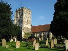
War memorial at Beaumont College approximately 45 metres from north west corner of main building Old Windsor War memorial c.1920 26 June 1998 SU9890973252
51°26′59″N 0°34′41″W / 51.449625°N 0.578028°W / 51.449625; -0.578028 (War memorial at Beaumont College approximately 45 metres from north west corner of main building)
1119797
Shottesbrooke Park Shottesbrooke Country house Late 16th century 11 April 1972 SU8407977212
51°29′15″N 0°47′26″W / 51.487617°N 0.790445°W / 51.487617; -0.790445 (Shottesbrooke Park)
1117448
Church of All Souls South Ascot, Sunninghill and Ascot Church 1896–97 3 March 1972 SU9228268001
51°24′13″N 0°40′29″W / 51.403541°N 0.674732°W / 51.403541; -0.674732 (Church of All Souls)
1119809
Bell Inn Waltham St Lawrence Inn c.1400 25 March 1955 SU8296876910
51°29′06″N 0°48′23″W / 51.485066°N 0.806513°W / 51.485066; -0.806513 (Bell Inn)
1135882
Church of St Lawrence Waltham St Lawrence Church 11th century 25 March 1955 SU8295076971
51°29′08″N 0°48′24″W / 51.485617°N 0.806758°W / 51.485617; -0.806758 (Church of St Lawrence)
1117515
Goosenest Farmhouse West End, Waltham St Lawrence Aisled house Early 14th century 1 March 1988 SU8242775109
51°28′08″N 0°48′53″W / 51.468955°N 0.814722°W / 51.468955; -0.814722 (Goosenest Farmhouse)
1117503
Kellinghams Waltham St Lawrence House 16th century 25 March 1955 SU8309276534
51°28′54″N 0°48′17″W / 51.481668°N 0.804816°W / 51.481668; -0.804816 (Kellinghams)
1135894
Church of St Mary White Waltham Parish church 12th century 11 April 1972 SU8547977517
51°29′25″N 0°46′13″W / 51.490149°N 0.770212°W / 51.490149; -0.770212 (Church of St Mary)
1117451
Church of St Andrew Wraysbury Parish church 13th century 23 September 1955 TQ0012573942
51°27′20″N 0°33′37″W / 51.455614°N 0.56034°W / 51.455614; -0.56034 (Church of St Andrew)
1117606
King John's Hunting Lodge Wraysbury Timber-framed house Late 15th/early 16th century 23 September 1955 SU9963874530
51°27′40″N 0°34′02″W / 51.460985°N 0.567181°W / 51.460985; -0.567181 (King John's Hunting Lodge)
1135976
1881 Chapel at Convent of St John the Baptist Clewer Anglican church 1881 2 October 1975 SU9519176180
51°28′36″N 0°37′51″W / 51.476582°N 0.630728°W / 51.476582; -0.630728 (1881 Chapel at Convent of St John the Baptist)
1380282
Adelaide Cottage Home Park, Windsor Lodge Re-erected 1831 2 October 1975 SU9798876512
51°28′45″N 0°35′25″W / 51.479089°N 0.590375°W / 51.479089; -0.590375 (Adelaide Cottage)
1319270
All Saints Cottage Boyn Hill, Maidenhead House 1854–57 24 July 1970 SU8776580831
51°31′11″N 0°44′11″W / 51.51959°N 0.736471°W / 51.51959; -0.736471 (All Saints Cottage)
1117615
Ann Foorde's House Windsor House 18th century 4 January 1950 SU9699876643
51°28′50″N 0°36′17″W / 51.480437°N 0.60459°W / 51.480437; -0.60459 (Ann Foorde's House)
1205343
Church of St John the Baptist Windsor Church 1820–22 4 January 1950 SU9688076793
51°28′54″N 0°36′22″W / 51.481805°N 0.606248°W / 51.481805; -0.606248 (Church of St John the Baptist)
1117708
Church Rooms Windsor Jettied house 16th century 4 January 1950 SU9687076839
51°28′56″N 0°36′23″W / 51.482221°N 0.606379°W / 51.482221; -0.606379 (Church Rooms)
1281315
Cranbourne Tower Cranbourne Tower Late 18th-century alterations 2 October 1975 SU9432073120
51°26′57″N 0°38′39″W / 51.449221°N 0.644081°W / 51.449221; -0.644081 (Cranbourne Tower)
1319295
Dial House Windsor House Late 18th century 4 January 1950 SU9699176647
51°28′50″N 0°36′17″W / 51.480474°N 0.60469°W / 51.480474; -0.60469 (Dial House)
1117728
Edgeworth House Youth Hostel Association Clewer House 1707 2 October 1975 SU9550877100
51°29′05″N 0°37′33″W / 51.484798°N 0.625917°W / 51.484798; -0.625917 (Edgeworth House Youth Hostel Association)
1117723
Gothic Ruin of Temple by Lake in Frogmore Gardens Home Park, Windsor Garden house c.1792 2 October 1975 SU9758676074
51°28′31″N 0°35′47″W / 51.475221°N 0.596283°W / 51.475221; -0.596283 (Gothic Ruin of Temple by Lake in Frogmore Gardens)
1319305
Number 4 with entrance to Black Lion Yard Windsor House Late 18th century 4 January 1950 SU9700676638
51°28′49″N 0°36′16″W / 51.480391°N 0.604477°W / 51.480391; -0.604477 (Number 4 with entrance to Black Lion Yard)
1319319
Old Bank House (brewery office) Windsor Brewery Late 18th/early 19th century 4 January 1950 SU9682277117
51°29′05″N 0°36′25″W / 51.484728°N 0.606994°W / 51.484728; -0.606994 (Old Bank House (brewery office))
1117676
Oldfield Lodge Maidenhead House Late 18th century 27 February 1950 SU8994681291
51°31′24″N 0°42′18″W / 51.523382°N 0.704929°W / 51.523382; -0.704929 (Oldfield Lodge)
1117620
Parish Centre Boyn Hill, Maidenhead Parish hall 1983 24 July 1970 SU8774880829
51°31′10″N 0°44′12″W / 51.519575°N 0.736717°W / 51.519575; -0.736717 (Parish Centre)
1312975
Prince Albert's Dairy and Cottage Home Park, Windsor House Circa 1830–40 2 October 1975 SU9790275995
51°28′28″N 0°35′30″W / 51.474457°N 0.591756°W / 51.474457; -0.591756 (Prince Albert's Dairy and Cottage)
1272281
Railway bridge carrying the Windsor–Slough line over the Thames Windsor Railway bridge 1849 2 October 1975 SU9605377289
51°29′11″N 0°37′05″W / 51.486405°N 0.618019°W / 51.486405; -0.618019 (Railway bridge carrying the Windsor–Slough line over the Thames)
1319297
Smythes Almshouses Maidenhead Almshouses 1659 27 February 1950 SU8948381336
51°31′26″N 0°42′42″W / 51.52386°N 0.711589°W / 51.52386; -0.711589 (Smythes Almshouses)
1136053
St George's School Windsor School 1803 4 January 1975 SU9690677209
51°29′08″N 0°36′21″W / 51.48554°N 0.60576°W / 51.48554; -0.60576 (St George's School)
1319325
St Leonards Dale Windsor House 1700–20 4 January 1950 SU9455675139
51°28′02″N 0°38′25″W / 51.46733°N 0.640147°W / 51.46733; -0.640147 (St Leonards Dale)
1319329
The Gate House Windsor House 18th century 4 January 1950 SU9701876631
51°28′49″N 0°36′16″W / 51.480326°N 0.604306°W / 51.480326; -0.604306 (The Gate House)
1280766
The Limes Clewer House 17th century 2 October 1975 SU9551277142
51°29′07″N 0°37′33″W / 51.485175°N 0.625848°W / 51.485175; -0.625848 (The Limes)
1117722
The Old House Hotel Windsor House Dated 1676 4 January 1950 SU9674077189
51°29′07″N 0°36′29″W / 51.485389°N 0.608155°W / 51.485389; -0.608155 (The Old House Hotel)
1319337
The Vicarage Boyn Hill, Maidenhead House 1854–57 24 July 1970 SU8777580859
51°31′11″N 0°44′11″W / 51.51984°N 0.73632°W / 51.51984; -0.73632 (The Vicarage)
1117617
Vicarage Cottage Boyn Hill, Maidenhead House 1857–57 12 August 1983 SU8777480846
51°31′11″N 0°44′11″W / 51.519724°N 0.736338°W / 51.519724; -0.736338 (Vicarage Cottage)
1136003
9–11 Park Street Windsor House Early 19th century 4 January 1950 SU9695576663
51°28′50″N 0°36′19″W / 51.480624°N 0.605204°W / 51.480624; -0.605204 (9–11 Park Street)
1117729
20 Park Street Windsor House Late 18th century 2 October 1975 SU9696076699
51°28′51″N 0°36′18″W / 51.480947°N 0.605122°W / 51.480947; -0.605122 (20 Park Street)
1117730
4 and 6 Church Street Windsor House 1640 4 January 1950 SU9686376852
51°28′56″N 0°36′23″W / 51.482339°N 0.606476°W / 51.482339; -0.606476 (4 and 6 Church Street)
1221042
12–16 Park Street Windsor Terrace Early 19th century 4 January 1950 SU9693276676
51°28′51″N 0°36′20″W / 51.480745°N 0.605531°W / 51.480745; -0.605531 (12–16 Park Street)
1280741

Wokingham

Name Location Type Completed [note 1]Date designated Grid ref.[note 2]
Geo-coordinates
Entry number [note 3]Image
Bartlett's Farmhouse Arborfield and Newland Farmhouse Late 16th century 26 January 1967 SU7528466177
51°23′23″N 0°55′10″W / 51.389651°N 0.919432°W / 51.389651; -0.919432 (Bartlett's Farmhouse)
1319119
Bearwood College (Royal Merchant Navy School) and terraces to south Arborfield and Newland Country house 1865–74 14 October 1986 SU7770569052
51°24′55″N 0°53′02″W / 51.415171°N 0.884016°W / 51.415171; -0.884016 (Bearwood College (Royal Merchant Navy School) and terraces to south)
1135967
Foxhill House Whiteknights Park, Earley House 1868 19 September 1983 SU7362872333
51°26′43″N 0°56′31″W / 51.44521°N 0.94195°W / 51.44521; -0.94195 (Foxhill House)
1136050
Banisters Finchampstead Farmhouse 16th century 26 January 1967 SU7763463087
51°21′42″N 0°53′11″W / 51.361555°N 0.886339°W / 51.361555; -0.886339 (Banisters)
1319143
Culham Court Culham, Remenham Country house 1771 1 August 1952 SU7892983800
51°32′51″N 0°51′47″W / 51.547582°N 0.863128°W / 51.547582; -0.863128 (Culham Court)
1118167
Hartley Court Great Lea Common, Shinfield Country house Early 16th century 26 January 1967 SU7055368935
51°24′54″N 0°59′13″W / 51.415053°N 0.986865°W / 51.415053; -0.986865 (Hartley Court)
1319124
Church of St Andrew Sonning Church Originally Norman 26 January 1967 SU7558875571
51°28′27″N 0°54′47″W / 51.474062°N 0.913062°W / 51.474062; -0.913062 (Church of St Andrew)
1135979
The Bull Hotel Sonning Inn Late 16th century 26 January 1967 SU7567375521
51°28′25″N 0°54′43″W / 51.473601°N 0.911849°W / 51.473601; -0.911849 (The Bull Hotel)
1117462
Haineshill St. Nicholas, Hurst Country house Late 16th century 1 August 1952 SU8123674080
51°27′36″N 0°49′56″W / 51.459877°N 0.832101°W / 51.459877; -0.832101 (Haineshill)
1117416
Hinton House St. Nicholas, Hurst House Late 16th century 1 August 1952 SU8037974773
51°27′58″N 0°50′39″W / 51.466229°N 0.844276°W / 51.466229; -0.844276 (Hinton House)
1117407
Hurst Lodge St. Nicholas, Hurst Country house Early 17th century 1 August 1952 SU8007373718
51°27′24″N 0°50′56″W / 51.456788°N 0.848919°W / 51.456788; -0.848919 (Hurst Lodge)
1117439
Barn approximately 80 metres north of Sheepbridge Court Sheep Bridge, Swallowfield Aisled barn Late 16th century 14 February 1986 SU7209265497
51°23′02″N 0°57′56″W / 51.383951°N 0.965436°W / 51.383951; -0.965436 (Barn approximately 80 metres north of Sheepbridge Court)
1135822
Hall's Farm Kennels Swallowfield Farmhouse Late 16th century 26 January 1967 SU7597464470
51°22′27″N 0°54′36″W / 51.374213°N 0.909882°W / 51.374213; -0.909882 (Hall's Farm Kennels)
1319167
Sheepbridge Court Sheep Bridge, Swallowfield Farmhouse Late 16th century 1 August 1952 SU7202965515
51°23′03″N 0°57′59″W / 51.384121°N 0.966337°W / 51.384121; -0.966337 (Sheepbridge Court)
1313105
Swallowfield Park and adjoining stable block Swallowfield Country house Late 16th and 17th century 1 August 1952 SU7311965516
51°23′02″N 0°57′02″W / 51.383991°N 0.950677°W / 51.383991; -0.950677 (Swallowfield Park and adjoining stable block)
1313056
The Harrison Almshouses Twyford Almshouse 1640 1 August 1952 SU7887476029
51°28′40″N 0°51′56″W / 51.477731°N 0.865657°W / 51.477731; -0.865657 (The Harrison Almshouses)
1118152
Bear Place Kiln Green, Wargrave Country house Late 18th century 26 January 1967 SU8104479114
51°30′19″N 0°50′01″W / 51.505158°N 0.83371°W / 51.505158; -0.83371 (Bear Place)
1118177
Church of St Mary Wargrave Church 1635 26 January 1967 SU7827678469
51°29′59″N 0°52′25″W / 51.499749°N 0.873726°W / 51.499749; -0.873726 (Church of St Mary)
1155023
Hannen Columbarium, 22 metres south-east of Church of St Mary Wargrave Mausoleum 1906–07 23 December 1983 SU7830078438
51°29′58″N 0°52′24″W / 51.499467°N 0.873387°W / 51.499467; -0.873387 (Hannen Columbarium, 22 metres south-east of Church of St Mary)
1155027
Ashridge Farmhouse Wokingham Farmhouse Late 16th century 12 November 1951 SU8137669727
51°25′15″N 0°49′52″W / 51.420725°N 0.831085°W / 51.420725; -0.831085 (Ashridge Farmhouse)
1319183
Church of All Saints Wokingham Parish church Late 14th century 12 November 1951 SU8152368801
51°24′45″N 0°49′45″W / 51.412379°N 0.829184°W / 51.412379; -0.829184 (Church of All Saints)
1155959
Church of St Paul Wokingham Parish church 1862–64 12 November 1951 SU8052468983
51°24′51″N 0°50′37″W / 51.414158°N 0.843504°W / 51.414158; -0.843504 (Church of St Paul)
1303384
Montague House and attached garden walls Wokingham Town house Mid-18th century 12 November 1951 SU8109468695
51°24′41″N 0°50′07″W / 51.411487°N 0.835376°W / 51.411487; -0.835376 (Montague House and attached garden walls)
1319160
Outbuildings at Lucas Hospital Chapel Green, Wokingham Almshouse 19th century 15 July 1987 SU8125067405
51°24′00″N 0°50′00″W / 51.399868°N 0.833428°W / 51.399868; -0.833428 (Outbuildings at Lucas Hospital)
1118047
Red Lion Public House Wokingham House Early 17th century 2 October 1969 SU8121268515
51°24′35″N 0°50′01″W / 51.409852°N 0.833721°W / 51.409852; -0.833721 (Red Lion Public House)
1118018
Shute End House Wokingham Town house 17th century 12 November 1951 SU8095868721
51°24′42″N 0°50′14″W / 51.411741°N 0.837325°W / 51.411741; -0.837325 (Shute End House)
1118009
The Elms Wokingham Town house 16th century or earlier 12 November 1951 SU8104668659
51°24′40″N 0°50′10″W / 51.411171°N 0.836074°W / 51.411171; -0.836074 (The Elms)
1118045
The Town Hall Wokingham Town hall 1860–1905 2 October 1969 SU8121168561
51°24′37″N 0°50′01″W / 51.410266°N 0.833724°W / 51.410266; -0.833724 (The Town Hall)
1303481
Tudor House Wokingham House Late 16th century 12 November 1951 SU8099868738
51°24′43″N 0°50′12″W / 51.411888°N 0.836746°W / 51.411888; -0.836746 (Tudor House)
1319161
Littlecourt (W.A.D.E. Day Centre) Wokingham House 18th century 12 November 1951 SU8068068884
51°24′48″N 0°50′29″W / 51.413245°N 0.841284°W / 51.413245; -0.841284 (Littlecourt (W.A.D.E. Day Centre))
1118028
6 Market Place Wokingham Town house Mid-18th century 12 November 1951 SU8117068564
51°24′37″N 0°50′04″W / 51.410299°N 0.834313°W / 51.410299; -0.834313 (6 Market Place)
1118021
6 Shute End Wokingham Timber-framed house 16th century 12 November 1951 SU8097668709
51°24′42″N 0°50′13″W / 51.41163°N 0.837069°W / 51.41163; -0.837069 (6 Shute End)
1303232
33 Rose Street Wokingham House Late 15th century 12 November 1951 SU8137468733
51°24′42″N 0°49′53″W / 51.411789°N 0.831342°W / 51.411789; -0.831342 (33 Rose Street)
1319178
35 and 35a Rose Street Wokingham House Mid-15th century 12 November 1951 SU8137868734
51°24′42″N 0°49′53″W / 51.411797°N 0.831284°W / 51.411797; -0.831284 (35 and 35a Rose Street)
1118002
80 Rose Street Wokingham House 17th century 2 October 1969 SU8141668792
51°24′44″N 0°49′51″W / 51.412313°N 0.830725°W / 51.412313; -0.830725 (80 Rose Street)
1155568
37 Rose Street Wokingham House Mid-15th century 12 November 1951 SU8138468740
51°24′43″N 0°49′52″W / 51.41185°N 0.831197°W / 51.41185; -0.831197 (37 Rose Street)
1303276
39 Rose Street Wokingham House Late 15th century 12 November 1951 SU8139468744
51°24′43″N 0°49′52″W / 51.411885°N 0.831052°W / 51.411885; -0.831052 (39 Rose Street)
1118003
Lock's House Wokingham Without House Early 18th century 26 August 1967 SU8335967727
51°24′09″N 0°48′11″W / 51.402457°N 0.803043°W / 51.402457; -0.803043 (Lock's House)
1118082
Bulmershe Manor Woodley House Late 16th century 1 August 1952 SU7559473739
51°27′27″N 0°54′48″W / 51.457592°N 0.913367°W / 51.457592; -0.913367 (Bulmershe Manor)
1312868
Church of St John the Evangelist Woodley Parish church 1873 26 January 1967 SU7683973692
51°27′25″N 0°53′44″W / 51.457002°N 0.895461°W / 51.457002; -0.895461 (Church of St John the Evangelist)
1136276

See also

Notes

  1. 1 2 3 4 5 6 The date given is the date used by Historic England as significant for the initial building or that of an important part in the structure's description.
  2. 1 2 3 4 5 6 Sometimes known as OSGB36, the grid reference is based on the British national grid reference system used by the Ordnance Survey.
  3. 1 2 3 4 5 6 The "List Entry Number" is a unique number assigned to each listed building and scheduled monument by Historic England.


Wikimedia Commons has media related to Grade II* listed buildings in Berkshire.
This article is issued from Wikipedia - version of the 8/24/2016. The text is available under the Creative Commons Attribution/Share Alike but additional terms may apply for the media files.