Grade I listed buildings in South Holland

There are over 9,000 Grade I listed buildings in England. This page is a list of these buildings in the district of South Holland in Lincolnshire.

South Holland

Name Location Type Completed [note 1]Date designated Grid ref.[note 2]
Geo-coordinates
Entry number [note 3]Image
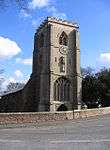
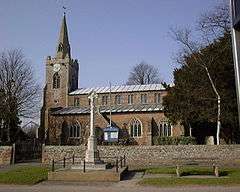
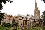
Church of St Mary Cowbit Parish Church c.1380 7 February 1967 TF2597918009
52°44′42″N 0°08′07″W / 52.745031°N 0.13519°W / 52.745031; -0.13519 (Church of St Mary)
1064482
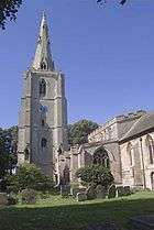
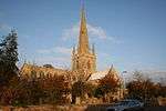
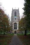
Crowland Abbey Crowland Abbey 1155-1999 7 February 1967 TF2415510326
52°40′35″N 0°09′54″W / 52.676421°N 0.165095°W / 52.676421; -0.165095 (Crowland Abbey)
1064550
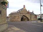
Holy Trinity Bridge Crowland Footbridge pre 943 1 January 1962 TF2393910237
52°40′32″N 0°10′06″W / 52.675671°N 0.168321°W / 52.675671; -0.168321 (Holy Trinity Bridge)
1064508
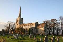
Church of St Mary and the Holy Rood Donington Church 1868 7 February 1967 TF2082435943
52°54′26″N 0°12′18″W / 52.907344°N 0.204885°W / 52.907344; -0.204885 (Church of St Mary and the Holy Rood)
1064449
Bell Tower Fleet Bell Tower c.1300 7 December 1987 TF3886823666
52°47′34″N 0°03′29″E / 52.792698°N 0.058015°E / 52.792698; 0.058015 (Bell Tower)
1064521
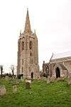
Church of St Mary Magdalen Fleet Parish Church c1180-1190 30 June 1966 TF3888823680
52°47′34″N 0°03′30″E / 52.792819°N 0.058317°E / 52.792819; 0.058317 (Church of St Mary Magdalen)
1146568
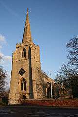
Church of St Mary Magdalene Gedney Parish Church 13th century 30 June 1966 TF4027824350
52°47′55″N 0°04′45″E / 52.798478°N 0.079204°E / 52.798478; 0.079204 (Church of St Mary Magdalene)
1359231
Church of St Peter and St Paul Gosberton Parish Church 12th century 7 February 1967 TF2375031759
52°52′09″N 0°09′47″W / 52.869087°N 0.162992°W / 52.869087; -0.162992 (Church of St Peter and St Paul)
1064425
Church of All Saints Holbeach Parish Church c1340-80 30 June 1966 TF3591024789
52°48′13″N 0°00′53″E / 52.803539°N 0.014643°E / 52.803539; 0.014643 (Church of All Saints)
1064486
Church of St Mary Long Sutton Parish Church Late 12th century 30 June 1966 TF4322822874
52°47′04″N 0°07′20″E / 52.784445°N 0.122281°E / 52.784445; 0.122281 (Church of St Mary)
1064562
Church of St Nicholas Lutton Parish Church Early 16th century 30 June 1966 TF4330725559
52°48′31″N 0°07′29″E / 52.808544°N 0.124627°E / 52.808544; 0.124627 (Church of St Nicholas)
1359229
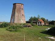
Sneaths Mill Lutton Windmill 1779 5 October 1976 TF4358424299
52°47′50″N 0°07′41″E / 52.797151°N 0.12818°E / 52.797151; 0.12818 (Sneaths Mill)
1064530
Church of All Saints Moulton Parish Church c.1180 7 February 1967 TF3071024115
52°47′56″N 0°03′46″W / 52.798768°N 0.062714°W / 52.798768; -0.062714 (Church of All Saints)
1147325
Moulton Windmill Moulton Tower Mill c.1822 7 February 1967 TF3075524035
52°47′53″N 0°03′43″W / 52.798038°N 0.062079°W / 52.798038; -0.062079 (Moulton Windmill)
1308557
Church of St Mary Pinchbeck Parish Church 12th century 7 February 1967 TF2419725594
52°48′49″N 0°09′31″W / 52.813593°N 0.158699°W / 52.813593; -0.158699 (Church of St Mary)
1064433
Church of St Margaret Quadring Parish Church 14th century 7 February 1967 TF2242434101
52°53′26″N 0°10′54″W / 52.890433°N 0.1818°W / 52.890433; -0.1818 (Church of St Margaret)
1147013
Church of St Lawrence Surfleet Parish Church 13th century 7 February 1967 TF2513628230
52°50′13″N 0°08′38″W / 52.83706°N 0.143766°W / 52.83706; -0.143766 (Church of St Lawrence)
1064403
Church of St Mary Tydd St. Mary Parish Church 12th century 30 June 1966 TF4461118591
52°44′44″N 0°08′27″E / 52.745601°N 0.140883°E / 52.745601; 0.140883 (Church of St Mary)
1204871
Church of St Mary Weston Church c.1170 7 February 1967 TF2924825153
52°48′30″N 0°05′02″W / 52.808445°N 0.083976°W / 52.808445; -0.083976 (Church of St Mary)
1064475
The Wykeham Chapel of St Nicholas Weston Chapel Late 19th century 7 February 1967 TF2763526433
52°49′13″N 0°06′27″W / 52.820329°N 0.107391°W / 52.820329; -0.107391 (The Wykeham Chapel of St Nicholas)
1064471
Church of St Mary Whaplode Parish Church c.1150 30 June 1966 TF3235124013
52°47′51″N 0°02′18″W / 52.797452°N 0.038431°W / 52.797452; -0.038431 (Church of St Mary)
1359295
Ayscoughfee Hall Spalding Open Hall House Mid 15th century 29 December 1950 TF2491322362
52°47′04″N 0°08′58″W / 52.784389°N 0.149315°W / 52.784389; -0.149315 (Ayscoughfee Hall)
1359532
Church of St Paul including attached former Sunday Schoolroom Fulney, Spalding Church 1877-80 20 November 1975 TF2614423802
52°47′49″N 0°07′50″W / 52.797041°N 0.130519°W / 52.797041; -0.130519 (Church of St Paul including attached former Sunday Schoolroom)
1306702
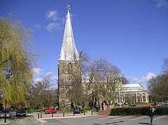
Parish Church of St Mary and St Nicolas Spalding Parish Church 1284 29 December 1950 TF2502422415
52°47′05″N 0°08′52″W / 52.78484°N 0.14765°W / 52.78484; -0.14765 (Parish Church of St Mary and St Nicolas)
1359547
Spalding War Memorial Spalding war memorial 1922 20 November 1975 TF2491722256
52°47′03″N 0°09′01″W / 52.7840792°N 0.1501686°W / 52.7840792; -0.1501686 (Spalding War Memorial)
1064002

Notes

  1. The date given is the date used by Historic England as significant for the initial building or that of an important part in the structure's description.
  2. Sometimes known as OSGB36, the grid reference is based on the British national grid reference system used by the Ordnance Survey.
  3. The "List Entry Number" is a unique number assigned to each listed building and scheduled monument by Historic England.

Media related to Grade I listed buildings in Lincolnshire at Wikimedia Commons

This article is issued from Wikipedia - version of the 10/29/2016. The text is available under the Creative Commons Attribution/Share Alike but additional terms may apply for the media files.