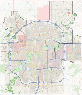
Griesbach, Edmonton
| Griesbach | |
|---|---|
| Neighbourhood | |
 Griesbach Location of Griesbach in Edmonton | |
| Coordinates: 53°36′25″N 113°30′04″W / 53.607°N 113.501°W | |
| Country |
|
| Province |
|
| City | Edmonton |
| Quadrant[1] | NW |
| Ward[1] | 2 |
| Sector[2] | North |
| Government[3] | |
| • Administrative body | Edmonton City Council |
| • Councillor | Kim Krushell |
| Area[4] | |
| • Total | 2.69 km2 (1.04 sq mi) |
| Elevation | 677 m (2,221 ft) |
| Population (2012)[5] | |
| • Total | 3,221 |
| • Density | 1,197.4/km2 (3,101/sq mi) |
| • Change (2009–12) |
|
| • Dwellings | 1,583 |
Griesbach is a residential neighbourhood in the Castledowns area of north west Edmonton, Alberta, Canada. This neighbourhood was formerly a military base, part of CFB Edmonton. The land was transferred to Canada Lands Company and is being redeveloped as a residential community.
The neighbourhood is bounded on the north by 153 Avenue, on the east by 97 Street, on the south by 137 Avenue, and on the west by Castledowns Road. Travel north along 97 Street provides access to the current CFB Edmonton. Travel south along 97 Street provides access to the downtown core and the Northern Alberta Institute of Technology
Shopping and services are available just outside the neighbourhood at Northgate Centre and North Town Centre. Both malls are located at the intersection of 137 Avenue and 97 Street at Griesbach's south east corner. Shoppers Drug Mart opened in November 2016 in Griesbach Village, located in the southeast corner of the neighbourhood.
According to the 2005 municipal census, the most common type of residence in Griesbach is the single-family dwelling. These account for four out of every ten (41%) of all residences in the neighbourhood. Row houses account for another three out of ten (30%) of residences. Duplexes[6] account for the remaining three out of ten (29%). Nine out of every ten (91%) are rented with only one in ten (9%) being owner occupied.[7]
Demographics
In the City of Edmonton's 2012 municipal census, Griesbach had a population of 3,221 living in 1,583 dwellings,[5] a 23.3% change from its 2009 population of 2,613.[8] With a land area of 2.69 km2 (1.04 sq mi),[4] it had a population density of 1,197.4 people/km2 in 2012.[4][5]
Surrounding neighbourhoods
 |
Dunluce | Beaumaris | Eaux Claires |  |
| Caernarvon Carlisle |
|
Evansdale Northmount | ||
| ||||
| | ||||
| Kensington | Rosslyn | Glengarry |
References
- 1 2 "City of Edmonton Wards & Standard Neighbourhoods" (PDF). City of Edmonton. Retrieved February 13, 2013.
- ↑ "Edmonton Developing and Planned Neighbourhoods, 2011" (PDF). City of Edmonton. Retrieved February 13, 2013.
- ↑ "City Councillors". City of Edmonton. Retrieved February 13, 2013.
- 1 2 3 "Neighbourhoods (data plus kml file)". City of Edmonton. Retrieved February 22, 2013.
- 1 2 3 "Municipal Census Results – Edmonton 2012 Census". City of Edmonton. Retrieved February 22, 2013.
- ↑ Duplexes include triplexes and fourplexes.
- ↑ http://censusdocs.edmonton.ca/C05002/MUNICIPAL%202005/Neighbourhood/GRIESBACH.pdf
- ↑ "2009 Municipal Census Results". City of Edmonton. Retrieved February 22, 2013.