Howards Ridge, Missouri

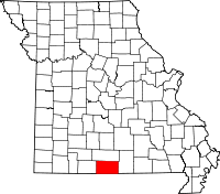
Howards Ridge is an unincorporated community in southeastern Ozark County in the southern Missouri Ozarks.[1] It is located seven miles southeast of Gainesville and 2.15 miles north of the Arkansas border. It is located at the intersection of Ozark County routes J and T. The community is at an elevation of 880 feet and lies two and a half miles west of Norfork Lake.[2]
Howards Ridge was served by a US Post Office from 1905 to 1978.[3] The community has the name of the Howard family which settled a nearby ridge.[4]
References
- ↑ U.S. Geological Survey Geographic Names Information System: Howards Ridge
- ↑ Udall Quadrangle, Missouri–Ozark County, 7.5 minute quad., USGS, 1968
- ↑ Post Offices in Ozark County, MO
- ↑ "Ozark County Place Names, 1928–1945". The State Historical Society of Missouri. Archived from the original on June 24, 2016. Retrieved November 27, 2016.
Coordinates: 36°31′44″N 92°19′56″W / 36.52889°N 92.33222°W
This article is issued from Wikipedia - version of the 11/28/2016. The text is available under the Creative Commons Attribution/Share Alike but additional terms may apply for the media files.
