List of cultural property of national significance in Switzerland: Ticino
This list contains all cultural property of national significance (class A) in the canton of Ticino from the 2009 Swiss Inventory of Cultural Property of National and Regional Significance. It is sorted by municipality and contains 150 individual buildings, 26 collections and 35 archaeological finds.
The geographic coordinates provided are in the Swiss coordinate system as given in the Inventory.
Acquarossa
| KGS No.? |
Picture | Name | Street Address | CH1903 X coordinate | CH1903 Y coordinate | Location |
|---|---|---|---|---|---|---|
| 10549 |  |
Heathens house in Boscone | Dongio | 716.950 | 144.110 | 46°26′17″N 8°57′38″E / 46.438124°N 8.960468°E |
| 5690 |  |
Church of Saint Charles in Negrentino | Prugiasco | 714.010 | 146.790 | 46°27′46″N 8°55′22″E / 46.462734°N 8.92288°E |
| 5432 | Church of Saint Remigius | Corzoneso | 715.957 | 144.144 | 46°26′19″N 8°56′51″E / 46.438602°N 8.947558°E | |
| 5527 | |
Pretorio's Palace (House of Landfogti) | Lottigna | 715.584 | 147.571 | 46°28′10″N 8°56′37″E / 46.469489°N 8.943561°E |
| 10532 | Ruins of monastery in Monastero | Corzoneso | 716.450 | 143.600 | 46°26′01″N 8°57′14″E / 46.433624°N 8.953835°E | |
| 3908 | |
ISOS Village: Dongio | ||||
| 4067 | ISOS Village: Ponto Valentino | |||||
| 3955 | |
ISOS Hamlet: Largario |
Airolo
| KGS No.? |
Picture | Name | Street Address | CH1903 X coordinate | CH1903 Y coordinate | Location |
|---|---|---|---|---|---|---|
| 9056 | 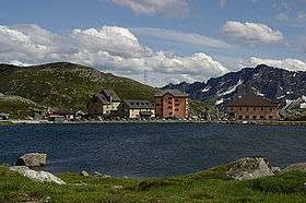 |
Hospice Complex on the St. Gotthard Pass with old station, house and barn |
686.510 | 156.621 | 46°33′19″N 8°34′00″E / 46.555275°N 8.566768°E | |
| 5226 |  |
Forte Airolo | 688.272 | 153.655 | 46°31′42″N 8°35′21″E / 46.528367°N 8.589175°E | |
| 9079 | |
Forte Foppa | 688.219 | 153.793 | 46°31′47″N 8°35′19″E / 46.529615°N 8.58851°E | |
| 10517 | Prehistoric Settlement and Roman Necropolis of Madrano | 691.280 | 153.450 | 46°31′34″N 8°37′42″E / 46.52612°N 8.628335°E | ||
| 10516 | Prehistoric Settlement on the St. Gotthard Pass (Alpe di Rodont) |
685.700 | 158.600 | 46°34′23″N 8°33′24″E / 46.57318°N 8.556574°E | ||
| Unknown | ISOS borgo: Airolo | |||||
| Unknown | ISOS villaggio: Fontana |
Alto Malcantone
| KGS No.? |
Picture | Name | Street Address | CH1903 X coordinate | CH1903 Y coordinate | Location |
|---|---|---|---|---|---|---|
| 5242 |  |
Parish Church of Di S. Michele | Arosio | 713.131 | 100.643 | 46°02′52″N 8°54′01″E / 46.047838°N 8.90025°E |
| Unknown | ISOS villaggio: Breno |
Aranno
| KGS No.? |
Picture | Name | Street Address | CH1903 X coordinate | CH1903 Y coordinate | Location |
|---|---|---|---|---|---|---|
| Unknown | ISOS villaggio: Aranno |
Arbedo-Castione
| KGS No.? |
Picture | Name | Street Address | CH1903 X coordinate | CH1903 Y coordinate | Location |
|---|---|---|---|---|---|---|
| 5238 | 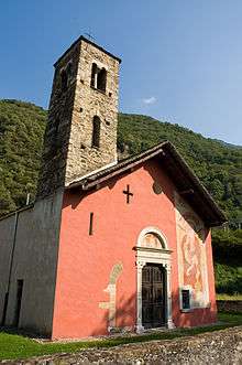 |
Church of S. Paolo detta Chiesa Rossa | Via Del Carmagnola | 723.529 | 118.431 | 46°12′22″N 9°02′21″E / 46.205995°N 9.039239°E |
Arogno
| KGS No.? |
Picture | Name | Street Address | CH1903 X coordinate | CH1903 Y coordinate | Location |
|---|---|---|---|---|---|---|
| 5240 | |
Parish Church of S. Stefano | Via Alla Church | 720.174 | 090.954 | 45°57′34″N 8°59′19″E / 45.959482°N 8.988747°E |
| Unknown | ISOS villaggio: Arogno |
Ascona
| KGS No.? |
Picture | Name | Street Address | CH1903 X coordinate | CH1903 Y coordinate | Location |
|---|---|---|---|---|---|---|
| 10262, 8634 |  |
Albergo Park, Houses and Monte Verità Museum |
Pvia Collina 78–84 | 702.290 | 112.759 | 46°09′31″N 8°45′46″E / 46.158541°N 8.762858°E |
| 5248 |  |
Serodine House | piazzetta San Pietro 4 | 702.680 | 112.343 | 46°09′17″N 8°46′04″E / 46.15474°N 8.767815°E |
| 9135 | Unifamiliare Tuia House | sentiero Roccolo 11 | 702.671 | 112.850 | 46°09′33″N 8°46′04″E / 46.159301°N 8.767809°E | |
| 5250 |  |
Church of S. Maria della Misericordia and the Collegio Papio | via delle Cappelle 1 | 702.915 | 112.395 | 46°09′19″N 8°46′15″E / 46.155172°N 8.770867°E |
| 5253 | |
Church of S. Michele with the ruins of a medieval castle |
702.355 | 112.235 | 46°09′14″N 8°45′49″E / 46.153818°N 8.763585°E | |
| 5249 |  |
Parish Church of Ss. Pietro e Paolo | 702.677 | 112.370 | 46°09′18″N 8°46′04″E / 46.154983°N 8.767782°E | |
| 5251 | Balladrum, Prehistoric and Medieval Settlement |
701.260 | 112.500 | 46°09′23″N 8°44′58″E / 46.156367°N 8.74947°E | ||
| 8640 | |
Museo comunale d’arte | via Borgo 34 | 702.630 | 112.449 | 46°09′21″N 8°46′02″E / 46.155701°N 8.767191°E |
| 8628 | |
Museo Epper | via Albarelle 14 | 703.112 | 111.922 | 46°09′03″N 8°46′24″E / 46.150887°N 8.773313°E |
| 9389 | |
Teatro S. Materno | via Losone 3 | 703.126 | 113.073 | 46°09′40″N 8°46′25″E / 46.161238°N 8.773748°E |
| 9136 | Villa | via Ludwig 26 | 701.053 | 112.076 | 46°09′09″N 8°44′48″E / 46.152584°N 8.7467°E | |
| Unknown | ISOS borgo: Ascona |
Astano
| KGS No.? |
Picture | Name | Street Address | CH1903 X coordinate | CH1903 Y coordinate | Location |
|---|---|---|---|---|---|---|
| Unknown | ISOS villaggio: Astano |
Avegno Gordevio
| KGS No.? |
Picture | Name | Street Address | CH1903 X coordinate | CH1903 Y coordinate | Location |
|---|---|---|---|---|---|---|
| Unknown | ISOS villaggio: Avegno Church e di dentro | |||||
| Unknown | ISOS villaggio: Avegno di fuori |
Balerna
| KGS No.? |
Picture | Name | Street Address | CH1903 X coordinate | CH1903 Y coordinate | Location |
|---|---|---|---|---|---|---|
| 5261 |  |
Collegiate church complex of S. Vittore | Via Carlo Silva | 721.902 | 078.778 | 45°50′59″N 9°00′28″E / 45.849669°N 9.007891°E |
| 10265 |  |
Magazzini Generali | via Magazzini Generali | 722.371 | 078.521 | 45°50′50″N 9°00′50″E / 45.847273°N 9.013861°E |
| 5262 |  |
Ruins of the Medieval Castle at Pontegana | 722.530 | 078.050 | 45°50′35″N 9°00′57″E / 45.843009°N 9.015785°E |
Bedigliora
| KGS No.? |
Picture | Name | Street Address | CH1903 X coordinate | CH1903 Y coordinate | Location |
|---|---|---|---|---|---|---|
| Unknown | ISOS villaggio: Bedigliora |
Bedretto
| KGS No.? |
Picture | Name | Street Address | CH1903 X coordinate | CH1903 Y coordinate | Location |
|---|---|---|---|---|---|---|
| Unknown | ISOS villaggio: Bedretto | |||||
| Unknown | ISOS villaggio: Villa |
Bellinzona
| KGS No.? |
Picture | Name | Street Address | CH1903 X coordinate | CH1903 Y coordinate | Location |
|---|---|---|---|---|---|---|
| 8974, 10528, 8565 | |
Archivio Di Stato Del Cantone Ticino | Collezione Etnografica Dello Stato E Collezione | 721.549 | 116.929 | 46°11′34″N 9°00′48″E / 46.192846°N 9.0132°E |
| 9029 | _II.jpg) |
Bagno Pubblico | via Mirasole 20 | 721.862 | 117.563 | 46°11′55″N 9°01′03″E / 46.198492°N 9.017419°E |
| 5270, 11786 | 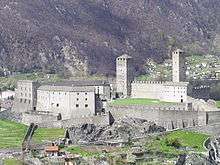 |
Castel Grande e Museo con collezioni archeologiche | 722.275 | 116.987 | 46°11′36″N 9°01′21″E / 46.193237°N 9.022617°E | |
| 9681 | |
Castelli e città (medioevo / epoca moderna) | 722.350 | 116.900 | 46°11′33″N 9°01′25″E / 46.19244°N 9.023566°E | |
| 5271, 11787 | 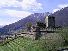 |
Castello di Montebello e Museo Civico | via Artore 4 | 722.599 | 116.771 | 46°11′28″N 9°01′36″E / 46.191235°N 9.026756°E |
| 5272 | 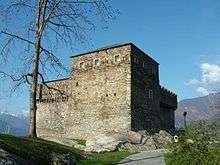 |
Castello di Sasso Corbaro | via Sasso Corbaro 44 | 722.805 | 116.435 | 46°11′17″N 9°01′46″E / 46.188176°N 9.029336°E |
| 5275 |  |
Church di S. Maria delle Grazie e convento | via Convento | 722.000 | 116.135 | 46°11′08″N 9°01′08″E / 46.185624°N 9.018833°E |
| 5274 |  |
Church parrocchiale di S. Biagio a Ravecchia | 722.181 | 116.125 | 46°11′08″N 9°01′16″E / 46.185501°N 9.021174°E | |
| 5276 | |
Collegiata dei Ss. Pietro e Stefano | piazza Collegiata | 722.376 | 116.815 | 46°11′30″N 9°01′26″E / 46.191671°N 9.02388°E |
| 10266 | |
Murata e fortificazioni Scuola media | via Lavizzari 28 | 721.821 | 116.945 | 46°11′35″N 9°01′00″E / 46.192941°N 9.016726°E |
| 9395 | .jpg) |
Scuola media | via Lavizzari 28 | 722.061 | 117.379 | 46°11′48″N 9°01′12″E / 46.196801°N 9.019948°E |
| 5278 |  |
Teatro sociale | piazza Governo 11 | 722.169 | 116.729 | 46°11′27″N 9°01′16″E / 46.190935°N 9.021177°E |
| Unknown | |
UNESCO World Heritage Site: Three Castles, Defensive Wall and Ramparts of the Market-Town of Bellinzona |
722.169 | 116.729 | 46°11′27″N 9°01′16″E / 46.190935°N 9.021177°E | |
| Unknown | ISOS città: Bellinzona |
Biasca
| KGS No.? |
Picture | Name | Street Address | CH1903 X coordinate | CH1903 Y coordinate | Location |
|---|---|---|---|---|---|---|
| 9096 | Arsenale | Via Ai Grotti 28 | 718.138 | 136.026 | 46°21′55″N 8°58′26″E / 46.365209°N 8.973865°E | |
| 5302 | |
Church prepositurale dei SS. Pietro e Paolo | 718.126 | 135.413 | 46°21′35″N 8°58′25″E / 46.359698°N 8.973553°E | |
| Unknown | ISOS borgo: Biasca | |||||
| Unknown | ISOS villaggio: Pontirone |
Bioggio
| KGS No.? |
Picture | Name | Street Address | CH1903 X coordinate | CH1903 Y coordinate | Location |
|---|---|---|---|---|---|---|
| 10518 |  |
Roman Cult Site and Old Church of S. Maurizio | Via Alla Church | 713.650 | 096.850 | 46°00′49″N 8°54′22″E / 46.013637°N 8.906038°E |
| Unknown | ISOS villaggio: Iseo |
Bissone
| KGS No.? |
Picture | Name | Street Address | CH1903 X coordinate | CH1903 Y coordinate | Location |
|---|---|---|---|---|---|---|
| 5321 |  |
Parish Church of S. Carpoforo | Via Maroggia | 718.455 | 089.754 | 45°56′56″N 8°57′59″E / 45.948993°N 8.966279°E |
| Unknown | ISOS villaggio: Bissone |
Blenio
| KGS No.? |
Picture | Name | Street Address | CH1903 X coordinate | CH1903 Y coordinate | Location |
|---|---|---|---|---|---|---|
| 5650 |  |
Parish Church of S. Martino | Olivone | 715.284 | 154.257 | 46°31′47″N 8°56′29″E / 46.529674°N 8.941323°E |
| Unknown | ISOS villaggio: Dangio | |||||
| Unknown |  |
ISOS villaggio: Olivone Chiesa-Solario |
Bodio
| KGS No.? |
Picture | Name | Street Address | CH1903 X coordinate | CH1903 Y coordinate | Location |
|---|---|---|---|---|---|---|
| 10269 | Centrale Idroelettrica Della Biaschina Hydroelectric Power Plant at Biaschina |
712.322 | 137.628 | 46°22′50″N 8°53′55″E / 46.380616°N 8.89869°E |
Bosco/Gurin
| KGS No.? |
Picture | Name | Street Address | CH1903 X coordinate | CH1903 Y coordinate | Location |
|---|---|---|---|---|---|---|
| 8564 |  |
Walserhaus Walser Style House |
680.976 | 130.078 | 46°19′02″N 8°29′24″E / 46.317219°N 8.489974°E | |
| Unknown | ISOS villaggio: Bosco/Gurin |
Breggia
| KGS No.? |
Picture | Name | Street Address | CH1903 X coordinate | CH1903 Y coordinate | Location |
|---|---|---|---|---|---|---|
| 5350 | Cantoni House | Cabbio | 724.768 | 084.254 | 45°53′54″N 9°02′46″E / 45.898395°N 9.046218°E | |
| 10291 | Nevèra | Muggio, alpe Genor | 723.058 | 086.695 | 45°55′14″N 9°01′29″E / 45.920661°N 9.024827°E | |
| Unknown | ISOS villaggio: Cabbio | |||||
| Unknown | ISOS villaggio: Muggio | |||||
| Unknown | ISOS villaggio: Scudellate |
Brione (Verzasca)
| KGS No.? |
Picture | Name | Street Address | CH1903 X coordinate | CH1903 Y coordinate | Location |
|---|---|---|---|---|---|---|
| Unknown | ISOS villaggio: Brione Verzasca |
Brissago
| KGS No.? |
Picture | Name | Street Address | CH1903 X coordinate | CH1903 Y coordinate | Location |
|---|---|---|---|---|---|---|
| 5339, 8625 | |
Baccalà E Museo Leoncavallo House | Vicolo Al Castello | 698.403 | 108.333 | 46°07′10″N 8°42′42″E / 46.119311°N 8.711618°E |
| 5340 |  |
Church of Madonna del Ponte | via Valmara | 697.926 | 107.512 | 46°06′43″N 8°42′19″E / 46.111996°N 8.705277°E |
| 5341 |  |
Church of Santuario di S. Maria Addolorata del Sacro Monte | 697.944 | 108.530 | 46°07′16″N 8°42′21″E / 46.121149°N 8.705722°E | |
| 5342, 10519 |  |
Isole, Botanical Garden and Cult Site |
con Via Crucis, gradinata del Calvario | 700.250 | 109.850 | 46°07′58″N 8°44′09″E / 46.132683°N 8.735831°E |
| Unknown | ISOS caso particolare: Isole di Brissago |
Brusino Arsizio
| KGS No.? |
Picture | Name | Street Address | CH1903 X coordinate | CH1903 Y coordinate | Location |
|---|---|---|---|---|---|---|
| Unknown | ISOS villaggio: Brusino Arsizio |
Cademario
| KGS No.? |
Picture | Name | Street Address | CH1903 X coordinate | CH1903 Y coordinate | Location |
|---|---|---|---|---|---|---|
| 5353, 8659 |  |
Parish Church of S. Ambrogio | Strada Della Church | 713.044 | 097.727 | 46°01′18″N 8°53′54″E / 46.021627°N 8.898426°E |
| 10520 | Necropolis a Forcora | 711.870 | 097.150 | 46°01′00″N 8°52′59″E / 46.016632°N 8.883132°E |
Camorino
| KGS No.? |
Picture | Name | Street Address | CH1903 X coordinate | CH1903 Y coordinate | Location |
|---|---|---|---|---|---|---|
| 10453 | .jpg) |
Fortifications of 18th century, known as «Fortini Della Fame» |
ai Scarsitt (vedi anche Monte Carasso e Sementina) | 721.914 | 113.819 | 46°09′53″N 9°01′02″E / 46.16481°N 9.017116°E |
Campo
| KGS No.? |
Picture | Name | Street Address | CH1903 X coordinate | CH1903 Y coordinate | Location |
|---|---|---|---|---|---|---|
| 5361 | |
Case Pedrazzini E Oratorio Di S. Giovanni Battista | 681.389 | 126.958 | 46°17′21″N 8°29′41″E / 46.289105°N 8.49479°E | |
| 5362 |  |
Parish Church of S. Bernardo e Via Crucis | 681.691 | 126.889 | 46°17′18″N 8°29′55″E / 46.288448°N 8.498697°E | |
| Unknown | ISOS villaggio: Campo Vallemaggia | |||||
| Unknown | ISOS villaggio: Cimalmotto |
Capriasca
| KGS No.? |
Picture | Name | Street Address | CH1903 X coordinate | CH1903 Y coordinate | Location |
|---|---|---|---|---|---|---|
| 5531 |  |
Church of Ss. Pietro E Paolo | Lugaggia | 718.733 | 101.044 | 46°03′02″N 8°58′22″E / 46.050483°N 8.972709°E |
| 5761 | |
Parish Church of Ss. Antonio, Giacomo e Filippo | Vaglio, via alla Chiesa | 717.469 | 102.268 | 46°03′42″N 8°57′24″E / 46.061712°N 8.956687°E |
| 10392 | |
Chiesa plebana di S. Stefano | Tesserete, via alla Church | 718.143 | 102.938 | 46°04′03″N 8°57′56″E / 46.06762°N 8.965564°E |
| 8639 | .jpg) |
Complesso del Convento di S. Maria Assunta e Museo a | 716.973 | 103.423 | 46°04′20″N 8°57′02″E / 46.072186°N 8.950567°E | |
| 9683 | .jpg) |
Torre e Settlement medievale a Redde | Vaglio | 717.830 | 101.215 | 46°03′08″N 8°57′40″E / 46.052179°N 8.961087°E |
| Unknown | ISOS villaggio: Bidogno | |||||
| Unknown | ISOS villaggio: Sala Capriasca |
Caslano
| KGS No.? |
Picture | Name | Street Address | CH1903 X coordinate | CH1903 Y coordinate | Location |
|---|---|---|---|---|---|---|
| Unknown | ISOS villaggio: Caslano |
Castel San Pietro
| KGS No.? |
Picture | Name | Street Address | CH1903 X coordinate | CH1903 Y coordinate | Location |
|---|---|---|---|---|---|---|
| 5385 | |
Church of S. Pietro (Chiesa Rossa) E Ruderi Del Castello | Via Al Ponte | 722.333 | 079.796 | 45°51′31″N 9°00′49″E / 45.858747°N 9.013701°E |
| 5384 | |
Parish Church of S. Eusebio | via alla Church | 722.026 | 079.898 | 45°51′35″N 9°00′35″E / 45.85972°N 9.009775°E |
| 5387 | Villa Turconi a Loverciano | via Loverciano | 721.465 | 080.105 | 45°51′42″N 9°00′09″E / 45.861682°N 9.002607°E | |
| Unknown | ISOS villaggio: Casima | |||||
| Unknown | ISOS villaggio: Castel San Pietro | |||||
| Unknown | ISOS villaggio: Monte | |||||
| Unknown | ISOS casale/piccolo villaggio: Campora |
Centovalli
| KGS No.? |
Picture | Name | Street Address | CH1903 X coordinate | CH1903 Y coordinate | Location |
|---|---|---|---|---|---|---|
| 5665 |  |
Parish Church of S. Michele, Piazza | Palagnedra, piazza Chiesa | 692.042 | 112.227 | 46°09′19″N 8°37′48″E / 46.155233°N 8.630108°E |
| Unknown | ISOS villaggio: Borgnone | |||||
| Unknown | ISOS villaggio: Costa | |||||
| Unknown | ISOS villaggio: Golino | |||||
| Unknown | ISOS villaggio: Intragna | |||||
| Unknown | ISOS villaggio: Lionza | |||||
| Unknown | ISOS villaggio: Palagnedra | |||||
| Unknown | ISOS villaggio: Rasa | |||||
| Unknown | ISOS villaggio: Verdasio | |||||
| Unknown | ISOS casale / piccolo villaggio: Bordei |
Cerentino
| KGS No.? |
Picture | Name | Street Address | CH1903 X coordinate | CH1903 Y coordinate | Location |
|---|---|---|---|---|---|---|
| Unknown | ISOS casale / piccolo villaggio: Corino |
Cevio
| KGS No.? |
Picture | Name | Street Address | CH1903 X coordinate | CH1903 Y coordinate | Location |
|---|---|---|---|---|---|---|
| 9273 | |
Respini-Moretti House | Piazza | 689.541 | 130.148 | 46°19′00″N 8°36′04″E / 46.316762°N 8.601174°E |
| 5402, 8566 | |
Case Franzoni e Museo di Valmaggia | 689.549 | 130.609 | 46°19′15″N 8°36′05″E / 46.320907°N 8.601366°E | |
| 5400 | |
Case Franzoni e Museo di Valmaggia Chiesa di S. Maria del Ponte alla Rovana |
689.346 | 129.740 | 46°18′47″N 8°35′55″E / 46.313118°N 8.598564°E | |
| 5403 | |
Parish Church, Medieval Religious Site of Cevio vecchio, Church of S. Maria Assunta e S. Giovanni with Ossuary and Portico |
689.615 | 130.760 | 46°19′20″N 8°36′08″E / 46.322257°N 8.602252°E | |
| 5401 |  |
Pretorio | 689.561 | 130.107 | 46°18′59″N 8°36′05″E / 46.316391°N 8.601425°E | |
| Unknown | ISOS villaggio: Bignasco | |||||
| Unknown | ISOS villaggio: Boschetto | |||||
| Unknown | ISOS villaggio: Cevio/Rovana | |||||
| Unknown | ISOS caso particolare: Val Bavona |
Chiasso
| KGS No.? |
Picture | Name | Street Address | CH1903 X coordinate | CH1903 Y coordinate | Location |
|---|---|---|---|---|---|---|
| Unknown | ISOS caso particolare: Chiasso |
Coldrerio
| KGS No.? |
Picture | Name | Street Address | CH1903 X coordinate | CH1903 Y coordinate | Location |
|---|---|---|---|---|---|---|
| 10531 |  |
Torbiera | 720.250 | 079.300 | 45°51′17″N 8°59′12″E / 45.854659°N 8.986763°E | |
| Unknown | ISOS villaggio: Coldrerio | |||||
| Unknown | ISOS villaggio: Villa |
Collina d'Oro
| KGS No.? |
Picture | Name | Street Address | CH1903 X coordinate | CH1903 Y coordinate | Location |
|---|---|---|---|---|---|---|
| 5614 |  |
Camuzzi House | Montagnola, Via Camuzzi | 714.728 | 093.478 | 45°58′59″N 8°55′09″E / 45.983128°N 8.919132°E |
| 5464 | |
Cimitero | Gentilino, via ai Canvetti | 715.294 | 094.149 | 45°59′21″N 8°55′36″E / 45.989067°N 8.926598°E |
| 5463 |  |
Parish Church of S. Abbondio with Ossuary and Via Crucis |
Gentilino, via Sant’Abbondio | 715.400 | 094.083 | 45°59′18″N 8°55′41″E / 45.988455°N 8.92795°E |
Corippo
| KGS No.? |
Picture | Name | Street Address | CH1903 X coordinate | CH1903 Y coordinate | Location |
|---|---|---|---|---|---|---|
| Unknown | ISOS villaggio: Corippo |
Croglio
| KGS No.? |
Picture | Name | Street Address | CH1903 X coordinate | CH1903 Y coordinate | Location |
|---|---|---|---|---|---|---|
| Unknown | ISOS villaggio: Castelrotto |
Cugnasco-Gerra
| KGS No.? |
Picture | Name | Street Address | CH1903 X coordinate | CH1903 Y coordinate | Location |
|---|---|---|---|---|---|---|
| 5441 |  |
Oratory of SS. Anna e Cristoforo a Curogna | Cugnasco | 713.292 | 115.817 | 46°11′03″N 8°54′22″E / 46.184285°N 8.905995°E |
| 5442 | Oratory of S. Martino a Ditto | Cugnasco | 711.928 | 116.074 | 46°11′13″N 8°53′18″E / 46.186824°N 8.888394°E |
Curio
| KGS No.? |
Picture | Name | Street Address | CH1903 X coordinate | CH1903 Y coordinate | Location |
|---|---|---|---|---|---|---|
| 8567 |  |
Museo Del Malcantone | 710.237 | 095.578 | 46°00′10″N 8°51′42″E / 46.002762°N 8.861683°E | |
| Unknown | ISOS villaggio: Curio |
Faido
| KGS No.? |
Picture | Name | Street Address | CH1903 X coordinate | CH1903 Y coordinate | Location |
|---|---|---|---|---|---|---|
| 5452 | Selvini House | Faido | 704.278 | 148.434 | 46°28′45″N 8°47′48″E / 46.479106°N 8.796581°E | |
| 5409 | |
Church of S. Maria Assunta | Chiggiogna | 706.326 | 147.197 | 46°28′04″N 8°49′23″E / 46.467658°N 8.822961°E |
| 5709 | |
Parish Church of SS. Lorenzo e Agata | Rossura | 706.452 | 148.006 | 46°28′30″N 8°49′29″E / 46.474915°N 8.824787°E |
| 5410 | |
Church of S. Ambrogio | 708.019 | 142.249 | 46°25′22″N 8°50′38″E / 46.422884°N 8.843844°E | |
| 5411 | Torre Pedrini | 708.045 | 142.230 | 46°25′22″N 8°50′39″E / 46.422709°N 8.844178°E | ||
| 5569 | Parish Church of S. Siro | 703.554 | 149.537 | 46°29′21″N 8°47′15″E / 46.489139°N 8.787401°E | ||
| Unknown | ISOS villaggio urbanizzato: Faido | |||||
| Unknown | ISOS villaggio: Calonico | |||||
| Unknown | ISOS villaggio: Rossura | |||||
| Unknown | ISOS villaggio: Tengia | |||||
| Unknown | ISOS casale/piccolo villaggio: Figgione | |||||
| Unknown | ISOS villaggio: Anzonico | |||||
| Unknown | ISOS villaggio: Calpiogna | |||||
| Unknown | ISOS casale/piccolo villaggio: Primadengo | |||||
| Unknown | 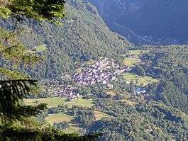 |
ISOS villaggio: Chironico | ||||
| Unknown | ISOS villaggio: Brusgnano-Freggio | |||||
| Unknown | ISOS villaggio: Osco | |||||
| Unknown | ISOS villaggio: Sobrio-Ronzano |
Gambarogno
| KGS No.? |
Picture | Name | Street Address | CH1903 X coordinate | CH1903 Y coordinate | Location |
|---|---|---|---|---|---|---|
| 5562 |  |
Complesso di S. Carlo: chiesa e casa parrocchiale |
Magadino | 709.584 | 111.668 | 46°08′51″N 8°51′25″E / 46.147582°N 8.857009°E |
| 9125 | |
Villa Ghisler | Magadino, vicolo Tamaro 7 | 709.541 | 111.733 | 46°08′53″N 8°51′23″E / 46.148173°N 8.856467°E |
| Unknown | ISOS villaggio: Magadino-Rivabella | |||||
| Unknown | ISOS villaggio: Indemini |
Giornico
| KGS No.? |
Picture | Name | Street Address | CH1903 X coordinate | CH1903 Y coordinate | Location |
|---|---|---|---|---|---|---|
| 10455 | Caslasc | Ruderi | 710.250 | 139.020 | 46°23′37″N 8°52′20″E / 46.393479°N 8.872093°E | |
| 5470 | |
Church of S. Maria del Castello | 710.166 | 139.875 | 46°24′04″N 8°52′16″E / 46.401183°N 8.871204°E | |
| 5471 |  |
Church of S. Nicolao | Rivascia | 710.402 | 139.804 | 46°24′02″N 8°52′27″E / 46.400506°N 8.874256°E |
| 5472 |  |
Church of S. Pellegrino | 709.468 | 141.053 | 46°24′43″N 8°51′45″E / 46.411892°N 8.862408°E | |
| 5473 | Torre di Attone | 710.596 | 140.100 | 46°24′11″N 8°52′37″E / 46.403136°N 8.876848°E | ||
| Unknown | ISOS villaggio: Giornico |
Gudo
| KGS No.? |
Picture | Name | Street Address | CH1903 X coordinate | CH1903 Y coordinate | Location |
|---|---|---|---|---|---|---|
| 10534 | Necropolis A Progero | 716.000 | 114.350 | 46°10′14″N 8°56′27″E / 46.17063°N 8.940696°E |
Lavertezzo
| KGS No.? |
Picture | Name | Street Address | CH1903 X coordinate | CH1903 Y coordinate | Location |
|---|---|---|---|---|---|---|
| Unknown | ISOS villaggio: Lavertezzo |
Lavizzara
| KGS No.? |
Picture | Name | Street Address | CH1903 X coordinate | CH1903 Y coordinate | Location |
|---|---|---|---|---|---|---|
| 10533 | A Mott D’Orei Settlement | Fusio | 693.930 | 144.150 | 46°26′32″N 8°39′40″E / 46.442104°N 8.66098°E | |
| Unknown | ISOS villaggio: Broglio | |||||
| Unknown | ISOS villaggio: Brontallo | |||||
| Unknown | ISOS villaggio: Fusio | |||||
| Unknown |  |
ISOS villaggio: Prato | ||||
| Unknown | ISOS villaggio: Sornico | |||||
| Unknown | ISOS casale/piccolo villaggio: Cortignelli |
Ligornetto
| KGS No.? |
Picture | Name | Street Address | CH1903 X coordinate | CH1903 Y coordinate | Location |
|---|---|---|---|---|---|---|
| 5503, 8631 | 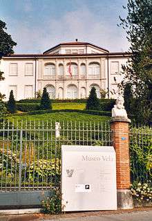 |
Museo Vela House | 717.384 | 080.286 | 45°51′51″N 8°57′00″E / 45.864029°N 8.95012°E | |
| Unknown | ISOS villaggio: Ligornetto |
Linescio
| KGS No.? |
Picture | Name | Street Address | CH1903 X coordinate | CH1903 Y coordinate | Location |
|---|---|---|---|---|---|---|
| Unknown | ISOS villaggio: Linescio |
Locarno
| KGS No.? |
Picture | Name | Street Address | CH1903 X coordinate | CH1903 Y coordinate | Location |
|---|---|---|---|---|---|---|
| 9266 | |
Casorella | Via Bartolomeo Rusca 5 | 704.642 | 113.886 | 46°10′06″N 8°47′37″E / 46.168316°N 8.793552°E |
| 5508 | |
Church of S. Francesco and former convent |
Piazza San Francesco 19 | 704.507 | 113.837 | 46°10′04″N 8°47′30″E / 46.167896°N 8.791793°E |
| 5509 | |
Church of S. Maria Assunta (new church) and House of the Canons |
via Cittadella | 704.660 | 114.017 | 46°10′10″N 8°47′38″E / 46.169492°N 8.793814°E |
| 5510 |  |
Church of S. Maria in Selva with Cemetery | via Vallemaggia | 704.225 | 114.053 | 46°10′12″N 8°47′17″E / 46.169883°N 8.788191°E |
| 5507, 11788 | |
Complex of Castello Visconteo with museum and archeological collection |
piazza Castello | 704.629 | 113.848 | 46°10′05″N 8°47′36″E / 46.167976°N 8.793375°E |
| 11762 |  |
Cantonal Library | Palazzo Morettini, | 704.745 | 114.175 | 46°10′15″N 8°47′42″E / 46.170899°N 8.79495°E |
| 8637 |  |
Pinacoteca comunale Casa Rusca | piazza Sant’Antonio | 704.482 | 114.012 | 46°10′10″N 8°47′29″E / 46.169474°N 8.791509°E |
| 9490 | |
Ai Saleggi Primary School | via delle Scuole | 704.675 | 113.222 | 46°09′44″N 8°47′38″E / 46.162339°N 8.793831°E |
| 9491 | |
Secondary School | via Dr. G. Varesi 30 | 704.788 | 113.357 | 46°09′49″N 8°47′43″E / 46.163535°N 8.795324°E |
| Unknown | ISOS città: Locarno |
Losone
| KGS No.? |
Picture | Name | Street Address | CH1903 X coordinate | CH1903 Y coordinate | Location |
|---|---|---|---|---|---|---|
| 9492 |  |
Scuola Media | Via Primore 13 | 702.597 | 113.847 | 46°10′06″N 8°46′01″E / 46.16828°N 8.76707°E |
Lugano
| KGS No.? |
Picture | Name | Street Address | CH1903 X coordinate | CH1903 Y coordinate | Location |
|---|---|---|---|---|---|---|
| 5535, 9347 | |
Biblioteca Cantonale | Viale Carlo Cattaneo 6 | 717.822 | 095.884 | 46°00′15″N 8°57′35″E / 46.004235°N 8.959649°E |
| 9310 | |
Biblioteca «Salita dei Frati» | salita dei Frati 4 | 717.005 | 096.306 | 46°00′29″N 8°56′57″E / 46.008172°N 8.94921°E |
| 5532 |  |
Cathedral of S. Lorenzo | via Cattedrale | 716.962 | 095.909 | 46°00′17″N 8°56′55″E / 46.004609°N 8.948556°E |
| 5533 | 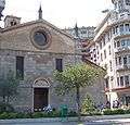 |
Church of S. Maria degli Angioli | piazza Bernardino Luin 4 | 717.009 | 095.399 | 46°00′00″N 8°56′57″E / 46.000014°N 8.949036°E |
| 5545 | |
Church of S. Rocco | piazzetta San Rocco 1 | 717.379 | 095.913 | 46°00′16″N 8°57′14″E / 46.004573°N 8.953939°E |
| 10282 | |
Complesso cimiteriale | via Trevano | 717.843 | 097.626 | 46°01′12″N 8°57′37″E / 46.019898°N 8.960356°E |
| 5534 |  |
Complesso di Villa Ciani | giardino pubblico e Museo civico | 717.580 | 095.926 | 46°00′17″N 8°57′24″E / 46.004655°N 8.956537°E |
| 8799 | |
Fonoteca nazionale svizzera | via Soldino 9 | 716.291 | 096.056 | 46°00′22″N 8°56′24″E / 46.006047°N 8.939933°E |
| 8627, 8626 |  |
Museo cantonale d’arte | via Canova 10 | 717.327 | 095.886 | 46°00′16″N 8°57′12″E / 46.004339°N 8.953261°E |
| 8644 | |
Museo cantonale di storia naturale | 717.863 | 095.969 | 46°00′18″N 8°57′37″E / 46.004992°N 8.9602°E | |
| 5554 |  |
Palazzo civico (Town Hall) |
piazza della Riforma | 717.172 | 095.792 | 46°00′13″N 8°57′04″E / 46.00352°N 8.951237°E |
| 10283 | |
Palazzo e cinema Corso | via Pioda | 717.375 | 096.096 | 46°00′22″N 8°57′14″E / 46.006219°N 8.953933°E |
| 5537 | |
Palazzo Riva | via Francesco Soave 9 | 717.104 | 095.892 | 46°00′16″N 8°57′01″E / 46.004432°N 8.950385°E |
| 5539 |  |
Palazzo Riva | via Massimiliano Magatti 2 | 717.267 | 095.859 | 46°00′15″N 8°57′09″E / 46.004107°N 8.95248°E |
| 5540 | |
Palazzo Riva | via Pretorio 7 | 717.190 | 096.032 | 46°00′20″N 8°57′06″E / 46.005676°N 8.951529°E |
| 9158 | |
Radiotelevisione svizzera di lingua italiana (RTSI) | D+A | 716.114 | 096.314 | 46°00′30″N 8°56′16″E / 46.008398°N 8.937712°E |
| 5379 | |
Villa Favorita and park | Castagnola | 719.292 | 095.454 | 46°00′00″N 8°58′43″E / 46.00011°N 8.978512°E |
| 5355 | |
Parish Church of S. Agata | Via Dei Circoli | 719.813 | 100.574 | 46°02′46″N 8°59′12″E / 46.046065°N 8.986539°E |
| 5373 |  |
Church of Della Madonna D’Ongero | 715.250 | 089.967 | 45°57′05″N 8°55′30″E / 45.951463°N 8.925008°E | |
| 5372 |  |
Parish Church of SS. Giorgio e Andrea e Loggia comunale | 716.156 | 090.765 | 45°57′31″N 8°56′13″E / 45.958485°N 8.936886°E | |
| 5375 |  |
Complesso di S. Maria Assunta di Torello | 714.288 | 089.487 | 45°56′50″N 8°54′45″E / 45.947309°N 8.912488°E | |
| 5742 | .jpg) |
Church Provost of S. Giovanni Battista a Corcaréi | 720.125 | 101.900 | 46°03′29″N 8°59′27″E / 46.057935°N 8.990908°E | |
| 5743 |  |
Oratory of S. Martino | 720.085 | 102.360 | 46°03′43″N 8°59′26″E / 46.062079°N 8.990508°E | |
| Unknown | ISOS città: Lugano | |||||
| Unknown | ISOS villaggio: Barbengo | |||||
| Unknown | ISOS villaggio: Brè | |||||
| Unknown | |
ISOS villaggio: Gandria | ||||
| Unknown | ISOS casale/piccolo villaggio: Biogno | |||||
| Unknown | ISOS caso particolare: Cantine di Gandria | |||||
| Unknown | ISOS caso particolare: Castagnola | |||||
| Unknown | ISOS villaggio: Carona | |||||
| Unknown | ISOS casale/piccolo villaggio: Ciona | |||||
| Unknown | ISOS caso particolare: Torello | |||||
| Unknown | ISOS villaggio: Cimadera | |||||
| Unknown | ISOS villaggio: Sonvico |
Maggia
| KGS No.? |
Picture | Name | Street Address | CH1903 X coordinate | CH1903 Y coordinate | Location |
|---|---|---|---|---|---|---|
| 5563 | |
Church of S. Maria Delle Grazie In Campagna | 698.355 | 121.836 | 46°14′27″N 8°42′50″E / 46.240768°N 8.713835°E | |
| Unknown | ISOS villaggio: Aurigeno | |||||
| Unknown | ISOS villaggio: Moghegno | |||||
| Unknown | ISOS villaggio: Someo |
Magliaso
| KGS No.? |
Picture | Name | Street Address | CH1903 X coordinate | CH1903 Y coordinate | Location |
|---|---|---|---|---|---|---|
| 10393 |  |
S. Giorgio Castle | 712.351 | 093.861 | 45°59′13″N 8°53′19″E / 45.986972°N 8.888557°E |
Massagno
| KGS No.? |
Picture | Name | Street Address | CH1903 X coordinate | CH1903 Y coordinate | Location |
|---|---|---|---|---|---|---|
| 9146 | D’Appartamenti Albairone House | Via Ceresio 5–9 | 716.389 | 096.350 | 46°00′31″N 8°56′29″E / 46.008674°N 8.94127°E |
Melano
| KGS No.? |
Picture | Name | Street Address | CH1903 X coordinate | CH1903 Y coordinate | Location |
|---|---|---|---|---|---|---|
| 5577 | Della Madonna Del Castelletto Church | Via Alla Madonna | 720.385 | 086.538 | 45°55′11″N 8°59′25″E / 45.91973°N 8.990342°E | |
| Unknown | ISOS villaggio: Melano |
Mendrisio
| KGS No.? |
Picture | Name | Street Address | CH1903 X coordinate | CH1903 Y coordinate | Location |
|---|---|---|---|---|---|---|
| 5586 | .jpg) |
Croci House | Via Municipio 13 | 720.176 | 081.186 | 45°52′18″N 8°59′11″E / 45.871634°N 8.986289°E |
| 10550 |  |
Dei Pagani Tre Buchi House | 720.430 | 082.050 | 45°52′46″N 8°59′23″E / 45.879359°N 8.989779°E | |
| 5590 |  |
Church of S. Sisinio alla Torre | 720.420 | 080.860 | 45°52′07″N 8°59′22″E / 45.868658°N 8.989348°E | |
| 5582 |  |
Church of S. Martino | 719.770 | 081.995 | 45°52′44″N 8°58′53″E / 45.878981°N 8.981267°E | |
| 5583 | .jpg) |
Complex of S. Giovanni: Convent, Church of S. Giovanni, Oratory of S. Maria |
via Vecchio Ginnasio 30 | 720.317 | 081.312 | 45°52′22″N 8°59′17″E / 45.872742°N 8.988137°E |
| 5584 | .jpg) |
Palazzo Pollini | via Portico Virunio | 720.230 | 080.947 | 45°52′10″N 8°59′13″E / 45.869475°N 8.986924°E |
| 5585 | Palazzo Torriani | via Paolo Torriani 1 | 720.339 | 081.086 | 45°52′15″N 8°59′18″E / 45.870705°N 8.988362°E | |
| 8633 |  |
Rancate, Pinacoteca cantonale Giovanni Züst |
via Pinacoteca Züst | 718.809 | 081.106 | 45°52′16″N 8°58′07″E / 45.871155°N 8.968669°E |
| 10456 | Tremona, Medieval Settlement with Scattered Prehistoric Objects |
718.100 | 082.650 | 45°53′07″N 8°57′36″E / 45.885165°N 8.959927°E | ||
| 5595 | .jpg) |
Villa Argentina | Largo Bernasconi 2 | 720.076 | 080.711 | 45°52′03″N 8°59′06″E / 45.867379°N 8.984881°E |
| 5581 |  |
Villa con mosaico a S. Maria in Borgo | via Santa Maria | 720.350 | 081.230 | 45°52′19″N 8°59′19″E / 45.871998°N 8.988541°E |
| Unknown | ISOS borgo: Mendrisio | |||||
| Unknown | ISOS villaggio: Arzo | |||||
| Unknown | ISOS villaggio: Rancate |
Meride
| KGS No.? |
Picture | Name | Street Address | CH1903 X coordinate | CH1903 Y coordinate | Location |
|---|---|---|---|---|---|---|
| 5600 |  |
Church of S. Silvestro | 717.259 | 083.395 | 45°53′31″N 8°56′57″E / 45.892011°N 8.949281°E | |
| Unknown | ISOS villaggio: Meride |
Mezzovico-Vira
| KGS No.? |
Picture | Name | Street Address | CH1903 X coordinate | CH1903 Y coordinate | Location |
|---|---|---|---|---|---|---|
| 5604 |  |
Church of S. Mamete | Via S. Mamete | 714.699 | 105.567 | 46°05′31″N 8°55′18″E / 46.091859°N 8.921705°E |
| 5603 | |
Oratory of S. Ambrogio | 715.551 | 106.243 | 46°05′52″N 8°55′58″E / 46.097794°N 8.932885°E |
Miglieglia
| KGS No.? |
Picture | Name | Street Address | CH1903 X coordinate | CH1903 Y coordinate | Location |
|---|---|---|---|---|---|---|
| 5606 |  |
Church of S. Stefano Al Colle with Ossuary | 709.843 | 098.098 | 46°01′32″N 8°51′26″E / 46.025491°N 8.857186°E |
Minusio
| KGS No.? |
Picture | Name | Street Address | CH1903 X coordinate | CH1903 Y coordinate | Location |
|---|---|---|---|---|---|---|
| 5609 |  |
Ca’ Di Ferro E Oratorio Della Vergine Dei Sette Dolori A Rivaplana | 706.921 | 114.710 | 46°10′31″N 8°49′24″E / 46.175369°N 8.823243°E |
Moleno
| KGS No.? |
Picture | Name | Street Address | CH1903 X coordinate | CH1903 Y coordinate | Location |
|---|---|---|---|---|---|---|
| Unknown | ISOS villaggio: Moleno |
Monteceneri
created on 21 November 2010 from Medeglia, Bironico, Camignolo, Rivera and Sigirino
| KGS No.? |
Picture | Name | Street Address | CH1903 X coordinate | CH1903 Y coordinate | Location |
|---|---|---|---|---|---|---|
| 10561 | Ruderi Del Castello Di S. Sofia | 715.790 | 108.340 | 46°07′00″N 8°56′11″E / 46.116613°N 8.936493°E | ||
| 11742, 10301 | 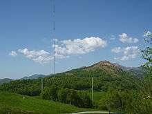 |
Stazione Radio Monte Ceneri | 714.213 | 110.933 | 46°08′25″N 8°55′00″E / 46.140203°N 8.916729°E | |
| Unknown | ISOS casale / piccolo villaggio: Osignano |
Monte Carasso
| KGS No.? |
Picture | Name | Street Address | CH1903 X coordinate | CH1903 Y coordinate | Location |
|---|---|---|---|---|---|---|
| 5617 | _IV.jpg) |
Church of S. Bernardo | 719.570 | 117.006 | 46°11′38″N 8°59′15″E / 46.193893°N 8.98759°E | |
| 5618 | _III.jpg) |
Fortificazioni ottocentesche (dette «Fortini della Fame»; vedi anche Camarino e Sementina) e Chiesa della SS. Trinità |
719.913 | 116.334 | 46°11′16″N 8°59′31″E / 46.187788°N 8.99186°E |
Morbio Inferiore
| KGS No.? |
Picture | Name | Street Address | CH1903 X coordinate | CH1903 Y coordinate | Location |
|---|---|---|---|---|---|---|
| 5624 |  |
Sanctuary of S. Maria Dei Miracoli | Salita Alla Basilica | 722.416 | 079.240 | 45°51′13″N 9°00′53″E / 45.853732°N 9.014625°E |
| 9495 |  |
Secondary School (Scuola media) |
723.191 | 078.432 | 45°50′47″N 9°01′28″E / 45.846325°N 9.02439°E | |
| 11700 | Villa Valsangiacomo, Archeological Site |
722.880 | 078.002 | 45°50′33″N 9°01′13″E / 45.842514°N 9.020276°E |
Morcote
| KGS No.? |
Picture | Name | Street Address | CH1903 X coordinate | CH1903 Y coordinate | Location |
|---|---|---|---|---|---|---|
| 10290 |  |
Chapel of S. Antonio Abate Con Scalinata Monumentale | 714.457 | 086.732 | 45°55′21″N 8°54′50″E / 45.922503°N 8.914°E | |
| 5629, 5628 |  |
Parish Church of S. Maria del Sasso with Oratory | 714.466 | 086.795 | 45°55′23″N 8°54′51″E / 45.923068°N 8.914131°E | |
| 5632 |  |
Cimitero monumentale | 714.513 | 086.868 | 45°55′25″N 8°54′53″E / 45.923716°N 8.914754°E | |
| 9496 | Scherrer Park | 714.210 | 086.901 | 45°55′27″N 8°54′39″E / 45.924064°N 8.910857°E | ||
| Unknown |  |
ISOS villaggio: Morcote |
Muralto
| KGS No.? |
Picture | Name | Street Address | CH1903 X coordinate | CH1903 Y coordinate | Location |
|---|---|---|---|---|---|---|
| 5639 | |
Collegiata Di S. Vittore | Via San Vittore | 705.530 | 114.404 | 46°10′22″N 8°48′19″E / 46.172837°N 8.805164°E |
| 10293 | |
Grand Hotel | via Sempione 15–17 | 705.045 | 114.330 | 46°10′20″N 8°47′56″E / 46.172247°N 8.798869°E |
| 10535 | Vicus | via della Collegiata / via del Municipio | 705.380 | 114.450 | 46°10′24″N 8°48′12″E / 46.173274°N 8.803233°E |
Muzzano
| KGS No.? |
Picture | Name | Street Address | CH1903 X coordinate | CH1903 Y coordinate | Location |
|---|---|---|---|---|---|---|
| Unknown | ISOS villaggio: Muzzano |
Novazzano
| KGS No.? |
Picture | Name | Street Address | CH1903 X coordinate | CH1903 Y coordinate | Location |
|---|---|---|---|---|---|---|
| Unknown | ISOS casale/piccolo villaggio: Brusata |
Onsernone
| KGS No.? |
Picture | Name | Street Address | CH1903 X coordinate | CH1903 Y coordinate | Location |
|---|---|---|---|---|---|---|
| 5424 | Palazzo Della Barca | Comologno | 687.832 | 117.596 | 46°12′15″N 8°34′36″E / 46.204087°N 8.576625°E | |
| 8653 | Museo Onsernonese | Loco, Strada Cantonale | 695.239 | 117.521 | 46°12′09″N 8°40′21″E / 46.202405°N 8.672563°E | |
| Unknown | ISOS villaggio: Auressio | |||||
| Unknown | ISOS villaggio: Berzona | |||||
| Unknown | ISOS villaggio: Loco | |||||
| Unknown | ISOS villaggio: Gresso | |||||
| Unknown | ISOS casale/piccolo villagio: Mosogno di sotto | |||||
| Unknown | ISOS villaggio: Comologno | |||||
| Unknown | ISOS villaggio: Russo |
Origlio
| KGS No.? |
Picture | Name | Street Address | CH1903 X coordinate | CH1903 Y coordinate | Location |
|---|---|---|---|---|---|---|
| Unknown | ISOS villaggio: Origlio |
Orselina
| KGS No.? |
Picture | Name | Street Address | CH1903 X coordinate | CH1903 Y coordinate | Location |
|---|---|---|---|---|---|---|
| 5661, 11764 | |
Sacro Monte, Church of Dell’Annunziata, Convent and Church of Della Madonna del Sasso e Museo |
via Santuario | 704.659 | 114.651 | 46°10′31″N 8°47′38″E / 46.175194°N 8.793943°E |
Personico
| KGS No.? |
Picture | Name | Street Address | CH1903 X coordinate | CH1903 Y coordinate | Location |
|---|---|---|---|---|---|---|
| 10295 |  |
Centrale Elettrica Comandi Biaschina | 714.675 | 135.930 | 46°21′54″N 8°55′44″E / 46.364946°N 8.92885°E |
Ponte Capriasca
| KGS No.? |
Picture | Name | Street Address | CH1903 X coordinate | CH1903 Y coordinate | Location |
|---|---|---|---|---|---|---|
| 5674 | .jpg) |
Parish Church of Di S. Ambrogio | Via Alla Church | 716.909 | 102.294 | 46°03′43″N 8°56′58″E / 46.062043°N 8.949459°E |
Prato Leventina
| KGS No.? |
Picture | Name | Street Address | CH1903 X coordinate | CH1903 Y coordinate | Location |
|---|---|---|---|---|---|---|
| 10297 | Dazio Vecchio | 700.800 | 149.310 | 46°29′15″N 8°45′05″E / 46.487517°N 8.751488°E |
Preonzo
| KGS No.? |
Picture | Name | Street Address | CH1903 X coordinate | CH1903 Y coordinate | Location |
|---|---|---|---|---|---|---|
| Unknown | ISOS villaggio: Preonzo |
Pura
| KGS No.? |
Picture | Name | Street Address | CH1903 X coordinate | CH1903 Y coordinate | Location |
|---|---|---|---|---|---|---|
| 10536 | Luogo di culto ai Monti Mondini | 709.840 | 094.020 | 45°59′20″N 8°51′22″E / 45.988815°N 8.856196°E |
Quinto
| KGS No.? |
Picture | Name | Street Address | CH1903 X coordinate | CH1903 Y coordinate | Location |
|---|---|---|---|---|---|---|
| 5693 |  |
Parish Church of SS. Pietro e Paolo | cripta | 697.666 | 151.871 | 46°30′40″N 8°42′40″E / 46.511016°N 8.711219°E |
| Unknown | ISOS villaggio: Altanca | |||||
| Unknown | ISOS villaggio: Piotta | |||||
| Unknown | ISOS villaggio: Quinto | |||||
| Unknown | ISOS villaggio: Ronco |
Riva San Vitale
| KGS No.? |
Picture | Name | Street Address | CH1903 X coordinate | CH1903 Y coordinate | Location |
|---|---|---|---|---|---|---|
| 5700 |  |
Battistero Di S. Giovanni | Via Settala | 718.910 | 084.825 | 45°54′17″N 8°58′15″E / 45.904584°N 8.970904°E |
| 9144 | Bianchi House | via Formeggie 6 | 718.763 | 086.231 | 45°55′02″N 8°58′10″E / 45.917255°N 8.969364°E | |
| 5701 | |
Church of S. Croce | via Santa Croce | 718.816 | 085.070 | 45°54′24″N 8°58′11″E / 45.906804°N 8.969755°E |
| 9272 | Palazzo della Croce | piazza Valleggio 6 | 718.833 | 085.024 | 45°54′23″N 8°58′12″E / 45.906388°N 8.969963°E | |
| Unknown | ISOS borgo: Riva San Vitale |
Rovio
| KGS No.? |
Picture | Name | Street Address | CH1903 X coordinate | CH1903 Y coordinate | Location |
|---|---|---|---|---|---|---|
| 5710 | |
Oratory of S. Vigilio | Via San Vigilio | 719.890 | 087.987 | 45°55′58″N 8°59′04″E / 45.932849°N 8.984332°E |
| Unknown | ISOS villaggio: Rovio |
Sant'Antonio
| KGS No.? |
Picture | Name | Street Address | CH1903 X coordinate | CH1903 Y coordinate | Location |
|---|---|---|---|---|---|---|
| 5717 | Antica Miniera A Carena | 728.460 | 114.040 | 46°09′56″N 9°06′07″E / 46.165581°N 9.101906°E |
Sementina
| KGS No.? |
Picture | Name | Street Address | CH1903 X coordinate | CH1903 Y coordinate | Location |
|---|---|---|---|---|---|---|
| 10537 | |
Fortificazioni Ottocentesche (Dette «Fortini Della Fame»; Vedi Anche Camorino E Monte Carasso) |
720.500 | 115.425 | 46°10′46″N 8°59′57″E / 46.179508°N 8.999227°E | |
| Unknown | Medieval Settlement of S. Defendente | 719.913 | 116.334 | 46°11′16″N 8°59′31″E / 46.187788°N 8.99186°E |
Serravalle
| KGS No.? |
Picture | Name | Street Address | CH1903 X coordinate | CH1903 Y coordinate | Location |
|---|---|---|---|---|---|---|
| 5572 |  |
Casa dei pagani (Castle built into a cave) |
Malvaglia | 718.960 | 141.120 | 46°24′39″N 8°59′09″E / 46.410879°N 8.985849°E |
| 5570 | |
Parish Church of S. Martino with Ossuary and Churchyard |
Malvaglia | 718.808 | 140.303 | 46°24′13″N 8°59′01″E / 46.403558°N 8.983664°E |
| 5725 | .jpg) |
Parish Church of S. Maria Assunta with Ossuary | Semione, Via Cantonale | 717.898 | 140.766 | 46°24′28″N 8°58′19″E / 46.407882°N 8.97195°E |
| 5727 | Oratory of S. Maria Bambina a Navone | Semione | 717.038 | 141.528 | 46°24′54″N 8°57′39″E / 46.414886°N 8.960961°E | |
| 5726 | |
Rovine del castello di Serravalle | Semione | 717.962 | 141.254 | 46°24′44″N 8°58′22″E / 46.41226°N 8.972907°E |
| Unknown | ISOS villaggio: Rongie/Orino | |||||
| Unknown | ISOS caso particolare: Val Malvaglia | |||||
| Unknown | ISOS villaggio: Semione | |||||
| Unknown | ISOS casale / piccolo villaggio: Navone |
Sessa
| KGS No.? |
Picture | Name | Street Address | CH1903 X coordinate | CH1903 Y coordinate | Location |
|---|---|---|---|---|---|---|
| Unknown | ISOS villaggio: Sessa |
Sonogno
| KGS No.? |
Picture | Name | Street Address | CH1903 X coordinate | CH1903 Y coordinate | Location |
|---|---|---|---|---|---|---|
| Unknown | ISOS villaggio: Sonogno |
Stabio
| KGS No.? |
Picture | Name | Street Address | CH1903 X coordinate | CH1903 Y coordinate | Location |
|---|---|---|---|---|---|---|
| Unknown | ISOS borgo: Stabio |
Terre di Pedemonte
| KGS No.? |
Picture | Name | Street Address | CH1903 X coordinate | CH1903 Y coordinate | Location |
|---|---|---|---|---|---|---|
| 5752 |  |
Castelliere, Scattered Prehistoric Items and Roman Buildings |
701.200 | 116.250 | 46°11′24″N 8°44′58″E / 46.190104°N 8.749505°E | |
| Unknown | ISOS village: Verscio |
Vezia
| KGS No.? |
Picture | Name | Street Address | CH1903 X coordinate | CH1903 Y coordinate | Location |
|---|---|---|---|---|---|---|
| 10515 | |
S. Martino, Medieval Settlement and Place of Worship |
716.310 | 098.310 | 46°01′35″N 8°56′27″E / 46.026316°N 8.940735°E | |
| 5764 | |
Villa Negroni with park | 715.945 | 098.491 | 46°01′41″N 8°56′10″E / 46.028006°N 8.936067°E |
References
- All entries, addresses and coordinates are from: "Kantonsliste A-Objekte". KGS Inventar (in German). Federal Office of Civil Protection. 2009. Retrieved 25 April 2011.
External links
- Swiss Inventory of Cultural Property of National and Regional Significance, 2009 edition:
- "Revision of the PCP Inventory (Revision des KGS-Inventars)". KGS Forum. Federal Office of Civil Protection (13/2008). 2008.
This article is issued from Wikipedia - version of the 8/12/2016. The text is available under the Creative Commons Attribution/Share Alike but additional terms may apply for the media files.