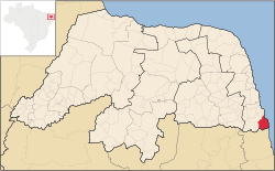
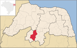
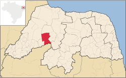
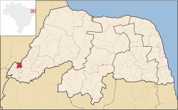
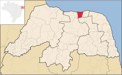
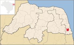
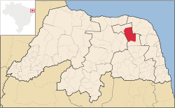
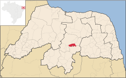
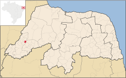
List of municipalities in Rio Grande do Norte
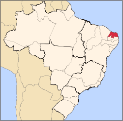
A picture of the east end of Brazil.
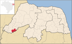
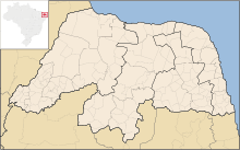
A map of the official subdivisions of Rio Grande do Norte

Rio Grande do Norte (English: Great River of the North)[1] is a state located in the Northeast Region of Brazil. According to the 2010 Census conducted by the Brazilian Institute of Geography and Statistics (IBGE), Rio Grande do Norte has a population of 3,168,133 inhabitants over 52,797 square kilometres (20,385 sq mi), which makes it the 16th largest state by population and the 22nd largest by area, out of 26 states.[2][3][4][5] It is home to cities such as Natal, Mossoró, and São Gonçalo do Amarante.

The land that became Rio Grande do Norte was a donatário to João de Barros, the factor of the House of India and Mina, from John III of Portugal in 1535;[6] prior to that, the Portuguese Crown owned the land.[7] The French, who trafficked Brazil wood in the area, had a foothold on the land until the Portuguese expelled them in 1598.[6] The Dutch took the land in 1634 as a part of Dutch Brazil and reigned until 1654, when they were defeated by the Portuguese.[8] In 1701, Rio Grande do Norte joined the Captaincy of Pernambuco, and became a province in 1822 and a state of Brazil in 1889.[6] In the DK Eyewitness Travel Guide, Alex Robinson and Christopher Pickard describe tourism as a "real growth industry" in the state.[9]

Rio Grande do Norte is divided into 167 municipalities, which are grouped into four mesoregions and 23 microregions. Of the 167 municipalities, Natal has the highest population, with 803,811 inhabitants, while Viçosa, with 1,618 inhabitants, has the lowest. The largest municipality by area is Mossoró, with an area of 2,110 square kilometres (815 sq mi); the smallest is Senador Georgino Avelino, named after the former Senator and Rio Grande do Norte Governor José Georgino Avelino,[10] which covers an area of 26 square kilometres (10 sq mi).

Municipalities
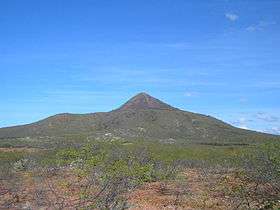
An extinct volcano with sparse greenery in the foreground
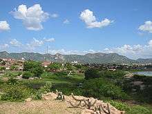
Pico do Cabugi, an extinct volcano in Angicos
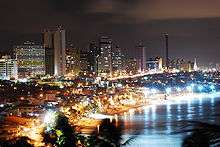
Natal pictured at night, by a body of water
Natal, the capital of Rio Grande do Norte
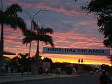
A street in Parelhas, with palm trees and buildings, and a banner stating "150 Anos" (150 years) across the street, at sunset
Parelhas celebrating the 150th anniversary of its founding
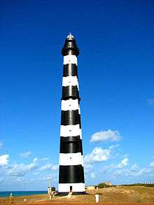
A black-and-white striped lighthouse, with the sea in the background
The Calcanhar Lighthouse, the largest traditional lighthouse in Brazil,[11] located in Touros
Map (coordinates)[12] Municipality Area
(square kilometers) (square miles)[5]
Population[4] Mesoregion[5] Microregion[5]
6°26′8″S 36°38′20″W / 6.43556°S 36.63889°W / -6.43556; -36.63889 Acari 608.565 (234.967) 11,035 Central Potiguar Seridó Oriental
5°29′54″S 36°30′20″W / 5.49833°S 36.50556°W / -5.49833; -36.50556 Afonso Bezerra 576.248 (222.489) 10,879 Central Potiguar Angicos
6°12′33″S 38°17′50″W / 6.20917°S 38.29722°W / -6.20917; -38.29722 Água Nova 50.683 (19.569) 2,984 Oeste Potiguar Serra de São Miguel
6°24′45″S 38°0′57″W / 6.41250°S 38.01583°W / -6.41250; -38.01583 Alexandria 381.202 (147.182) 13,475 Oeste Potiguar Pau dos Ferros
6°9′8″S 37°45′58″W / 6.15222°S 37.76611°W / -6.15222; -37.76611 Almino Afonso 128.029 (49.432) 4,880 Oeste Potiguar Umarizal
5°17′18″S 36°45′44″W / 5.28833°S 36.76222°W / -5.28833; -36.76222 Alto do Rodrigues 191.311 (73.865) 12,306 Oeste Potiguar Vale do Açu
5°39′56″S 36°36′4″W / 5.66556°S 36.60111°W / -5.66556; -36.60111 Angicos 741.654 (286.353) 11,553 Central Potiguar Angicos
6°12′46″S 37°54′20″W / 6.21278°S 37.90556°W / -6.21278; -37.90556 Antônio Martins 244.620 (94.448) 6,907 Oeste Potiguar Umarizal
5°39′51″S 37°47′56″W / 5.66417°S 37.79889°W / -5.66417; -37.79889 Apodi 1,602.659 (618.787) 34,777 Oeste Potiguar Chapada do Apodi
4°57′22″S 37°8′13″W / 4.95611°S 37.13694°W / -4.95611; -37.13694 Areia Branca 357.580 (138.062) 25,263 Oeste Potiguar Mossoró
6°11′40″S 35°9′37″W / 6.19444°S 35.16028°W / -6.19444; -35.16028 Arês 112.584 (43.469) 12,931 Leste Potiguar Litoral Sul
5°34′36″S 36°54′31″W / 5.57667°S 36.90861°W / -5.57667; -36.90861 Assu 1,269.235 (490.052) 53,245 Oeste Potiguar Vale do Açu
6°22′10″S 35°0′28″W / 6.36944°S 35.00778°W / -6.36944; -35.00778 Baía Formosa 245.510 (94.791) 8,569 Leste Potiguar Litoral Sul
5°4′48″S 37°37′0″W / 5.08000°S 37.61667°W / -5.08000; -37.61667 Baraúna 825.802 (318.842) 24,187 Oeste Potiguar Mossoró
5°52′2″S 35°55′35″W / 5.86722°S 35.92639°W / -5.86722; -35.92639 Barcelona 152.629 (58.930) 3,957 Agreste Potiguar Borborema Potiguar
5°41′38″S 35°49′11″W / 5.69389°S 35.81972°W / -5.69389; -35.81972 Bento Fernandes 301.075 (116.245) 5,110 Agreste Potiguar Baixa Verde
6°9′30″S 35°36′2″W / 6.15833°S 35.60056°W / -6.15833; -35.60056 Boa Saúde 187.211 (72.282) 9,009 Agreste Potiguar Agreste Potiguar
5°59′18″S 36°24′47″W / 5.98833°S 36.41306°W / -5.98833; -36.41306 Bodó 253.513 (97.881) 2,425 Central Potiguar Serra de Santana
5°59′2″S 35°34′53″W / 5.98389°S 35.58139°W / -5.98389; -35.58139 Bom Jesus 122.033 (47.117) 9,432 Agreste Potiguar Agreste Potiguar
6°11′27″S 35°21′24″W / 6.19083°S 35.35667°W / -6.19083; -35.35667 Brejinho 58.528 (22.598) 11,577 Agreste Potiguar Agreste Potiguar
5°3′52″S 36°3′21″W / 5.06444°S 36.05583°W / -5.06444; -36.05583 Caiçara do Norte 189.415 (73.133) 6,016 Central Potiguar Macau
5°45′37″S 35°59′54″W / 5.76028°S 35.99833°W / -5.76028; -35.99833 Caiçara do Rio do Vento 261.191 (100.846) 3,304 Central Potiguar Angicos
6°27′30″S 37°5′52″W / 6.45833°S 37.09778°W / -6.45833; -37.09778 Caicó 1,228.574 (474.352) 62,727 Central Potiguar Seridó Ocidental
5°51′50″S 37°18′36″W / 5.86389°S 37.31000°W / -5.86389; -37.31000 Campo Grande 896.962 (346.317) 9,289 Oeste Potiguar Médio Oeste
6°14′29″S 36°10′57″W / 6.24139°S 36.18250°W / -6.24139; -36.18250 Campo Redondo 213.629 (82.482) 10,266 Agreste Potiguar Borborema Potiguar
6°22′48″S 35°7′44″W / 6.38000°S 35.12889°W / -6.38000; -35.12889 Canguaretama 245.529 (94.799) 30,900 Leste Potiguar Litoral Sul
5°47′33″S 37°33′24″W / 5.79250°S 37.55667°W / -5.79250; -37.55667 Caraúbas 1,095.001 (422.780) 19,582 Oeste Potiguar Chapada do Apodi
6°33′20″S 36°35′42″W / 6.55556°S 36.59500°W / -6.55556; -36.59500 Carnaúba dos Dantas 245.648 (94.845) 7,429 Central Potiguar Seridó Oriental
5°20′24″S 36°50′24″W / 5.34000°S 36.84000°W / -5.34000; -36.84000 Carnaubais 529.835 (204.569) 9,775 Oeste Potiguar Vale do Açu
5°38′4″S 35°25′2″W / 5.63444°S 35.41722°W / -5.63444; -35.41722 Ceará-Mirim 739.686 (285.593) 67,844 Leste Potiguar Macaíba
6°2′44″S 36°20′45″W / 6.04556°S 36.34583°W / -6.04556; -36.34583 Cerro Corá 393.569 (151.957) 10,916 Central Potiguar Serra de Santana
6°22′57″S 36°12′53″W / 6.38250°S 36.21472°W / -6.38250; -36.21472 Coronel Ezequiel 185.752 (71.719) 5,405 Agreste Potiguar Borborema Potiguar
6°15′35″S 38°26′37″W / 6.25972°S 38.44361°W / -6.25972; -38.44361 Coronel João Pessoa 117.140 (45.228) 4,774 Oeste Potiguar Serra de São Miguel
6°24′42″S 36°47′23″W / 6.41167°S 36.78972°W / -6.41167; -36.78972 Cruzeta 295.829 (114.220) 7,968 Central Potiguar Seridó Oriental
6°24′42″S 36°47′23″W / 6.41167°S 36.78972°W / -6.41167; -36.78972 Currais Novos 864.431 (333.757) 42,668 Central Potiguar Seridó Oriental
6°5′40″S 38°22′29″W / 6.09444°S 38.37472°W / -6.09444; -38.37472 Doutor Severiano 108.277 (41.786) 6,495 Oeste Potiguar Serra de São Miguel
6°6′38″S 38°18′19″W / 6.11056°S 38.30528°W / -6.11056; -38.30528 Encanto 125.747 (48.555) 5,228 Oeste Potiguar Serra de São Miguel
6°56′42″S 36°43′6″W / 6.94500°S 36.71833°W / -6.94500; -36.71833 Equador 264.983 (102.310) 5,822 Central Potiguar Seridó Oriental
6°19′56″S 35°18′34″W / 6.33222°S 35.30944°W / -6.33222; -35.30944 Espírito Santo 143.673 (55.472) 10,480 Leste Potiguar Litoral Sul
5°42′20″S 35°18′26″W / 5.70556°S 35.30722°W / -5.70556; -35.30722 Extremoz 125.665 (48.519) 24,550 Leste Potiguar Natal
5°36′9″S 37°41′19″W / 5.60250°S 37.68861°W / -5.60250; -37.68861 Felipe Guerra 268.427 (103.640) 5,734 Oeste Potiguar Chapada do Apodi
5°41′50″S 36°31′52″W / 5.69722°S 36.53111°W / -5.69722; -36.53111 Fernando Pedroza 322.540 (124.533) 2,850 Central Potiguar Angicos
6°7′38″S 36°49′5″W / 6.12722°S 36.81806°W / -6.12722; -36.81806 Florânia 504.022 (194.603) 9,672 Central Potiguar Serra de Santana
6°4′42″S 38°7′10″W / 6.07833°S 38.11944°W / -6.07833; -38.11944 Francisco Dantas 181.593 (70.113) 2,874 Oeste Potiguar Pau dos Ferros
6°9′30″S 37°53′23″W / 6.15833°S 37.88972°W / -6.15833; -37.88972 Frutuoso Gomes 63.278 (24.432) 4,233 Oeste Potiguar Umarizal
5°5′26″S 36°16′31″W / 5.09056°S 36.27528°W / -5.09056; -36.27528 Galinhos 342.442 (132.217) 2,150 Central Potiguar Macau
6°15′53″S 35°12′35″W / 6.26472°S 35.20972°W / -6.26472; -35.20972 Goianinha 192.227 (74.219) 22,467 Leste Potiguar Litoral Sul
5°27′32″S 37°31′15″W / 5.45889°S 37.52083°W / -5.45889; -37.52083 Governador Dix-Sept Rosado 1,129.373 (436.051) 12,373 Oeste Potiguar Chapada do Apodi
4°58′47″S 37°9′17″W / 4.97972°S 37.15472°W / -4.97972; -37.15472 Grossos 126.451 (48.823) 9,393 Oeste Potiguar Mossoró
5°6′27″S 36°19′13″W / 5.10750°S 36.32028°W / -5.10750; -36.32028 Guamaré 259.181 (100.070) 12,431 Central Potiguar Macau
5°49′27″S 35°33′10″W / 5.82417°S 35.55278°W / -5.82417; -35.55278 Ielmo Marinho 305.185 (117.832) 12,188 Agreste Potiguar Agreste Potiguar
5°29′54″S 36°51′18″W / 5.49833°S 36.85500°W / -5.49833; -36.85500 Ipanguaçu 374.239 (144.494) 13,855 Oeste Potiguar Vale do Açu
6°48′51″S 37°11′56″W / 6.81417°S 37.19889°W / -6.81417; -37.19889 Ipueira 127.347 (46.169) 2,074 Central Potiguar Seridó Ocidental
5°38′39″S 36°52′17″W / 5.64417°S 36.87139°W / -5.64417; -36.87139 Itajá 203.623 (78.619) 6,952 Oeste Potiguar Vale do Açu
5°50′23″S 37°59′24″W / 5.83972°S 37.99000°W / -5.83972; -37.99000 Itaú 133.032 (51.364) 5,568 Oeste Potiguar Pau dos Ferros
6°25′33″S 36°12′18″W / 6.42583°S 36.20500°W / -6.42583; -36.20500 Jaçanã 54.558 (21.065) 7,925 Agreste Potiguar Borborema Potiguar
5°21′23″S 36°7′41″W / 5.35639°S 36.12806°W / -5.35639; -36.12806 Jandaíra 435.678 (168.215) 6,796 Agreste Potiguar Baixa Verde
6°00′56″S 37°24′32″W / 6.01556°S 37.40889°W / -6.01556; -37.40889 Janduís 304.899 (117.722) 5,350 Oeste Potiguar Médio Oeste
6°27′54″S 35°56′48″W / 6.46500°S 35.94667°W / -6.46500; -35.94667 Japi 188.990 (72.969) 5,522 Agreste Potiguar Borborema Potiguar
5°39′13″S 35°58′8″W / 5.65361°S 35.96889°W / -5.65361; -35.96889 Jardim de Angicos 254.045 (98.087) 2,607 Central Potiguar Angicos
6°22′43″S 37°21′7″W / 6.37861°S 37.35194°W / -6.37861; -37.35194 Jardim de Piranhas 330.553 (127.627) 13,511 Central Potiguar Seridó Ocidental
6°35′4″S 36°46′28″W / 6.58444°S 36.77444°W / -6.58444; -36.77444 Jardim do Seridó 368.643 (142.333) 12,115 Central Potiguar Seridó Oriental
5°32′15″S 35°49′11″W / 5.53750°S 35.81972°W / -5.53750; -35.81972 João Câmara 714.951 (276.043) 32,203 Agreste Potiguar Baixa Verde
6°16′28″S 37°47′46″W / 6.27444°S 37.79611°W / -6.27444; -37.79611 João Dias 88.173 (34.044) 2,601 Oeste Potiguar Umarizal
6°19′0″S 38°16′53″W / 6.31667°S 38.28139°W / -6.31667; -38.28139 José da Penha 117.634 (45.418) 5,868 Oeste Potiguar Pau dos Ferros
6°2′2″S 37°1′13″W / 6.03389°S 37.02028°W / -6.03389; -37.02028 Jucurutu 933.718 (360.509) 17,692 Oeste Potiguar Vale do Açu
6°16′19″S 35°19′37″W / 6.27194°S 35.32694°W / -6.27194; -35.32694 Jundiá 45.261 (17.475) 3,585 Agreste Potiguar Agreste Potiguar
6°26′28″S 35°35′54″W / 6.44111°S 35.59833°W / -6.44111; -35.59833 Lagoa d'Anta 105.650 (40.791) 6,227 Agreste Potiguar Agreste Potiguar
6°8′57″S 35°26′16″W / 6.14917°S 35.43778°W / -6.14917; -35.43778 Lagoa de Pedras 117.660 (45.429) 6,992 Agreste Potiguar Agreste Potiguar
6°0′14″S 35°52′18″W / 6.00389°S 35.87167°W / -6.00389; -35.87167 Lagoa de Velhos 112.832 (43.564) 2,632 Agreste Potiguar Borborema Potiguar
6°7′16″S 35°28′38″W / 6.12111°S 35.47722°W / -6.12111; -35.47722 Lagoa Nova 176.299 (68.069) 13,990 Central Potiguar Serra de Santana
6°7′15″S 35°28′38″W / 6.12083°S 35.47722°W / -6.12083; -35.47722 Lagoa Salgada 79.515 (30.701) 7,515 Agreste Potiguar Agreste Potiguar
5°42′0″S 36°14′41″W / 5.70000°S 36.24472°W / -5.70000; -36.24472 Lajes 676.417 (261.165) 10,385 Central Potiguar Angicos
6°9′1″S 36°7′2″W / 6.15028°S 36.11722°W / -6.15028; -36.11722 Lajes Pintadas 120.308 (46.451) 4,614 Agreste Potiguar Borborema Potiguar
6°7′12″S 37°48′56″W / 6.12000°S 37.81556°W / -6.12000; -37.81556 Lucrécia 30.935 (11.944) 3,633 Oeste Potiguar Umarizal
6°24′50″S 38°23′19″W / 6.41389°S 38.38861°W / -6.41389; -38.38861 Luís Gomes 166.637 (64.235) 9,612 Oeste Potiguar Serra de São Miguel
5°51′30″S 35°21′14″W / 5.85833°S 35.35389°W / -5.85833; -35.35389 Macaíba 512.487 (197.871) 69,538 Leste Potiguar Macaíba
5°6′54″S 36°38′4″W / 5.11500°S 36.63444°W / -5.11500; -36.63444 Macau 788.022 (304.255) 28,974 Central Potiguar Macau
6°24′22″S 38°19′26″W / 6.40611°S 38.32389°W / -6.40611; -38.32389 Major Sales 31.971 (12.344) 3,536 Oeste Potiguar Serra de São Miguel
6°17′39″S 38°10′2″W / 6.29417°S 38.16722°W / -6.29417; -38.16722 Marcelino Vieira 345.707 (133.477) 8,265 Oeste Potiguar Pau dos Ferros
6°5′16″S 37°54′40″W / 6.08778°S 37.91111°W / -6.08778; -37.91111 Martins 169.446 (65.423) 8,228 Oeste Potiguar Umarizal
5°31′2″S 35°15′23″W / 5.51722°S 35.25639°W / -5.51722; -35.25639 Maxaranguape 131.300 (50.695) 10,442 Leste Potiguar Litoral Nordeste
6°4′44″S 37°30′15″W / 6.07889°S 37.50417°W / -6.07889; -37.50417 Messias Targino 135.094 (52.160) 4,188 Oeste Potiguar Médio Oeste
6°29′9″S 35°17′15″W / 6.48583°S 35.28750°W / -6.48583; -35.28750 Montanhas 82.213 (31.742) 11,418 Leste Potiguar Litoral Sul
6°4′4″S 35°19′56″W / 6.06778°S 35.33222°W / -6.06778; -35.33222 Monte Alegre 199.519 (77.034) 20,670 Agreste Potiguar Agreste Potiguar
6°26′29″S 35°46′57″W / 6.44139°S 35.78250°W / -6.44139; -35.78250 Monte das Gameleiras 71.945 (27.778) 2,266 Agreste Potiguar Borborema Potiguar
5°11′15″S 37°20′39″W / 5.18750°S 37.34417°W / -5.18750; -37.34417 Mossoró 2,110.207 (814.751) 259,886 Oeste Potiguar Mossoró
5°47′42″S 35°12′34″W / 5.79500°S 35.20944°W / -5.79500; -35.20944 Natal 170.298 (65.752) 803,811 Leste Potiguar Natal
6°5′28″S 35°12′31″W / 6.09111°S 35.20861°W / -6.09111; -35.20861 Nísia Floresta 306.051 (118.166) 23,818 Leste Potiguar Macaíba
6°28′41″S 35°26′2″W / 6.47806°S 35.43389°W / -6.47806; -35.43389 Nova Cruz 277.657 (107.203) 35,541 Agreste Potiguar Agreste Potiguar
5°57′23″S 37°42′20″W / 5.95639°S 37.70556°W / -5.95639; -37.70556 Olho-d'Água do Borges 141.170 (54.506) 4,301 Oeste Potiguar Umarizal
6°42′4″S 36°56′44″W / 6.70111°S 36.94556°W / -6.70111; -36.94556 Ouro Branco 253.300 (97.799) 4,699 Central Potiguar Seridó Oriental
6°29′11″S 38°18′47″W / 6.48639°S 38.31306°W / -6.48639; -38.31306 Paraná 81.390 (31.425) 3,952 Oeste Potiguar Pau dos Ferros
5°46′28″S 37°6′5″W / 5.77444°S 37.10139°W / -5.77444; -37.10139 Paraú 410.858 (158.632) 3,862 Oeste Potiguar Médio Oeste
5°13′23″S 35°50′18″W / 5.22306°S 35.83833°W / -5.22306; -35.83833 Parazinho 274.668 (106.057) 4,845 Agreste Potiguar Baixa Verde
6°41′16″S 36°39′27″W / 6.68778°S 36.65750°W / -6.68778; -36.65750 Parelhas 513.052 (198.089) 20,670 Central Potiguar Seridó Ocidental
5°54′56″S 35°15′46″W / 5.91556°S 35.26278°W / -5.91556; -35.26278 Parnamirim 120.202 (46.410) 202,413 Leste Potiguar Natal
6°26′8″S 35°38′36″W / 6.43556°S 35.64333°W / -6.43556; -35.64333 Passa e Fica 42.137 (16.269) 11,111 Agreste Potiguar Agreste Potiguar
6°16′44″S 35°22′39″W / 6.27889°S 35.37750°W / -6.27889; -35.37750 Passagem 41.235 (15.921) 2,899 Agreste Potiguar Agreste Potiguar
6°6′36″S 37°18′12″W / 6.11000°S 37.30333°W / -6.11000; -37.30333 Patu 319.932 (123.526) 11,964 Oeste Potiguar Umarizal
6°6′33″S 38°12′16″W / 6.10917°S 38.20444°W / -6.10917; -38.20444 Pau dos Ferros 259.960 (100.371) 27,733 Oeste Potiguar Pau dos Ferros
5°9′1″S 35°52′44″W / 5.15028°S 35.87889°W / -5.15028; -35.87889 Pedra Grande 221.429 (85.494) 3,521 Leste Potiguar Litoral Nordeste
5°34′57″S 36°6′17″W / 5.58250°S 36.10472°W / -5.58250; -36.10472 Pedra Preta 294.979 (113.891) 2,583 Central Potiguar Angicos
5°31′18″S 36°23′17″W / 5.52167°S 36.38806°W / -5.52167; -36.38806 Pedro Avelino 952.688 (367.833) 7,168 Central Potiguar Angicos
6°26′21″S 35°13′17″W / 6.43917°S 35.22139°W / -6.43917; -35.22139 Pedro Velho 192.707 (74.404) 14,119 Leste Potiguar Litoral Sul
5°15′36″S 36°43′20″W / 5.26000°S 36.72222°W / -5.26000; -36.72222 Pendências 419.141 (161.830) 13,436 Oeste Potiguar Vale do Açu
6°16′7″S 38°2′36″W / 6.26861°S 38.04333°W / -6.26861; -38.04333 Pilões 82.691 (31.927) 3,453 Oeste Potiguar Pau dos Ferros
5°37′22″S 35°39′46″W / 5.62278°S 35.66278°W / -5.62278; -35.66278 Poço Branco 230.730 (89.085) 13,947 Agreste Potiguar Baixa Verde
6°1′26″S 37°59′16″W / 6.02389°S 37.98778°W / -6.02389; -37.98778 Portalegre 110.052 (42.491) 7,297 Oeste Potiguar Pau dos Ferros
5°4′4″S 36°46′54″W / 5.06778°S 36.78167°W / -5.06778; -36.78167 Porto do Mangue 418.636 (161.635) 5,217 Oeste Potiguar Vale do Açu
5°28′1″S 35°33′22″W / 5.46694°S 35.55611°W / -5.46694; -35.55611 Pureza 504.317 (194.717) 8,432 Leste Potiguar Litoral Nordeste
6°11′41″S 38°13′33″W / 6.19472°S 38.22583°W / -6.19472; -38.22583 Rafael Fernandes 78.230 (30.205) 4,692 Oeste Potiguar Pau dos Ferros
6°4′32″S 37°43′0″W / 6.07556°S 37.71667°W / -6.07556; -37.71667 Rafael Godeiro 100.073 (38.638) 3,070 Oeste Potiguar Umarizal
5°56′11″S 37°56′47″W / 5.93639°S 37.94639°W / -5.93639; -37.94639 Riacho da Cruz 127.221 (49.120) 3,165 Oeste Potiguar Pau dos Ferros
6°15′48″S 38°18′56″W / 6.26333°S 38.31556°W / -6.26333; -38.31556 Riacho de Santana 128.104 (49.461) 4,157 Oeste Potiguar Serra de São Miguel
5°48′54″S 35°49′30″W / 5.81500°S 35.82500°W / -5.81500; -35.82500 Riachuelo 262.873 (101.495) 7,067 Agreste Potiguar Agreste Potiguar
5°16′22″S 35°22′59″W / 5.27278°S 35.38306°W / -5.27278; -35.38306 Rio do Fogo 150.282 (58.024) 10,060 Leste Potiguar Litoral Nordeste
5°47′17″S 38°3′36″W / 5.78806°S 38.06000°W / -5.78806; -38.06000 Rodolfo Fernandes 154.840 (59.784) 4,417 Oeste Potiguar Pau dos Ferros
5°52′53″S 35°56′5″W / 5.88139°S 35.93472°W / -5.88139; -35.93472 Ruy Barbosa 125.813 (48.576) 3,595 Agreste Potiguar Borborema Potiguar
6°13′46″S 36°1′22″W / 6.22944°S 36.02278°W / -6.22944; -36.02278 Santa Cruz 624.390 (241.077) 35,759 Agreste Potiguar Borborema Potiguar
5°50′23″S 35°41′43″W / 5.83972°S 35.69528°W / -5.83972; -35.69528 Santa Maria 219.572 (84.777) 4,762 Agreste Potiguar Agreste Potiguar
5°57′27″S 36°39′20″W / 5.95750°S 36.65556°W / -5.95750; -36.65556 Santana do Matos 1,420.313 (548.383) 13,798 Central Potiguar Serra de Santana
6°46′14″S 36°44′0″W / 6.77056°S 36.73333°W / -6.77056; -36.73333 Santana do Seridó 188.402 (72.742) 2,526 Central Potiguar Seridó Oriental
6°18′38″S 35°28′44″W / 6.31056°S 35.47889°W / -6.31056; -35.47889 Santo Antônio 301.052 (116.236) 22,214 Agreste Potiguar Agreste Potiguar
5°3′59″S 36°2′17″W / 5.06639°S 36.03806°W / -5.06639; -36.03806 São Bento do Norte 288.637 (111.443) 2,974 Central Potiguar Macau
6°20′30″S 36°5′14″W / 6.34167°S 36.08722°W / -6.34167; -36.08722 São Bento do Trairi 190.816 (73.674) 3,909 Agreste Potiguar Borborema Potiguar
6°22′35″S 37°11′4″W / 6.37639°S 37.18444°W / -6.37639; -37.18444 São Fernando 404.415 (156.145) 3,401 Central Potiguar Seridó Ocidental
5°58′30″S 38°9′6″W / 5.97500°S 38.15167°W / -5.97500; -38.15167 São Francisco do Oeste 75.550 (29.170) 3,874 Oeste Potiguar Pau dos Ferros
5°47′36″S 35°19′46″W / 5.79333°S 35.32944°W / -5.79333; -35.32944 São Gonçalo do Amarante 251.308 (97.030) 87,700 Leste Potiguar Macaíba
6°43′6″S 37°12′2″W / 6.71833°S 37.20056°W / -6.71833; -37.20056 São João do Sabugi 277.010 (106.954) 5,914 Central Potiguar Seridó Ocidental
6°4′29″S 35°14′16″W / 6.07472°S 35.23778°W / -6.07472; -35.23778 São José de Mipibu 293.877 (113.466) 39,771 Leste Potiguar Macaíba
5°47′36″S 35°42′50″W / 5.79333°S 35.71389°W / -5.79333; -35.71389 São José do Campestre 341.403 (131.816) 12,359 Agreste Potiguar Borborema Potiguar
6°26′57″S 36°52′40″W / 6.44917°S 36.87778°W / -6.44917; -36.87778 São José do Seridó 174.504 (67.376) 4,231 Central Potiguar Seridó Oriental
6°12′43″S 38°29′49″W / 6.21194°S 38.49694°W / -6.21194; -38.49694 São Miguel 171.690 (66.290) 22,159 Oeste Potiguar Serra de São Miguel
5°7′29″S 35°38′21″W / 5.12472°S 35.63917°W / -5.12472; -35.63917 São Miguel do Gostoso 342.445 (132.218) 8,659 Leste Potiguar Litoral Nordeste
5°53′42″S 35°45′46″W / 5.89500°S 35.76278°W / -5.89500; -35.76278 São Paulo do Potengi 240.435 (92.832) 15,866 Agreste Potiguar Agreste Potiguar
5°53′53″S 35°38′4″W / 5.89806°S 35.63444°W / -5.89806; -35.63444 São Pedro 195.238 (75.381) 6,223 Agreste Potiguar Agreste Potiguar
5°47′58″S 36°55′14″W / 5.79944°S 36.92056°W / -5.79944; -36.92056 São Rafael 469.096 (181.118) 8,106 Oeste Potiguar Vale do Açu
5°58′21″S 36°4′31″W / 5.97250°S 36.07528°W / -5.97250; -36.07528 São Tomé 862.577 (333.041) 10,868 Agreste Potiguar Borborema Potiguar
6°13′2″S 36°41′4″W / 6.21722°S 36.68444°W / -6.21722; -36.68444 São Vicente 197.814 (76.376) 6,030 Central Potiguar Serra de Santana
6°2′8″S 35°41′34″W / 6.03556°S 35.69278°W / -6.03556; -35.69278 Senador Elói de Souza 167.592 (64.707) 5,645 Agreste Potiguar Agreste Potiguar
6°9′46″S 35°7′21″W / 6.16278°S 35.12250°W / -6.16278; -35.12250 Senador Georgino Avelino 26.383 (10.186) 3,924 Leste Potiguar Litoral Sul
6°6′21″S 35°42′46″W / 6.10583°S 35.71278°W / -6.10583; -35.71278 Serra Caiada 167.348 (64.613) 8,774 Agreste Potiguar Agreste Potiguar
6°25′2″S 35°42′16″W / 6.41722°S 35.70444°W / -6.41722; -35.70444 Serra de São Bento 96.635 (37.311) 5,746 Agreste Potiguar Borborema Potiguar
5°10′12″S 37°1′46″W / 5.17000°S 37.02944°W / -5.17000; -37.02944 Serra do Mel 616.509 (238.034) 10,281 Oeste Potiguar Mossoró
6°39′56″S 37°23′50″W / 6.66556°S 37.39722°W / -6.66556; -37.39722 Serra Negra do Norte 562.935 (217.349) 7,770 Central Potiguar Seridó Ocidental
6°16′34″S 35°29′56″W / 6.27611°S 35.49889°W / -6.27611; -35.49889 Serrinha 193.352 (74.653) 6,581 Agreste Potiguar Agreste Potiguar
6°6′36″S 37°57′23″W / 6.11000°S 37.95639°W / -6.11000; -37.95639 Serrinha dos Pintos 122.644 (47.353) 4,538 Oeste Potiguar Umarizal
5°46′38″S 37°57′28″W / 5.77722°S 37.95778°W / -5.77722; -37.95778 Severiano Melo 157.833 (60.939) 5,752 Oeste Potiguar Pau dos Ferros
6°6′14″S 35°54′40″W / 6.10389°S 35.91111°W / -6.10389; -35.91111 Sítio Novo 213.470 (82.421) 5,020 Agreste Potiguar Borborema Potiguar
5°55′48″S 38°2′42″W / 5.93000°S 38.04500°W / -5.93000; -38.04500 Taboleiro Grande 124.094 (47.913) 2,317 Oeste Potiguar Pau dos Ferros
5°37′18″S 35°35′48″W / 5.62167°S 35.59667°W / -5.62167; -35.59667 Taipu 352.818 (136.223) 11,836 Leste Potiguar Litoral Nordeste
6°11′58″S 35°48′6″W / 6.19944°S 35.80167°W / -6.19944; -35.80167 Tangará 156.780 (60.533) 14,175 Agreste Potiguar Borborema Potiguar
6°27′54″S 38°10′47″W / 6.46500°S 38.17972°W / -6.46500; -38.17972 Tenente Ananias 223.670 (86.359) 9,911 Oeste Potiguar Pau dos Ferros
6°8′53″S 36°43′9″W / 6.14806°S 36.71917°W / -6.14806; -36.71917 Tenente Laurentino Cruz 74.376 (28.717) 5,406 Central Potiguar Serra de Santana
4°50′14″S 37°15′9″W / 4.83722°S 37.25250°W / -4.83722; -37.25250 Tibau 162.407 (62.705) 3,687 Oeste Potiguar Mossoró
6°11′12″S 35°5′31″W / 6.18667°S 35.09194°W / -6.18667; -35.09194 Tibau do Sul 101.793 (39.302) 11,402 Leste Potiguar Litoral Sul
6°27′54″S 37°16′28″W / 6.46500°S 37.27444°W / -6.46500; -37.27444 Timbaúba dos Batistas 135.450 (52.297) 2,295 Central Potiguar Seridó Ocidental
5°11′56″S 35°27′39″W / 5.19889°S 35.46083°W / -5.19889; -35.46083 Touros 839.351 (324.073) 31,076 Leste Potiguar Litoral Nordeste
5°52′1″S 37°11′19″W / 5.86694°S 37.18861°W / -5.86694; -37.18861 Triunfo Potiguar 268.706 (103.747) 3,366 Oeste Potiguar Médio Oeste
5°59′26″S 37°48′52″W / 5.99056°S 37.81444°W / -5.99056; -37.81444 Umarizal 213.582 (82.464) 10,669 Oeste Potiguar Umarizal
5°38′31″S 37°15′28″W / 5.64194°S 37.25778°W / -5.64194; -37.25778 Upanema 811.806 (313.438) 12,985 Oeste Potiguar Médio Oeste
6°20′53″S 35°22′33″W / 6.34806°S 35.37583°W / -6.34806; -35.37583 Várzea 67.245 (25.963) 5,227 Agreste Potiguar Agreste Potiguar
6°19′35″S 38°29′3″W / 6.32639°S 38.48417°W / -6.32639; -38.48417 Venha-Ver 71.622 (27.653) 3,821 Oeste Potiguar Serra de São Miguel
6°2′39″S 35°25′42″W / 6.04417°S 35.42833°W / -6.04417; -35.42833 Vera Cruz 92.117 (35.566) 10,725 Agreste Potiguar Agreste Potiguar
5°59′40″S 37°56′40″W / 5.99444°S 37.94444°W / -5.99444; -37.94444 Viçosa 37.905 (14.635) 1,618 Oeste Potiguar Pau dos Ferros
6°18′52″S 35°4′38″W / 6.31444°S 35.07722°W / -6.31444; -35.07722 Vila Flor 47.656 (18.340) 2,872 Leste Potiguar Litoral Sul

See also

References

  1. Smith, Benjamin Eli (1918). The Century cyclopedia of names: a pronouncing and etymological dictionary of names in geography, biography, mythology, history, ethnology, art, archaeology, fiction, etc., etc. 6. The Century Company. p. 857.
  2. "Censo 2010: população do Brasil é de 190.732.694 pessoas" [Census 2010: Brazil's population is 190,732,694 people] (in Portuguese). Brazilian Institute of Geography and Statistics. Archived from the original on January 18, 2012. Retrieved November 26, 2011.
  3. "Área Territorial Oficial" [Official Territorial Area] (in Portuguese). Brazilian Institute of Geography and Statistics. Retrieved November 26, 2011.
  4. 1 2 "Censo 2010– Rio Grande do Norte" [Census 2010– Rio Grande do Norte] (in Portuguese). Brazilian Institute of Geography and Statistics. November 29, 2010. Archived from the original (PDF) on May 21, 2011. Retrieved November 26, 2011.
  5. 1 2 3 4 "Divisão Territorial do Brasil" [Territorial Divisions of Brazil] (Zip file) (in Portuguese). Brazilian Institute of Geography and Statistics. July 1, 2008. Retrieved November 26, 2011.
  6. 1 2 3 "História" [History] (in Portuguese). State Government of Rio Grande do Norte. Archived from the original on March 22, 2012. Retrieved March 10, 2012.
  7. Olson, James Stuart; Shadle, Robert (1991). Historical Dictionary of European Imperialism. Greenwood Publishing Group. p. 527. ISBN 978-0-313-26257-9.
  8. "Paraíba & Rio Grande do Norte" (PDF). Lonely Planet. BBC Worldwide. Archived from the original (PDF) on October 2, 2012. Retrieved March 10, 2012.
  9. Robinson, Alex; Pickard, Christopher (2010). DK Eyewitness Travel Guide: Brazil. Penguin Books. p. 227. ISBN 978-0-7566-8337-5.
  10. "Senador Georgino Avelino" (in Portuguese). Portal Oficial De Turismo do Rio Grande do Norte. Retrieved March 6, 2015.
  11. "São Miguel do Gostoso entra na onda do kitesurf" [São Miguel do Gostoso enters the wave of the kite]. Paraná Online (in Portuguese). August 23, 2008. Archived from the original on March 25, 2012. Retrieved March 16, 2012.
  12. "Rio Grande do Norte" (in Portuguese). Empresa Brasileira de Pesquisa Agropecuária. Retrieved February 18, 2012.
This article is issued from Wikipedia - version of the 10/15/2016. The text is available under the Creative Commons Attribution/Share Alike but additional terms may apply for the media files.